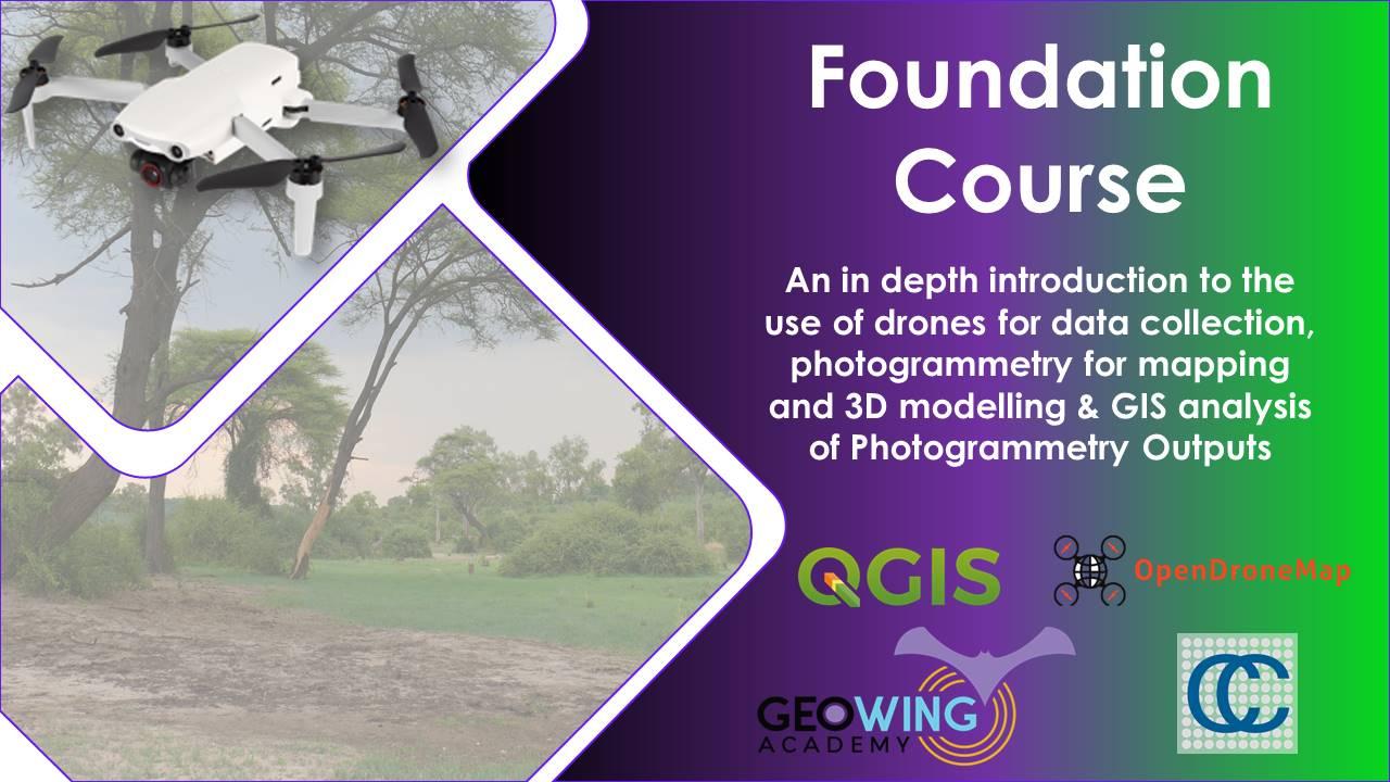
Foundation Courses
The Foundation Course will provide you with everything you need to know about how to set up & use your off-the-shelf consumer level (RGB) drone (UAV) as a powerful data capture platform. It will also teach you how to process the drone data into maps and 3D models using photogrammetry software & then how to do some basic analysis with the photogrammetry outputs in Geographics information system software. The Foundation Course consists of 4 parts; 2 theory components & 2 practical components.
Price - Keystone Foundation Course = USD $100.
*All training data & documentation are provided, the software used is free open source (but please donate) & you do not need a drone to complete the courses. All you need is a laptop & some time!! Software download links are also provided. The courses can be completed in your own time for your convenience. ENJOY!!
**Due to the high interest of the Free Foundation Course, the course will no longer be available to until 30 May 2025 but will instead expire on the 12 April 2025. However, this is not the end!!! GeoWing Academy will be offering more specials and courses soon. We hope to see you in the Wildlabs Discussions section on how you think inexpensive consumer drones and open source software technologies can help improve conservation management and where GeoWing Academy can improve with regards to the drone geospatial training process. Grazie mille!!
Part 1 (for those who are brand new to UAVs and photogrammetry):
- A history of Unmanned Aerial Vehicles (UAVs)
- Types of civilian UAVs
- Drone payloads (sensors, camera etc)
- What is photogrammetry?
- What is GIS?
- How UAV data and photogrammetry outputs can be used in different software platforms to quantify the world in different ways with examples.
- Drone laws and regulations (according to International Civil Aviation Organisation)
- UAV considerations
Part 2 (pre-practical lecture):
- Available autonomous flight apps for DJI drones
- What the different programs are used for (WebODM and QGIS)
- How to best set up your camera for data capture
- How to plan a mapping mission
- Mission planning video showing how to use a flight automation app to capture data correctly.
- What to consider before flying and what to consider before planning an operation.
- Useful tips and tricks
- General aviation regulations according to ICAO/FAA (and the differences between civilian and commercial drone use).
Followed by a two-part practical course, the Basics Practical component will cover:
Part 3: WebODM Photogrammetry Practical:
This course will cover the basics of how to generate maps and models from drone captured data (explained in the Getting started Lecture). You will need to download and install WebODM (this course uses version 2.2.0 build 102) from Software/ Hardware Requirements Page to complete this course along with the free data set. If you are unable to download the WebODM installer, FEAR NOT! GeoWing Academy provides pre generated maps and models for use in Part 4 GIS Practical.
- How to correctly file your raw drone data and create folders for post photogrammetry outputs (data organisation for consistency)
- How to use photogrammetry software to generate maps and 3D models
- How to navigate through different photogrammetry outputs and what they mean
- How to use measurement tools, create shape files and contours in photogrammetry software
- Useful tips and tricks
- Brief look at photogrammetry reports and what the information means
- Export maps and models correctly for following GIS course.
- Free drone data is provided for this course (check Course System Requirements page to make sure your computer can run the programs and therefore the data set)
- Add orthomap and digital surface model (raster layers) outputs from previous WebODM course to QGIS and order the layers correctly
- Raster layer properties menu and what it entails
- The importance of Coordinate Reference Systems (CRS)
- How to change visualisation of layers to better represent digital landscape information
- How to use quick measurement tools
- How to use feature identification tool, why it is so useful and what data it shows
- Learn how to add vector layers (digitizing) to raster layers
- Understanding attribute tables.
- Learn how to add measurement information to vector layers
- How to add labels, buffers and change styles of vector layers for better representation.
- Useful tips and tricks
- Free data is provided for this course (check Course System Requirements page to make sure your computer can run the programs and therefore the data set)
Part 4: Quantum Graphics Information Systems (QGIS) Practical:
This course will cover the basics of Graphics Information Systems software (GIS) and follows on from the WebODM practical. *If you are unable to process the data set from the WebODM course for whatever reason, please download the pre-processed data for this course! You will need to download and install QGIS (this course uses QGIS version 3.22.15 Bailowieza) from the Software/ Hardware Requirements page to complete this course.
This in-depth course will give you the best foundation for acquiring, processing and understanding the power of aerial image data modelling.
Paid, external course
The Keystone Foundation Course costs USD $100.
Popular with peers

Lessons Outline
Discussion
Use this space to ask questions, discuss with fellow participants, or share your thoughts after course completion.
Participants
Below are the WILDLABS members who have enrolled in and completed this course.