Pairing Scientists and Citizen Scientists with AI Assistants

18 May 2017 7:06pm
Live Webcast May 17: Can Technology Save the Earth?

17 May 2017 10:09am
Wildlife Crime Tech Challenge: Mars Omega LLP Boosts Wildlife Crime Intelligence
11 May 2017 12:00am
Machine learning, meet the ocean

10 May 2017 12:00am
acoustics for Human-Wildlife Conflict Prevention, Anti-poaching, and more

27 April 2017 6:40pm
Getting SMART in Cambodia

8 May 2017 12:00am
PIT tag suppliers in the UK

22 February 2017 1:19pm
29 March 2017 11:02am
Hi Kai - I asked for a UK supplier, but thanks.
Hi everyone -
I had a recommendation for http://www.wyremicrodesign.co.uk/. Apparently used successfully for a couple of projects, and designed/built some bespoke readers. The owner can be contacted on phil.rycroft@wyremicrodesign.co.uk.
I went with Francis Scientific Instruments in the end, as they've been reliable and helpful on past projects. You can contact Mike (Francis) on fsilog@btconnect.com.
Cheers, Ollie

29 March 2017 1:44pm
Hi Ollie,
Thank you for the update! This will be of use to other community members!
-John
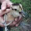
5 May 2017 5:24pm
Not been on Wildlabs for a long time but I recommend Eccel Technology in Leicester and even build them into bird rings. We have been using theirs.
RSPB have built a data logger around the Arduino and plan to put the design and code on Wildlabs sometime later in the year. There are many commercially available and cheap means of solely reading PIT or as they also known RFID tags.
Thanks
Nigel
acoustics for Human-Wildlife Conflict Prevention, Anti-poaching, and more
27 April 2017 6:44pm
acoustics for Human-Wildlife Conflict Prevention, Anti-poaching, and more
27 April 2017 6:43pm
Acoustics for Human-Wildlife Conflict Prevention, Anti-poaching, and more
27 April 2017 6:35pm
UAV for surveying river dolphins in the Amazon
14 February 2017 5:40pm
7 April 2017 4:00pm
Many thanks Tom. Your tips were very useful.
Have a look on the video with subtitles.
https://vimeo.com/208864580
By the way, conservationdrones is a partner and will work on the algorithm.
Cheers
7 April 2017 4:04pm
Many thanks indeed.
Please have a look at this video: https://vimeo.com/208864580
here you can see how we are working on the project.
Cheers
26 April 2017 2:50pm
Hi Marcelo,
To improve autonomy, you'll either need less weight on your drone, better batteries, or what about a fixed wing aircraft? Look at the parrot disco - it's much cheaper than the eBee, and you can outfit it with a downward facing camera instead of the forward, though it seems from your video, the one it has is fine). Those things can fly much longer than copters.
best,
aurélie
Using social media to survey exotic pet owners

3 April 2017 2:08pm

6 April 2017 5:23am
Thanks @StephODonnell for the mention,
Our study (TRAFFIC) has shown that the social media used is really dependent on the country. Some countries prefer Facebook, other Instagram, there are other options such as WeChat and Blackberry Messenger, but these require more private access.
Another issue is the language, you will get more in the local language of each country compared to English. This is something that has been overlooked.
But if you want to use Facebook and Instagram, you already have a lot of going on and a big story there. I would suggest that as the easiest and most accessible one.
We found that manual surveys (Taking screenshots and manually entering data into excel) is good to get a general idea of what is going on, but not effective to capture information such as market turn over, or how much increase/ decrease in demand and offer there is.
Many groups that work in data mining and machine learning have also come up with methods to automatically extract data. I know a group in NYU is even developing an app to monitor the online market: https://news.mongabay.com/wildtech/2016/10/egi-filling-in-the-gaps-in-law-enforcement-for-the-online-wildlife-trade/
Just a little note from me, is to ensure that you are also taking into considerations privacy matters when you publish. It is still not clear on the regulations of how to use data uploaded in social media. And it's also country specific on the legal aspects of that.
Anyway, I am more than happy to talk more if you need to. PM me if needed and we can chat more
Hope this helps
Karlina

13 April 2017 6:19am
Lindsey,
You might also want to consider WeChat as a key channel. I know that it is very commonly used to trade wildlife in China and Vietnam. It is more of a texting service, however, so I'm not sure if that would be in the scope.
Rosemary
25 April 2017 5:26pm
Just to clarify, you mean illegal owners of exotic animals or legal owners? I'm assuming illegal because you reference wildlife crime, but in a lot of countries there are large amounts of legal domestically traded wildlife. It might be kind of difficult to get illegal traders to take the survey, but legal traders might be more receptive.
-John
Upcoming human-wildlife conflict workshop

25 April 2017 2:16pm
Biodesign - using pheromones & tech to curate future ecosystems

25 April 2017 9:52am
25 April 2017 1:49pm
Hi. Personally, I like the idea of number 1. It could also be useful for catching invasive species such as lionfish, or maybe it could also act as a lure for them. Could species over time adapt to the presence of the phermones though?
The third point sounds like a GMO and it's one thing when it's being proposed for crops, but it's another when it comes to wild species. That could forever alter the gene pool, similar to the debate over the farming of GMO salmon in proximity to wild populations.
CCF GIS Group Social

11 April 2017 9:02am
24 April 2017 10:35am
The next social is on Thursday 27th - same details as above. Hope to see you there!
Aerial seeding with drones

19 April 2017 1:09pm
19 April 2017 2:35pm
This is really fascinating! This could also be potentially useful as a way to distribute vaccines for wildlife and livestock!
Job opening!

19 April 2017 11:03am
Education to combat wildlife crime

2 February 2017 4:54pm
9 February 2017 1:09pm
@StephODonnell Good to hear from you, and thanks for drawing my attention to this question!
Hi Chris,
As Steph is mentioning, as Ranger Campus Foundation we aim to strengthen law enforcement in protected areas, by focusing on ranger training. We are developing an e-learning platform (Ranger Academy) and acconpanying training modules specifically targeted to the needs of rangers. The content is based on the training guidelines that were written by the big players in the field and were just made public:
http://d2ouvy59p0dg6k.cloudfront.net/downloads/anti_poaching_training_guidelines___electronic_version.pdf
Main advantages of Ranger Academy are:
- Combine e-learning with physical training and shorten the time you spend on basic level training. This enables instructors to make better use of their time when on the ground.
- Rangers can access their personal e-learning environment when they have time for it - no internet is required for following lessons. So no need to take people off patrols.
- Rangers can communicate with other rangers around the world and lessons in all modules are given by rangers.
- Managers have more insight in ranger competence levels and certificates acquired.
This turned into quite a story so will leave it at that. Let me know if there is anything I could assist with.
Best wishes,
Dominique
P.S. Attaching a picture of the filming of the Care under Fire module last month, where Joseph is demonstrating the correct use of a tourniquet. Picture copyright of Cees Baardman.

13 February 2017 12:26pm
Hi Chris,
@StephODonnell thanks for the heads up on this question!
United for Wildlife have an free online course https://learn.unitedforwildlife.org/ which has an "Introducing Conservation" lesson which covers conservation basics.
Over this year we're (for transparency - I work on the project) releasing a new series of Insights on specific areas of conservation.
So far we've released "Species and Spaces" and "Worth More Alive" insights - the latter is focussed on the Illegal wildlife trade.
We're also releasing a series of films called "Natures Guardians" which focus on the Southern African Wildlife College and cover some of the aspects of ranger training. You can view these on our YouTube channel https://www.youtube.com/playlist?list=PLH4rBFGCnvow7YQe3ycwWJ3mVR2MAwuIu or Facebook page
Thanks!
12 April 2017 5:30pm
Peter, thanks for your reply and sorry for the dealyed repsonse, I have been ahving some issues getting alerts in my email. I would like to talk to you more about your trafficking courses, especially who you have identified as your target audience and what the model was that these courses were designed aorund.
Anti-Corruption Resource Center Brief on Technology for NRM

27 March 2017 10:24pm
11 April 2017 11:05pm
Thanks for sharing this Rachel.
There is some great technology in here and some fantastic ideas. I like the use of AI to create patroling routes that are more likely to catch poachers.
One thing the article doesn't seem to address directly is the challenge created by corrupt officials explicitly blocking the use of technology, prefering instead to keep records "off the the books." Is this potentially a problem?
In some of the more sensitive bio-diversity regions, social media is only so accessible, and digitization not only cost money, it requires explicit acceptance "on the ground." I don't have any answers, unfortunately. Maybe the ideas presented here can start circumventing some of the corruption, but until we can find a way to make sure that the governments, and officials, and local populations all see greater economic benefit from co-existing with biodervisity than through the exploitation of it, the challenge will continue.
12 April 2017 4:03pm
Thanks, @Drue+Freeman . You raise excellent points, here. In my experience with projects that use protected area monitoring and management software such as the Spatial Monitoring and Reporting Tool (SMART Conservation Software), transparency is enhanced and the influence of special interests/corruption can be reduced. But for robust results, it is importnat to move beyond pilots and encourage the adoption of a single system on a national level, throughout a country's parks, protected areas and (where appopriate) community-managed areas. Securing this kind of commitment requires robust funding and active engagement of government.
GPS wildlife tracking on the cheap

8 December 2016 2:54am
12 April 2017 3:00pm
Hi Colin,
In short yes, they make a GSM device. The issue would be weight. What is the weight limit/minimum recording time? Best off firing further questions at Blake Allan, he knows a lot more than me! bmallan@deakin.edu.au
All the best,
Euan
12 April 2017 3:17pm
Alasdair,
I'm in Australia. The network provider with the widest coverage is Telstra.
Colin
12 April 2017 3:32pm
Euan,
Thanks for the feedback and I'll be in touch with Blake sometime soon. I'm investigating options for tracking falcons and phascogales.
Colin
6th International Bio-Logging Science Symposium
11 April 2017 1:06pm
CCF GIS Group Social
11 April 2017 8:50am
QGIS UK Midlands & East User Group meeting
20 March 2017 9:57am
11 April 2017 8:44am
This meeting will now be followed by the Missing Maps May Mapathon - Cambridge from 18:00 - 20:30, which will also be hosted at the British Antarctic Survey. We also plan to squeeze in a post-mapping drink at The Punter just down the road. Open source GIS followed by humanitarian mapping, followed by free pizza and a pint - what more could you ask for!?
Missing Maps May Mapathon - Cambridge
11 April 2017 8:38am
Missing Maps April Mapathon - Cambridge
21 March 2017 7:30pm
6 April 2017 12:07pm
Hi Steph,
It was fantastic! We had a full house, with all 40 tickets sold out and really good attendance rate. We were mapping an area of Zimbabwe for the Clinton Health Access Initiative's malaria program. We were joined remotely by some collaborators at OpenStreetMap Bangladesh, and together we completed > 70% of the task. The next Cambridge Missing Maps is going to be at the British Antarctic Survey on Thursday 18th May and you can register here! We hope to include the David Attenborough Building on the Missing Maps Cambridge circuit for future events. The Cambridge Conservation Forum GIS Group are also planning to hold a MapforEnvironment event in the very near future, which will of course be advertised on WILDLABS.NET!
Thanks!
6 April 2017 2:11pm
Sounds awesome! Will you be working to finish the other 30% at the next meeting, or working on a new project?
Adding in a great photo you posted from the event on Twitter last night :)
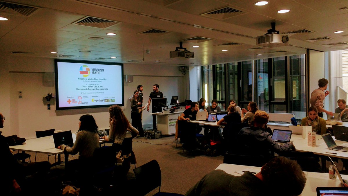
11 April 2017 8:33am
Thanks for adding the photo from the event. Missing Maps is becoming really popular, so tasks get completed quite quickly. We shared the task numbers for people to finish off at home if they wanted to, but by the time of next month's mapping party, this task will long have been completed so we'll be working on another one! I hope you can make it on Thursday 18th May.
SCCS Bengaluru 2017 in Bengaluru, India
10 April 2017 12:00am
Comparing two sound wave files - for a conservation game
20 March 2017 8:59am
29 March 2017 8:46pm
Dynamic Time Warping is often used as a foundation.
30 March 2017 1:47am
Hey Gautam!
Could you share few sample files? I want to try out a couple algorithm and see if that's useful to you.
Thanks,
Bhavesh
7 April 2017 1:42pm
Hi Bhavesh - thanks a lot. WildLabs doesn't allow me to upload .wav files - can I email you or get them to you another way? They are small - 2 seconds each.
You can email me at gautam@internetofelephants.com
Gautam!
From the Field: Dr Raman Sukumar and Technology Developments Needed to Conserve Elephants
5 April 2017 12:00am
Lasers in the Jungle Somewhere: How Airborne LiDAR Reveals the Structure of Forests
 Phil Wilkes
4 April 2017 12:00am
Heat Maps
2 March 2016 3:18pm
31 March 2017 10:45am
Hi @AdamBloch
I'd like to know more about your setup. I'm monitoring temperatures on a nature reserve using an array of 100 iButton Thermocron temperature sensors. I'm interested in what the benefits of using Arduino and Raspberry Pi might be. I need to collect my sensors in and read through a USB device. Then there's the interpolation and plotting of the data, and I'm particularly interested in how you are filtering and querying your data i.e. 'selectable [time?] range'.
Thanks
31 March 2017 9:49pm
Hi Thomas
We are mapping a very small area in real time. The data rate is controlled by the time it take to read all the DS18B20s. The logger I use in the Octogons is using about 90 sensors and refreshes about every 5 to 15 seconds. The data is store as a CSV in series of files.
Best thing to do is drop me a PM and your number.
Many thanks
Adam
8 May 2017 4:13pm
Thanks very much for cross-posting this update, @Jan+Kees - where are you field testing the SERVAL-sensor?