April Meetup: Can UAVs be used to measure forest quality?

24 May 2016 2:06pm
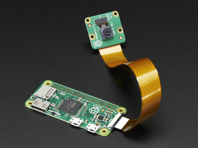
Project Feedback Wanted: Building Low Cost Cameras
2 March 2016 9:59am
20 May 2016 11:07pm
Hi Sorry been away, I'll list more about parts etc.. In the mean time the Pi Zero has just had an upgrade..
http://petapixel.com/2016/05/19/5-raspberry-pi-zero-now-camera-compatible/
Snake telemetry?

18 May 2016 6:52pm
Polar Bear Satellite Telemetry Innovation Workshop - Redesigning Satellite Telemetry Devices for Polar Bears and Beyond
18 May 2016 1:23am

18 May 2016 4:18pm
I tweeted about it!
Internet of Elephants game play survey
16 May 2016 7:44am
Sensory: BBC Wildlife Director John Downer & the technology of ‘spy-cam’ filmmaking
13 May 2016 11:55am
UNEP-WCMC Informatics Ignite Talks
11 May 2016 8:30am
The Coral Trait Database
5 May 2016 3:12pm
Drone Training in the U.S.

5 May 2016 9:46am
Trophy hunting and #tech4wildlife

3 May 2016 1:30pm
Great article talking about applying drones to scientific research
13 April 2016 6:30pm
3 May 2016 9:16am
Interesting. A case in point is the viral video making the rounds about drone fishing:
We've seen an array of inventive uses for drones of late across a whole range of endeavors, often having direct or indirect implications for natural resource management. Using drones to improve our ability to target/hunt species of concern seems at once both a natural progression and something new with a slightly ominous overtone. This strikes me as one of those moments where we might want to pause and take stock of what is going on with this technology and where it might go in the not too distant future.
Should we ignore this development? Work to restrict the use of drones for such activities? Support this? Regardless of where we might come down on this question, I can't help but fell that this notion of drone fishing certainly seems to have the sense of "crossing the Rubicon" somehow.
http://aarr.piratelab.org/news/drone-fishing/
Blue Economy Challenge / Sustainable aquaculture for Indian Ocean developing countries

5 March 2016 2:14am

18 March 2016 12:46am
I'll be entering the Blue Economy Challege. Would be really cool to start a conversation and collaboration between community members here and others who join the challenge. What if entrants to the BEC got a link to WildLabs and invited to join this conversation after they submitted their application?
7 April 2016 2:35am
Jamieson, this is a great idea, and although my reply is rather delayed, it is not too late for me to update the message for Blue Economy Challenge applicants! I encourage applicants to the BEC to use this space to continue the conversation about technological innovations that will transform aquaculture.
2 May 2016 11:47am
Algae technology is central to innovation to conserve biodiversity against the threats of climate change. I am part of a global scientific group called Ocean Foresters. Our proposed Haven Atoll system aims to use algae to help save coral biodiversity and reduce ocean acidity. We are seeking partners for the Blue Economy Aquaculture Challenge.
In the northern section of Australia’s Great Barrier Reef, 95% of the coral is damaged or dead from excessive ocean heat. Coral bleaching is not limited to Australia, but is occurring in every ocean around the world. CO2 emissions are the cause of the crisis, but the real problem now is that emission reductions alone are just too slow to prevent catastrophic biodiversity loss. Immediate steps are needed to reduce the heat, acidity and nutrients that are killing our reefs. Algae is the key to save reefs by providing cooler and cleaner water in atolls. As Dr Tim Flannery argues in his 2015 book Atmosphere of Hope, the Ocean Foresters have presented compelling argument that large scale deployment of artificial forests of seaweeds, kelps and algae is the most promising response to fixing ocean health and removing CO2.
Ocean Foresters’ key proposal is called Haven Atolls, a system for protecting coral by growing large amounts of marine plants for fuel, food, fertilizer, fabric and fodder. Australia has the need, expertise, resources, locations and innovative culture to lead the world on Haven Atolls, targeted to the coral systems under most threat from global warming. Haven Atolls will produce fresh water, energy and algae products and protect local corals. Our key innovation is to bring cool nutrient-rich deep ocean water to the surface and feed it into coral atolls for sustainable aquaculture and to cool the coral during heat waves, protecting against global warming. The Haven Atoll will serve as a reservoir of biodiversity to seed reefs destroyed by bleaching. Haven Atolls will serve the global agendas of supporting food security and biodiversity, and will be critical to helping achieve negative carbon emissions, as identified by world governments in the Paris Climate Agreement as necessary to keep warming below two degrees.
Time is the enemy of coral. Our magnificent reefs are dying. Many have gone extinct or will soon. Algae systems can save the reefs while developing technology for sustainable energy and food supply and beginning to remove the dangerous extra carbon that fossil fuels have added to our air and sea. We urgently need partnerships for innovation, to implement rapid practical cost-effective methods to save our precious coral reefs from the looming extinction.
TEAM Network and Wildlife Insights
28 April 2016 12:00am
Utilizing thermal imaging technology
27 April 2016 7:43pm
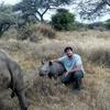
Can UAVs be Used to Measure Forest Quality?

27 April 2016 12:00am
Conservation apps with a GPS focus
5 April 2016 3:27pm

26 April 2016 2:34pm
My goto application is CyberTracker. It can be adapted on your desktop exactly to record the data that you want (including pictures and GPS reading, but not compass direction).
26 April 2016 4:53pm
Another option is OruxMaps, free for android, not very intuitive but very powerful. But it's important to bear in mind that phone GPS accuracy can be lower than "traditional" GPS, specially when part of the sky is blocked.
Here is a test https://blogs.esri.com/esri/arcgis/2013/07/15/smartphones-tablets-and-gps-accuracy/
Calculating species abundance from Acoustic Data
26 January 2016 1:22pm

26 April 2016 10:45am
Hi,
I think Steffen provided a good summary of the challenges.
IMO, the two most promising methods of estimating animal density from acoustic monitoring are the "generalised random encounter model" (gREM) and an extension of spatially-explicit capture-recapture (SECR). These potentially solve Steffen's problems 2 and 3, i.e. linking acoustic counts to abundance (2), and converting abundance to density (3).
gREM, although theoretically possible, may be tricky in practice (especially obtaining an estimate of how wide an animal's acoustic signal is). See here:
http://onlinelibrary.wiley.com/doi/10.1111/2041-210X.12346/abstract
SECR is potentially very powerful, but depends on an independent estimate of calling rate (a problem Yu Shiu rightly picked up on). I think this would be entirely possible for a species you can find and observe (e.g. a frog or common bird species), but difficult for lots of cryptic, low density species (e.g. tigers!, as Courtney mentioned). See here:
https://www.researchgate.net/publication/272371302_A_general_framework_for_animal_density_estimation_from_acoustic_detections_across_a_fixed_microphone_array
However, gREM and SECR do not help with Steffen's first point (1) "quantifying the number of vocalisations from a stream of acoustic recordings". Others might be able to advise on the best approaches there. Perhaps this is primarily a software / data processing problem...?
In terms of sampling design (as Mariane and Courtney were interested in), it depends what your aims are. For occupancy (which is not equal to abundance/density), similar design principles to camera-trapping are fair (but taking into consideration Yu Shiu's point that the effective sampling area might be MUCH larger for an acoustic sensor than a camera trap, so camera spacing will have to be larger too). For gREM, you can fairly flexible about sampling design (repeated detections of the same individual are not a problem), but your sensors should be set randomly in space (with respect to animal movement), not along trails etc. For SECR, you don't have to set your sensors randomly, but sensors must be close enough together for repeated detections of the same call in multiple sensors simultaneously (this design constrasts, therefore, with an occupancy design).
Hth,
Ollie

26 April 2016 11:59am
Hi Stephanie,
This is an interesting thread. For those interested in the topic, and forgive me for the blatant self-promotion of work, a Biological Reviews 2013 paper on the topic can be downloaded here http://www.creem.st-and.ac.uk/decaf/outputs. Additional case studies papers as well as a more general public paper in Acoustics Today are also available for download from the link. This link is the outputs page from project DECAF, dedicated to estimating animal density from passive acoustic fixed sensors, using cetaceans as case studies. The methods have been far more developed and used in the cetacean community, but I suspect a wider use in terrestrial environments will occur in the coming years. A key hurdle is perhaps the dynamics involved in acoustic cue rate production, but the issues will be much easier to tackle in terrestrial environments than in the marine environments we have been working on.
Hope this is helpful,
Tiago
26 April 2016 12:13pm
Hi Tiago,
Thank you for sharing this paper and contributing your experience to the thread. Blantant self promotion, as you put it, is more than welcome when the work you're pointing to is such a helpful resource!
Cheers,
Stephanie
What to you is the biggest small problem with using UAVs in the field?
24 February 2016 7:47pm
5 April 2016 5:17pm
Wait, can you implement the range extenders in DJI systems? Is it costly in order to do so?
5 April 2016 5:58pm
jprobert,
Due to the proprietary nature of DJI, no the antenna tracker listed above cannot be added easily. Some engineering would need to go into hacking DJI. I'm not sure if you can get the telemetry data from DJI's app or ground control station. If so, one could parse the telemetry data and feed the GPS location into the open source tracker. You could also add another radio on board which transmits the GPS from the UAV. However, this is not the most efficient way and will cost some flight time for the added weight and power consumption.
Without hacking DJI or doing some digging, you could replace the antennas on the hand controller and UAV with higher gain antennas. This could improve range, but would limit the directions you could fly(directional antenna).
I will look into data provided by DJI and see what it possible.
26 April 2016 9:34am
I agree that it is likely that a dirigible would probably struggle in a lot of common mapping settings. People do use kites though. If you are interested in developing the flight control systems for dirigibles though I would also suggest that the best place to start is Ardupilot.
Migration monitoring app
25 April 2016 1:36pm
Text Messages from Teenage Gannets

25 April 2016 12:00am
Assessment of Detection and Tracking Dog Programs in Africa

5 April 2016 7:43pm
15 April 2016 5:45pm
Hi Rachel, the link seems to be broken, fyi.
Marie
18 April 2016 9:41am
Hi Marie,
Thanks for alerting us to a possible broken link. I've just double checked both links Rachel shared and they both appear to be working. Just in case, the links are:
Working Dogs for Conservation: http://wd4c.org/
Assessment of Detection and Tracking Dog Programs in Africa (PDF): http://files7.design-editor.com/90/9024931/UploadedFiles/520bd328-b718-423f-b041-da20b254e24a.pdf
24 April 2016 3:22am
Thanks!
Is Google’s Cloud Vision useful for identifying animals from camera-trap photos?

20 April 2016 12:00am
Deterring bears while backpacking
5 April 2016 3:15pm

19 April 2016 3:32pm
Ho John,
That's a great idea and thanks for sharing, but as you said, limitations on battery and speaker capacity abound. Might anyone else have any thoughts on how we could use apps to prevent HWC? There are apps that provide the ability to track wildlife through satellite collars for monitoring purposes. Is anyone aware of whether this type of app is being used also for HWC prevention using geo-fencing through collars or other means? Thanks.
Nilanga
ZSL Symposium: Space - the final frontier for biodiversity monitoring?
19 April 2016 2:29pm
Request for GPS based animal movement data
11 March 2016 8:26am

13 April 2016 4:27pm
Gautam,
You can join ebird.org and make a request to download their data that contains GPS data for birds.
Jason
13 April 2016 4:50pm
There's also movebank, which is a repository fo wildlife tracking information.
Wildlife Crime Apps
13 April 2016 3:46pm
Going into Business for Wildlife Conservation
13 April 2016 12:31pm
Automated Forest Restoration with Drones

10 March 2016 4:59pm
13 April 2016 10:56am
Hi Lot, great to see you here too.
Collecting Your Opinions about Drones
11 April 2016 6:52pm
12 April 2016 9:26am
Hi Sean,
Thanks for sharing your survey - is there a specific date you'll be closing the survey?
It'd be great if you could share the results of the survey here, as I (for one) will be quite interested to see what comes back.
Cheers,
Steph
ContentMine: Mining Helpful Facts for Conservation
5 April 2016 12:00am
11 May 2016 6:27pm
thanks for this very interesting post! i was also trying to develop an inexpensive camera trap but with not good results. i think the use of a PIR sensor can give more battery life than motion detection via software. Can you give more details about the components you used please?
Thanks
Paolo