


Related Inventory Content
Great news everyone!!
In November 2024 GeoWing Academy scanned 239 hectares of forested valleys using an off-the-shelf DJI Phantom 4 drone. The resulting maps were then analysed using custom machine learning (ML) pipelines in open source software which were trained to look for flowering Acacia mearnsii (black wattle). The Black wattle is native to Australia and highly invasive in many parts of the world, degrading biodiversity and increasing fire intensity by a huge margin!
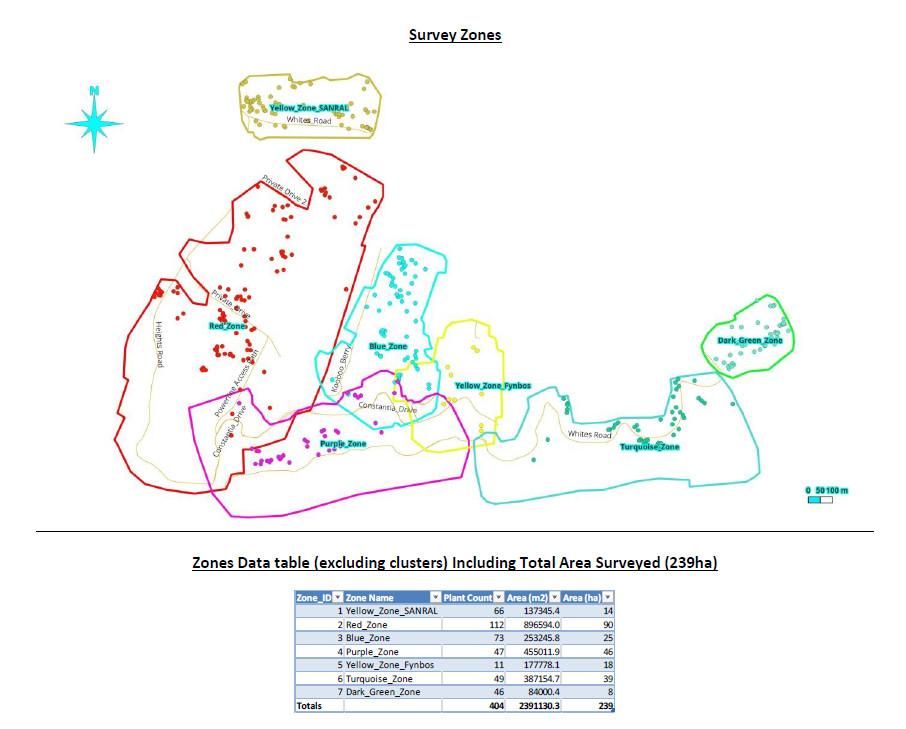
Image 1 (above): The greater study area was divided into scan Zones. Detections were then made through each area using GeoWing Academy custom built machine learning pipelines trained to look for flowering black wattle. The resulting data table for each Zone below the map image.
The resulting wattle tree detections where then analysed in terms of their ease of access (how close to roads/access points they were), if they were in large clusters or individual trees, their GPS locations and how tall they were (age estimation)
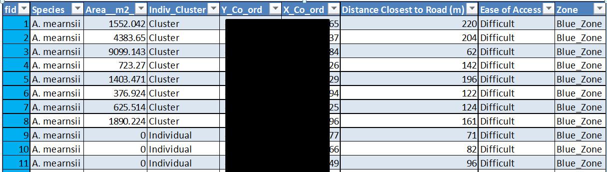
Image 2 (above): An example of the data table output from the machine learning pipeline. GPS coordinates blacked out for privacy reasons. Clustered plants cover area and distance from roads/nearest access points given in metres. Individual tree canopy area not given for this study.
The data tables, attributes and maps where then transferred to hand held devices (cell phones and tablets) for use by field/ground alien plant clearing teams who were able to easily navigate to and locate the wattle trees in the forested areas using the GPS locations. It is important to note that many of these trees have never been seen before due to the fact that they are growing in dense forest and in steep valleys so therefore cannot be seen by ground teams. Many have gone undetected for decades, seeding many of the dense problematic wattle stands/clusters found downstream. But its pretty hard for them to hide from a drone, WOOHOO!!
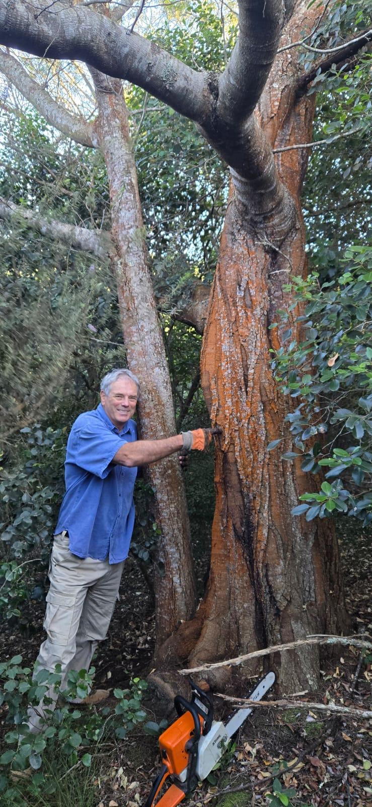
Image 3 (Left): Prof Jos Louw from NMU University and volunteer AIP clearer with a massive Black Wattle detected by drone and open source ML pipelines in GIS software that had remained undetected in dense forest for decades.
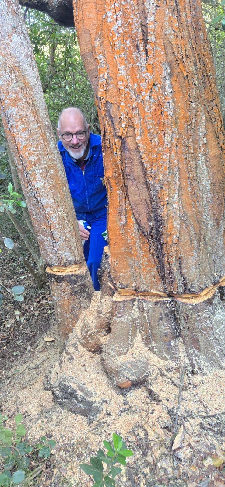
Image 4 (Centre): Flo, a volunteer alien vegetation clearer with the ringbarked Leviathan. No more shall it taint the forest with its unsavoury, lecherous offspring... HOORAY!
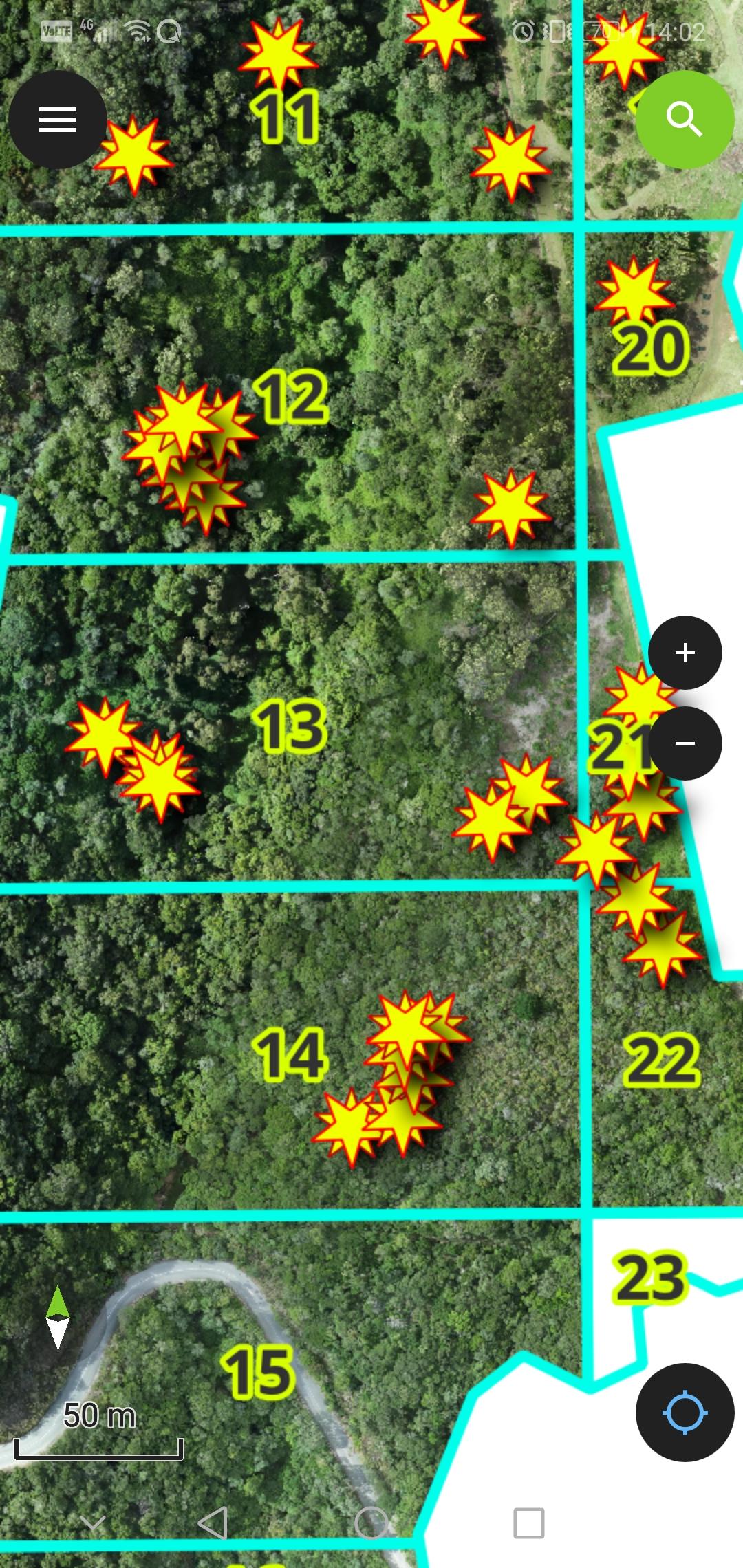
Image 5 (left): An example of what the hand held app looks like. The field members GPS location (device location) shows up as a blue arrow on the high resolution up to date drone map (like your car on Google maps), the wattle tree detections are represented by the yellow stars and the blue grids divide the Zones into subsections for teams to work in.
Technology incorporation into wildlife management planning is critical in our ever advancing world. Tech is so often used to destroy our life support system that is Mother Earth and our way of life through division, war and propaganda. We should be using it for the betterment of the planet and society. This project (ongoing to date since 2024) is just one tiny way in which we can do something positive for the bigger picture. Proof that tech and wildlife conservation can and must work hand in hand, for the enrichment of our entire blue dot orbiting the sun
13 August 2025 2:06pm
This is awesome!!
Lara Fuller