In recent years, drone technologies have been explored for a range of applications in conservation including (but not limited to) mapping, biodiversity inventories, antipoaching patrols, wildlife tracking, and fire monitoring. The rise of customizable, open-source drones like those of ArduPilot and OpenROV hold promise for more effective conservation applications, and combined with other monitoring sensors and devices, they are capable of collecting high-resolution data quickly, noninvasively, and at relatively low cost.
However, challenges remain in putting these tools to use. A recent paper reviewing 256 conservation drone projects highlighted some of these major obstacles, ranging from unintended social and ecological consequences of drone operations to still prohibitive costs, both in terms of hardware and in terms of storing and processing large volumes of data. The longstanding challenge of power/battery life remains as well.
If you're considering trying out drones for yourself, and want to explore the possibilities and understand the major conversations happening around this technology, check out these beginner's resources and conversations from across the WILDLABS platform:
Three Resources for Beginners:
- Conservation Technology User Guidelines Issue 5: Drones, World Wildlife Fund | Drones, best practices, ethics, regulations, case studies
- WILDLABS Virtual Meetup Recording: Drones, Craig Elder, Dr. Claire Burke, and Gabriel Levin | Drones, thermal camera, wildlife crime, ML, biologging
- New Paper: Drones and Bornean Orangutan Distribution, Sol Milne | Drones, data analysis, citizen science, community science, primates
Three Forum Threads for Beginners:
- Curious about radio-tracking with drones? | Wildlife Drones, Biologging (5 replies)
- Drones for GIS Best practice Document | Adrian Hughes, Drones (10 replies)
- WWF Conservation Technology Series: Drones in Conservation | Aurélie Shapiro, Drones (7 replies)
Three Tutorials for Beginners:
- How do I use a drone to capture radio-tracking data? | Debbie Saunders, Tech Tutors
- How do I choose the right drone for my conservation goals? | Shashank Srinivasan, Tech Tutors
- How do I strategically allocate drones for conservation? | Elizabeth Bondi, Tech Tutors
Want to know more about using drones, and learn from experts in the WILDLABS community? Make sure you join the conversation in our Drones group!
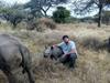
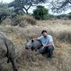
*Header photo: Parker Levinson, Point Blue Conservation Science
No showcases have been added to this group yet.

- @fsanger
- | she / her/ ella
- 0 Resources
- 5 Discussions
- 7 Groups

Environmentalist and Python developer working in the realm of Remote Sensing. Fascinated by the intersection of technology and nature, with a focus on machine learning, ecological modeling, and biodiversity monitoring. 🌍
- 0 Resources
- 0 Discussions
- 11 Groups

Founder & CEO of we.are.tohorā, creating a community that cares about whales, the environment and each other.
- 0 Resources
- 0 Discussions
- 13 Groups

Friends of Brisbane Ranges

- 0 Resources
- 33 Discussions
- 5 Groups

- @LindyClydeKnowles
- | he/him

- 0 Resources
- 6 Discussions
- 6 Groups

Passionate advocate for nature and experienced communicator, looking to explore opportunities to leverage technology in wildlife and marine conservation
- 0 Resources
- 0 Discussions
- 7 Groups

- 0 Resources
- 0 Discussions
- 1 Groups
- 0 Resources
- 0 Discussions
- 16 Groups

- 0 Resources
- 0 Discussions
- 6 Groups
Research coordinator Transfrontier Africa, PhD student STELLENBOSCH UNIVERSITY
- 0 Resources
- 8 Discussions
- 2 Groups

Partner in Conservation at WWF

- 0 Resources
- 17 Discussions
- 6 Groups

- @aljmichel
- | she/her
PhD student at UC Davis studying gorilla communication & movement
- 0 Resources
- 3 Discussions
- 6 Groups
Careers

The Marine Robotics and Remote Sensing (MaRRS) Lab at Duke University seeks a highly motivated UAS pilot and geospatial analyst to support the ongoing development of new and existing research and conservation programs,...
10 August 2022
Careers
The Marine Robotics and Remote Sensing (MaRRS) Lab at Duke University seeks a highly motivated postdoctoral researcher to support the ongoing development of new and existing research and conservation programs, both...
10 August 2022
Link

Just sharing our latest paper in PeerJ that describes the use of drones in a low-connectivity setting to help monitor and protect megaherbivores. Please contact zoe@wildtrack.org for any information.Thanks everyone!
9 August 2022

Article

This WhaleSeeker article discusses how reliable distribution data depends on accurate labelling from survey images, and how AI can improve this process.
13 July 2022
Article
Drone Pilot Training with Wildlife Drones (Australia)

Wildlife Drones
Ever wanted to become a Drone Pilot? Here is your chance!
10 June 2022
Article

Hundreds of tons of the toxic chemical have likely littered the ocean floor near Santa Catalina Island for decades.
4 June 2022
Article
"A drone emitting orca sounds will be used in attempt to guide the animal, whose health is fast deteriorating"
1 June 2022
Article
Authors: Geison P Mesquita, Margarita Mulero-Pázmány, Serge A Wich, José Domingo Rodríguez-Teijeiro
29 May 2022
Article
News: The Latest in Conservation Tech (March 24)

WILDLABS Team
Check out this round-up of three of the latest conservation tech studies and news. See more conservation tech news by subscribing to our bi-monthly digest.
24 March 2022
Careers

Fauna & Flora International is seeking a qualified candidate for the position of a Technical Specialist, Analytics to support and grow the use of spatial technologies and analyses for conservation planning and...
21 March 2022
Article
Technical Difficulties: Cleared for Takeoff
Eric Becker and 1 more
In their three-part interview from our new series Technical Difficulties, Colby Loucks and Eric Becker share the failures they've encountered and learned from throughout six years of working on the WWF-US Wildlife Crime...
20 October 2021
August 2025
event

Louisa Richmond-Coggan
September 2025
event
Louisa Richmond-Coggan
March 2026

May 2023

April 2023
33 Products
Recently updated products
| Description | Activity | Replies | Groups | Updated |
|---|---|---|---|---|
| Hi all, I'm thinking about going for my license. In doing so, I'll do a writeup of my experiences for you all so that way those of you in the... |
|
Drones | 8 years 10 months ago | |
| Ups, it's true :( I hope that you can try to apply anyway. Regards |
|
Drones | 8 years 10 months ago | |
| Anyone want to work on Elephants (in natural habitat) ? At Pah Muang Wildlife Sanctuary (along to road Chiang Mai to Lampang) there are... |
|
Drones | 8 years 10 months ago | |
| Unfortunately, I could not see the full article, but the executive summary makes a lot of sense. I think there might be a couple of other considerations. 1) As... |
|
Drones | 8 years 11 months ago | |
| For anyone interested in an overview of how drones are being deployed for conservation, this piece by Serge Wich (of ConservationDrones.org) provides a... |
|
Drones | 8 years 11 months ago | |
| In April, the Cambridge Conservation Tech Group held its second meetup, which brought together colleagues from RSPB, Birdlife, FFI,... |
|
Drones | 9 years 2 months ago | |
| Interesting. A case in point is the viral video making the rounds about drone fishing: We've seen an array of inventive uses for drones of late across a whole range... |
|
Drones | 9 years 3 months ago | |
| I agree that it is likely that a dirigible would probably struggle in a lot of common mapping settings. People do use kites though. If you are interested in developing the flight... |
|
Drones | 9 years 3 months ago | |
| Hi Lot, great to see you here too. |
|
Drones | 9 years 4 months ago | |
| Hi Sean, Thanks for sharing your survey - is there a specific date you'll be closing the survey? It'd be great if you could share the results of the... |
|
Drones | 9 years 4 months ago | |
| Hi Daniel Thanks for the interest in the project. The load carrying capacity will be a few kgs. The battery I've sized at this stage is around 2kgs and should allow it... |
|
Drones | 9 years 4 months ago | |
| http://www.esri.com/products/drone2map#beta ESRI is developing the means of putting UAV imagery into ArcGIS. Sign up to keep... |
|
Drones | 9 years 5 months ago |