In recent years, drone technologies have been explored for a range of applications in conservation including (but not limited to) mapping, biodiversity inventories, antipoaching patrols, wildlife tracking, and fire monitoring. The rise of customizable, open-source drones like those of ArduPilot and OpenROV hold promise for more effective conservation applications, and combined with other monitoring sensors and devices, they are capable of collecting high-resolution data quickly, noninvasively, and at relatively low cost.
However, challenges remain in putting these tools to use. A recent paper reviewing 256 conservation drone projects highlighted some of these major obstacles, ranging from unintended social and ecological consequences of drone operations to still prohibitive costs, both in terms of hardware and in terms of storing and processing large volumes of data. The longstanding challenge of power/battery life remains as well.
If you're considering trying out drones for yourself, and want to explore the possibilities and understand the major conversations happening around this technology, check out these beginner's resources and conversations from across the WILDLABS platform:
Three Resources for Beginners:
- Conservation Technology User Guidelines Issue 5: Drones, World Wildlife Fund | Drones, best practices, ethics, regulations, case studies
- WILDLABS Virtual Meetup Recording: Drones, Craig Elder, Dr. Claire Burke, and Gabriel Levin | Drones, thermal camera, wildlife crime, ML, biologging
- New Paper: Drones and Bornean Orangutan Distribution, Sol Milne | Drones, data analysis, citizen science, community science, primates
Three Forum Threads for Beginners:
- Curious about radio-tracking with drones? | Wildlife Drones, Biologging (5 replies)
- Drones for GIS Best practice Document | Adrian Hughes, Drones (10 replies)
- WWF Conservation Technology Series: Drones in Conservation | Aurélie Shapiro, Drones (7 replies)
Three Tutorials for Beginners:
- How do I use a drone to capture radio-tracking data? | Debbie Saunders, Tech Tutors
- How do I choose the right drone for my conservation goals? | Shashank Srinivasan, Tech Tutors
- How do I strategically allocate drones for conservation? | Elizabeth Bondi, Tech Tutors
Want to know more about using drones, and learn from experts in the WILDLABS community? Make sure you join the conversation in our Drones group!
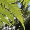
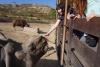
*Header photo: Parker Levinson, Point Blue Conservation Science
No showcases have been added to this group yet.

- 0 Resources
- 0 Discussions
- 4 Groups

WildAid
Surveillance and enforcement of marine protected areas.
- 0 Resources
- 2 Discussions
- 5 Groups

- @nancyalice
- | she/her
Design x Climate Action

- 0 Resources
- 0 Discussions
- 10 Groups

- @Arjun_Viswa
- | S
- 0 Resources
- 0 Discussions
- 26 Groups
- 0 Resources
- 0 Discussions
- 12 Groups
- @PierreBonnet
- | Pierre
https://orcid.org/0000-0002-2828-4389

- 0 Resources
- 1 Discussions
- 6 Groups
- @mjwethin
- | He/Him
Quantitative Ecologist
- 0 Resources
- 0 Discussions
- 4 Groups

- @frides238
- | She/her
Hi! I am Frida Ruiz, with a bachelor's in Mechanical Engineering and very interested in habitat restoration & conservation. I am excited to connect with others and learn about technology applications within applied ecology & potential research opportunities

- 0 Resources
- 5 Discussions
- 13 Groups

- @eliseb227
- | she/her
Yale University
Biodiversity Data Coordinator @ Yale Center for Biodiversity and Global Change
- 0 Resources
- 0 Discussions
- 8 Groups
Conservationist | Ecologist| Geospatial Scientist
- 0 Resources
- 1 Discussions
- 12 Groups

- @MandyEyrich
- | She/Her
University of Florida (UF)
Bridging industries with 15+ years of cross-sector expertise specializing in user-centric technology and product strategy, UX research, UX/UI design, process optimization, and end-to-end agile product development moving from ideation to iteration.
- 0 Resources
- 0 Discussions
- 26 Groups
- @KellyFaller
- | she/her/hers
Rutgers University
Lead Estuary Science Coordinator at the Partnership for the Delaware Estuary and Masters Student at Rutgers University in the Department of Ecology and Evolution. Using bioacoustics in tidal marsh ecosystems for restoration and conservation.
- 0 Resources
- 4 Discussions
- 14 Groups
Article
Technical Difficulties: Understanding the Realities
Eric Becker and 1 more
In their three-part interview from our new series Technical Difficulties, Colby Loucks and Eric Becker share the failures they've encountered and learned from throughout six years of working on the WWF-US Wildlife Crime...
13 October 2021
Article
New Papers: Remote Sensing in Ecology and Conservation

Zoological Society London (ZSL)
ZSL's Remote Sensing in Ecology and Conservation journal has released new research for early view before inclusion in an issue. See the full list of recent open access research papers on RSEC.
22 April 2021
Community Announcement
Whether you spent the last year working in the field, lab, at home, or virtually, the WILDLABS community's conservation tech achievements were on full display in our annual #Tech4Wildlife Photo Challenge! Relive our...
25 March 2021
Funding
Funding Opportunity: COVID-19 Science Fund

National Geographic
National Geographic is offering funding up to up to $50,000 for conservationists conducting research on how the pandemic has impacted wildlife and conservation work. If you are interested in researching aspects of the...
10 March 2021
Article
How can drones and ATVs protect black-footed ferrets from the plague? In this case study from WWF's Northern Great Plains Program, Black-footed Ferret Restoration Manager Kristy Bly discusses how delivering vaccines to...
17 February 2021
Article

Sol Milne's new paper, Drivers of Bornean Orangutan Distribution across a Multiple-Use Tropical Landscape, is now available. Using drones to detect orangutan nest density in aerial surveys (as shared during our...
12 February 2021
Article
Press Release: BAS Giant Iceberg Mission
British Antarctic Survey
A research mission to determine the impact of the giant A-68a iceberg on one of the world’s most important ecosystems using underwater robotic gliders gets underway this January. A team of scientists, led by British...
13 January 2021
Article
Conservation Technology User Guidelines Issue 5: Drones
World Wide Fund for Nature/ World Wildlife Fund (WWF)
The latest issue of WWF's Conservation Technology Series is about drones and is designed for a broad audience of conservationists. Containing ten case studies, scientific literature, and handy information on getting...
18 November 2020
Article
Report: Helping Ensure Ethical Indian Drone Operations

Shashank Srinivasan
As drone usage continues to grow within the conservation tech community, driven by improved performance, increased accessibility, and the wide range of data collection methods that can be served by drones, so do the...
19 October 2020
Article
#Tech4Wildlife News: Airdropping Sensors from Moths

WILDLABS Team
The miniaturisation of technology is rapidly opening up new possibilities for conservationists and environmental scientists in need of less invasive, easy to deploy solutions. University of Washington researchers have...
13 October 2020
Article
Sustainable Fishing Challenges: Fishing Gear Innovations

Daniel Steadman
Today, Sustainable Fishing Challenges group leader Daniel Steadman discusses how fishing gear itself could benefit from fresh technological innovations to prevent both environmental damage and damage to species and...
19 August 2020
Article
In this case study from herpetologist Emily Taylor, we learn about the best methods and gear used to track snakes, lizards, and other reptiles and amphibians via radio-telemetry, and how these techniques have changed...
31 July 2020
August 2025
event

Louisa Richmond-Coggan
September 2025
event
Louisa Richmond-Coggan
March 2026

February 2025
event

Wildlife Drones

January 2025
event
Wildlife Drones
33 Products
Recently updated products
| Description | Activity | Replies | Groups | Updated |
|---|---|---|---|---|
| Very cool, thanks for sharing, Adrian! We'll put this up on Twitter as well. |
|
Drones | 4 years 10 months ago | |
| Hi all, Firstly, I'd just like to say a big thank you to everyone who attended my Tech Tutors presentation last month. And secondly, thank you for your patience in allowing... |
|
Animal Movement, Drones | 4 years 10 months ago | |
| We are happy to share that we open a worldwide-first research residency in ecosystem restoration with drones and native seeds. Do you... |
|
Drones | 5 years ago | |
| Hi all, There is a conversation underway in the "Ethics of conservation tech" group on best practices for responsible use of... |
|
Drones | 5 years 2 months ago | |
| Hi! We've been using our Mavic 2 Pro to create 3d models and volumetric assessments of mangroves. We're learning more about... |
|
Drones | 5 years 3 months ago | |
| Hi Ruth, Thanks for your email. Essentially the software is only an advantage if the drones are being flown at altitudes that provide a wide area and less visible detail (i.... |
|
Drones | 5 years 4 months ago | |
| Hi everyone! We are very excited to announce that the BIRDSAI dataset for conservation drones is now publicly available at https://sites.... |
|
Drones | 5 years 5 months ago | |
| We are very excited to announce that our open-source drone-reforestation crowdfunding is LIVE! We know climate change is here,... |
|
Drones | 5 years 5 months ago | |
| Hello, I'm new here. I thought I would share an article that I wrote a couple of years ago about my work with using drones for... |
|
Drones | 5 years 6 months ago | |
| Hi everyone, I have a LIDAR sensor (LIDAR USA-Fagerman Technologies-Velodyne puck) and a DJI M-600 drone. I would like to use... |
|
Drones | 5 years 7 months ago | |
| Cheers Al, and looking forward to hearing more about them. I am, as we speak, editing some thermal videos of wallaby behaviour near roads, specifically in relation to devices... |
|
Drones | 5 years 7 months ago | |
| Really useful to know about that package, thanks |
|
Drones | 5 years 8 months ago |


Global model for Livestock detection in airborne imagery - Data, Applications, and Needs
12 August 2024 8:19pm

6 September 2024 12:46pm
Hi Ben!
Great initiative!
A review of deep learning techniques for detecting animals in aerial and satellite images
https://www.sciencedirect.com/science/article/pii/S1569843224000864#b0475
lists a number of data sets (incl. one published by you it seems...)
Also, @dmorris keeps a list of Terrestrial wild animal images (aerial/drone):
https://lila.science/otherdatasets#images-terrestrial-animals-drone
List of other conservation data sets - LILA BC
LILA BC - List of other conservation-related data sets

which seem like it might be useful for you.

9 September 2024 8:10pm
Hi @benweinstein !
- Surely a general detector might be very useful for detecting objects in aerial imagery! Maybe something similar to what MegaDetector does in camera trap images, generally detecting person, animal, and vehicle (and thus also empty photos). This could greatly improve semi-automated procedures. It could also serve as a first step for context-specific detectors or classifiers to be developed on top of this general one.
- There is also the WAID dataset that is readily available. Our research group could also provide images containing cows, sheep, and deer from South America.
Best
PhD positions available on dolphin ecology

26 August 2024 2:54pm
DroneDeploy's Resilient Futures Grant Program ($75,000)
26 August 2024 2:39pm
Catch up with The Variety Hour: August 2024
20 August 2024 12:58pm
Community Choice Award Winners: 2024 #Tech4Wildlife Photo Challenge

15 August 2024 2:41am
Cast your vote in the #Tech4Wildlife Photo Challenge Community Choice Awards!
12 August 2024 1:46pm

12 August 2024 9:15pm

13 August 2024 11:26am
Open Source Photogrammetry Software

15 June 2022 9:43pm
28 June 2022 10:21am
Hi Lindy, ODM has a steep learning curve but is fantastic once you understand it. I have much better results than from commerical services, although we were just stitching fairly small (<10ha) areas.
Have a look at WebODM Lightning, this is a paid-for, but very cheap, processing service using ODM that is more similar to commercial services (upload your images, press go). You can upload using the web interface or a Windows app.

7 February 2023 11:39am
Hi Lindy,
WebODM has now a native Windows installer version which costs around 147 $ once - https://opendronemap.org/webodm/download/.
Is has almost all the advantages of the high priced softwares and even presets for some use cases.
Best regards!
Steffen
9 August 2024 1:18pm
RealityCapture is now free to use for students, educators, and hobbyists and for companies making less than $1 million USD/year.
Best regards!
Steffen
Drones for IUU (illegal fishing activities & vessel monitoring)

20 March 2023 6:00am
11 April 2023 5:48am
Hi Frank! Thanks so much for your reply. Yes I have been looking into the same sort of workflow as with camera traps etc and seem to be getting somewhere (although am yet to have my own data set with which to check!).
Yes, with the transponder issue, actually NONE of the boats here have them! There has been a push to get boats to install them further down the coast, but it was marred by the usual corruption and forceless enforcement. So everything will be visual, rather than working on any signal given out by the boats themselves. I am looking into ai programs that can analyse footage and as you say, it can be done with species so I see no reason it cannot be done with vessels given the parameters to look for

14 April 2023 12:57am
Seeing the pictures that @lmccaskill uploaded got my brain storming, so to say. Are you working with similar small boats? I was assuming bigger fishing ships that are registered somewhere. If the boats are not registered and there are no existing photos of them, and you want to identify the individual boats, you'll need to build your own catalogue to train an AI.
However / in addition, if the boats have written text on them with a name or a code or number, like in the pictures, then it should be ridiculously easy to identify boats. No AI needed. I discovered recently that my laptop has started showing find results based on text in photos. If different boats are of the same model, again like in the pictures, then there is nothing else left than what is written on them ... well, perhaps the color scheme.
... or perhaps face recognition if the image quality allows it. But then you'll be at square 1 again with training an AI.
9 August 2024 12:48pm
Hi all,
maybe it helps 😉 My free manual 'Drones in Biomonitoring' - https://doi.org/10.5281/zenodo.8077113 can help to get (more) knowledge how to proceed easily and successfully 😉 It covers topics from buy to fly and data processing.
📖 The manual was developed to help authorities, landscape conservation / maintenance or nature conservation associations etc. in nature conservation to manage their growing monitoring tasks more effectively and cost-efficiently.
🛸 The use of drones can contribute in many ways to increasing the effectiveness of monitoring, reducing costs and minimizing disturbance - https://www.researchgate.net/profile/Steffen-Doering.
Best regards!
Steffen
Selecting a thermal imaging drone for wildlife monitoring
24 July 2023 4:52am
26 August 2023 1:09am
We have recently applied funding for one of these to find bird nests on the tundra in Greenland.
29 August 2023 12:42pm
Hi Doug,
we are a young startup that uses AI as a tool in nature and wildlife conservation. At the moment we develop a drone with on-board AI (for object detection) and thermal and "normal" camera. If you want to know more about the project, you can contact me philipp@raingers.ai. I would be happy to help you.
9 August 2024 12:45pm
Hi all,
maybe it helps 😉 My free manual 'Drones in Biomonitoring' - https://doi.org/10.5281/zenodo.8077113 can help to get (more) knowledge how to proceed easily and successfully 😉
📖 The manual was developed to help authorities, landscape conservation / maintenance or nature conservation associations etc. in nature conservation to manage their growing monitoring tasks more effectively and cost-efficiently.
🛸 The use of drones can contribute in many ways to increasing the effectiveness of monitoring, reducing costs and minimizing disturbance - https://www.researchgate.net/profile/Steffen-Doering.
Best regards!
Steffen
19th Australasian Vertebrate Pest Conference 2024
12 July 2024 12:42am
ForestSAT
5 July 2024 7:04pm

3 September 2024 6:02pm
Handbook 'Drones in Biomonitoring & Nature Conservation'
27 June 2024 9:29pm
Handbook 'Drones in Biomonitoring & Nature Conservation'
27 June 2024 9:16pm
Handbook 'Drones in Biomonitoring & Nature Conservation'
This manual has been specifically developed to support conservation efforts and to help make the growing monitoring tasks more effective and cost-efficient. The use of drones can contribute in various ways to increase the effectiveness of monitoring, reduce costs, and minimize disturbances. Only by utilizing more innovative methods of data collection can we address the challenges of an increasingly fast-paced world and meet rising demands. This manual is aimed not only at authorities but also at businesses such as planning firms and freelance field ecologists entrusted with preserving our environment.

Enter to win a free thermal camera!
26 June 2024 5:38pm
Case Study: Drone-based radio-tracking of Eastern Bandicoots
14 June 2024 3:53am
Fully funded PhD in AI biodiversity monitoring

11 June 2024 1:07pm
New WILDLABS Funding & Finance group
5 June 2024 3:24pm
5 June 2024 4:14pm

6 June 2024 1:38am
6 June 2024 4:16am
Apply! 2024 Conservation Tech Award

3 June 2024 3:51pm
Share Your Work in a Conservation Technology Video

17 May 2024 9:06pm
Using drones and camtraps to find sloths in the canopy
18 July 2023 7:39pm
3 May 2024 6:48pm
Thank you for the tip, Eve! In fact, in the area where the foundation works, there clearly are dry seasons, the past few years much drier than normal, where trees loose their leaves a lot.
6 May 2024 4:29pm
Yes, if the canopy is sparse enough, you can see through the canopy with TIR what you cannot see in the RGB. We had tested with large mammals like rhinos and elephants that we could not see at all with the RGB under a semi-sparse canopy but were very clearly visible in TIR. It was actually quite surprising how easily we could detect the mammals under the canopy. It's likely similar for mid-sized mammals that live in the canopy that those drier seasons will be much easier to detect, although we did not test small mammals for visibility through the seasons. Other research has and there are a number of studies on primates now.
I did quite a bit of flying above the canopy, and did not have many problems. It's just a matter of always flying bit higher than the canopy. There are built in crash avoidance mechanisms in the drones themselves for safety so they do not crash, although they do get confused with a very brancy understory. They often miss smaller branches.If you look in the specifications of the particular UAV you will see they do not perform well with certain understories, so there is a chance of crashing. The same with telephone wires or other infrastructure that you have to be careful about.
Also, it's good practice to always be able to see the drone, line-of-sight, which is actually a requirement for flight operations in many countries. Although you may be able to get around it by being in a tower or being in an open area.
Some studies have used AI classifiers and interesting frameworks to discuss full or partial detections, sometimes it is unknown if it is the animal of interest. I would carefully plan any fieldwork around the seasons and make sure to get any of your paperwork approved well before the months of the dry season. It's going to be your best chance to detect them.
7 May 2024 1:49am
Thank you for elaborating, @evebohnett ! And for the heads ups!
Elephant Collective Behaviour Project - Principal Investigator
1 May 2024 1:59pm
The Inventory User Guide

1 May 2024 12:46pm
Introducing The Inventory!
1 May 2024 12:46pm
22 July 2024 10:55am

23 July 2024 2:05pm
23 July 2024 2:53pm
The IUCN-SSC Crocodile Specialist Group (CSG) Conference
9 April 2024 8:21am
Wildlife Drones will be at the 21st Australasian Bat Society Conference
9 April 2024 6:03am
PhD Opening: Revealing the Dynamics of Soaring Environments Through GPS and Drones
13 March 2024 2:11pm
4 September 2024 6:15pm
It looks like the website has not been updated since 2022 and indeed you need to register. If you go under 'Manage Account' you may be able to register. I tried to register but I got an error saying 'Login failed! Account is not active'. I got an email saying "Your account must be approved before being activated. Once your account has been approved, you will be notified." So I am waiting for the account to be approved...
I'll keep you posted