In recent years, drone technologies have been explored for a range of applications in conservation including (but not limited to) mapping, biodiversity inventories, antipoaching patrols, wildlife tracking, and fire monitoring. The rise of customizable, open-source drones like those of ArduPilot and OpenROV hold promise for more effective conservation applications, and combined with other monitoring sensors and devices, they are capable of collecting high-resolution data quickly, noninvasively, and at relatively low cost.
However, challenges remain in putting these tools to use. A recent paper reviewing 256 conservation drone projects highlighted some of these major obstacles, ranging from unintended social and ecological consequences of drone operations to still prohibitive costs, both in terms of hardware and in terms of storing and processing large volumes of data. The longstanding challenge of power/battery life remains as well.
If you're considering trying out drones for yourself, and want to explore the possibilities and understand the major conversations happening around this technology, check out these beginner's resources and conversations from across the WILDLABS platform:
Three Resources for Beginners:
- Conservation Technology User Guidelines Issue 5: Drones, World Wildlife Fund | Drones, best practices, ethics, regulations, case studies
- WILDLABS Virtual Meetup Recording: Drones, Craig Elder, Dr. Claire Burke, and Gabriel Levin | Drones, thermal camera, wildlife crime, ML, biologging
- New Paper: Drones and Bornean Orangutan Distribution, Sol Milne | Drones, data analysis, citizen science, community science, primates
Three Forum Threads for Beginners:
- Curious about radio-tracking with drones? | Wildlife Drones, Biologging (5 replies)
- Drones for GIS Best practice Document | Adrian Hughes, Drones (10 replies)
- WWF Conservation Technology Series: Drones in Conservation | Aurélie Shapiro, Drones (7 replies)
Three Tutorials for Beginners:
- How do I use a drone to capture radio-tracking data? | Debbie Saunders, Tech Tutors
- How do I choose the right drone for my conservation goals? | Shashank Srinivasan, Tech Tutors
- How do I strategically allocate drones for conservation? | Elizabeth Bondi, Tech Tutors
Want to know more about using drones, and learn from experts in the WILDLABS community? Make sure you join the conversation in our Drones group!
*Header photo: Parker Levinson, Point Blue Conservation Science

Conservation Director, Texas with National Audubon Society
- 0 Resources
- 4 Discussions
- 3 Groups
Margo Supplies - Wildlife Technology


- 0 Resources
- 39 Discussions
- 3 Groups

I am a scientist with research background in evolutionary-ecological genomics and have impact at the senate level to prevent a government viral biocontrol release. UK based and looking to connect with passionate dreamers ready to shift paradigms
- 0 Resources
- 3 Discussions
- 9 Groups

- @LauraKloepper
- | she/her
Associate Professor at the University of New Hampshire. Our research aims to uncover behavioral principles underlying acoustic sensing, inspire the design of active sensing technology, and improve population monitoring for animal conservation.
- 1 Resources
- 3 Discussions
- 5 Groups

Tech-Driven Conservation with a Wild Twist

- 0 Resources
- 1 Discussions
- 8 Groups
- 0 Resources
- 0 Discussions
- 14 Groups

Zoological Society London (ZSL)
Technical Project Manager in ZSL's Conservation Technology Unit


- 2 Resources
- 26 Discussions
- 7 Groups
- @Thorondor
- | He/Him
AI engineering working on cutting edge AI research and product for detecting objects. Big wildlife and conservation enthusiast and amateur wildlife photographer.
- 0 Resources
- 0 Discussions
- 2 Groups

Currently a data scientist in industry working on mechanistic models of risk, previously worked on modeling coral reefs. I am interested in the potential for emerging technologies and new ideas to help us solve environmental crises.
- 0 Resources
- 0 Discussions
- 14 Groups

- @Kasi
- | He/him
Game Rangers International
Kasi Amor Kalande is a young conservationist with experience in elephant movement research, GIS, and conservation technology.
- 1 Resources
- 0 Discussions
- 7 Groups
- @Phillip_Swart
- | He
I'm a conservationist working in the Vulture conservation space in South Africa with a huge passion for technology.
- 0 Resources
- 0 Discussions
- 18 Groups
- @Prabisha
- | she/her
Dedicated research scientist with over 8 years of experience in cartography, spatial analysis, and statistical modeling to tackle environmental, public health, and socio-economic challenges. Passionate about leveraging geospatial technology to drive impactful solutions.
- 0 Resources
- 0 Discussions
- 12 Groups
Article
How can drones and ATVs protect black-footed ferrets from the plague? In this case study from WWF's Northern Great Plains Program, Black-footed Ferret Restoration Manager Kristy Bly discusses how delivering vaccines to...
17 February 2021
Article

Sol Milne's new paper, Drivers of Bornean Orangutan Distribution across a Multiple-Use Tropical Landscape, is now available. Using drones to detect orangutan nest density in aerial surveys (as shared during our...
12 February 2021
Article
Press Release: BAS Giant Iceberg Mission
British Antarctic Survey
A research mission to determine the impact of the giant A-68a iceberg on one of the world’s most important ecosystems using underwater robotic gliders gets underway this January. A team of scientists, led by British...
13 January 2021
Article
Conservation Technology User Guidelines Issue 5: Drones
World Wide Fund for Nature/ World Wildlife Fund (WWF)
The latest issue of WWF's Conservation Technology Series is about drones and is designed for a broad audience of conservationists. Containing ten case studies, scientific literature, and handy information on getting...
18 November 2020
Article
Report: Helping Ensure Ethical Indian Drone Operations

Shashank Srinivasan
As drone usage continues to grow within the conservation tech community, driven by improved performance, increased accessibility, and the wide range of data collection methods that can be served by drones, so do the...
19 October 2020
Article
#Tech4Wildlife News: Airdropping Sensors from Moths

WILDLABS Team
The miniaturisation of technology is rapidly opening up new possibilities for conservationists and environmental scientists in need of less invasive, easy to deploy solutions. University of Washington researchers have...
13 October 2020
Article
Sustainable Fishing Challenges: Fishing Gear Innovations

Daniel Steadman
Today, Sustainable Fishing Challenges group leader Daniel Steadman discusses how fishing gear itself could benefit from fresh technological innovations to prevent both environmental damage and damage to species and...
19 August 2020
Article
In this case study from herpetologist Emily Taylor, we learn about the best methods and gear used to track snakes, lizards, and other reptiles and amphibians via radio-telemetry, and how these techniques have changed...
31 July 2020
Article
Kākāpō Dreaming: A Wildlife Drones Adventure

Wildlife Drones
What is it like to track endangered species using drones? In this blog post from Wildlife Drones, Dr. Debbie Saunders travels to New Zealand to track the Kākāpō, an extemely rare and elusive bird of which approximately...
8 July 2020
Article
Connecting to MBARI's Deep-Sea Instruments
Monterey Bay Aquarium Research Institute (MBARI)
The Monterey Bay Aquarium Research Institute's MARS ocean observatory may someday make conducting deep-sea research more accessible and affordable thanks to Deep-Sea Connect, their new wireless system engineered to ...
31 March 2020
Community Announcement
WILDLABS Community Call Recording: Rainforest X-PRIZE

WILDLABS Admin
Our second WILDLABS Community Call took place on April 1st to continue the discussion started by Ben Tregenna in our Data Science group, in which he suggested the idea of submitting a collaborative entry to the X-Prize...
30 March 2020
Article
#Tech4Wildlife 2020 Photo Challenge In Review
WILDLABS Team
2020 marked our fifth year holding our annual #Tech4Wildlife Photo Challenge, and our community made it a milestone to remember. Conservationists took to Twitter last week to share their best high-tech snapshots from...
4 March 2020
August 2024

July 2024
event

Wildlife Drones
33 Products
Recently updated products
| Description | Activity | Replies | Groups | Updated |
|---|---|---|---|---|
| Hi Lot, great to see you here too. |
|
Drones | 9 years 1 month ago | |
| Hi Sean, Thanks for sharing your survey - is there a specific date you'll be closing the survey? It'd be great if you could share the results of the... |
|
Drones | 9 years 1 month ago | |
| Hi Daniel Thanks for the interest in the project. The load carrying capacity will be a few kgs. The battery I've sized at this stage is around 2kgs and should allow it... |
|
Drones | 9 years 1 month ago | |
| http://www.esri.com/products/drone2map#beta ESRI is developing the means of putting UAV imagery into ArcGIS. Sign up to keep... |
|
Drones | 9 years 2 months ago | |
| These two fully funded PhD positions may be of interest to the community: Primate Conservation And UAV Technology:... |
|
Drones | 9 years 3 months ago | |
| DJI and Ford are teaming up for a contest open to the public to pioneer the development of a drone that is able to be launched and then... |
|
Drones | 9 years 4 months ago | |
| True, but ideal the navigation system would need to be more interactive to be able to respond to the elephant movements in real-time. |
|
Drones | 9 years 5 months ago |


Able to Provide Movement Detection Software For Live Feed Video
16 January 2020 5:15am
15 March 2020 5:15pm
Hi Jessi,
I can check on the regulations for the specific area that is planned for a wildlife sanctuary in Zimbabwe. What altitude does the drone need to operate in? Does it require communications with any ground-based facility?
Ruth
15 March 2020 11:40pm
Hi Ruth,
Thanks for your email.
Essentially the software is only an advantage if the drones are being flown at altitudes that provide a wide area and less visible detail (i.e. if the operator flies at 3000ft (instead of 1000ft) it will cover 9x the area and see very small detail (which the software can pick up but the human eye may miss). In addition the software needs video feed from a computer (it sort of overlays the video) so it is only useful for drones that are able to relay decent quality video feed to a ground control station where an operator is viewing it live.
I have been advised that the drones that this is most useful for are likely to be at least 5kg (ie not the small toy ones that give video to a tablet).
I hope that helps? Please feel free to ask anything else and I will see what I can find out,
Jessi
#Tech4Wildlife 2020 Photo Challenge In Review

4 March 2020 12:00am
Call for Nominations: Tusk Conservation Awards

3 March 2020 12:00am
Hawai'i Conservation Conference
 Hawaiʻi Conservation Alliance
28 February 2020 12:00am
New Conservation Dataset with Thermal Infrared Images from Drones
26 February 2020 6:48pm
Drone Reforestation Tech for everyone
24 February 2020 12:04pm
Hacking Climate Change - Coaction on Climate Crisis
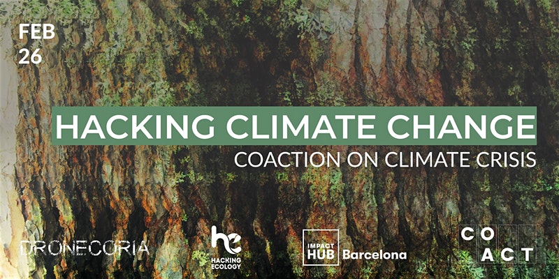 COACT
COACT
20 February 2020 12:00am
Habitat Restoration in the Pennines, UK
30 January 2020 8:48am
LIDAR USA sensor
14 January 2020 12:38pm
Thermal imaging, drones, and loggerhead sea turtles: a #tech4wildlife case study using FLIR's new Duo Pro R camera

21 September 2018 3:21pm
24 December 2019 6:42am
Rob thanks for the offer, sorry about delay in reply work has been in way. I have spoken to our coordinator here and we would be interested in borrowing flair 640 to see if it helps locate. Let me know he best way to get in touch.

2 January 2020 5:10pm
Hi thermal people,
Just a quick heads up, but I am exploring some of Seek Thermal's (ex FLIR engineers I believe) new Mosaic Core modules by having a play with their developer's kit. I'll report back once I receive the equipment, but their intention is to release 320 x 240 cameras at very low cost. Note - they won't sell them individually, so a reseller will be necessary, but if they are cost effective at this resolution it could prove excellent for wildlife conservation use.
https://www.thermal.com/uploads/1/0/1/3/101388544/mosaic_core_specification_sheet.pdf
Cheers,
Alasdair
2 January 2020 6:12pm
Cheers Al, and looking forward to hearing more about them. I am, as we speak, editing some thermal videos of wallaby behaviour near roads, specifically in relation to devices that activate lights and sounds when a car is approaching (activated by vehicle headlights at night). Used a Flir 640R, but I reckon half that resolution would still be fine. Unfortunately, not much support for the devices themselves working as a deterrent/warning (although I have some ideas on how they could with additional stimuli), but the thermal camera works great for non-invasive observations!
Image Processing Advice
22 October 2018 11:53am

13 November 2018 12:09pm
I just thought I would mention that i've been talking to Sol about his issue and also around multispectral and thermal sensors. No solution as yet to the issue but Sol will share some of his data with us so we can take a look.

28 November 2019 1:45am
Just wanted to mention I found a solution to my georeferencing issue. You can use the 'geosphere' package in R to identify the coordinates of specific coordinates in each image, based on the position of the central coordinate, bearing and distance to target pixel.
Feel free to drop me a line if you want a hand doing this!
28 November 2019 8:53am
Really useful to know about that package, thanks
[ARCHIVE] Virtual Meetup Discussion: Drones
19 November 2019 3:04pm
[ARCHIVE] WILDLABS Virtual Meetup Invitation: Drones
18 November 2019 4:35pm
WILDLABS Virtual Meetup Recording: Drones
 WILDLABS Team
9 November 2019 12:00am
How do you weigh a live whale?
9 October 2019 12:00am
Aerial Seeding with drones: reforestation Workshop in Brazil next November
2 September 2019 4:51pm
Tips to create a reforestation platform.
25 August 2019 11:37pm
[ARCHIVE] Promises and Pitfalls of Conservation Drones webinar (June 6)

3 June 2019 11:37am

22 August 2019 5:14pm
Is the webinar recorded and uploaded somewhere?

22 August 2019 5:24pm
It is indeed. You can watch it here:
https://consbio.org/products/webinars/scgis-webinar-promises-and-pitfalls-conservation-drones
I'll also see if we can add it to our resources area for ease of access. Leave it with me.
Workshop: Drones in the Coastal Zone
13 August 2019 12:00am
From the Field: Melissa Schiele
10 June 2019 12:00am
SALE: WingCopter HeavyLift drone, LiDAR, Multispektral camera, NextVision NightHawk
5 June 2019 10:20am
Circular Polarising Filters for the Mavic 2 Pro
29 April 2019 2:36pm

8 May 2019 7:23pm
I like the stuff Polar Pro puts out. I think they are some of the best you can get and it is what I use.

4 June 2019 3:31pm
Thank you for the tip! Shall try and pick up a set soon.
Drone flight in Indonesia
16 April 2019 12:08pm
17 April 2019 4:14pm
Hi Sophie,
The best thing would be to get in contact with the Department of Civil Aviation in the Indonesian state you're working in. You're right that you can fly without a permit for at low altitude in most places, but there may be diferent restrictions if the drone is used for research purposes so its worth checking. I received a license for drone work in Sabah (Malaysian Borneo) and they mainly wanted to know the drone specs, activities, flight coordinates, dates and if possible, times. The only restriction they gave us was to fly below 300 m,
There is usually a lot of back and forth between departments about who is ultimately responsible but they should be able to get it processed, as there are groups in Kalimantan using drones pretty regularly. Please let me know if you have any issues or need any other info.
Best wishes,
Sol
18 April 2019 5:07pm
Thanks so much Sol! How long did it take you to get permission to fly? And were there any costs associated with getting the permit?
4 June 2019 1:33pm
Hi Sophie,
Sorry- I only just saw your reply!
It took about 3 months to get it through the department of civil aviation, but this doesn't mean much, because the Indonesian system may be pretty different. It cost 250RM (£50) for each drone.
Cheers,
Sol
Canopy height mapping with drones
31 May 2019 12:00am
Technology for Wildlife and the Looming Spectre of E-Waste
3 May 2019 12:00am
WILDLABS Virtual Meetup: Low Cost, Open-Source Solutions
 WILDLABS Team
18 March 2019 12:00am
#Tech4Wildlife Photo Challenge: Our Favourites from 2019
3 March 2019 12:00am
Using Swiss AI and Drones to Count African Wildlife
18 February 2019 12:00am
Getting up close and personal with Antarctica's orcas
4 February 2019 12:00am
Drones with thermal imaging
21 January 2019 10:34am
11 March 2020 3:22am
Hi Ruth,
Thanks for your reply and the suggestion.
I contacted air shepherd and a few similar groups a few moths ago and they were all saying they are not interested due to the difficult drone regulations. Hopefully the regulations are not as arduous in Zimbabwe?
Please don't hesitate to ask if there is any technical information or assistance that I can provide to help with your project,
Jessi Hargrave