In recent years, drone technologies have been explored for a range of applications in conservation including (but not limited to) mapping, biodiversity inventories, antipoaching patrols, wildlife tracking, and fire monitoring. The rise of customizable, open-source drones like those of ArduPilot and OpenROV hold promise for more effective conservation applications, and combined with other monitoring sensors and devices, they are capable of collecting high-resolution data quickly, noninvasively, and at relatively low cost.
However, challenges remain in putting these tools to use. A recent paper reviewing 256 conservation drone projects highlighted some of these major obstacles, ranging from unintended social and ecological consequences of drone operations to still prohibitive costs, both in terms of hardware and in terms of storing and processing large volumes of data. The longstanding challenge of power/battery life remains as well.
If you're considering trying out drones for yourself, and want to explore the possibilities and understand the major conversations happening around this technology, check out these beginner's resources and conversations from across the WILDLABS platform:
Three Resources for Beginners:
- Conservation Technology User Guidelines Issue 5: Drones, World Wildlife Fund | Drones, best practices, ethics, regulations, case studies
- WILDLABS Virtual Meetup Recording: Drones, Craig Elder, Dr. Claire Burke, and Gabriel Levin | Drones, thermal camera, wildlife crime, ML, biologging
- New Paper: Drones and Bornean Orangutan Distribution, Sol Milne | Drones, data analysis, citizen science, community science, primates
Three Forum Threads for Beginners:
- Curious about radio-tracking with drones? | Wildlife Drones, Biologging (5 replies)
- Drones for GIS Best practice Document | Adrian Hughes, Drones (10 replies)
- WWF Conservation Technology Series: Drones in Conservation | Aurélie Shapiro, Drones (7 replies)
Three Tutorials for Beginners:
- How do I use a drone to capture radio-tracking data? | Debbie Saunders, Tech Tutors
- How do I choose the right drone for my conservation goals? | Shashank Srinivasan, Tech Tutors
- How do I strategically allocate drones for conservation? | Elizabeth Bondi, Tech Tutors
Want to know more about using drones, and learn from experts in the WILDLABS community? Make sure you join the conversation in our Drones group!
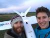
*Header photo: Parker Levinson, Point Blue Conservation Science
No showcases have been added to this group yet.

- @Margaret
- | Her/she
- 0 Resources
- 1 Discussions
- 8 Groups
- @Kwabs22
- | He
I'm a dynamic environmental conservationist driving change through research and innovation. I merge farming experience with agroforestry skills and drone technology, fueled by a passion for sustainable agriculture, championing a greener future for a sustainable food system.
- 0 Resources
- 0 Discussions
- 3 Groups

Conservation X Labs
Inventor/Engineer at Parula Innovations, Hardware Engineer for Sentinel at Conservation X Labs, (Recovering) Field Biologist
- 0 Resources
- 0 Discussions
- 6 Groups

Research software engineer working in computer vision for animal behaviour
- 1 Resources
- 1 Discussions
- 13 Groups

I help conservation scientists spend less time on boring stuff.


- 0 Resources
- 54 Discussions
- 6 Groups
- @mlamb2
- | she/her
PhD Student working on a computer vision model to detect colonial waterbirds along the Texas coast in aerial imagery
- 0 Resources
- 3 Discussions
- 3 Groups

The World Can Be Better
- 0 Resources
- 0 Discussions
- 9 Groups

- @Gcharron
- | Mr.
Cofounder of Outreach Robotics, I have a master in mechanical engineering and I thrive on developing new technology for field scientists using remote controlled robots.


- 1 Resources
- 15 Discussions
- 4 Groups

- @ppebs
- | she/her
Primatologist who studies human-primate coexistence and self-medicative behavior in non-human primates
- 0 Resources
- 1 Discussions
- 7 Groups

Liverpool John Moores University
Sensors, remote sensing, embedded systems, Drones
- 0 Resources
- 1 Discussions
- 7 Groups
Wildlife Drones
Wildlife Drones has developed the world’s most innovative radio animal-tracking system using drones so you can track your radio-tagged animals like never before.


- 18 Resources
- 8 Discussions
- 31 Groups
- @GrecoBobby
- | He/Him
PhD Student Clemson University. Investigating applied management techniques in crocodilians
- 0 Resources
- 0 Discussions
- 4 Groups
This paper explores the use of UAVs equipped with thermal and standard cameras to accurately count the group sizes of the Critically Endangered cao vit gibbon, highlighting how this technology can overcome the...
13 June 2023
Link

AirSeed has developed a unique approach to tackle climate change and restore biodiversity by combining drone technology, machine learning, and seed pod biotechnology to carry out planting that’s 25x faster than...
30 May 2023
Link
Using computer vision to understand bee vision

Ellie Warren
Here's an innovative project from the Harvey Mudd College Bee Lab that could help us understand how bees view their environments, and thus better protect bee habitat. This project uses computer vision and drone imagery...
5 May 2023
Link
Researchers use taxidermy bird drones to monitor wildlife

Stephanie O'Donnell
Interesting project - “Our main goal for this is to develop a nature-friendly drone concept for wildlife monitoring,” Hassanalian said. “Traditional drones are often disruptive to ecosystems due to issues such as sound...
26 April 2023
Careers
Hardware Lead - Biodiversity / Conservation

Ben Williamson
New role at Pivotal Earth
4 April 2023
Article

New paper in Journal of Animal Ecology
24 March 2023
Link
We used a combination of high-resolution satellite tracking (Fastloc-GPS), uncrewed aerial vehicle (UAV) surveys, and capture-mark-recapture approaches to assess the abundance of immature hawksbill (Eretmochelys...
21 March 2023
Article

Discover how drones are revolutionising conservation efforts and learn five essential tips to fly responsibly and minimise harm to wildlife, humans, and the environment.
14 March 2023
Careers
Proposals wanted for Innovation in Practice
Ellie Warren
The Innovation in Practice edition of Methods in Ecology and Evolution is still seeking proposals about conservation technology
6 March 2023
Interesting article that links to research on how technology has made studying moose populations easier, with particularly good explanation of what makes moose populations difficult to track.
22 February 2023
Careers
The Environmental Robotics Lab at ETH Zurich welcomes applications for a postdoctoral fellowship on robotics methods for the collection of environmental DNA to automate monitoring of biodiversity in terrestrial...
12 February 2023
Link
How daredevil drones find nearly extinct plants hiding in cliffs
Stephanie O'Donnell
Nice article about one of the Rainforest XPrize semifinalist teams - using drones to sample plant species. 'Nyberg and the National Tropical Botanical Garden (NTBG) team, working with the State of Hawaii's Division of...
10 February 2023
August 2025
event

Louisa Richmond-Coggan
September 2025
event
Louisa Richmond-Coggan
March 2026

July 2024
event

Wildlife Drones
33 Products
Recently updated products
| Description | Activity | Replies | Groups | Updated |
|---|---|---|---|---|
| hi Stephen, Kites have gimbals too (ranging from simple strings to metal rigs) and you can connect to a camera much like a drone. In my case I have a gimbal... |
|
Drones | 7 years 3 months ago | |
| Hi Chris, Your project sounds interesting! How's it coming along? I'm based in the SF Bay Area. I don't have much drone experience, but it's something... |
|
Drones | 7 years 7 months ago | |
| Hi, I would like to share this article with good social reflections about drones and mapping: https://forestcompass.org/drones-pros-... |
|
Drones | 7 years 8 months ago | |
| Excellent - started reading this yesterday. This is a very timely and pertinent paper. Thanks for sharing. |
|
Drones | 7 years 11 months ago | |
| Hi Mazidi, all the systems that I recommended are separate systems with their own GPS, not connected to the drone. Just the last one was the only finished product. Good luck... |
|
Drones | 7 years 11 months ago | |
| The European Space Agency have an exciting funding opportunity coming up and got in touch with us to ask that we share it with you,... |
|
Drones | 8 years 1 month ago | |
| For those who couldn't make it to the webinar, there's a recording at https://drive.google.com/file/d/0B0smOWFNRzuoLXpPSWREUnE2YzA/view. What do people think? Is this the... |
|
Drones | 8 years 1 month ago | |
| People in this thread might be interested in this special issue of remote sensing in ecology and conservation, looking for papers on "New Approaches to Citizen Science... |
+22
|
Drones | 8 years 1 month ago | |
| Cool! Thanks @Tomas Starnes. Meanwhile, http://precisionmapper.com/ has adopted the freemium model, so the first 60 maps by year are free, It's not open source but... |
|
Drones | 8 years 1 month ago | |
| Hey @ahughes_rspb , thanks for starting this thread! It would be really useful to share experience on GCPs in particular. We're about to start experimenting by... |
|
Drones | 8 years 2 months ago | |
| Hi Marcelo, To improve autonomy, you'll either need less weight on your drone, better batteries, or what about a fixed wing aircraft? Look at the parrot disco - it... |
|
Drones | 8 years 3 months ago | |
| This is really fascinating! This could also be potentially useful as a way to distribute vaccines for wildlife and livestock! |
|
Drones | 8 years 3 months ago |


WILDLABS Virtual Meetup Recording: Drones
 WILDLABS Team
9 November 2019 12:00am
How do you weigh a live whale?

9 October 2019 12:00am
Aerial Seeding with drones: reforestation Workshop in Brazil next November
2 September 2019 4:51pm
Tips to create a reforestation platform.
25 August 2019 11:37pm
[ARCHIVE] Promises and Pitfalls of Conservation Drones webinar (June 6)
3 June 2019 11:37am
22 August 2019 5:24pm
It is indeed. You can watch it here:
https://consbio.org/products/webinars/scgis-webinar-promises-and-pitfalls-conservation-drones
I'll also see if we can add it to our resources area for ease of access. Leave it with me.
Workshop: Drones in the Coastal Zone
13 August 2019 12:00am
From the Field: Melissa Schiele
10 June 2019 12:00am
SALE: WingCopter HeavyLift drone, LiDAR, Multispektral camera, NextVision NightHawk
5 June 2019 10:20am
Circular Polarising Filters for the Mavic 2 Pro

29 April 2019 2:36pm

8 May 2019 7:23pm
I like the stuff Polar Pro puts out. I think they are some of the best you can get and it is what I use.
4 June 2019 3:31pm
Thank you for the tip! Shall try and pick up a set soon.
Drone flight in Indonesia
16 April 2019 12:08pm

17 April 2019 4:14pm
Hi Sophie,
The best thing would be to get in contact with the Department of Civil Aviation in the Indonesian state you're working in. You're right that you can fly without a permit for at low altitude in most places, but there may be diferent restrictions if the drone is used for research purposes so its worth checking. I received a license for drone work in Sabah (Malaysian Borneo) and they mainly wanted to know the drone specs, activities, flight coordinates, dates and if possible, times. The only restriction they gave us was to fly below 300 m,
There is usually a lot of back and forth between departments about who is ultimately responsible but they should be able to get it processed, as there are groups in Kalimantan using drones pretty regularly. Please let me know if you have any issues or need any other info.
Best wishes,
Sol
18 April 2019 5:07pm
Thanks so much Sol! How long did it take you to get permission to fly? And were there any costs associated with getting the permit?
4 June 2019 1:33pm
Hi Sophie,
Sorry- I only just saw your reply!
It took about 3 months to get it through the department of civil aviation, but this doesn't mean much, because the Indonesian system may be pretty different. It cost 250RM (£50) for each drone.
Cheers,
Sol
Canopy height mapping with drones

31 May 2019 12:00am
Technology for Wildlife and the Looming Spectre of E-Waste
3 May 2019 12:00am
WILDLABS Virtual Meetup: Low Cost, Open-Source Solutions
WILDLABS Team
18 March 2019 12:00am
#Tech4Wildlife Photo Challenge: Our Favourites from 2019
3 March 2019 12:00am
Using Swiss AI and Drones to Count African Wildlife
18 February 2019 12:00am
Getting up close and personal with Antarctica's orcas
4 February 2019 12:00am
Drones with thermal imaging
21 January 2019 10:34am
Viral bear video shows how drones threaten wildlife – and what to do about it
22 November 2018 12:00am
Infrared filters for drone cameras
3 August 2017 11:17am
22 August 2017 3:09am
Although not for NDVI but worth a mention for anyone looking at converting a camera into IR only.
I have had sucess using a DIY filter made out of blank processed camera film from a disposable camera. So long as you can still find somewhere to process the film (or do it yourself) you just cut the processed film (negatives) and replace the digital cameras IR filter (placed over the cameras sensor). This will simply turn the camera into an IR camera only so won't fit your requirement for NDVI but thought that it is worth posting if others are looking at converting a camera or Go-Pro into an IR camera.

23 May 2018 9:41am
Hi Thom,
Did you have any luck with the DIY sensor?
Sam
10 November 2018 11:40am
If you need a piece of exposed (black) film then please get in touch. I still take "real" slides and have a few black frames at start and end of each roll of film.
Drones, Orangutans, and Strangler Figs in Malaysian Borneo
22 October 2018 12:00am
Multispectral Cameras
27 September 2018 2:38pm
Underwater Robot Trained to Kill Coral-Destroying Reef Starfish
18 September 2018 12:00am
Thermal imaging, drones, and sea turtles: a case study using FLIR’s new Duo Pro R camera
23 August 2018 12:00am
Drone Applications in Water Quality Research?

14 March 2018 4:42pm
16 March 2018 5:49am
Hi Ned,
Thank you so much for your response!
I absolutely agree- going out and testing flights over water at different angles and times of the day would be best. I'll look into a polarizing filter. I have spoken with some colleagues who recommend flying between noon and 3pm, and also that a cloudy day with diffused light can actually be quite helpful to avoid glint. I will look into the oil spill mapping - sounds very interesting. I've also heard that drones are sometimes restricted from oil spill regions due to risks of battery-caused fires (if the drones fall into the water).
Ved! Fantastic idea. I used to work with him down at Ames, so I will certainly reach out. Thank you for the reminder!
Cheers,
Chippie
6 June 2018 6:48pm
Hi CHippie - I am wondering how your thoughts are progressing on this topic? Please let us know an update.
Thanks
Michael
9 June 2018 12:10am
Hi Michael!
Thanks so much for following up. I have yet to really get my feet wet with drones & algal blooms (my water quality issue of interest at the moment), but what I gathered from my literature review is that hyperspectral cameras are a much more precise option than multispectral cameras for algal identification. I'm hoping to try out a red-edge camera to see if there is anything spectrally interesting, as I do not currently have access to a hyperspectral camera. For the time being, I am hoping to play with a MicaSense camera over wet habitat and see if anything can be observed. I'll keep you posted if I find anything of interest!
Thanks,
Chippie
From drone swarms to tree batteries, new tech is revolutionising ecology and conservation
 Euan Ritchie
and 1 more
Euan Ritchie
and 1 more
9 May 2018 12:00am
Tethered UAVs
14 March 2018 4:29pm
27 April 2018 11:46pm
Thanks - I did look into blimps but the helium problem is a big one for remote work. I do have a couple UAVs but the area I work is tricky (airport, waterdrome, and helicopter landing with occasional ships that carry helicopters). my hope was for a tethered solution that could run for longer than the 20min battery life of a drone. thanks for the info.
27 April 2018 11:53pm
thanks I adnt thought of kites - I will have to test one in the field this year. I imagined one of the advantages of a tethered UAV is that I can parasitize all the camera elements (gimble stabilization, pan/tilt/zoom, and real time viewing of the imagery). Maybe I could just secure a cheap UAV under a kite... I wonder how I choose the correct kite size.
28 April 2018 5:13pm
hi Stephen,
Kites have gimbals too (ranging from simple strings to metal rigs) and you can connect to a camera much like a drone. In my case I have a gimbal hanging on a string, and to connect to my camera I get live connection and can change settings with the GoPro app! this website has lots of info - size of the kite depends on payload (some people fly SLRs!) and wind.
Www.kapshop.com
Eddy Expedition Log: Characterizing Eddies
23 April 2018 12:00am
Eddy Expedition Log: Chasing Eddies
10 April 2018 12:00am
Eddy Expedition Log: Setting Off to Explore Eddies
3 April 2018 12:00am
#Tech4Wildlife Photo Challenge 2018: Our Top 10
3 March 2018 12:00am
22 August 2019 5:14pm
Is the webinar recorded and uploaded somewhere?