Group curators

Vance Russell
3point.xyz

Ahmed Junaid
- @ahmedjunaid
- | He/His

Elsa Carla De Grandi
Fauna & Flora
Who We Are
Geospatial data and analysis is critical for conservation, from planning to implementation and measuring success. Every day, mapping and spatial analysis are aiding conservation decisions, protected areas designation, habitat management on reserves and monitoring of wildlife populations, to name but a few examples. The Geospatial group focuses on all aspects of this field, from field surveys to remote sensing and data development/analysis to GIS systems.
How to Get Started
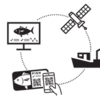
Want to learn more about how remote sensing is used in conservation? Check out the first two episodes of this season of Tech Tutors, where our Tutors answer the questions How do I use open source remote sensing data to monitor fishing? and How do I access and visualise open source remote sensing data in Google Earth Engine? You can also check out our Virtual Meetup Archive for a range of panels that overlap with Geospatial topics, or take a look at our Earth Observation 101 lecture series from Dr. Cristian Rossi.
Our Purpose
The WILDLABS Geospatial Group is for conservation practitioners, geospatial analysts, and academics that want to:
- Share geospatial resources, best practices, data, and ideas;
- Network amongst geospatial and data practitioners;
- Create peer learning opportunities;
- Promote the use of free and open-source geospatial software; and
- Improve the use of GIS software and geospatial analyses in conservation management and research.
Group curators
3point.xyz
Over 35 years of experience in biodiversity conservation worldwide, largely focused on forests, rewilding and conservation technology. I run my own business assisting nonprofits and agencies in the conservation community


- 7 Resources
- 69 Discussions
- 12 Groups
- @ahmedjunaid
- | He/His
Zoologist, Ecologist, Herpetologist, Conservation Biologist


- 75 Resources
- 7 Discussions
- 16 Groups
Fauna & Flora
Remote Sensing Scientist, Conservation Technology & Nature Markets @ Fauna & Flora - WILDLABS Geospatial Group Co-Lead

- 42 Resources
- 49 Discussions
- 9 Groups
No showcases have been added to this group yet.
- @KiaraHaylock
- | She/Her
PhD in Animal Ecology and Behavioural Physiology. Interested in the movement, behavioural and physiological responses of animals to environmental variability.
- 0 Resources
- 0 Discussions
- 13 Groups
20+ years traveler and management consultant turned tech founder and conservationist. Founder & CEO of ZAMBEZI ZERØ; super intelligence to safeguard biodiversity.
- 0 Resources
- 0 Discussions
- 15 Groups
Hen Mpoano
- 0 Resources
- 0 Discussions
- 3 Groups
- @brunameneses
- | she/her
- 0 Resources
- 0 Discussions
- 8 Groups
- @TheDataEnthusiastic
- | He/Him
Hi, I'm pursuing Master's in Data Science. And I want work help protect nature and wildlife.
- 0 Resources
- 0 Discussions
- 13 Groups
- 0 Resources
- 1 Discussions
- 8 Groups
World Wide Fund for Nature/ World Wildlife Fund (WWF)

- 0 Resources
- 12 Discussions
- 15 Groups
- @jodirowley
- | she/her
Conservation biologist obsessed with frogs
- 1 Resources
- 0 Discussions
- 5 Groups
- @apcxs
- | He, his, them
- 0 Resources
- 0 Discussions
- 11 Groups

- 1 Resources
- 5 Discussions
- 9 Groups

I am a Geoscientist interested in using geospatial data science to contribute to solutions of today’s environmental challenges. I mostly worked with land surafce temperature data from satellites and drones to study how high mountain landscapes respond to climate change.
- 0 Resources
- 0 Discussions
- 6 Groups

- @Helga_Kuechly
- | she/her
World Wide Fund for Nature/ World Wildlife Fund (WWF)
I am a Geo-ecologist, who loves to use GIS, remote sensing, citizen science and knowledge transfer to shape for a better future for nature - We are part of nature, so let's act like it!
- 2 Resources
- 1 Discussions
- 8 Groups
Careers
Conservation Technology Research Internship

Meredith Palmer
Boost cons tech capacity at an international NGO! Fauna & Flora International is offering a paid three-month internship to consolidate and share best practices for the application of emerging hardware and software...
26 August 2022
Careers

The incumbent will conduct research to advance the integration of wildlife tracking & space-based remote sensing, serve as a member of the multi-agency Internet of Animals project & participate as an inter-...
25 August 2022
Funding
RCMRD Map Competition 2022

Netty Cheruto
Through this Competition, RCMRD aims to enhance the role of Geo-conservation in Protected Areas Management and Environmental Conservation. With a Total Prize Tag of 10,000 Euros, participants will be required to use...
19 August 2022
Link
A vegetation carbon isoscape for Australia | TERN Australia

Stephanie O'Donnell
TERN Australia has launched a new set of open-access data products that will advance research in a range of subjects, including food chain dynamics, animal migration, carbon fluxes, and plant productivity 🌿🦘
19 August 2022
Careers

The Marine Robotics and Remote Sensing (MaRRS) Lab at Duke University seeks a highly motivated UAS pilot and geospatial analyst to support the ongoing development of new and existing research and conservation programs,...
10 August 2022
Careers
The Marine Robotics and Remote Sensing (MaRRS) Lab at Duke University seeks a highly motivated postdoctoral researcher to support the ongoing development of new and existing research and conservation programs, both...
10 August 2022
Careers
Smithsonian Conservation Biology Institute (SCBI) & International Fund for Houbara Conservation (IFHC)
22 July 2022
Article
CERES TAG

Kim Lane
Ceres Tag sends just in time alerts and GPS location to have the power to track and trace.
22 July 2022
Careers
Conservation Data Coordinator
Giraffe Conservation Foundation (GCF)
Giraffe Conservation Foundation has now opened this opportunity to qualified candidates willing to work remotely. The position is desktop-based and the successful candidate can work from anywhere in the world to provide...
15 July 2022
Careers
In this role, you will serve as the main data liaison for the USAID Forest Data Partnership project, integrating with Global Forest Watch and Land & Carbon Lab research teams.
14 July 2022
Careers
Service Designer

Catherine Greene
Love design, passionate about conversation? Want to make sure that technologies that are being developed actually meet the needs of the people who use them? Come and work for us!
13 July 2022
Careers
WHOI is establishing an Imaging Technology Laboratory (ITL) & seeks a senior technical leader to lead the initiative. The primary goal of the ITL is to create a center of excellence to serve the technical imaging...
11 July 2022
September 2025
event

Ideal Workplace Solutions
October 2025
event

Lacey Hughey and 3 more
November 2025

event

Brigitta Keeves
March 2026

December 2023

131 Products
Recently updated products
| Description | Activity | Replies | Groups | Updated |
|---|---|---|---|---|
| Hey MGatta, I'm working with adehabitatLt as well, i have a good paper on spatial referencing your data and changing your coordinates to UTM, if you want it (by C.J.... |
|
Geospatial | 8 years 8 months ago | |
| Hello all, I came across this website featuring free vector and raster datasets. Feel free to use it! |
|
Geospatial | 8 years 9 months ago | |
| Now the course is officially over, I wonder how people found it? Too difficult, too easy or just right? |
|
Geospatial | 8 years 10 months ago | |
| I'm not affiliated with Google or this event, but I thought it would be of interest to the community. I have previously attended and it... |
|
Geospatial | 9 years 2 months ago | |
| Things just got a whole lot easier for those of us at universities who train students to use drones as tools for conservation. Many... |
|
Geospatial | 9 years 3 months ago | |
| Another option is OruxMaps, free for android, not very intuitive but very powerful. But it's important to bear in mind that phone GPS accuracy can be lower than... |
|
Geospatial | 9 years 4 months ago | |
| ZSL is holding a remote sensing symposium on the 29th April, 2016: Space - the final frontier for biodiversity monitoring?... |
|
Geospatial | 9 years 4 months ago | |
| Hello all, This blog immediately make me think of our community and the possibilities for one of our members to provide a solution.... |
|
Geospatial | 9 years 5 months ago | |
| Thank you. I am doing pre reading and Information gathering, so I'll know what to expect and be prepared. Thank you for your kind answer Stephanie. |
|
Geospatial | 9 years 5 months ago | |
| Hello all - this paper looks highly relevant to this thread. "Satellite alerts track deforestation in real time: System uses... |
|
Geospatial | 9 years 6 months ago | |
| Advance Object-Based Classification of Delta Region Sindh. A project completed by COGE team. If you have any queries please contact :... |
|
Geospatial | 9 years 6 months ago | |
| Greetings all! I just received this invitation from Google. Feel free to distribute to your colleages. Applications due by March 15.... |
|
Geospatial | 9 years 6 months ago |


SCGIS-CBI 2021 Spring Webinar Series
6 March 2021 3:46pm
New Maps from Allen Coral Atlas
10 February 2021 7:24pm
Using AIS Data to Investigate the World’s Fishing Ports
2 February 2021 12:00am
SCGIS New Year's Happy Hour Meetup
27 January 2021 10:12am
Event: Role of GIS in Ocean Conservation
26 January 2021 12:00am
Drone Mapping for Algal Blooms?

14 March 2018 4:24am
19 December 2020 12:20am
Hi Ryan,
Great question. I think it depends on the water clarity and illumination of the water (solar angle can have a big impact on this). I was able to fly above the water and see down to about 2-3 meters below the water's surface down to the benthic algae in the Klamath River last summer. I was flying a Phantom 4 Pro.
Hope this helps!
Chippie

19 December 2020 1:05am
OK that opens up some doors. The mavic mini is a lot less expensive and can fly for 30 minutes at a time. The only question would be the camera on board and if it's got what you need for your work.
17 January 2021 2:39pm
Hi,
Not exactly what you were looking for, but Public Lab have used balloons with cameras to map oil spills. This could be adapted to your purpose. You could stick one of Ryan's cameras on it and livestream it 24/7.
Here is another old technology that doesn't get talked about.
I have also worked on an AUV, with the ultimate intent of coastal algal bloom detection. This doesn't map a bloom, rather it would report anomalous chlorophyl-a readings. This work is stalled due to lack of testing/development facilities. And money.
Thanks,
-harold
Press Release: BAS Giant Iceberg Mission
13 January 2021 12:00am
British Antarctic Survey: Monitoring Whales From Space
21 December 2020 12:00am
Announcing the 2020 Geospatial Conservation Annual Report

17 December 2020 12:00am
Tech Tutors: How do I access remote sensing data with Google Earth Engine?

10 December 2020 2:25pm
14 December 2020 7:58pm
Just came across this newly released paper on using Google Earth Engine in conservation :)
FIS Call for Expressions of Interest (closed)

8 December 2020 12:00am
Tech Tutors: How do I use open access remote sensing data to monitor fishing?

2 December 2020 9:12pm
Making the Most of Tech Tutors Season 2!
 WILDLABS Team
30 November 2020 12:00am
WILDLABS Tech Tutors: Season Two
WILDLABS Team
24 November 2020 12:00am
How do I use open access remote sensing data to monitor fishing?
WILDLABS Team
24 November 2020 12:00am
Hackathon Opportunity: Vaquita Hacks
10 November 2020 12:00am
Southern Right Whales & Genome and Satellite Technology
5 November 2020 12:00am
Call for Tech Tutors questions: remote sensing
22 October 2020 9:30am
Maps and GIS webinars and virtual events
29 April 2020 2:10pm
1 May 2020 7:10am
As if that wasn't enough, here's another webinar for you...
Women in GIS
To celebrate the release of the second volume of Women and GIS, Esri Press, in partnership with Esri’s Women’s Enablement & Career Advancement Network (WeCan), is excited to host a webinar focused on celebrating and highlighting the amazing women featured in the book. The recording of this webinar is now available here.
During this webinar, participants will:
• Hear directly from several women featured in Women and GIS Volume 2 about their work
• Learn how women are using GIS to making a difference in government, education, sustainable development, and more
The amazing presenters in this webinar include: Dr. Susan Wolfinbarger, Rhiannan Price, Verónica Nelly Vélez, and Dr. Catherine Nakalembe
To learn more about the women featured in the webinar, and many other amazing women in GIS, check out "Women and GIS, Volume 2: Stars of Spatial Science". This book is available for purchase today at most online retailers. Grab a copy here.
15 October 2020 11:20am
Webinar/training series: Remote Sensing for Mangroves in Support of the UN Sustainable Development Goals.
This training focuses on mapping and monitoring mangroves and how it relates to UN sustainable development indicator 6.6.1: Change in the extent of water-related ecosystems over time. Indicator 6.6.1 is used in determining progress toward meeting Sustainable Development Goal 6, which is to “Ensure availability and sustainable management of water and sanitation for all.
Three parts, weekly beginning 5th November 2020 (there are two sessions per day to cover different time zones).
(thanks for flagging @hattiebranson )
Opportunity: Sustainable Development Goals Internship

13 October 2020 12:00am
Webinar: Advances in Fisheries Electronic Monitoring
 SAFET
SAFET
21 September 2020 12:00am
Icarus Starts First Global Research Project

15 September 2020 12:00am
Argos Satellite Tag Open-Source Grant

17 August 2020 12:00am
Webinar: Building location-based narratives
11 August 2020 12:00am
Sustainable Fishing Challenges: Fishing Vessels of the Future

4 August 2020 12:00am
Training Opportunity: Durrell Conservation Academy
 Durrell Conservation Academy
16 July 2020 12:00am
Estimating carbon from 3d models of mangroves

13 May 2020 1:14pm

26 June 2020 8:10am
Hello Nandini. I did something similar mapping carbon stocks of subsurface peat reserves in upland habitats in the UK. It was pretty basic though. Modelled the 3D volume of peat from uav, field survey, geostatistical analysis and 3D modelling techniques. They simply calculated the carbon stock through the volume present.


Ecology Live: Satellite Imagery, Land Cover Mapping, and More
 British Ecological Society
23 June 2020 12:00am
Webinar: The Next Generation Of Animal Telemetry
 BOEM
BOEM
1 June 2020 12:00am
Era of the Condor: A Species' Future in Recovery
5 May 2020 12:00am
6 March 2021 3:33pm
Wow, thanks for sharing, @ZoeLieb ! Great initiative and wonderful opportunity for people to contribute to the atlas. Good luck!