The Boring Fund 2025: Ask your questions!
 Henry Rees
and 2 more
Henry Rees
and 2 more
2 July 2025 5:10pm

15 August 2025 1:13am
Question: the application form link leads to a Google account sign in page. How about those of us who do not have and/or do not wish to have a Google account? Could you tweak the permissions so that someone under this scenario can still submit? Kind regards
16 August 2025 10:35pm
Hello, and thank you for this opportunity. I would like to ask for clarification about the scope of eligible projects.
The guidelines mention that the Boring Fund supports training materials, documentation and guidance, data mobilisation, knowledge transfer, and maintaining existing technology for conservation technology. My question is:
Can the fund also support training materials, documentation, or guidance focused on the internal administration of conservation organisations? For example:
- Practical guides on good practices for financial and accounting management.
- Documentation or training resources on project management and reporting systems.
- Support for implementing or maintaining project management software tools (not new tools, but improving accessibility and use of existing ones).
The idea is that by strengthening the administrative and financial foundations of small NGOs and community organisations, they can become more sustainable and effective in the long term when using conservation technologies. Would this type of proposal fit within the Boring Fund’s mission, or should applications remain limited only to materials and documentation directly related to conservation technologies (e.g. drones, GIS, bioacoustics, etc.)?
Thank you very much for your guidance.
Welcome to WILDLABS!

29 October 2015 5:16pm

15 August 2025 12:06pm
Hi all, happy to join this great community! My name is Caitlyn Socwell, self-proclaimed Austramerican currently based in the Netherlands. I'm a physio-turned-sustainability champion and am the founder of The Waste Not Spot, where I work on projects around the world tackling conservation and anti-pollution projects. Excited to connect with you and potentially work together on a project in the future!
15 August 2025 3:20pm
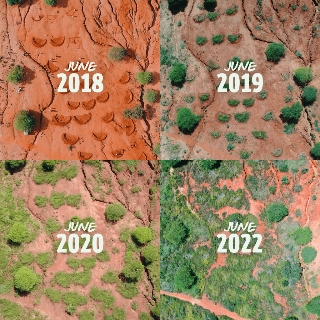
Hello Everyone,
I work for Justdiggit. We have been regreening landscapes in Africa for over a decade. We work with farmers and pastoralists to regreen their land and cool down the planet. This leads to richer soil, richer biodiversity and richer farmers.
So far we have about 500.000 hectares of land under restoration. This is great, but we want the regreening movement to scale up. This is why we invest in digital tools to spread the adoption of regreening methods.
My role as Head of Digital Regreening is to build the platform and the partnerships we need to inspire millions to take action. Just last week we celebrated the first year of Kijani in Tanzania, the Android app with personalised trainings on techniques to improve soil and livelihoods. Regreening is done together, I am very open to exploring how we can collaborate, or even just learn from each other.
Nice to meet you!
Carl
16 August 2025 7:50pm
Hi everyone! I'm Sadie, a zooarchaeologist currently based in Brazil. My current research examines climate change via stable isotopes in molluscs from archaeological sites called sambaquis, or shell mounds. I also have worked with VASI (Amazonian Vision for Integrated Sustainability) for the past seven years in projects that improved the health, biodiversity, and environment in the Peruvian Amazon. Archaeological datasets - faunal, microbotanical, and macrobotanical remains - are an underused resource in the conservation space, so I'm excited to be here and learn and share with you all.
-Sadie
How AI Can Help Save Wetlands: The Power of Large Language Models in Conservation

16 August 2025 2:06pm
Mau Consavation

Programmable drop-off units

12 August 2025 11:18am

12 August 2025 2:29pm
Hi Emily,
Timelord and @Rob_Appleby might help:

15 August 2025 10:15am
Thanks Adrien, I have reached out to Rob
Mini AI Wildlife Monitor

25 June 2025 12:27pm

26 July 2025 7:04am
A side note, For insects you'll need an higher resolution camera. The Mothbox porject uses a 64MP camera

14 August 2025 12:55am
Aloha Luke,
This is an amazing tool that you have created. Are your cameras availble for purchase? We use a lot of camera traps in the Hono O Na Pali Natural Area Reserve on Kauai to pasively detect animals. We do not have the staff knowledge and capacity to build our own camera traps like this.
15 August 2025 7:53am
Hi Chris!
Send me a direct message and we can have a chat!
International Conference on Computer Vision, ICCV 2025

14 August 2025 2:41pm
API endpoint to detect & classify animals

14 August 2025 12:54pm
Updates on Mole-Rat Mystery Drone Project

10 June 2025 10:21am

10 June 2025 6:04pm
Such a great case study!!
12 June 2025 11:33am
Thank you Elsa :)
14 August 2025 6:07am
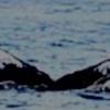
want to join 2025 contest for humpback whale photos in Juneo Alaska of Kelp
Women Conserving Southern Africa
16 July 2025 10:38am

24 July 2025 9:01pm
Thanks for sharing this, Emily! Feel free to also add this as an event on WILDLABS so it appears on our community calendar.
25 July 2025 8:10am
Thanks for that Alex, I've added the event!
14 August 2025 3:29am
This is wonderful, thanks for sharing!
How has the Funding & Finance group done?

6 August 2025 9:52am

8 August 2025 5:47pm
Thank you for this amazing summary Frank!
As someone regularly seeking conservation technology funding the posts on the resources page are very very helpful! I only just realized today that those are there and will now be checking back regularly.
In terms of general feedback, it would be very useful to be able to subscribe to receive email notifications of new funding opportunities posted on the resources page.
Thanks for all you do!

11 August 2025 6:21pm
Hi Frank,
First thanks to you, Henry, and Aurélie for making this group happen. It's much needed. This probably isn't that useful, but I find all three useful (announcements, resources, ?s). One big quest for me and others is, once you find the funding source that fits, how do you make the application easier to put together, e.g., are there parts of a proposal or application you can automate (not using AI to write, just automating the boring stuff)? Or could you utilize coding and AI to extract the necessary components from an RFP and structure the files and sections within them to then write and develop the budget? Super exciting stuff, but it gets tedious when you have a lot of proposals, each with their own slightly different requirements.
There are some software solutions for this, but they're business oriented, expensive, and proprietary. This is really more funding solutions than funding but wondering if there's any interest in a team pursuing something that helps with this?
Best,
V
14 August 2025 3:17am
Thanks Frank.
Advice and cooperation for small amphibian movement transmiter

13 August 2025 3:13pm
WOOHOO ITS WORKING!! Tech finds undetected decades old Alien Invasive Parent Plants in indigenous forest!
24 July 2025 12:21pm
13 August 2025 2:06pm
This is awesome!!
The Boring Fund 2024: Ask your questions!
16 September 2024 5:59pm

9 October 2024 9:05pm
Thanks! That’s something to consider then! I always think abt going to Huaqiangbei market in Shenzhen, and buying there for big savings. But it feels like it might a recipe for getting scammed, if you don’t speak the language!
21 October 2024 11:21am
Hi,
I lost track of the timeline; the Green Box submitted an idea for development, but I have not received any further communication. Could you please remind me what the timetable is, and if we will get feedback on our applications (knowing we are not the only ones with ideas, I can imagine the workload this has given)?
I am looking forward to your reply and insights.
Best wishes,
Gijs
12 August 2025 10:43am
How to submit a proposal for the Boring Fund on the Platform ?

Environmental DNA – An emerging tool in conservation for monitoring past and present biodiversity

Seeking Connections with Chile’s Wildlife Conservation
11 August 2025 6:28pm
Safe and Sound: a standard for bioacoustic data

7 April 2025 11:05pm

23 April 2025 4:19pm
Fantastic! Can't wait to hear updates.

11 July 2025 3:29pm
For anyone seeing this in the future. An update can be seen in the June 2025 event:

11 August 2025 12:15pm
As someone from the future, thank you for posting this update!
Camera Trapping Software
21 March 2019 8:50am
25 July 2025 10:30am
Well either or really, but in this particular case we have massive datasets that have already been processed so more the data management side of things, but if there was a potential to include software that would be cool - but I find that its not always possible to necessarily combine them both with the ammount of desired flexibility. In terms of the database side, something like the Panthera IDS system would probably be closest to what I'm searching for (although I'm aware this does also have the software side of things)
26 July 2025 8:19pm
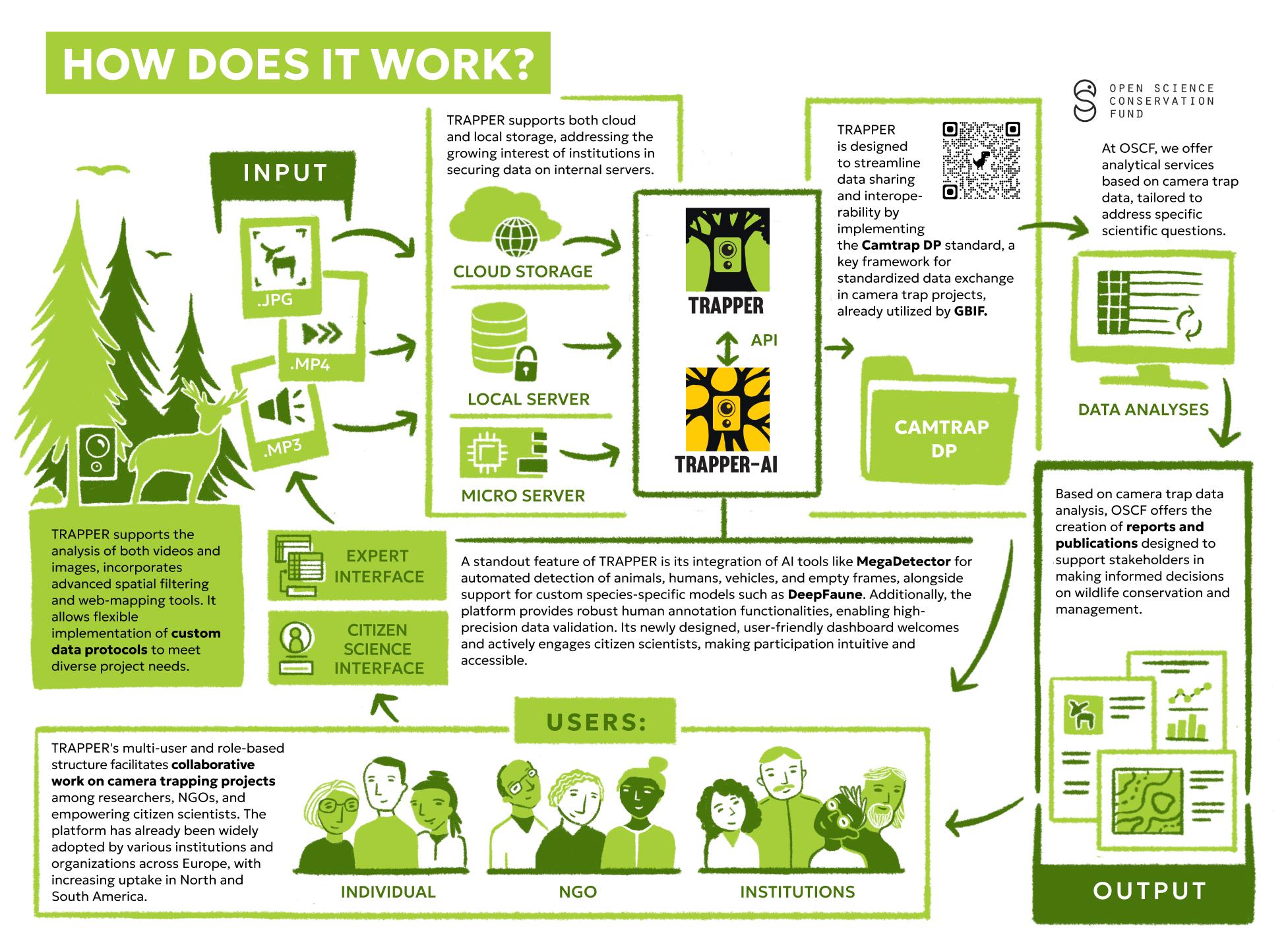
@LydiaKatsis The latest version of TRAPPER has an integrated AI module with multiple models available. We are currently collaborating on a project, Trapper Keeper, sponsored by a WILDLABS Award to make TRAPPER even easier to use and deploy.
Some of the OSCF team, which drive TRAPPER development, are also on WILDLABS: @kbubnicki and @icorei

11 August 2025 11:25am
@LydiaKatsis Trapper was designed to process large-scale camera trap projects, and it offers two interfaces for data management: a simple citizen science interface and an expert interface that will likely meet your needs. As the Open Science Conservation Fund is also the initiator of the CamTrap DP standards, it is fully integrated with Trapper. More details can be provided by @kbubnicki .
Here a bit how Trapper infrastructure works:
Zimbabwe Shines: 5 Key Takeaways from Ramsar COP15
10 August 2025 11:56pm
Suggestions for research funds

10 August 2025 5:56pm
Safeguarding Amazonian Stingless Bees

3 June 2025 1:10pm
9 August 2025 1:42pm
Hi everyone!
Sharing a Project Update here :)
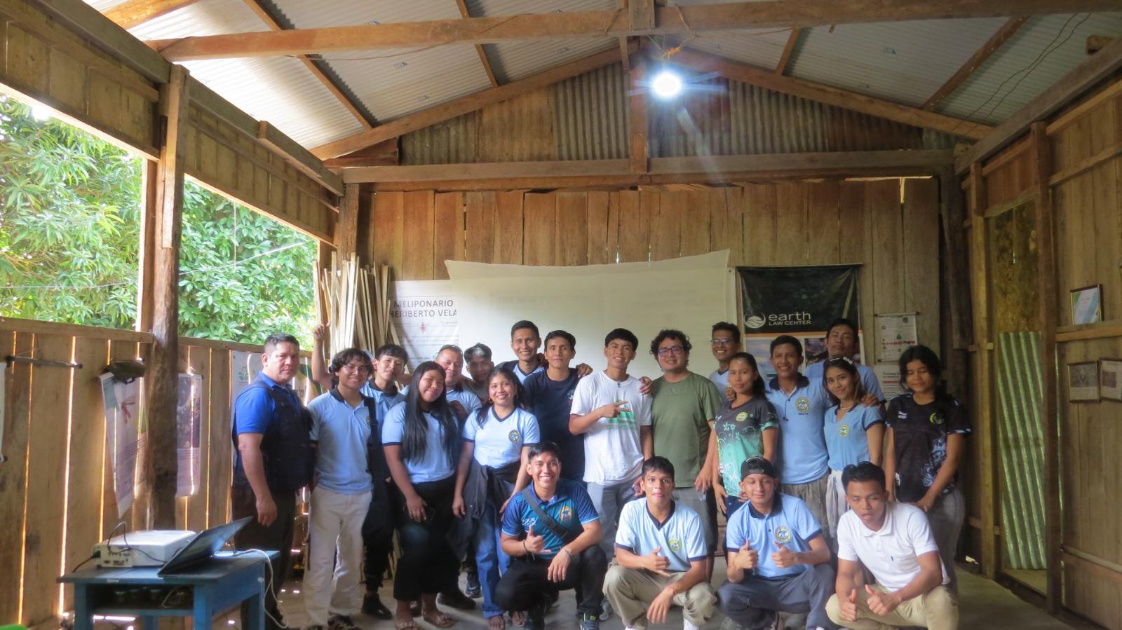
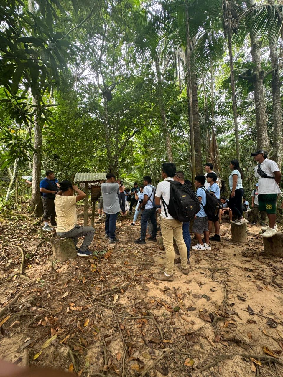
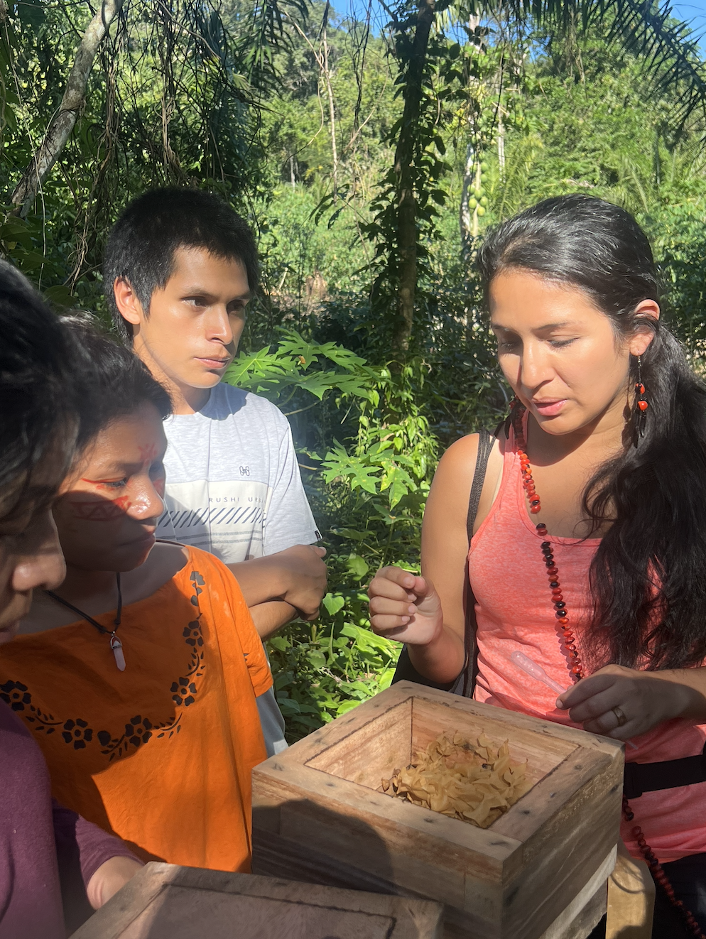
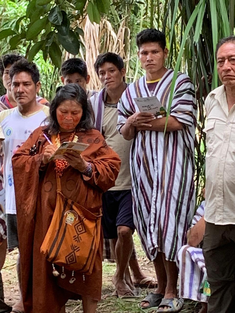
This past July, we successfully launched the expansion of our bee mapping work across the Peruvian Amazon with the support of WildLabs. During our expedition, collectively with our team members we identified 38 stingless beehives representing several key species, strengthening our database for conservation planning.
We also led capacity-building workshops for 25 Indigenous men, women and youth on stingless beekeeping, habitat monitoring, and GPS-based data collection. These sessions are part of our broader effort to integrate technology with traditional knowledge and to equip the next generation of conservation leaders.
Also we are very happy to share that our pilot work in the Junín region has now been published in the Journal of Ecology and Environment (link), providing a scientific foundation for the methodologies we are now scaling to new regions.
With each expedition, we are building not only a clearer picture of where Amazonian stingless bees live and the threats they face, but also a strong network of Indigenous scientists and community conservationists who will safeguard this knowledge and these species for the future. This is strengthened with the co-creation of a Biocultural Community Protocol together with our Indigenous partners and environmental lawyer partners (Earth Law Center) which will continue to gather key data and knowledge to serve as the basis for bee and ecosystem protection.
For our pilot work (recently published), we used ARCGIS to map the wild beehives identified, and overlaid national deforestation data to understand the risk endangering bees. For this next-phase, that incorporates multiple regions and thus allows us to look at climate impact, we aim to go even further. We would love to get anyone's thoughts and inputs on this, so we can empower more Peruvian local youth to lead this impactful science work!
Thank you!
Rosa
Tracking Individual Whales in 360-degree Videos
28 July 2025 1:22am
5 August 2025 5:20pm
Hey Courtney! I've just sent you an email about coming on Variety Hour to talk about your work :) Looking forward to hearing from you!

8 August 2025 4:40pm
Have you tried using Insta360's DeepTrack feature on your Studio desktop app? We have used it for similar use cases and it worked well. I would love to hear if it works for your science objectives. We are also experimenting and would love to know your thoughts. :) https://youtu.be/z8WKtdPCL_E?t=123
9 August 2025 12:44am
Hi @CourtneyShuert
We support NOAA with AI for individual ID for belugas (but from aerial and from lateral surface too). If some of our techniques can be cross-applied please reach out: jason at wildme dot org
Cheers,
Jason
Free online tool to analyze wildlife images
4 August 2025 8:01am
8 August 2025 5:23pm
Hello Eugene, I just tried your service:
Was wondering how possible will it be to have the option to upload a second image and have a comparison running to let the user know if body patterns are: 'same' or 'different', helping to identify individuals.
Thanks and kind regards from Colombia,
Alejo
Unlock New Features by Earning Your Community Involvement Badge!

14 March 2024 11:54am
14 March 2024 2:41pm
The journey to Ent begins

14 March 2024 2:56pm
@Rob_Appleby follow these instructions to get your Sprout badge!

8 August 2025 4:53pm
Interesting way to get community members contributing to the platform, to learn and share knowledge on GIS-Based conservation
Online Ocean-Focused GIS Course

8 August 2025 2:53pm
Anyone using InVEST?
10 July 2025 1:31pm
5 August 2025 7:27pm
If you're curious about InVEST I just created a page in "The Inventory" (see link on this page) with some resources and just wanted to hlighlight some potentially interesting models that are worth having a look at!
- Habitat Quality: this model uses habitat quality and rarity as proxies to represent the biodiversity of a landscape, estimating the extent of habitat and vegetation types across a landscape, and their state of degradation.
- Habitat Risk Assessment: this model evaluates risks posed to coastal and marine habitats in terms of exposure to human activities and the habitat-specific consequence of that exposure for delivery of ecosystem services.
Crop Pollination: this model focuses on wild pollinators providing an ecosystem service. The model estimates insect pollinator nest sites, floral resources, and flight ranges to derive an index of pollinator abundance on each cell on a landscape. If desired, the model can creates an index of the value of these pollinators to agricultural production, and attributes this value back to source cells.

7 August 2025 7:40pm
Elsa,
We have been working with InVEST for a number of years. We have found them helpful for conservation and scenario planning. Happy to share as helpful.
John

8 August 2025 2:23pm
Hi Elsa,
We have used InVEST for a pollinator project we supported (the crop pollination model - details here), and looking to using it more for marine and coastal applications so really appreciate the details you shared here!
Cheers,
Liz
🐸 WILDLABS Awards 2025: Open-Source Solutions for Amphibian Monitoring: Adapting Autonomous Recording Devices (ARDs) and AI-Based Detection in Patagonia

27 May 2025 8:39pm
7 August 2025 9:27pm
Project Update — Sensors, Sounds, and DIY Solutions (sensores, sonidos y soluciones caseras)
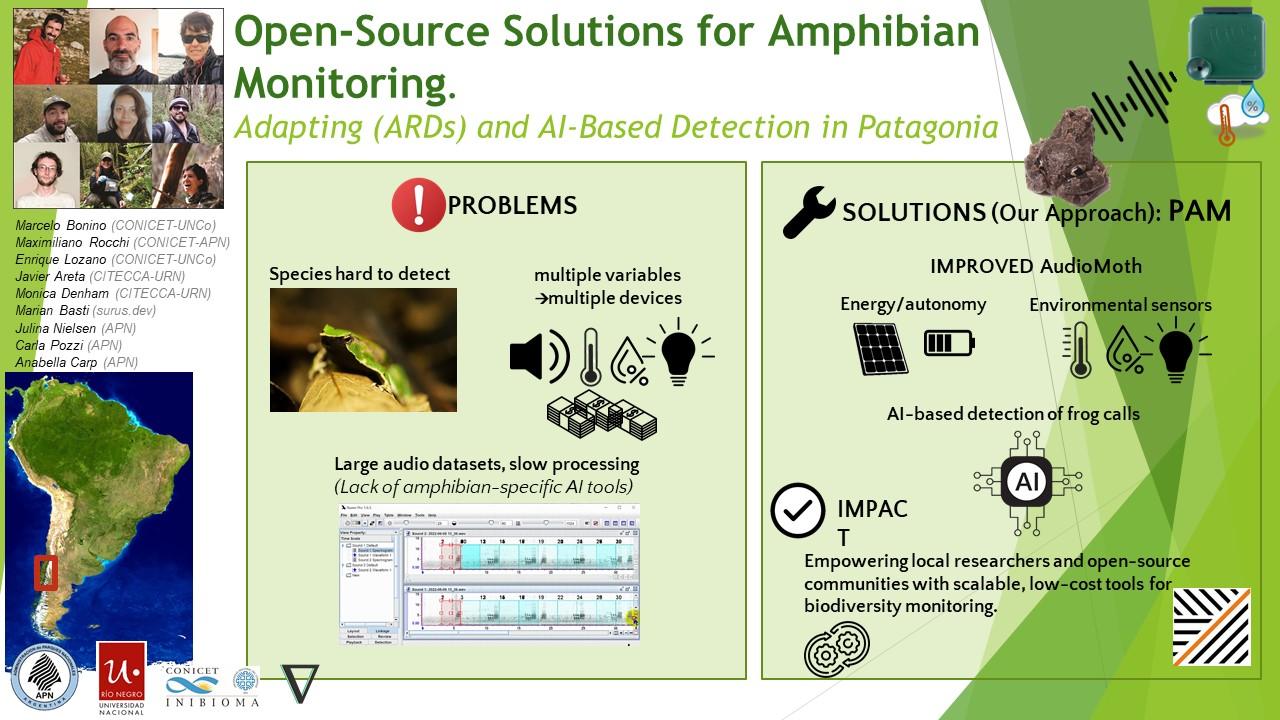
We continue making progress on our bioacoustics project focused on the conservation of Patagonian amphibians, thanks to the support of WILDLABS. Here are some of the areas we’ve been working on in recent months:
(Seguimos avanzando en nuestro proyecto de bioacústica aplicada a la conservación de anfibios patagónicos, gracias al apoyo de WildLabs.Queremos compartir algunos de los frentes en los que estuvimos trabajando estos meses)
1. Hardware
One of our main goals was to explore how to improve AudioMoth recorders to capture not only sound but also key environmental variables for amphibian monitoring. We tested an implementation of the I2C protocol using bit banging via the GPIO pins, allowing us to connect external sensors. The modified firmware is already available in our repository:
👉 https://gitlab.com/emiliobascary/audiomoth
We are still working on managing power consumption and integrating specific sensors, but the initial tests have been promising.
(Uno de nuestros principales objetivos fue explorar cómo mejorar las grabadoras AudioMoth para que registren no sólo sonido, sino también variables ambientales clave para el monitoreo de anfibios. Probamos una implementación del protocolo I2C mediante bit banging en los pines GPIO, lo que permite conectar sensores externos. La modificación del firmware ya está disponible en nuestro repositorio:
https://gitlab.com/emiliobascary/audiomoth
Aún estamos trabajando en la gestión del consumo energético y en incorporar sensores específicos, pero los primeros ensayos son alentadores.)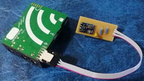
2. Software (AI)
We explored different strategies for automatically detecting vocalizations in complex acoustic landscapes.
BirdNET is by far the most widely used, but we noted that it’s implemented in TensorFlow — a library that is becoming somewhat outdated.
This gave us the opportunity to reimplement it in PyTorch (currently the most widely used and actively maintained deep learning library) and begin pretraining a new model using AnuraSet and our own data. Given the rapid evolution of neural network architectures, we also took the chance to experiment with Transformers — specifically, Whisper and DeltaNet.
Our code and progress will be shared soon on GitHub.
(Exploramos diferentes estrategias para la detección automática de vocalizaciones en paisajes acústicos complejos. La más utilizada por lejos es BirdNet, aunque notamos que está implementado en TensorFlow, una libreria de que está quedando al margen. Aprovechamos la oportunidad para reimplementarla en PyTorch (la librería de deep learning con mayor mantenimiento y más popular hoy en día) y realizar un nuevo pre-entrenamiento basado en AnuraSet y nuestros propios datos. Dado la rápida evolución de las arquitecturas de redes neuronales disponibles, tomamos la oportunidad para implementar y experimentar con Transformers. Más específicamente Whisper y DeltaNet. Nuestro código y avances irán siendo compartidos en GitHub.)
3. Miscellaneous
Alongside hardware and software, we’ve been refining our workflow.
We found interesting points of alignment with the “Safe and Sound: a standard for bioacoustic data” initiative (still in progress), which offers clear guidelines for folder structure and data handling in bioacoustics. This is helping us design protocols that ensure organization, traceability, and future reuse of our data.
We also discussed annotation criteria with @jsulloa to ensure consistent and replicable labeling that supports the training of automatic models.
We're excited to continue sharing experiences with the Latin America Community— we know we share many of the same challenges, but also great potential to apply these technologies to conservation in our region.
(Además del trabajo en hardware y software, estamos afinando nuestro flujo de trabajo. Encontramos puntos de articulación muy interesantes con la iniciativa “Safe and Sound: a standard for bioacoustic data” (todavía en progreso), que ofrece lineamientos claros sobre la estructura de carpetas y el manejo de datos bioacústicos. Esto nos está ayudando a diseñar protocolos que garanticen orden, trazabilidad y reutilización futura de la información. También discutimos criterios de etiquetado con @jsulloa, para lograr anotaciones consistentes y replicables que faciliten el entrenamiento de modelos automáticos. Estamos entusiasmados por seguir compartiendo experiencias con Latin America Community , con quienes sabemos que compartimos muchos desafíos, pero también un enorme potencial para aplicar estas tecnologías a la conservación en nuestra región.)
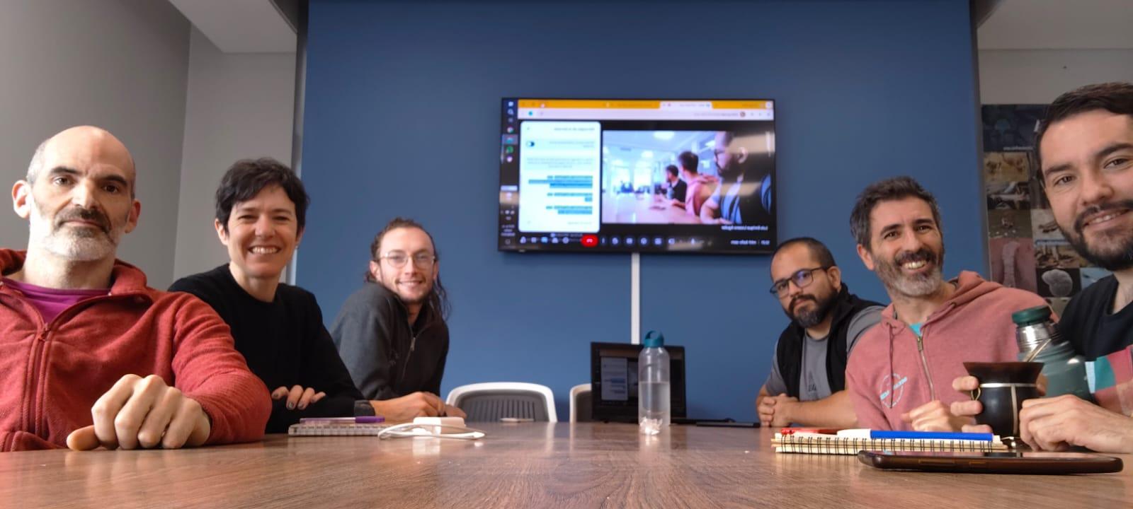

7 August 2025 10:02pm
Love this team <3
We would love to connect with teams also working on the whole AI pipeline- pretraining, finetuning and deployment! Training of the models is in progress, and we know lots can be learned from your experiences!
Also, we are approaching the UI design and development from the software-on-demand philosophy. Why depend on third-party software, having to learn, adapt and comply to their UX and ecosystem? Thanks to agentic AI in our IDEs we can quickly and reliably iterate towards tools designed to satisfy our own specific needs and practices, putting the researcher first.
Your ideas, thoughts or critiques are very much welcome!

8 August 2025 1:20pm
Kudos for such an innovative approach—integrating additional sensors with acoustic recorders is a brilliant step forward! I'm especially interested in how you tackle energy autonomy, which I personally see as the main limitation of Audiomoths
Looking forward to seeing how your system evolves!
Siguiendo Ballenas: rastreo satelital desde el espacio revela sus rutas migratorias // Tracking right whales from outer space reveals their migratory routes
7 August 2025 10:26pm
12 August 2025 3:46pm
Hello Henry
Can someone submit more than one application with different ideas?