In recent years, drone technologies have been explored for a range of applications in conservation including (but not limited to) mapping, biodiversity inventories, antipoaching patrols, wildlife tracking, and fire monitoring. The rise of customizable, open-source drones like those of ArduPilot and OpenROV hold promise for more effective conservation applications, and combined with other monitoring sensors and devices, they are capable of collecting high-resolution data quickly, noninvasively, and at relatively low cost.
However, challenges remain in putting these tools to use. A recent paper reviewing 256 conservation drone projects highlighted some of these major obstacles, ranging from unintended social and ecological consequences of drone operations to still prohibitive costs, both in terms of hardware and in terms of storing and processing large volumes of data. The longstanding challenge of power/battery life remains as well.
If you're considering trying out drones for yourself, and want to explore the possibilities and understand the major conversations happening around this technology, check out these beginner's resources and conversations from across the WILDLABS platform:
Three Resources for Beginners:
- Conservation Technology User Guidelines Issue 5: Drones, World Wildlife Fund | Drones, best practices, ethics, regulations, case studies
- WILDLABS Virtual Meetup Recording: Drones, Craig Elder, Dr. Claire Burke, and Gabriel Levin | Drones, thermal camera, wildlife crime, ML, biologging
- New Paper: Drones and Bornean Orangutan Distribution, Sol Milne | Drones, data analysis, citizen science, community science, primates
Three Forum Threads for Beginners:
- Curious about radio-tracking with drones? | Wildlife Drones, Biologging (5 replies)
- Drones for GIS Best practice Document | Adrian Hughes, Drones (10 replies)
- WWF Conservation Technology Series: Drones in Conservation | Aurélie Shapiro, Drones (7 replies)
Three Tutorials for Beginners:
- How do I use a drone to capture radio-tracking data? | Debbie Saunders, Tech Tutors
- How do I choose the right drone for my conservation goals? | Shashank Srinivasan, Tech Tutors
- How do I strategically allocate drones for conservation? | Elizabeth Bondi, Tech Tutors
Want to know more about using drones, and learn from experts in the WILDLABS community? Make sure you join the conversation in our Drones group!
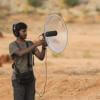
*Header photo: Parker Levinson, Point Blue Conservation Science
No showcases have been added to this group yet.
- 0 Resources
- 1 Discussions
- 1 Groups
- @a.zubiria
- | she/her
- 0 Resources
- 3 Discussions
- 11 Groups

- 0 Resources
- 0 Discussions
- 14 Groups

- @martinyonga
- | He/His
a Research Entrepreneur always looking for ways to demonstrate the interconnectedness of nature & our livelihoods

- 0 Resources
- 0 Discussions
- 3 Groups
- 0 Resources
- 0 Discussions
- 15 Groups

- @Durgananda
- | He
- 0 Resources
- 0 Discussions
- 19 Groups

- @hjayanto
- | He/Him
KONKLUSI (Kolaborasi Inklusi Konservasi - Yayasan)
Your friendly Indo-Crocky-Croc


- 0 Resources
- 44 Discussions
- 17 Groups

- @MStarking
- | she/her/hers
Ecologist and conservation researcher, currently an Assistant Professor at University of Michigan-Flint, research areas include landscape ecology, forestry and wildlife interactions, wildlife habitat relationships, spatial ecology, GIS.

- 0 Resources
- 1 Discussions
- 15 Groups
Tech for Conservation

- 0 Resources
- 2 Discussions
- 13 Groups

- 0 Resources
- 1 Discussions
- 5 Groups

Technologist and Visual storyteller focusing on social, conservations issues.


- 1 Resources
- 47 Discussions
- 17 Groups

- @Valentin_Stefan
- | He/Him
Interested in emerging technologies related to camera traps for pollinators
- 0 Resources
- 4 Discussions
- 18 Groups
Article
ICOTEQ launch TAGRANGER® system of products

Craig Rackstraw
TagRanger® is a state-of-the-art wildlife finding, monitoring and tracking solution for research, conservation and environmental professionals. With superior configurability for logging data, reporting location and...
23 November 2023
Link

A secure platform designed for those working to monitor & protect natural resources. Insight facilitates sharing experience, knowledge & tools to increase efficiency & effectiveness in conservation. By...
7 November 2023
Article
With the rising threats to biodiversity such as wildlife crime, climate change and human-wildlife conflict today, wildlife monitoring technologies have become vital to study movement ecology, behaviour patterns, changes...
25 October 2023
Article
Listen in on our interview with Mara Elephant Project’s Tracking Manager, Wilson Sairowua, as he explains how MEP is using software, geofencing and drone technologies to resolve human-elephant conflict across Maasai...
20 October 2023
Careers
Conservation Innovation Manager

David Will
Island Conservation's Innovation Team is dedicated to developing innovative, data-driven tools to increase the scale, scope, and pace of island restorations around the world. As the Conservation Innovation Manager, you...
27 September 2023
Article
Rewildology Podcast - Wildlife Tracking

Wildlife Drones
An engaging conversation about wildlife drones
21 August 2023
Article

In this article, Sol Milne discusses his experiences with sustainability, both in terms of environmental impact and project longevity, and considers how uncoupling conservation work from colonial ideas can help us build...
9 August 2023
Article
#Tech4Wildlife Photo Challenge: Judges' Panel Honorees

WILDLABS Team
Please join us in celebrating this year’s top #Tech4Wildlife Photo Challenge Honorees as chosen by our panel of leading conservation organization judges, and enjoy the story contained within these entries about how our...
4 August 2023
Link
Mapping seagrass with drones and AI

Ellie Warren
GeoNadir shared how drones and AI can help assess seagrass habitats at the Great Barrier Reef, as well as how satellite imagery can monitor seagrass on a wider scale.
4 August 2023
Article
Join us as we count down the WILDLABS community's honorees in the first-ever #Tech4Wildlife Community Choice Awards!
3 August 2023
Funding
2023 Canon Oceania Grants - Environmental Grant AU$5,000

Esther Githinji
Applications are now open till 23 July for the 2023 Canon Oceania Grants with the category of the Environmental Grant valued at AU$5,000. The finalist will be selected based on the environmental and social merits of...
7 July 2023
Article
Osa Conservation: A Multi-Tech Toolbox of Solutions

Osa Conservation
In this Conservation Tech Showcase case study from Osa Conservation, you’ll learn about how technology is aiding their long-term efforts to prevent wildlife crime, protect critical species, and build a climate-adaptive...
22 June 2023
September 2025
event

Louisa Richmond-Coggan
March 2026

September 2024
33 Products
Recently updated products
| Description | Activity | Replies | Groups | Updated |
|---|---|---|---|---|
| This is a just an amazing project and career,we have a similar project here in kenya, i will be looking forwad for a cooperation with you to engage our kids and expand our... |
|
Animal Movement, Drones, Emerging Tech, Human-Wildlife Coexistence | 1 day ago | |
| I create ocean exploration and marine life content on YouTube, whether it be recording nautilus on BRUVs, swimming with endangered bowmouth... |
|
Acoustics, AI for Conservation, Animal Movement, Camera Traps, Citizen Science, Drones, Emerging Tech, Marine Conservation, Sensors, Sustainable Fishing Challenges, Wildlife Crime | 1 month 4 weeks ago | |
| want to join 2025 contest for humpback whale photos in Juneo Alaska of Kelp |
|
Citizen Science, Conservation Tech Training and Education, Drones, Emerging Tech, Geospatial, Human-Wildlife Coexistence, Marine Conservation, Open Source Solutions | 2 weeks ago | |
| This is awesome!! |
|
Conservation Tech Training and Education, Drones, Emerging Tech, Geospatial, Open Source Solutions | 2 weeks 1 day ago | |
| Thank you for sharing. Would love to learn bit more about the data workflow. Last year I tired to using QGIS and few existing models to count the birds from orthomosaics of... |
|
Drones, Latin America Community | 1 month ago | |
| G-DiNC 2026: Global Drones in Nature Conservation Symposium & ExpoNairobi & Naivasha, Kenya | March 3–6,... |
|
Drones, AI for Conservation, Conservation Tech Training and Education, Emerging Tech, Marine Conservation, Sensors | 1 month 1 week ago | |
| 15 years ago I had to rebuild the dams on a game reserve I was managing due to flood damage and neglect. How I wished there was an easier,... |
|
Drones, Conservation Tech Training and Education, Data Management & Mobilisation, Emerging Tech, Geospatial, Open Source Solutions | 4 months 1 week ago | |
| Thank you for your reply, ChadI meant 10 as a whole, indeed. Perhaps you see your post in one group, but since it is tagged for all groups, I assumed you meant 10 in total.In your... |
|
Acoustics, AI for Conservation, Animal Movement, Camera Traps, Citizen Science, Climate Change, Community Base, Connectivity, Drones, eDNA & Genomics, Emerging Tech, Funding and Finance, Geospatial, Human-Wildlife Coexistence, Software Development, Wildlife Crime | 2 months 1 week ago | |
| Thank you for your comment Chris! Using these tools has made a huge difference in the way we can monitor and manage Invasive Alien Vegetation. I hope you are able to integrate... |
|
AI for Conservation, Citizen Science, Conservation Tech Training and Education, Drones, Geospatial, Human-Wildlife Coexistence, Open Source Solutions | 2 months 1 week ago | |
| I would love to hear updates on this if you have a mailing list or list of intersted parties! |
|
AI for Conservation, Community Base, Drones, Latin America Community, Marine Conservation, Open Source Solutions, Software Development | 2 months 2 weeks ago | |
| True, the US ecosystem is a challenging space right now, for basically all sectors. We should not let the US chaos prevent us from engaging with opportunities in other... |
|
AI for Conservation, Camera Traps, Connectivity, Drones, Emerging Tech, Ethics of Conservation Tech, Marine Conservation, Sensors | 4 months 1 week ago | |
| Not the same equipment, but at work I have used Metashape with DJI drones with an IR sensor (Mavic 3 Thermal, Matrice 3DT, Matrice 4T, etc) and the workflow to create IR maps... |
|
Drones | 3 months ago |


New article (Reuters): Orca stuck in river to be lured to sea using drone with loudspeakers

1 June 2022 4:02pm
New paper: A practical approach with drones, smartphones, and tracking tags for potential real-time animal tracking
29 May 2022 1:15pm
News: The Latest in Conservation Tech (March 24)
24 March 2022 12:00am
Opportunity: Technical Specialist, Analytics, Conservation Technology

21 March 2022 12:00am
Drone autopilot for logging position and orientation?
9 November 2021 6:45am

3 December 2021 2:55pm
Hi,
Since you already have a workable system, it seems to me a simple next step can be to have the RPi trigger the shutter via an MC-DC2 cable (this hack can help). This way the RPi commands the camera instead of the camera informing the RPi, and you can reuse most of the code you already have. Not to knock the PX4 which I have no experience with, but this incremental approach might make more sense in your situation than a radical change.
14 January 2022 2:49pm
>>>Ideally I'd be able to log angle/acceleration data (IMU), GPS (XYZ)
>>>camera-trigger events (hotshoe of camera) to an SD card.
The Pixhawk class of autopilots is a good choice. All of that data and much more can be logged, but not all of the hardware versions have the ability to use the hotshoe as an input to trigger logging the position and attitude when the photo is taken. All of them can log when the command to take the photo is sent to the camera but not all of them have the ability to use the hotshoe as an input. The original Pixhawk design is getting pretty old though. We have moved to newer versions that have more memory available for the flight code.
You can use a Cube with a standard carrier board. https://cubepilot.org/#/ecosystem/wiring
and ArduPilot https://ardupilot.org/ to log this data
>>>However, I'm concerned about how difficult it would be to configure the autopilot to 'arm' and start logging at the beginning of a session, since it's not connected to motors or servos.
That is not difficult at all. Your setup is very common. No need to be connected to any motors or servos in order to arm or start and stop logging.
>>> and power needs are simpler (USB input).
Don't power it off the USB in flight. Use one of the power inputs instead. a) USB connectors are not super reliable and b) we use the presense of USB power to indicate it is "powered on the bench" and there are some differences in functions between "in flight" and "on the bench"
Cheers,
Craig Elder
ArduPilot Community Manager
http://www.ardupilotinitiative.com/whoweare
Technical Difficulties: Cleared for Takeoff
 Eric Becker
and 1 more
Eric Becker
and 1 more
20 October 2021 12:00am
Technical Difficulties: Understanding the Realities
Eric Becker
and 1 more
13 October 2021 12:00am
Open positions for drones & conservation
18 August 2021 1:26pm
New Papers: Remote Sensing in Ecology and Conservation

22 April 2021 12:00am
The 2021 #Tech4Wildlife Photo Challenge: Community Highlights
25 March 2021 12:00am
Funding Opportunity: COVID-19 Science Fund

10 March 2021 12:00am
Cargo Drones for Conservation

1 March 2021 3:04pm
2 March 2021 1:39am
Exactly the type of thing I was looking for. I'll get in contact with them. Thanks, Steph!
2 March 2021 10:42am
Nice, where in Zambia are you working? Do you need to transport a lot and regularly?
2 March 2021 8:02pm
Hi Egil,
The group I'm involved with works with remote communities in/around North and South Luangwa National Parks and there is some expansion happening to community areas around Kafue National Park. I think they're interested in regular transport, but I'm not sure exactly how much and how regular, I need to collect more details on the specifics here.
Thank you! Rosemary
Seven technological priorities for automated restoration of tropical forest ecosystems

1 March 2021 12:03pm
Effect of drone flights on wild animals
26 July 2017 11:00pm

19 September 2017 3:22pm
This recent systematic review might be of interest: 'Unmanned aircraft systems as a new source of disturbance for wildlife: A systematic review'
Abstract
The use of small Unmanned Aircraft Systems (UAS; also known as “drones”) for professional and personal-leisure use is increasing enormously. UAS operate at low altitudes (<500 m) and in any terrain, thus they are susceptible to interact with local fauna, generating a new type of anthropogenic disturbance that has not been systematically evaluated. To address this gap, we performed a review of the existent literature about animals’ responses to UAS flights and conducted a pooled analysis of the data to determine the probability and intensity of the disturbance, and to identify the factors influencing animals’ reactions towards the small aircraft. We found that wildlife reactions depended on both the UAS attributes (flight pattern, engine type and size of aircraft) and the characteristics of animals themselves (type of animal, life-history stage and level of aggregation). Target-oriented flight patterns, larger UAS sizes, and fuel-powered (noisier) engines evoked the strongest reactions in wildlife. Animals during the non-breeding period and in large groups were more likely to show behavioral reactions to UAS, and birds are more prone to react than other taxa. We discuss the implications of these results in the context of wildlife disturbance and suggest guidelines for conservationists, users and manufacturers to minimize the impact of UAS. In addition, we propose that the legal framework needs to be adapted so that appropriate actions can be undertaken when wildlife is negatively affected by these emergent practices.
Mulero-Pázmány M, Jenni-Eiermann S, Strebel N, Sattler T, Negro JJ, Tablado Z (2017) Unmanned aircraft systems as a new source of disturbance for wildlife: A systematic review. PLoS ONE 12(6): e0178448. https://doi.org/10.1371/journal.pone.0178448
16 November 2017 5:02pm
Hi all
I would like to know your opinion about this footage:
https://vimeo.com/196847435
I fly drones in this place far away of birds for not disturbing them.
And then National Geographic fly a drone very close to birds to have an excellent footage.
You don't think that they are clearly disturbing them?

25 February 2021 9:45am
Hi!
Interesting subject indeed.
In most cases where UAVs are used in nature "documentaries" it is pretty obvious to a behavioural biologist that the animals were negatively affected.
I know that Sophie Gilbert collected bad examples of wildlife UAV harassment/disturbance at one stage.
WWF: Protecting Ferrets with Drones and Vaccines
17 February 2021 12:00am
Tech Tutors: How do I strategically allocate drones for conservation?

16 February 2021 1:01pm
New Paper: Drones and Bornean Orangutan Distribution
12 February 2021 12:00am
How do I strategically allocate drones for conservation?
 WILDLABS Team
8 February 2021 12:00am
WWF Conservation Technology Series: Drones in Conservation
19 November 2020 9:11am
24 November 2020 8:33am
Hi Julie,
yes authorizations are needed for drones and these are particularly difficult in many countries and are specific to the weight/size of the drone. Look at our report because the difference with a drone from an (untethered) balloon is the the presence of active collision avoidance, manueverability, size/weight and how far it flies (i.e. if it is beyond line of sight it is a different permit).

4 December 2020 12:15pm
This looks like a great resource, thanks!
29 January 2021 7:17pm
Hello Aurelie,
Thank you for sharing this info. I just downloaded the brochure and I am sure I will find it very useful. I have senseFly's eBee Classic, with RGB, multispectral and thermal cameras, and look for cases of using those in nature/biodiversity monitoring/management. I guess the brochure will include some cases. Thanks for sharing.
kind regards, Giorgi (from Georgia)
Tech Tutors: How do I choose the right drone for my conservation goals?
14 January 2021 1:05pm
Press Release: BAS Giant Iceberg Mission
13 January 2021 12:00am
Horizon 2020 UFO project Matchmaking event

8 January 2021 10:58am
Existing guidelines for reducing disturbance to wildlife when using drones-

6 March 2020 3:01pm

18 December 2020 6:34pm
Hi Isla,
That's something that the drone world really needs to take on because there can be a world of difference in drone size, prop types and motor types to reduce impact on the wildlife we're studying.
I've had one real world experience where a Marmot about the size of a large cat was scared of a small drone (DJI Mavic Pro)
But a drone about half the size that could do the exact same work was able to fly 15 feet from the Marmot and not disturb it. If you're only needing an observation drone to take photos and videos I highly recommend the DJI Mavic Mini. I'm not a rep for them but fly their products a lot.
If you have any questions I'm happy to help.

Event: Wildlife Drones at ESA20
 Wildlife Drones
30 November 2020 12:00am
Making the Most of Tech Tutors Season 2!
WILDLABS Team
30 November 2020 12:00am
WILDLABS Tech Tutors: Season Two
WILDLABS Team
24 November 2020 12:00am
Conservation Technology User Guidelines Issue 5: Drones
18 November 2020 12:00am
Towards a more ethical Indian drone industry

15 October 2020 10:26am

23 October 2020 1:11pm
Hello Shashank, I found your post very interesting - congratulations on looking at the ethical side of this technology! One of the reasons that our organisation, WildTrack, focuses on non-invasive wildlife monitoring technology is to avoid the ethical problems associated with disturbing animal behaviour, physiology and ecology. We're also using drones, both fixed wing and multicopter for monitoring and developing AI recognition algorithms, and trying to work out the optimal protocols for collecting data without any disturbance. I'd be interested to talk more with you about what you see as the major ethical challenges.
Report: Helping Ensure Ethical Indian Drone Operations
19 October 2020 12:00am
#Tech4Wildlife News: Airdropping Sensors from Moths
13 October 2020 12:00am
20 November 2021 8:08am
Looks like a good product - and now have an Artemis OpenLog board on the way for testing as well. WIll report back!