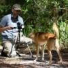
In recent years, drone technologies have been explored for a range of applications in conservation including (but not limited to) mapping, biodiversity inventories, antipoaching patrols, wildlife tracking, and fire monitoring. The rise of customizable, open-source drones like those of ArduPilot and OpenROV hold promise for more effective conservation applications, and combined with other monitoring sensors and devices, they are capable of collecting high-resolution data quickly, noninvasively, and at relatively low cost.
However, challenges remain in putting these tools to use. A recent paper reviewing 256 conservation drone projects highlighted some of these major obstacles, ranging from unintended social and ecological consequences of drone operations to still prohibitive costs, both in terms of hardware and in terms of storing and processing large volumes of data. The longstanding challenge of power/battery life remains as well.
If you're considering trying out drones for yourself, and want to explore the possibilities and understand the major conversations happening around this technology, check out these beginner's resources and conversations from across the WILDLABS platform:
Three Resources for Beginners:
- Conservation Technology User Guidelines Issue 5: Drones, World Wildlife Fund | Drones, best practices, ethics, regulations, case studies
- WILDLABS Virtual Meetup Recording: Drones, Craig Elder, Dr. Claire Burke, and Gabriel Levin | Drones, thermal camera, wildlife crime, ML, biologging
- New Paper: Drones and Bornean Orangutan Distribution, Sol Milne | Drones, data analysis, citizen science, community science, primates
Three Forum Threads for Beginners:
- Curious about radio-tracking with drones? | Wildlife Drones, Biologging (5 replies)
- Drones for GIS Best practice Document | Adrian Hughes, Drones (10 replies)
- WWF Conservation Technology Series: Drones in Conservation | Aurélie Shapiro, Drones (7 replies)
Three Tutorials for Beginners:
- How do I use a drone to capture radio-tracking data? | Debbie Saunders, Tech Tutors
- How do I choose the right drone for my conservation goals? | Shashank Srinivasan, Tech Tutors
- How do I strategically allocate drones for conservation? | Elizabeth Bondi, Tech Tutors
Want to know more about using drones, and learn from experts in the WILDLABS community? Make sure you join the conversation in our Drones group!
*Header photo: Parker Levinson, Point Blue Conservation Science
No showcases have been added to this group yet.

- 0 Resources
- 0 Discussions
- 3 Groups

- @frankglujan
- | He/Him/His
- 0 Resources
- 0 Discussions
- 3 Groups

Senior Wildlife Research Scientist
- 0 Resources
- 0 Discussions
- 7 Groups

University of Florida (UF)
- 0 Resources
- 2 Discussions
- 4 Groups
- 0 Resources
- 0 Discussions
- 3 Groups
- 0 Resources
- 0 Discussions
- 2 Groups
- @Robincrocs
- | He/Him//El//Ele
Wildlife biologist, works with Caimans and Crocodiles
- 0 Resources
- 0 Discussions
- 15 Groups

- @Dimitar
- | Dimitar
Ecologist, biodiversity expert

- 0 Resources
- 0 Discussions
- 1 Groups
- @StephODonnell
- | She / Her


- 196 Resources
- 676 Discussions
- 31 Groups

2023 Bachelor Degree Graduate from the College of African Wildlife Management, Mweka.

- 0 Resources
- 3 Discussions
- 14 Groups

Associate Wildlife Biologist M.S. Student


- 2 Resources
- 19 Discussions
- 7 Groups
- @Rob_Appleby
- | He/him
Wild Spy
Whilst I love everything about WILDLABS and the conservation tech community I am mostly here for the badges!!


- 1 Resources
- 315 Discussions
- 11 Groups
Careers
Consultancy opportunity: Wildlife monitoring specialist

Anthony Dancer
Consultancy opportunity at ZSL for an experienced monitoring specialist to support species monitoring in rewilding landscapes across Europe
31 January 2023
Careers
Conservation Technology Intern (Vietnam)

Meredith Palmer
WILDLABS and Fauna & Flora International are seeking an early career Vietnamese conservationist for 12-month paid internship position to grow and support the Southeast Asia regional community in our global...
11 January 2023

We are developing a project in Thailand, using drones to locate lost & discarded fishing gear across Koh Phangan, Thailand. We're 86% there & only need $1500 to get us over the line. If you can help us, we...
18 December 2022
Careers
12 PhD Positions - WildDrone

Jake Burton
The WildDrone team are looking for 12 PhD candidates to join the "WildDrone - Autonomous Drones for Nature Conservation Missions" Marie-Skłodowska-Curie Doctoral Network
1 December 2022
Careers
Shark Lab Data Analyst

Carly Batist
This position (at California State University, Long Beach) provides data management & analysis support to Shark Lab research operations including shark tagging, active tracking, receiver data, AUV & UAV data...
24 October 2022
Article
New conservation tech articles from Mongabay
Carly Batist
Five articles that include conservation tech published at Mongabay
20 October 2022
Careers
Conservation Technology Intern (Vietnam)

Stephanie O'Donnell and 1 more
*New closing date!* WILDLABS and Fauna & Flora International are seeking an early career conservationist for 12-month paid internship position to grow and support the Southeast Asia regional community in our global...
19 October 2022
Careers
The Senior Conservation Technology Specialist will be responsible for providing technical advice and capacity development to GWP project teams on conservation technology, distilling challenges and lessons from project...
22 September 2022
Article
Collecting Critically Endangered Plants on Cliffs using a Drone

Guillaume Charron
This technology was recently tested in Kauai, Hawaii, with the National Tropical Botanical Garden and has successfully collected from 5 critically endangered species that were otherwise inaccessible.
16 September 2022
Funding
The European Biodiversity Partnership Biodiversa+, co-funded by the European Union, has launched a call for research proposals on “Improved transnational monitoring of biodiversity and ecosystem change for science and...
14 September 2022
Careers
Conservation Technology Research Internship
Meredith Palmer
Boost cons tech capacity at an international NGO! Fauna & Flora International is offering a paid three-month internship to consolidate and share best practices for the application of emerging hardware and software...
26 August 2022
Careers

Full funded, UK and International
11 August 2022
August 2025
event

Louisa Richmond-Coggan
September 2025
event
Louisa Richmond-Coggan
March 2026

October 2024

September 2024

33 Products
Recently updated products
| Description | Activity | Replies | Groups | Updated |
|---|---|---|---|---|
| Very cool, thanks for sharing, Adrian! We'll put this up on Twitter as well. |
|
Drones | 4 years 10 months ago | |
| Hi all, Firstly, I'd just like to say a big thank you to everyone who attended my Tech Tutors presentation last month. And secondly, thank you for your patience in allowing... |
|
Animal Movement, Drones | 4 years 10 months ago | |
| We are happy to share that we open a worldwide-first research residency in ecosystem restoration with drones and native seeds. Do you... |
|
Drones | 5 years ago | |
| Hi all, There is a conversation underway in the "Ethics of conservation tech" group on best practices for responsible use of... |
|
Drones | 5 years 2 months ago | |
| Hi! We've been using our Mavic 2 Pro to create 3d models and volumetric assessments of mangroves. We're learning more about... |
|
Drones | 5 years 3 months ago | |
| Hi Ruth, Thanks for your email. Essentially the software is only an advantage if the drones are being flown at altitudes that provide a wide area and less visible detail (i.... |
|
Drones | 5 years 4 months ago | |
| Hi everyone! We are very excited to announce that the BIRDSAI dataset for conservation drones is now publicly available at https://sites.... |
|
Drones | 5 years 5 months ago | |
| We are very excited to announce that our open-source drone-reforestation crowdfunding is LIVE! We know climate change is here,... |
|
Drones | 5 years 5 months ago | |
| Hello, I'm new here. I thought I would share an article that I wrote a couple of years ago about my work with using drones for... |
|
Drones | 5 years 6 months ago | |
| Hi everyone, I have a LIDAR sensor (LIDAR USA-Fagerman Technologies-Velodyne puck) and a DJI M-600 drone. I would like to use... |
|
Drones | 5 years 7 months ago | |
| Cheers Al, and looking forward to hearing more about them. I am, as we speak, editing some thermal videos of wallaby behaviour near roads, specifically in relation to devices... |
|
Drones | 5 years 7 months ago | |
| Really useful to know about that package, thanks |
|
Drones | 5 years 8 months ago |


The Wildlife Society Conference
19 June 2023 5:59am
Catch up with The Variety Hour: June 2023
16 June 2023 11:43am
UAV-assisted counts of group size facilitate accurate population surveys of the Critically Endangered cao vit gibbon Nomascus nasutus
13 June 2023 3:51am
UAV-assisted counts of group size facilitate accurate population surveys of the Critically Endangered cao vit gibbon Nomascus nasutus | Oryx | Cambridge Core
UAV-assisted counts of group size facilitate accurate population surveys of the Critically Endangered cao vit gibbon Nomascus nasutus - Volume 58 Issue 2

ISO Speakers for Emerging Technologies class.

31 May 2023 4:29pm

2 June 2023 2:08pm
Carly, that would be great! Thanks! I work with soundscapes and love the work of Rainforest Connection! I'll send you an email (@CUNY) to coordinate!
AirSeed: Drone planting takes flight to promote reforestation in flood-affected NSW

30 May 2023 12:28pm
AirSeed: Drone planting takes flight to promote reforestation in flood-affected NSW | Humanitech | Australian Red Cross
AirSeed has developed a unique approach to tackle climate change and restore biodiversity by combining drone technology, machine learning, and seed pod biotechnology. To validate whether this approach could be delivered in partnership with disaster-affected communities to support local regeneration efforts, AirSeed collaborated with landholders impacted by landslides in northern NSW.

Looking for AI volunteer positions

24 May 2023 5:41am
24 May 2023 3:45pm
Hi Donya! You might check out the Conservation Tech Directory to see what projects/organizations/tools best align with your interests and skills.
Animal tracking stories
22 May 2023 2:19am
Using computer vision to understand bee vision
5 May 2023 1:10am

Researchers use taxidermy bird drones to monitor wildlife
26 April 2023 2:40pm
Researchers use taxidermy bird drones to monitor wildlife
Researchers at the New Mexico Institute of Mining and Technology are developing wildlife surveillance drones using taxidermy birds.

Drone imagery management software

17 April 2023 2:17am
21 April 2023 2:41pm
GeoNadir and OpenDroneMap might be of interest for drones?
The Conservation Tech Directory might have some additional projects/tools of note.
AI for Pelicans Challenge

20 April 2023 10:04am
ML-ready datasets for aerial/drone wildlife surveys

29 March 2023 5:27pm

29 March 2023 9:51pm
Excellent resource, Dan!
12 April 2023 5:53pm
Following up here... a few of us huddled virtually and assembled standardized metadata, standardized sample code, and sample annotated images for all the datasets on that list. I don't know whether this exercise was useful, but it was fun!
The URL hasn't changed, but I consider the list open for business now, let us know what we're missing:
https://github.com/agentmorris/agentmorrispublic/blob/main/drone-datasets.md
The 59th Annual Meeting of Illinois Chapter of The Wildlife Society
12 April 2023 5:24am
Advice on afforable LiDAR scanners for Amazon forest surveys

5 April 2023 3:47pm

6 April 2023 6:21pm
Hi Jeremy,
With a quick search I've found the paper linked below. It looks like equipments such as Livox MID are sufficient for plot-level analyses, but not for individual trees. Also, it has performed worse in dense canopies and broadleaf forest, thus I believe we won't have a technology capable of doing what you aim for this amount of money (< $1000) in a few years from now.
I hope someone give us an alternative, though. :D
Best,

Exploring storage options for mass data collection

22 March 2023 3:20am
22 March 2023 7:36pm
Hi Adam!
I mostly live within the ecoacoustics space so I'll just speak on the hydrophone part of your request; Arbimon is a free web/cloud-based platform with unlimited storage for audio files. We've got an uploader app as well for mass-uploading lots of files. There's also a bunch of spectrogram visualization/annotation tools and analysis workflows available. It's AWS running under the hood.
I have some experience working directly with AWS & Microsoft Azure, and I've found personally that AWS was more user-friendly and intuitive for the (fairly simplistic) kinds of tasks I've done.
27 March 2023 5:23am

Synergistic use of UAV surveys, satellite tracking data, and mark-recapture to estimate abundance of elusive species
21 March 2023 5:21pm
Wildlife Conservation Drones & Technologies Summit 2023
16 March 2023 11:31am
30 March 2023 4:15pm
12 April 2023 5:18am
15 April 2023 3:26pm
Computer Science student looking to work for wildlife
5 March 2023 10:04pm
14 March 2023 2:00pm
Great information! Thank you for sharing this. I actually have Masters in Zoology and have done some field work in Marine Conservation. Since then I have worked in Science education and eventually switched to Software Programming. My dream has always been to work in Conservation, however life happened and I had to give up on this pipe dream. I currently work as a Developer in a contractor role for the Federal Government. Would someone with my experience have an advantage in conservation Tech?

14 March 2023 2:58pm
I think the real demand in conservation tech is for transdisciplianry individuals. If you look at all the stand-out people in this space they are people who occupy multiple domains that are traditionally isolated. These are people who talk fluently in computer science and ecology, for example. Not only this, they are also people who create and imagine in ways that intertwin ideas and concepts across these domains. Its these people, thinking in these ways, that lead to innovations that really move us forward. Some of these people started out where you are now, having crossed domains through their career and then seeing opportunities to bring these skills together in imaginative ways.
14 March 2023 9:53pm
I couldn't agree more with both of these comments tom! I'm reading hundreds (literally hundreds) of applications for open WILDLABS roles at the moment, and the ones that stand out are those where it's really clear they're following genuine curiosity across different disciplines. If you're in conservation, it's the evidence of interest in tech (courses, projects, things you're trying and learning yourself). For tech, it's getting into conservation - all the things you mentioned.
Top 5 things you need to do before flying your drone: A guide for beginners

14 March 2023 7:26pm
Proposals wanted for Innovation in Practice
6 March 2023 10:34pm
Drones for GIS - Best Practice
17 October 2017 8:22am
31 March 2020 10:38am
We've just created a new version. General updates throughout
version notes
General refresh and update based on knowledge acquired over the last couple of years
Checked links
Updated CAA regulations, drone model advice including Yuneec, sensor advice (including thermal), classification advice, hydrological modelling advice, and nest survey info
15 February 2023 9:39am
This thread continues to be one of the most useful, evergreen resources - even 5+ years later! Who would have thought?
I was speaking to a colleague from another conservation ngo last week - and it came out that she was having to start from scratch developing some consistent internal guidance to support staff members using drones. I've poiinted her here and it's already been super useful, but I'm curious if anyone has newer guidance they've developed to support drone use their organisation that they'd be able to share? If you've updated your guidance, what have you changed or found to be most important?
Reinvigorating this thread might turn out to be super useful for lots of folk and save a lot of time in developing supporting documentation - I appreciate anyone who is able to share!
Thanks
Steph
24 February 2023 12:30pm
Hi all,
I've been quickly developing in-house drone services in the UK for Providence Ecological and have found some useful information for building a workflow with Rich Charpentier's YouTube channel. There are loads of good resources on YouTube but Rich's channel seems to be more useful with regard to budget/free software etc.
It has occurred to me that there may not be very good "Best Practice" guidance for drone pilots with regard to wildlife disturbance so when considering employing a drone pilot, please bear this in mind. It is useful to talk through their experience of avoiding/mitigating disturbance to wildlife during drone operations asnd provide guidance where you feel it is required.
Hopefully this is helpful!
Using drones and camera trapping to track New Hampshire’s moose populations
22 February 2023 9:38pm
Using drones and camera trapping to track New Hampshire’s moose populations | UNH Today
New research led by New Hampshire Agricultural Experiment Station scientist Remington Moll assessed how emerging technologies may help improve population calculations of North America's moose (Alces alces) population.

Texas Chapter of The Wildlife Society’s Annual Meeting 2023
20 February 2023 10:56pm
Recommendations needed: UAV controlled via 4G or 5G and capable of carrying a heat camera?
16 February 2023 3:39pm
Postdoctoral fellowship in drone-assisted collection of environmental DNA.
12 February 2023 4:01pm
Call for Data: A Global Database of Tree Crown Footprints from RGB Imagery
3 February 2023 11:22am
3 February 2023 7:01pm
You should definitely talk with Ben Weinstein and co (the folks behind DeepForest), if you haven't already!

10 February 2023 4:18pm
Bluesky have a commercial tree crown dataset available covering most of Great Britain (England, Wales and parts of Scotland). There is a canopy layer with approximate outlines of each canopy (the image on this page shows just circular crowns). It's created using aerial imagery.
National Tree Map | Bluesky International Limited
Bluesky’s National Tree Map™ (NTM™) is the most detailed dataset of its kind ever produced, with coverage across Great Britain and Ireland.

How daredevil drones find nearly extinct plants hiding in cliffs
10 February 2023 11:07am
Daredevil drones finding hard to find extinct plants | World Economic Forum
Scientists are developing robotic drones that will enable them to reach endangered plants from hard-to-access places before it's too late.

Consultancy opportunity: Wildlife monitoring specialist
31 January 2023 11:26am
31 May 2023 10:21pm
Definitely interested! I'm in the ecoacoustics/acoustic monitoring space, working at Rainforest Connection and Arbimon.