Group curators

Vance Russell
3point.xyz

Ahmed Junaid
- @ahmedjunaid
- | He/His

Elsa Carla De Grandi
Fauna & Flora
Who We Are
Geospatial data and analysis is critical for conservation, from planning to implementation and measuring success. Every day, mapping and spatial analysis are aiding conservation decisions, protected areas designation, habitat management on reserves and monitoring of wildlife populations, to name but a few examples. The Geospatial group focuses on all aspects of this field, from field surveys to remote sensing and data development/analysis to GIS systems.
How to Get Started
Want to learn more about how remote sensing is used in conservation? Check out the first two episodes of this season of Tech Tutors, where our Tutors answer the questions How do I use open source remote sensing data to monitor fishing? and How do I access and visualise open source remote sensing data in Google Earth Engine? You can also check out our Virtual Meetup Archive for a range of panels that overlap with Geospatial topics, or take a look at our Earth Observation 101 lecture series from Dr. Cristian Rossi.
Our Purpose
The WILDLABS Geospatial Group is for conservation practitioners, geospatial analysts, and academics that want to:
- Share geospatial resources, best practices, data, and ideas;
- Network amongst geospatial and data practitioners;
- Create peer learning opportunities;
- Promote the use of free and open-source geospatial software; and
- Improve the use of GIS software and geospatial analyses in conservation management and research.
Group curators
3point.xyz
Over 35 years of experience in biodiversity conservation worldwide, largely focused on forests, rewilding and conservation technology. I run my own business assisting nonprofits and agencies in the conservation community


- 7 Resources
- 69 Discussions
- 12 Groups
- @ahmedjunaid
- | He/His
Zoologist, Ecologist, Herpetologist, Conservation Biologist


- 75 Resources
- 7 Discussions
- 16 Groups
Fauna & Flora
Remote Sensing Scientist, Conservation Technology & Nature Markets @ Fauna & Flora - WILDLABS Geospatial Group Co-Lead

- 42 Resources
- 49 Discussions
- 9 Groups
No showcases have been added to this group yet.
Currently a data scientist in industry working on mechanistic models of risk, previously worked on modeling coral reefs. I am interested in the potential for emerging technologies and new ideas to help us solve environmental crises.
- 0 Resources
- 0 Discussions
- 14 Groups

- @Kasi
- | He/him
Game Rangers International
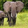
Kasi Amor Kalande is a young conservationist with experience in elephant movement research, GIS, and conservation technology.
- 1 Resources
- 0 Discussions
- 7 Groups
- @claumemo
- | she/her
- 0 Resources
- 0 Discussions
- 7 Groups
- @Manahil_ijaz
- | she
I’m a nature enthusiast who loves exploring wildlife and ecosystems. Through my research in ecology, I channel this passion into protecting and preserving biodiversity.
- 0 Resources
- 0 Discussions
- 3 Groups
A Highly Motivated and Enthusiastic Scholer. I done M.phil in Zoology From PMAS Arid Agriculture University Rawalpindi. My research Work focused on Identifying the pathogens of honeybee in Pakistan and finding there control method through Green Synthesis Nanotechnology.
- 0 Resources
- 0 Discussions
- 1 Groups
- 0 Resources
- 0 Discussions
- 1 Groups
- @Sumbul
- | Herpetologist
- 0 Resources
- 0 Discussions
- 1 Groups
- @Phillip_Swart
- | He
I'm a conservationist working in the Vulture conservation space in South Africa with a huge passion for technology.
- 0 Resources
- 0 Discussions
- 17 Groups
- @Prabisha
- | she/her
Dedicated research scientist with over 8 years of experience in cartography, spatial analysis, and statistical modeling to tackle environmental, public health, and socio-economic challenges. Passionate about leveraging geospatial technology to drive impactful solutions.
- 0 Resources
- 0 Discussions
- 12 Groups

Ecodash.ai is an artificial intelligence platform for ecological modeling, design, and restoration.

- 0 Resources
- 4 Discussions
- 7 Groups

- @Hadjah
- | Her
Hadjah Naggayi is a land surveyor/GIS analyst by profession. She is a climate justice activist, and an upcoming Fitness fitness instructor. She is currently working with Actogether Uganda as a Data manager
- 0 Resources
- 0 Discussions
- 2 Groups

- @vinz
- | Him
United Nations Environment Program World Conservation Monitoring Centre (UNEP WCMC)
GIS & EO Specialist with almost 20 years experience working with GIS in different topics. I am now working in Digital Tranformation Team at UNEP-WCMC mainly focus on Protected Planet programme to upgrade National and Global Stats for Target 3.1 (30x30) and UN Biodivesity Lab.

- 0 Resources
- 2 Discussions
- 1 Groups
Careers
Conservation Technology Research Internship

Meredith Palmer
Boost cons tech capacity at an international NGO! Fauna & Flora International is offering a paid three-month internship to consolidate and share best practices for the application of emerging hardware and software...
26 August 2022
Careers

The incumbent will conduct research to advance the integration of wildlife tracking & space-based remote sensing, serve as a member of the multi-agency Internet of Animals project & participate as an inter-...
25 August 2022
Funding
RCMRD Map Competition 2022

Netty Cheruto
Through this Competition, RCMRD aims to enhance the role of Geo-conservation in Protected Areas Management and Environmental Conservation. With a Total Prize Tag of 10,000 Euros, participants will be required to use...
19 August 2022
Link
A vegetation carbon isoscape for Australia | TERN Australia

Stephanie O'Donnell
TERN Australia has launched a new set of open-access data products that will advance research in a range of subjects, including food chain dynamics, animal migration, carbon fluxes, and plant productivity 🌿🦘
19 August 2022
Careers

The Marine Robotics and Remote Sensing (MaRRS) Lab at Duke University seeks a highly motivated UAS pilot and geospatial analyst to support the ongoing development of new and existing research and conservation programs,...
10 August 2022
Careers
The Marine Robotics and Remote Sensing (MaRRS) Lab at Duke University seeks a highly motivated postdoctoral researcher to support the ongoing development of new and existing research and conservation programs, both...
10 August 2022
Careers
Smithsonian Conservation Biology Institute (SCBI) & International Fund for Houbara Conservation (IFHC)
22 July 2022
Article
CERES TAG

Kim Lane
Ceres Tag sends just in time alerts and GPS location to have the power to track and trace.
22 July 2022
Careers
Conservation Data Coordinator
Giraffe Conservation Foundation (GCF)
Giraffe Conservation Foundation has now opened this opportunity to qualified candidates willing to work remotely. The position is desktop-based and the successful candidate can work from anywhere in the world to provide...
15 July 2022
Careers
In this role, you will serve as the main data liaison for the USAID Forest Data Partnership project, integrating with Global Forest Watch and Land & Carbon Lab research teams.
14 July 2022
Careers
Service Designer

Catherine Greene
Love design, passionate about conversation? Want to make sure that technologies that are being developed actually meet the needs of the people who use them? Come and work for us!
13 July 2022
Careers
WHOI is establishing an Imaging Technology Laboratory (ITL) & seeks a senior technical leader to lead the initiative. The primary goal of the ITL is to create a center of excellence to serve the technical imaging...
11 July 2022
September 2025
event

Ideal Workplace Solutions
October 2025
event

Lacey Hughey and 3 more
November 2025

event

Brigitta Keeves
March 2026

February 2024
event
Catherine Greene
January 2024
event

Esther Githinji
131 Products
Recently updated products
| Description | Activity | Replies | Groups | Updated |
|---|---|---|---|---|
| In what ways can drones contribute to linking individuals, communities, and small-scale producers in rural areas, facilitating the support... |
|
Drones, Geospatial | 1 year 8 months ago | |
| @dmorris joined Variety Hour to give us 'a bunch of lightning talks inside a lightning talk'. Check out the recording to get a whirlwind... |
|
AI for Conservation, Drones, Geospatial | 1 year 8 months ago | |
| I'm registered with the TWS2023 app, so feel free to nudge me there as well |
|
Animal Movement, Geospatial, Software Development | 1 year 9 months ago | |
| Digital Earth Africa are doing fantastic work to make Earth Observation data free and accessible, delivering decision-ready products to the... |
|
East Africa Community, Geospatial | 1 year 10 months ago | |
| Stefano Puliti joined Variety Hour to share his work using 3D photogrammetric data from UAVs for pre- and post-harvest inventory of forest... |
|
Climate Change, Data Management & Mobilisation, Drones, Geospatial | 1 year 10 months ago | |
| Carly, that would be great! Thanks! I work with soundscapes and love the work of Rainforest Connection! I'll send you an email (@CUNY) to coordinate! |
|
Acoustics, AI for Conservation, Conservation Tech Training and Education, Drones, eDNA & Genomics, Emerging Tech, Geospatial | 2 years 2 months ago | |
| Do you have a wild animal tracking story that involves adventure or misadventure? Share it with us! From going around in circles for hours... |
|
Animal Movement, Citizen Science, Drones, Geospatial | 2 years 3 months ago | |
| I'm looking for any recommendations for any entry level/internship remote roles/companies in the United States that are focused in... |
|
AI for Conservation, Conservation Tech Training and Education, Early Career, Geospatial | 2 years 4 months ago | |
| Hi Jeremy, With a quick search I've found the paper linked below. It looks like equipments such as Livox MID are sufficient for plot-level analyses, but not for individual... |
|
Drones, Earth Observation 101 Community, Emerging Tech, Geospatial, Sensors | 2 years 4 months ago | |
| Indeed, I'll be there too! I like to meet new conservation friends with morning runs, so I will likely organize a couple of runs, maybe one right near the conference, and... |
|
Acoustics, AI for Conservation, Autonomous Camera Traps for Insects, Camera Traps, Geospatial | 2 years 4 months ago | |
| Thank you so much for your reply! I'll look in to this now :) |
|
Acoustics, Autonomous Camera Traps for Insects, Camera Traps, Data Management & Mobilisation, Drones, Geospatial, Software Development | 2 years 5 months ago | |
| Our project in very short is, setting up a sensor network for monitoring airborne biomass, mainly insects, birds and bats in near realtime, and to develop a forecast model to be... |
|
Autonomous Camera Traps for Insects, Animal Movement, Geospatial, Sensors | 2 years 5 months ago |


WWF student assistant wanted: forest impact monitoring with Earth Observation

29 August 2022 4:41pm
Conservation Technology Research Internship
26 August 2022 4:58pm
Research Scientist - NASA Ames Earth Science Division
25 August 2022 2:25pm
RCMRD Map Competition 2022
19 August 2022 1:54pm
A vegetation carbon isoscape for Australia | TERN Australia
19 August 2022 12:40pm
A vegetation carbon isoscape for Australia | TERN Australia
A vegetation carbon isoscape for Australia. Click here to learn more.

Research Technician - Unoccupied Aircraft Systems Pilot and Geospatial Analyst
10 August 2022 10:40pm
3yr Postdoctoral Associate: Remote Sensing and Unoccupied Aircraft Systems
10 August 2022 5:29pm
Pacific Geospatial Conference 2022
10 August 2022 2:35pm
Earth Ranger Projection
28 June 2022 10:15am
28 July 2022 11:47am
HI benard sorry am replying late,and yes i the data was exported as shapefile 2.i used same projection which is 37N WGS 84 on both apps and still the exported shape file projection read away from the wanted location
funny story is,the exported shapefile pins quite well when using QGIS but then on ARC GIS pro i don't get what the issue is
Postdoc: Spatial Ecology & Conservation of Bustard spp.
22 July 2022 7:45pm
International Workshop on Animal Movement Ecology & Human Mobility
22 July 2022 7:25pm
30 August 2022 6:24pm
CERES TAG
22 July 2022 3:36am
Conservation Data Coordinator
15 July 2022 11:02am
Data Analysis Research Associate, World Resources Institute
14 July 2022 6:45pm
Service Designer
13 July 2022 9:05am
Director, Imaging Technology Lab (Woods Hole Oceanographic Institution)
11 July 2022 6:32pm
Data Fellow at National Center for Ecological Analysis & Synthesis
9 July 2022 1:02am
Postdoc: Environmental Remote Sensing
30 June 2022 2:10pm
Research Associate in Data Fusion for Forest Monitoring & Modelling
30 June 2022 2:05pm
Postdoc: Remote sensing of invasive alien trees & ecosystem degradation in Cape Floristic Region
ARSET webinar series - Monitoring Aquatic Vegetation with Remote Sensing
27 June 2022 10:44pm
New Conservation Tech Directory update
27 June 2022 4:45pm
Research Associate in Data Fusion for Forest Monitoring and Modelling
15 June 2022 10:49am
New Paper: Comparative Analysis of Multi-Platform, Multi-Resolution, Multi-Temporal LiDAR Data for Forest Inventory

13 June 2022 2:48pm
New remote sensing papers/datasets
13 June 2022 1:53pm
Multiple ML & ecology positions open at Pachama
4 June 2022 12:38pm
Postdoc: evaluation of tropical forest restoration
4 June 2022 12:03pm
Global Forest Watch Small Grants Fund
1 June 2022 4:19pm
30 June 2022 12:40pm
Hi Turu,
To be able to assist you, I would like to understand the following first:
1. What feature of data did you export/get from EarthRanger? i.e shapefile? CSV? etc.
2. What coordinate system was your data from EarthRanger?
2. When plotting did you match/project with the correct coordinate system?
3. Do you think there was an active layer with a different projection system in your work frame?
4. Did you check whether your work frame projection was correct to match what you were plotting?