Groups joined
Discussions started
Discussion Comments
Resources added
Szilvia Szilagyi added a new R&D - "Drone STEM curriculum for classrooms"
Szilvia Szilagyi added a new External Link - "Women and GIS " to Acoustics
Szilvia Szilagyi contributed to Organisation - "Drone Design Lab "
Szilvia Szilagyi added a new Organisation - "Drone Design Lab "
Szilvia Szilagyi added a new Discussion - "Roe deer protection needed in Hungary, national government should stop funding hunting organizations - call for international support" to Acoustics
Szilvia Szilagyi added a new Discussion - "In what ways can drones contribute to linking individuals, communities, and small-scale producers in rural areas, facilitating the support of local food value chains" to Acoustics
Szilvia Szilagyi added a new Article - "Sustainable land managment" to Acoustics
Szilvia Szilagyi added a new External Link - "Geospatial data training and education for conservation" to Acoustics
Groups
Group
- Latest Resource
- /
- Behind the Buzz Season 1: From Data to Decisions
Come along to the first season of Behind the Buzz, where we’ll bring in experts to break down the basics of global conservation policy frameworks through the lens of animal movement and explore how our community can better translate movement data to decision-making.
Group
- Latest Discussion
- Feedback on PCB for Mothbox
Applications are open until April 15th
Group
- Latest Discussion
- DIY: Pressure Chamber
- Latest Resource
- /
- Can CBIs promote coexistence? A Case Study from Northern Tanzania
Can conservation-based incentives promote the willingness of local communities to coexist with wildlife? A case of Burunge Wildlife Management Area, Northern Tanzania
Group
- Latest Discussion
- Overview of Image Analysis and Visualization from Camera traps
- Latest Resource
- /
- Nature Tech for Biodiversity Sector Map launched!
Conservation International is proud to announce the launch of the Nature Tech for Biodiversity Sector Map, developed in partnership with the Nature Tech Collective!
Group
- Latest Discussion
- Can RGB drone data & Machine Learning be of value in Conservation?
- Latest Resource
- /
- Can/Should UAVs Be The Answer To Urbanisation & Wildlife Conflicts
Over the years, a large number of developments have gone up in the area that I live in and the municipality is not doing what they should when it comes to upholding the laws that have been put in place to protect the wildlife in this protected paradise. Is anyone else around the world facing this in their communities? Can/should drones and open source software be the answer to better monitoring of construction companies that are in breach of wildlife regulations? I would like to get others thoughts on this subject as it can be complicated. GeoWing Academy has been using drones and opensource software to monitor some of the changes and damages to the environment to illustrate the issues to the local municipality and government. There is a PDF version of the article attached should the images in the article not be visible
Group
- Latest Discussion
- Can RGB drone data & Machine Learning be of value in Conservation?
- Latest Resource
- /
- What Are Innovative Technologies, and Why Should Conservationists Care?
Conservationists use tools like drones, satellites, and camera traps to monitor ecosystems and scale their impact. But new challenges like transparency, funding gaps, and engagement remain. Web 3.0 technologies offer solutions, but adoption can be complex. Understanding their benefits and barriers is key.
Group
- Latest Discussion
- AgTech: Breaking out of silos
- Latest Resource
- /
- Brokering finance deals to fund nature restoration with Rob Gardner
This is the title of an episode of Ben Goldsmith's 'Rewilding the World' podcast series. I have been wondering for a while, how is it done? Here is a crystal clear outline.
Group
- Latest Discussion
- Overview of Image Analysis and Visualization from Camera traps
- Latest Resource
- /
- HawkEars: a high-performance bird sound classifier for Canada
HawkEars is a deep learning model designed specifically to recognize the calls of 328 Canadian bird species and 13 amphibians.
Group
- Latest Discussion
- Can RGB drone data & Machine Learning be of value in Conservation?
- Latest Resource
- /
- Nature Tech for Biodiversity Sector Map launched!
Conservation International is proud to announce the launch of the Nature Tech for Biodiversity Sector Map, developed in partnership with the Nature Tech Collective!
Group
- Latest Discussion
- Ground Truth: How Are You Verifying What Maps Show?
- Latest Resource
- /
- Fires in the Serengeti: Burn Severity & Remote Sensing with Earth Engine
Fires in Serengeti and Masai Mara National Parks have burned massive areas this year. With Google Earth Engine, it's possible to quantify burn severity using the normalized burn ratio function, then calculate the total area burned by classification areas.
Group
- Latest Discussion
- AI accelerator for nonprofits working in the Climate area
- Latest Resource
- /
- Case Study: Drone-based radio-tracking of Eastern Bandicoots
Wildlife Drones was deployed by Zoos Victoria in a trial project tracking captive-bred Eastern Barred Bandicoots that were tagged and released into the wild
Group
- Latest Discussion
- Autonomizing Small Mammal Traps
- Latest Resource
- /
- Judging Panel Award Winners: 2024 #Tech4Wildlife Photo Challenge
Join us in celebrating this year’s Judging Panele Award winners!
Group
- Latest Discussion
- From Field to Funder: How to communicate impact?
- Latest Resource
- /
- Brokering finance deals to fund nature restoration with Rob Gardner
This is the title of an episode of Ben Goldsmith's 'Rewilding the World' podcast series. I have been wondering for a while, how is it done? Here is a crystal clear outline.
Group
- Latest Discussion
- Planet Imagery is no longer available on GFW
Group
- Latest Discussion
- Overview of Image Analysis and Visualization from Camera traps
- Latest Resource
- /
- Nature Tech for Biodiversity Sector Map launched!
Conservation International is proud to announce the launch of the Nature Tech for Biodiversity Sector Map, developed in partnership with the Nature Tech Collective!
Group
- Latest Discussion
- Ground Truth: How Are You Verifying What Maps Show?
- Latest Resource
- /
- What Are Innovative Technologies, and Why Should Conservationists Care?
Conservationists use tools like drones, satellites, and camera traps to monitor ecosystems and scale their impact. But new challenges like transparency, funding gaps, and engagement remain. Web 3.0 technologies offer solutions, but adoption can be complex. Understanding their benefits and barriers is key.
Group
- Latest Discussion
- Field-Ready Bioacoustics System in Field Testing
- Latest Resource
- /
- Nature Tech for Biodiversity Sector Map launched!
Conservation International is proud to announce the launch of the Nature Tech for Biodiversity Sector Map, developed in partnership with the Nature Tech Collective!
Group
- Latest Discussion
- A call for support
- Latest Resource
- /
- MyProgress: Advancing GIS and R programming skills.
A fascinating journey of unleashing my potentials in spatial analysis using ArcGIS Pro and R programming.
Bookmarks
Keep track of the resources that matter to you! Collections let you save, organise, and share content from all over the WILDLABS community. Create your first collection by clicking on the bookmark icon wherever you see it.
My Courses
These are your in-progress and completed courses. Explore more courses through our catalogue.
To find courses you have created, see your "My Draft Content" or "My Content" tabs.
Camera Trapping for Conservation
Introduction to Conservation Technology
Environmental DNA for Terrestrial Vertebrate Conservation
Settings
Szilvia Szilagyi's Content
Link
Empower GIS day, 20th of November 2024 Welcome to join over the globe
9 October 2024
According to Bern Convention, The European Roe deer - Capreolus capreolus, is protected fauna species Annex III, however in Hungary is legal...
7 October 2024
In what ways can drones contribute to linking individuals, communities, and small-scale producers in rural areas, facilitating the support of local food value chains?
15 December 2023
Article
How to engage decision makers for a more sustainable land management for both citizens and landowners in developing countries.
15 December 2023
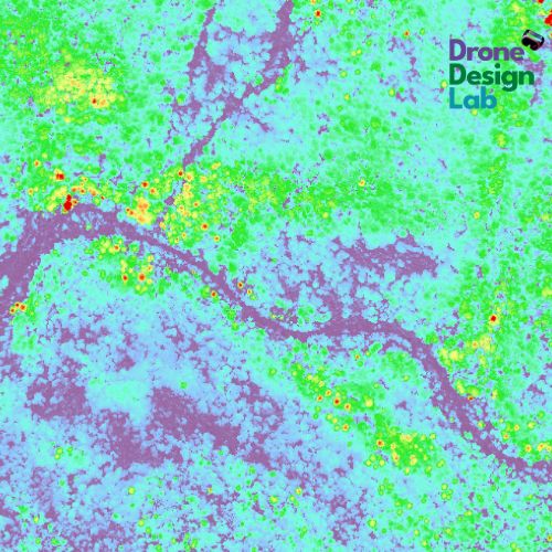
Sharing our startup's webpage, featuring information about our services and products. We are open for new partnership, collaboration R&D project in the field of GIS data analysis.
15 December 2023












Szilvia Szilagyi commented on "Query Regarding ArcMap"