Group curators

Vance Russell
3point.xyz

Ahmed Junaid
- @ahmedjunaid
- | He/His

Elsa Carla De Grandi
Fauna & Flora
Who We Are
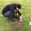
Geospatial data and analysis is critical for conservation, from planning to implementation and measuring success. Every day, mapping and spatial analysis are aiding conservation decisions, protected areas designation, habitat management on reserves and monitoring of wildlife populations, to name but a few examples. The Geospatial group focuses on all aspects of this field, from field surveys to remote sensing and data development/analysis to GIS systems.
How to Get Started
Want to learn more about how remote sensing is used in conservation? Check out the first two episodes of this season of Tech Tutors, where our Tutors answer the questions How do I use open source remote sensing data to monitor fishing? and How do I access and visualise open source remote sensing data in Google Earth Engine? You can also check out our Virtual Meetup Archive for a range of panels that overlap with Geospatial topics, or take a look at our Earth Observation 101 lecture series from Dr. Cristian Rossi.
Our Purpose
The WILDLABS Geospatial Group is for conservation practitioners, geospatial analysts, and academics that want to:
- Share geospatial resources, best practices, data, and ideas;
- Network amongst geospatial and data practitioners;
- Create peer learning opportunities;
- Promote the use of free and open-source geospatial software; and
- Improve the use of GIS software and geospatial analyses in conservation management and research.
Group curators
3point.xyz
Over 35 years of experience in biodiversity conservation worldwide, largely focused on forests, rewilding and conservation technology. I run my own business assisting nonprofits and agencies in the conservation community


- 7 Resources
- 69 Discussions
- 12 Groups
- @ahmedjunaid
- | He/His
Zoologist, Ecologist, Herpetologist, Conservation Biologist


- 75 Resources
- 7 Discussions
- 16 Groups
Fauna & Flora
Remote Sensing Scientist, Conservation Technology & Nature Markets @ Fauna & Flora - WILDLABS Geospatial Group Co-Lead

- 42 Resources
- 49 Discussions
- 9 Groups
No showcases have been added to this group yet.
- @hannahrisser
- | She/her
CEH
- 0 Resources
- 0 Discussions
- 10 Groups

- @Mathilde
- | she/her
Natural Solutions
Engineer, I work for a web development company on web application projects for biodiversity conservation. I'm especially interested by camera traps, teledetection and DeepLearning subjects.
- 0 Resources
- 0 Discussions
- 11 Groups

Max Planck Institute of Animal Behavior
Behavioral Ecologist
- 1 Resources
- 1 Discussions
- 14 Groups

Rainforest Trust


- 0 Resources
- 11 Discussions
- 7 Groups

I am an Impact Monitoring Officer in a REDD+ Project in Zambia.
- 0 Resources
- 0 Discussions
- 1 Groups

- 0 Resources
- 0 Discussions
- 6 Groups

International Union for the Conservation of Nature (IUCN)
Key Biodiversity Areas Programme Officer, IUCN


- 0 Resources
- 89 Discussions
- 8 Groups

- @jakefaber
- | he/him
Upstream Tech

- 0 Resources
- 0 Discussions
- 4 Groups
- 0 Resources
- 0 Discussions
- 1 Groups

British Antarctic Survey
Machine learning researcher at the British Antarctic Survey
- 0 Resources
- 0 Discussions
- 5 Groups
Author of Conservation Biology in Sub-Saharan Africa
- 0 Resources
- 0 Discussions
- 1 Groups

working on the digital transformation for environment, climate, and conservation
- 0 Resources
- 5 Discussions
- 2 Groups
Article
Download Now: A Best Practice Guide to Satellite Technologies for Tracking Wildlife

WILDLABS Team and 1 more
The Zoological Society of London, with the support of WILDLABS and the UK Space Agency, are proud to publish this new guide to satellite technologies for tracking wildlife.
17 February 2023
Article
As part of the AniMove eLearning programme, you are now able to stream 2022 Animal movement & remote sensing course lectures opensource.
10 February 2023
Careers
Consultancy opportunity: Wildlife monitoring specialist

Anthony Dancer
Consultancy opportunity at ZSL for an experienced monitoring specialist to support species monitoring in rewilding landscapes across Europe
31 January 2023
Article

Meet the women and men supporting gender equality in conservation #tech. Here is a panel discussion the Women in Conservation Tech (WiCT) led in November 2022, during the EarthRanger User Conference (ERUC). Opening up...
30 January 2023
Link

An online portal to help governments, researchers, conservation advocates & others monitor activity throughout the world’s marine environment, as well as design & implement protected areas. The Marine Manager is...
13 January 2023
Link
The authors "tested the use of a thermal imager to assess the occupancy of enclosed nests, using nest-box populations of small passerines. Based on a thermal image of each nest box, observers were able to predict nest-...
13 January 2023
Careers
Conservation Technology Intern (Vietnam)

Meredith Palmer
WILDLABS and Fauna & Flora International are seeking an early career Vietnamese conservationist for 12-month paid internship position to grow and support the Southeast Asia regional community in our global...
11 January 2023
Careers
Join NASA’s harmful algal bloom ML challenge and win prizes!

Katie Wetstone
Using satellite imagery to detect and classify the severity of cyanobacteria blooms in small, inland water bodies.
15 December 2022

The International Space Station's GEDI instrument uses lasers to gather data on deforestation and impacts on atmospheric concentrations of carbon dioxide to highlight key areas to conserve.
2 December 2022
Careers
Spatial Data Analysis, TNC

The Nature Conservancy
Working with a team of conservation practioners, scientists, and technologists, the Spatial Data Analyst uses leading-edge earth observation data in new and effective ways to inform conservation practice locally,...
8 November 2022
Link
Opinion paper describing "how data acquired from remote sensing, citizen science & other monitoring approaches could feed in near-real time to an early warning system for biodiversity that integrates automated red-...
7 November 2022
Article

This SPACES paper aims to inspire the audience to use spatial intelligence as an enabler for integrated nature and climate action. It showcases ’emerging’ data sources and digital technology in the nature and climate...
28 October 2022
September 2025
event

Ideal Workplace Solutions
October 2025
event

Lacey Hughey and 3 more
November 2025

event

Brigitta Keeves
March 2026

September 2023

event

Stephanie O'Donnell
event

Cassie Anderson
131 Products
Recently updated products
| Description | Activity | Replies | Groups | Updated |
|---|---|---|---|---|
| Thanks, Cathy! |
|
Geospatial | 1 year 1 month ago | |
| Tagging @Chelsea_Smith so she sees this :) |
|
Geospatial, Data Management & Mobilisation, Protected Area Management Tools | 1 year 2 months ago | |
| Hi Vance,I just wanted to assign landcover types to each point data. But you mentioning temporal change of landcover, that will be best analysis to do.Thank you so much,Sarah. |
|
Geospatial | 1 year 2 months ago | |
| Unfortunately I may fail to deliver so I cannot take it up. Am off net at times for two weeks straight. But excited about everything GIS so I follow keenly. Thank you... |
|
Geospatial | 1 year 2 months ago | |
| Thank you Carly, I will definitely take a look. |
|
Acoustics, Animal Movement, Climate Change, Conservation Tech Training and Education, Data Management & Mobilisation, Geospatial, Software Development | 1 year 5 months ago | |
| We will be conducting in-person demos of our cutting-edge drone technology in the US this year! 🇺🇸 If you're interested in experiencing... |
|
Animal Movement, Drones, Geospatial, Software Development | 1 year 6 months ago | |
| Real nice video. I'll have another look in the weekend in detail. |
+10
|
Acoustics, Community Base, Protected Area Management Tools, Geospatial, Sensors | 1 year 7 months ago | |
| Hi!I would take a look at Although developed for camera trap imagery, it is by no means restricted to such.Cheers,Lars |
|
Camera Traps, Community Base, Data Management & Mobilisation, Drones, Emerging Tech, Geospatial, Software Development | 1 year 7 months ago | |
| Thank you for this! Will take a look. |
|
Climate Change, Conservation Tech Training and Education, East Africa Community, Geospatial | 1 year 7 months ago | |
| Appreciate that Lars! |
+20
|
Animal Movement, Geospatial | 1 year 7 months ago | |
| Hi Eva, Me and my colleagues run a small NGO based on Yogyakarta in Indonesia, although our projects are spread around the country. One of our active project is working with... |
|
Community Base, Animal Movement, Citizen Science, Climate Change, Human-Wildlife Coexistence, Marine Conservation, Geospatial | 1 year 8 months ago | |
| I am not an acoustics person but train and deploy canines in the field. Are you looking for something that records sniff rate and patterns? For GPS I just use a Garmin... |
|
Acoustics, Animal Movement, Geospatial | 1 year 8 months ago |


