Group curators

Vance Russell
3point.xyz

Ahmed Junaid
- @ahmedjunaid
- | He/His

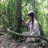
Elsa Carla De Grandi
Fauna & Flora
Who We Are
Geospatial data and analysis is critical for conservation, from planning to implementation and measuring success. Every day, mapping and spatial analysis are aiding conservation decisions, protected areas designation, habitat management on reserves and monitoring of wildlife populations, to name but a few examples. The Geospatial group focuses on all aspects of this field, from field surveys to remote sensing and data development/analysis to GIS systems.
How to Get Started
Want to learn more about how remote sensing is used in conservation? Check out the first two episodes of this season of Tech Tutors, where our Tutors answer the questions How do I use open source remote sensing data to monitor fishing? and How do I access and visualise open source remote sensing data in Google Earth Engine? You can also check out our Virtual Meetup Archive for a range of panels that overlap with Geospatial topics, or take a look at our Earth Observation 101 lecture series from Dr. Cristian Rossi.
Our Purpose
The WILDLABS Geospatial Group is for conservation practitioners, geospatial analysts, and academics that want to:
- Share geospatial resources, best practices, data, and ideas;
- Network amongst geospatial and data practitioners;
- Create peer learning opportunities;
- Promote the use of free and open-source geospatial software; and
- Improve the use of GIS software and geospatial analyses in conservation management and research.
Group curators
3point.xyz
Over 35 years of experience in biodiversity conservation worldwide, largely focused on forests, rewilding and conservation technology. I run my own business assisting nonprofits and agencies in the conservation community


- 7 Resources
- 69 Discussions
- 12 Groups
- @ahmedjunaid
- | He/His
Zoologist, Ecologist, Herpetologist, Conservation Biologist


- 75 Resources
- 7 Discussions
- 16 Groups
Fauna & Flora
Remote Sensing Scientist, Conservation Technology & Nature Markets @ Fauna & Flora - WILDLABS Geospatial Group Co-Lead

- 42 Resources
- 49 Discussions
- 9 Groups
No showcases have been added to this group yet.

- @EllieW
- | She/Her


- 88 Resources
- 123 Discussions
- 13 Groups

Passionate about deciphering patterns from complex datasets, I am a skilled data analyst with a keen eye for detail and a knack for transforming raw information into actionable insights. With a solid foundation in statistical analysis, and data visualization.
- 0 Resources
- 0 Discussions
- 1 Groups
- @billardball8
- | She/Her
- 0 Resources
- 0 Discussions
- 6 Groups

- @Godwin
- | Mr
Student at University of Dar es Salaam Taking Bachelor Degree in Electronics Enginneering
- 0 Resources
- 0 Discussions
- 2 Groups
- @annie2
- | she/her
- 0 Resources
- 0 Discussions
- 16 Groups
- @jahiyaclark
- | she/her
PhD Student at UCSC Ecology and Evolutionary Biology
- 0 Resources
- 0 Discussions
- 6 Groups
- 0 Resources
- 1 Discussions
- 6 Groups
- @Diep
- | Ms


- 8 Resources
- 0 Discussions
- 4 Groups
- @jsevans
- | He, Him
Senior biometrician, with the Nature Conservancy science team, attempting to bring vigor from diverse fields such as landscape ecology, spatial statistics, remote sensing and applied mathematics to answer practical conservation questions.
- 0 Resources
- 0 Discussions
- 7 Groups
- 0 Resources
- 0 Discussions
- 4 Groups

- @shahselbe
- | he/him
Conservify
Conservation Technologist, National Geographic Explorer, and Founder of Conservify and FieldKit
- 0 Resources
- 5 Discussions
- 18 Groups
- @WakioMwandoe
- | She/her
I am a GIS Analyst currently working at Center for Ecosystem Restoration Kenya, a non-profit whose vision is to restore resilient and thriving ecosystems. I have a Bachelor's degree in Geoinformation Technology and I am looking to explore applications of GIS in Conservation.
- 0 Resources
- 0 Discussions
- 7 Groups
Link
Article on DYNAMICSDM (R Package) by Rachel Dobson, Andy J. Challinor, Robert A. Cheke, Stewart Jennings, Stephen G. Willis and Martin Dallimer (2023).
9 September 2024
Link
Article on phytools 2.0 (R Package) by Liam J. Revell (2024).
9 September 2024
Link
Alaska Satellite Facility
Ahmed Junaid
Alaska Satellite Facility (ASF) operates NASA's archive of SAR data, offering invaluable services to researchers worldwide.
9 September 2024
Link
EarthExplorer USGS
Ahmed Junaid
EarthExplorer USGS provides access to a vast array of satellite imagery. Whether you're tracking environmental changes, conducting research, or simply exploring the Earth's surface, EarthExplorer USGS is your go-to...
9 September 2024
Link
Article by Javier Loidi, Gonzalo Navarro-Sánchez and Denys Vynokurov (2023). A vector map of biotic units encompassing the entire terrestrial area of the earth is provided in this arctile.
9 September 2024
Link
Esri's LULC (Land Use/Land Cover) Models of the World, offers one of the finest and most detailed representations of global land use and cover. It's an invaluable tool for researchers, environmentalists, and planners...
9 September 2024
Article
Geospatial Announcement: Introducing New Geospatial Group Leaders
Elsa Carla De Grandi and 2 more
We are thrilled to welcome our 3 new Group Leaders for the 2024-2025 term, Vance Russell, Ahmed Junaid, and Elsa Carla De Grandi!
22 August 2024
Article

Join us in celebrating this year’s Judging Panele Award winners!
19 August 2024
Article

Join us in celebrating this year’s Community Choice Award winners!
15 August 2024
Article
Vote for your favorite submissions that best demonstrate conservation impact, novel innovation/discovery, and strong storytelling of the work and the sector.
12 August 2024
Careers
We are recruiting an (extendable) 2-year postdoc in my group to develop new technologies (cameras, microphones, deep learning, etc) to track earthworm activity in the field.
16 July 2024
Careers
Data Manager, Conservation International

Esther Githinji
Conservation International are seeking a data expert to help (a) serve as a day-to-day technical project manager to ensure data collection, data management, and data quality control with global program teams and...
8 July 2024
September 2025
event

Ideal Workplace Solutions
October 2025
event

Lacey Hughey and 3 more
November 2025
event

Brigitta Keeves
March 2026

November 2022
event

Carly Batist
event
Carly Batist
October 2022
event
Elsa Carla De Grandi
event

Stephanie O'Donnell
131 Products
Recently updated products
| Description | Activity | Replies | Groups | Updated |
|---|---|---|---|---|
| Hi Thom, Thanks a lot for the response! The abstracts were very interesting and I hope we can share more of the work from you and your colleagues. Please feel free to... |
|
Geospatial | 6 years 11 months ago | |
| NASA's Applied Remote Sensing Training (ARSET) program is hosting a free advanced webinar series in Change Detection for Land... |
|
Geospatial | 6 years 11 months ago | |
| Check out the Compendium of guidance on key global databases related to biodiversityrelated conventions from UNEP-WCMC (2018... |
|
Geospatial | 6 years 11 months ago | |
| Hi Steve, I have used GIS Pro by Garafa on an iPad. I found it was one of the only apps that allowed importing of custom raster images. This feature has allowed me to... |
|
Geospatial | 7 years ago | |
| Although not specifically about potential wildlife applications for space technology, this hack may well be of interest to some of our... |
|
Geospatial | 7 years 9 months ago | |
| Hi all, I just wanted to draw your attention to the new OS Geo UK Training page. This is a really helpful list of GIS training courses on offer in the UK. Anyone can contribute... |
|
Geospatial | 7 years 10 months ago | |
| I don't think there is an open like for like replacement. I normally work with ESRI software so mainly use Geodatabases now. Open options are really in the web format... |
|
Geospatial | 7 years 10 months ago | |
| The European Space Agency have an exciting funding opportunity coming up and got in touch with us to ask that we share it with you,... |
|
Geospatial | 8 years 1 month ago | |
| The European Space Agency have an exciting funding opportunity coming up and got in touch with us to ask that we share it with you,... |
|
Geospatial | 8 years 1 month ago | |
| Satellite Image Analysis and Terrain Modelling – A practical manual for natural resource management, disaster risk and development planning using free geospatial data and... |
|
Geospatial | 8 years 1 month ago | |
| The ISPRS-SC is soliciting stories for our newsletter articles which will be published in our website: http://sc.isprs.org... |
|
Geospatial | 8 years 2 months ago | |
| Fantastic opportunity - thanks for sharing, @dave ! The Google Earth Engine User Summit 2017 was convened this week also at Google in CA. I know that @... |
|
Geospatial | 8 years 2 months ago |