Who We Are
Geospatial data and analysis is critical for conservation, from planning to implementation and measuring success. Every day, mapping and spatial analysis are aiding conservation decisions, protected areas designation, habitat management on reserves and monitoring of wildlife populations, to name but a few examples. The Geospatial group focuses on all aspects of this field, from field surveys to remote sensing and data development/analysis to GIS systems.
How to Get Started
Want to learn more about how remote sensing is used in conservation? Check out the first two episodes of this season of Tech Tutors, where our Tutors answer the questions How do I use open source remote sensing data to monitor fishing? and How do I access and visualise open source remote sensing data in Google Earth Engine? You can also check out our Virtual Meetup Archive for a range of panels that overlap with Geospatial topics, or take a look at our Earth Observation 101 lecture series from Dr. Cristian Rossi.
Our Purpose
The WILDLABS Geospatial Group is for conservation practitioners, geospatial analysts, and academics that want to:
- Share geospatial resources, best practices, data, and ideas;
- Network amongst geospatial and data practitioners;
- Create peer learning opportunities;
- Promote the use of free and open-source geospatial software; and
- Improve the use of GIS software and geospatial analyses in conservation management and research.
Group curators
Over 35 years of experience in biodiversity conservation worldwide, largely focused on forests, rewilding and conservation technology. I run my own business assisting nonprofits and agencies in the conservation community


- 5 Resources
- 62 Discussions
- 12 Groups
- @ahmedjunaid
- | He/His
Zoologist, Ecologist, Herpetologist, Conservation Biologist


- 63 Resources
- 7 Discussions
- 26 Groups
Fauna & Flora
Remote Sensing Scientist, Conservation Technology & Nature Markets @ Fauna & Flora - WILDLABS Geospatial Group Co-Lead


- 34 Resources
- 30 Discussions
- 9 Groups
- @hmanning
- | they/them
- 0 Resources
- 0 Discussions
- 3 Groups
- @KellyFaller
- | she/her/hers
Rutgers University
Lead Estuary Science Coordinator at the Partnership for the Delaware Estuary and Masters Student at Rutgers University in the Department of Ecology and Evolution. Using bioacoustics in tidal marsh ecosystems for restoration and conservation.

- 0 Resources
- 3 Discussions
- 14 Groups
Student at Texas A&M. Electronic hobbyist, audiomoth user
- 0 Resources
- 0 Discussions
- 4 Groups
Over 35 years of experience in biodiversity conservation worldwide, largely focused on forests, rewilding and conservation technology. I run my own business assisting nonprofits and agencies in the conservation community


- 5 Resources
- 62 Discussions
- 12 Groups
- @roxirisa
- | roxi
Biologist I consider myself a data scientist with a passion for nature and with an extensive experience in species distribution modeling, handling large data sets from different sources such as gbif, eBird, xeno-canto, Worldclim, Terraclimate, ocean color e NASA among others. But
- 0 Resources
- 0 Discussions
- 9 Groups
- @Halima_Hassan
- | She
Halima Hassan is a geographer, environmentalist, educator, and climate change activist who is passionate about bridging science, community, and conservation.
- 0 Resources
- 0 Discussions
- 6 Groups
- @a.zubiria
- | she/her
- 0 Resources
- 2 Discussions
- 11 Groups
- 0 Resources
- 0 Discussions
- 14 Groups
- 0 Resources
- 1 Discussions
- 7 Groups

- 0 Resources
- 0 Discussions
- 15 Groups
- @otgonbayartm
- | He / His
Many thanks to WILDLABS. This community aligns precisely with my professional interest in applying IT expertise to nature conservation.

- 0 Resources
- 1 Discussions
- 7 Groups

- 0 Resources
- 0 Discussions
- 13 Groups
As an early career conservationist with a keen interest in utilizing GIS for monitoring wildlife species and their habitats, the WiCT program has served as a pivotal platform for my professional development.
15 June 2024
Wildlife Drones was deployed by Zoos Victoria in a trial project tracking captive-bred Eastern Barred Bandicoots that were tagged and released into the wild
14 June 2024
How businesses can use the framework to develop nature strategies and prepare disclosures for regulations such as CSRD.
12 June 2024
Come and do the first research into responsible AI for biodiversity monitoring, developing ways to ensure these AIs are safe, unbiased and accountable.
11 June 2024
The International Climate initiative, opened a call for €20-25M projects. It will fund one project in this call with relevance for landscape restoration.
5 June 2024
WildLabs will soon launch a 'Funding and Finance' group. What would be your wish list for such a group? Would you be interested in co-managing or otherwise helping out?
5 June 2024
Human/wildlife conflict in a county in Kenya, worth the read.
27 May 2024
Do you have photos and videos of your conservation tech work? We want to include them in a conservation technology showcase video
17 May 2024
Article
Read in detail about how to use The Inventory, our new living directory of conservation technology tools, organisations, and R&D projects.
1 May 2024
Article
The Inventory is your one-stop shop for conservation technology tools, organisations, and R&D projects. Start contributing to it now!
1 May 2024
Technology to End the Sixth Mass Extinction. Salary: $132 - $160k; Location: Seattle WA; 7+ years of experience in hardware product development and manufacturing; View post for full job description
1 May 2024
Article
What better way to conclude InConversation Season 1: East Africa than by delving into the exciting yet complex world of #tech4wildlife innovation across the region. This episode is going to be double the insight and...
30 April 2024
June 2025
event
event
October 2025
event
November 2025
February 2025
event
event
event
January 2025
event
126 Products
Recently updated products
| Description | Activity | Replies | Groups | Updated |
|---|---|---|---|---|
| Thanks for adding the photo from the event. Missing Maps is becoming really popular, so tasks get completed quite quickly. We shared the task numbers for people to finish off at... |
|
Geospatial | 8 years 1 month ago | |
| Hi @P.Glover.Kapfer Have you looked at the Environment Agency LiDAR data available under the Open Government Licence and available from http://environment.data.gov.uk/ds/... |
|
Geospatial | 8 years 1 month ago | |
| Hi, I'm a GIS consultant to conservation and research groups, mostly using ArcGIS and, increasingly, QGIS. Lately I've been doing a lot of work with satellite imagery. I... |
|
Geospatial | 8 years 1 month ago | |
| Thanks for the update, @joelm . I wonder why they were cancelled - lack of uptake or something else? I'll see what I can find out. |
|
Geospatial | 8 years 1 month ago | |
| Last week's GIS social topics included: IfSAR and InSAR Interferometric synthetic aperture radar, as used by the German Aerospace Center (DLR) in their new TanDEM-X... |
|
Geospatial | 8 years 1 month ago | |
| The Cambridge Conservation Forum's Conservation GIS group had returned! If you're based in or around Cambridge, and are... |
|
Geospatial | 8 years 2 months ago | |
| The first bi-monthly Conservation GIS social of 2017 will be at The Eagle on Benet Street from 18:00 on Thursday 9th March. This informal... |
|
Geospatial | 8 years 2 months ago | |
| I'm a software developer with the British Trust for Ornithology (BTO), working on online map-based applications for bird surveys (e.g. BirdTrack). My main focus is the... |
|
Geospatial | 8 years 4 months ago | |
| Hey MGatta, I'm working with adehabitatLt as well, i have a good paper on spatial referencing your data and changing your coordinates to UTM, if you want it (by C.J.... |
|
Geospatial | 8 years 5 months ago | |
| Hello all, I came across this website featuring free vector and raster datasets. Feel free to use it! |
|
Geospatial | 8 years 6 months ago | |
| Now the course is officially over, I wonder how people found it? Too difficult, too easy or just right? |
|
Geospatial | 8 years 7 months ago | |
| I'm not affiliated with Google or this event, but I thought it would be of interest to the community. I have previously attended and it... |
|
Geospatial | 8 years 11 months ago |
Climate changes in wildlife protected areas
14 August 2024 11:26am
14 August 2024 8:15pm
Great minds think alike. In awe that some of our questions synchronized🤭...thanks so much tina♥️
11 February 2025 5:17pm
I agree Adventina. I am also interested in "How has the climate variability affected the trend of BAT species in the ecosystem? and respond on their increase and (or) extinction.
@Norah, I am also interested in the findings regardless of the species you pick. In 2022 - 2023 we created a climate database for an NGO project in Amhara, Ethiopia. It would be cool to come up with a climate variability databasa for the park.
Nature Tech intern
Tropical fieldwork funding! Up to $15,000 -Susan Wojcicki Fellowship
10 February 2025 7:01pm
🌍 explorer.land Beginners Webinar: Create your first project and funding opportunity
6 February 2025 1:05pm
rmacrostrat: An R package for accessing and retrieving data from the Macrostrat geological database
Rewilding Affric Highlands – GIS and Data Officer
31 January 2025 9:38am
Deliver stronger VM0047-aligned Nature-Based Solutions
31 January 2025 9:30am
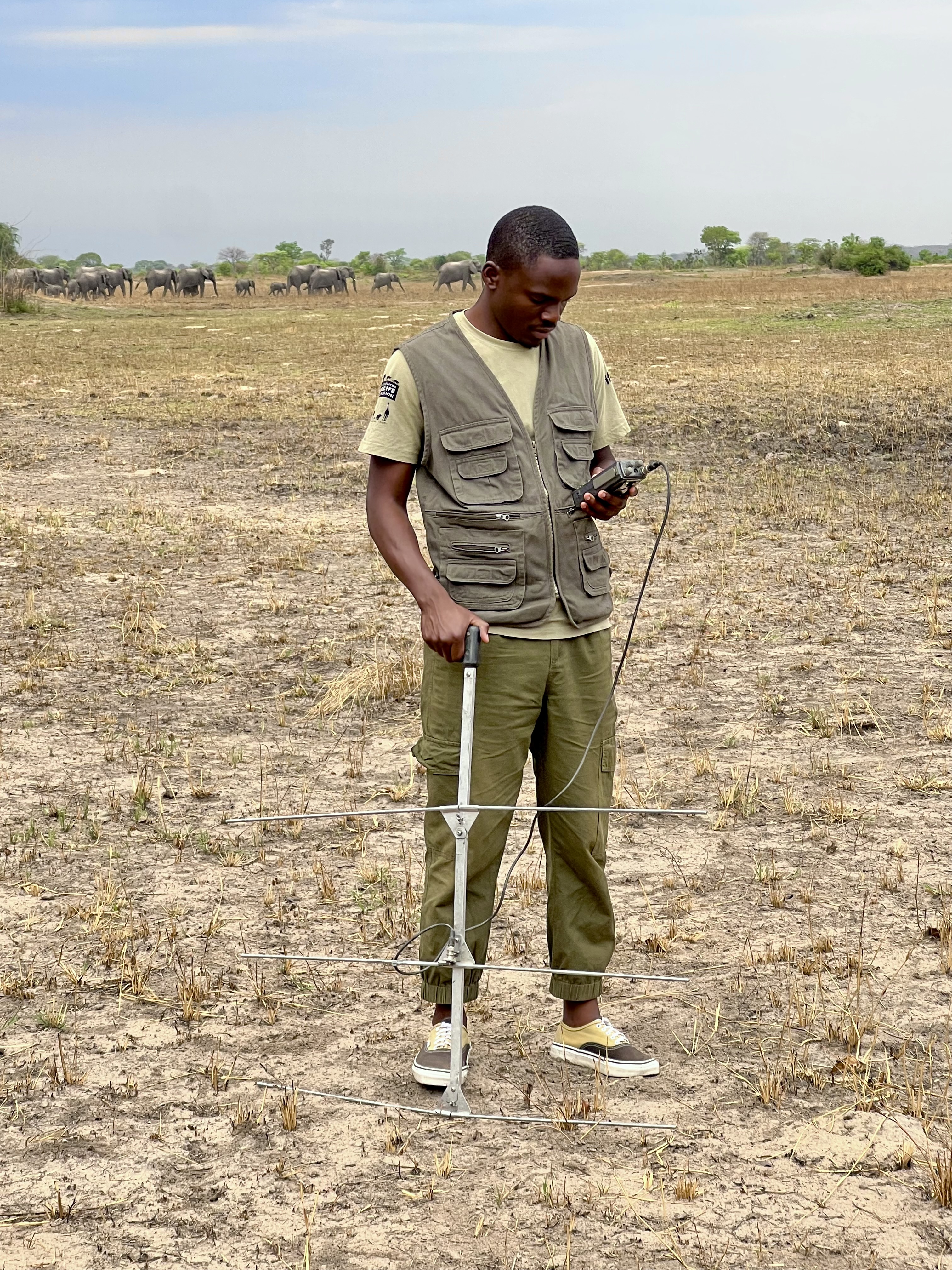
Collaring elephants and post-release monitoring
29 January 2025 8:18am
Collaring Elephants and Post Release Monitoring
28 January 2025 3:16pm
Help Shape the Future of the WILDLABS Geospatial Group!
7 December 2024 2:43pm
7 January 2025 5:49pm
Happy New Year Geospatial community! Don't forget to fill in the survey. Closing date is 19th January.
We'd love to hear from you!
27 January 2025 8:24pm
We're extending the survey deadline! Please don't forget to let us know if you would like to speak about your work at one of the future Geospatial community events.
Many thanks!
Updated Planted Trees Map Reaches Near-Global Coverage
25 January 2025 4:41pm
New Data Provides First Global Annual Picture of Cultivated and Natural Grasslands
25 January 2025 2:22pm
Can/Should UAVs Be The Answer To Urbanisation & Wildlife Conflicts
20 January 2025 11:00am
Impact of Wildfires on Land Surface Cold Season Climate in the Northern High-Latitudes: A Study on Changes in Vegetation, Snow Dynamics, Albedo, and Radiative Forcing
19 January 2025 12:08pm
BIOSPACE 2025
Nature Tech Unconference
Drone specific GIS training online for Conservationists
9 January 2025 11:12am
EARTHVISION 2025
Postdoc on camera trapping, remote sensing, and AI for wildlife studies
15 January 2025 4:53pm











14 August 2024 5:27pm
Hi Norah!
This is a great concern! Kudos!
Climate change data especially for such a long time can help us answer a lot of questions including the few listed below:
I would love to read a paper from the data you have! Very resourceful!
Break the leg!