Who We Are
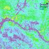
Geospatial data and analysis is critical for conservation, from planning to implementation and measuring success. Every day, mapping and spatial analysis are aiding conservation decisions, protected areas designation, habitat management on reserves and monitoring of wildlife populations, to name but a few examples. The Geospatial group focuses on all aspects of this field, from field surveys to remote sensing and data development/analysis to GIS systems.
How to Get Started
Want to learn more about how remote sensing is used in conservation? Check out the first two episodes of this season of Tech Tutors, where our Tutors answer the questions How do I use open source remote sensing data to monitor fishing? and How do I access and visualise open source remote sensing data in Google Earth Engine? You can also check out our Virtual Meetup Archive for a range of panels that overlap with Geospatial topics, or take a look at our Earth Observation 101 lecture series from Dr. Cristian Rossi.
Our Purpose
The WILDLABS Geospatial Group is for conservation practitioners, geospatial analysts, and academics that want to:
- Share geospatial resources, best practices, data, and ideas;
- Network amongst geospatial and data practitioners;
- Create peer learning opportunities;
- Promote the use of free and open-source geospatial software; and
- Improve the use of GIS software and geospatial analyses in conservation management and research.
Group curators
3point.xyz
Over 35 years of experience in biodiversity conservation worldwide, largely focused on forests, rewilding and conservation technology. I run my own business assisting nonprofits and agencies in the conservation community


- 7 Resources
- 69 Discussions
- 12 Groups
- @ahmedjunaid
- | He/His
Zoologist, Ecologist, Herpetologist, Conservation Biologist


- 75 Resources
- 7 Discussions
- 16 Groups
Fauna & Flora
Remote Sensing Scientist, Conservation Technology & Nature Markets @ Fauna & Flora - WILDLABS Geospatial Group Co-Lead


- 42 Resources
- 49 Discussions
- 9 Groups
No showcases have been added to this group yet.
- @hannahrisser
- | She/her
CEH
- 0 Resources
- 0 Discussions
- 10 Groups
- @Mathilde
- | she/her
Natural Solutions
Engineer, I work for a web development company on web application projects for biodiversity conservation. I'm especially interested by camera traps, teledetection and DeepLearning subjects.
- 0 Resources
- 0 Discussions
- 11 Groups
Max Planck Institute of Animal Behavior
Behavioral Ecologist
- 1 Resources
- 1 Discussions
- 14 Groups
Rainforest Trust


- 0 Resources
- 11 Discussions
- 7 Groups
I am an Impact Monitoring Officer in a REDD+ Project in Zambia.
- 0 Resources
- 0 Discussions
- 1 Groups
- 0 Resources
- 0 Discussions
- 6 Groups
International Union for the Conservation of Nature (IUCN)
Key Biodiversity Areas Programme Officer, IUCN


- 0 Resources
- 89 Discussions
- 8 Groups
- @jakefaber
- | he/him
Upstream Tech

- 0 Resources
- 0 Discussions
- 4 Groups
- 0 Resources
- 0 Discussions
- 1 Groups
British Antarctic Survey
Machine learning researcher at the British Antarctic Survey
- 0 Resources
- 0 Discussions
- 5 Groups
Author of Conservation Biology in Sub-Saharan Africa
- 0 Resources
- 0 Discussions
- 1 Groups
working on the digital transformation for environment, climate, and conservation
- 0 Resources
- 5 Discussions
- 2 Groups
Article
What better way to conclude InConversation Season 1: East Africa than by delving into the exciting yet complex world of #tech4wildlife innovation across the region. This episode is going to be double the insight and...
30 April 2024
Review by Professor Iain H Woodhouse
29 April 2024
The incumbent will develop models and metrics that can be used to shape conservation policy using multiple data sources including camera traps, movement data and citizen science concerning the diversity and...
23 April 2024
Careers
The Smithsonian National Zoo & Conservation Biology Institute is seeking a Program Manager to help coordinate multiple organizations in an effort to integrate movement data & camera trap data with global...
22 April 2024
The Smithsonian National Zoo & Conservation Biology Institute is seeking a Postdoctoral Research Fellow to help us integrate movement data & camera trap data with global conservation policy.
22 April 2024
Watch our interview with pioneering young Tanzanian vulture researcher Vainess Laizer! Her research investigating the breeding success of white-backed vultures in the western corridor of the Serengeti ecosystem using...
16 April 2024
ZSL is looking for an enthusiastic research scientist to join the multidisciplinary team and help deliver a project in Wales to better understand the ecology of tope sharks (Galeus galeus) in North Cardigan Bay and the...
9 April 2024
NASA and IBM have teamed up to create an AI Foundation Model for Earth Observations, using large-scale satellite and remote sensing data, including the Harmonized Landsat and Sentinel-2 (HLS) data.
28 March 2024
WWF is looking for consultant(s) with expertise in spatial data mapping and analysis.
19 March 2024
The Smithsonian’s National Zoo and Conservation Biology Institute (SNZCBI) is seeking two postdoctoral fellows to engage more directly with identifying conservation metrics for vertebrate communities and populations.
14 March 2024
The Max Planck Institute of Animal Behavior at its sites in Constance and Radolfzell offers an international, interdisciplinary, and collaborative environment that opens up unique research opportunities. The goal of our...
13 March 2024
Texas A&M is seeking applicants for a fully funded Ph.D. assistantship to begin a long-term study on collared peccary (also known as javelina) ecology in southern Texas.
13 March 2024
September 2025
October 2025
event
November 2025
event
event
March 2026
September 2023
event
event
131 Products
Recently updated products
| Description | Activity | Replies | Groups | Updated |
|---|---|---|---|---|
| In what ways can drones contribute to linking individuals, communities, and small-scale producers in rural areas, facilitating the support... |
|
Drones, Geospatial | 1 year 8 months ago | |
| @dmorris joined Variety Hour to give us 'a bunch of lightning talks inside a lightning talk'. Check out the recording to get a whirlwind... |
|
AI for Conservation, Drones, Geospatial | 1 year 8 months ago | |
| I'm registered with the TWS2023 app, so feel free to nudge me there as well |
|
Animal Movement, Geospatial, Software Development | 1 year 9 months ago | |
| Digital Earth Africa are doing fantastic work to make Earth Observation data free and accessible, delivering decision-ready products to the... |
|
East Africa Community, Geospatial | 1 year 10 months ago | |
| Stefano Puliti joined Variety Hour to share his work using 3D photogrammetric data from UAVs for pre- and post-harvest inventory of forest... |
|
Climate Change, Data Management & Mobilisation, Drones, Geospatial | 1 year 10 months ago | |
| Carly, that would be great! Thanks! I work with soundscapes and love the work of Rainforest Connection! I'll send you an email (@CUNY) to coordinate! |
|
Acoustics, AI for Conservation, Conservation Tech Training and Education, Drones, eDNA & Genomics, Emerging Tech, Geospatial | 2 years 2 months ago | |
| Do you have a wild animal tracking story that involves adventure or misadventure? Share it with us! From going around in circles for hours... |
|
Animal Movement, Citizen Science, Drones, Geospatial | 2 years 3 months ago | |
| I'm looking for any recommendations for any entry level/internship remote roles/companies in the United States that are focused in... |
|
AI for Conservation, Conservation Tech Training and Education, Early Career, Geospatial | 2 years 4 months ago | |
| Hi Jeremy, With a quick search I've found the paper linked below. It looks like equipments such as Livox MID are sufficient for plot-level analyses, but not for individual... |
|
Drones, Earth Observation 101 Community, Emerging Tech, Geospatial, Sensors | 2 years 4 months ago | |
| Indeed, I'll be there too! I like to meet new conservation friends with morning runs, so I will likely organize a couple of runs, maybe one right near the conference, and... |
|
Acoustics, AI for Conservation, Autonomous Camera Traps for Insects, Camera Traps, Geospatial | 2 years 4 months ago | |
| Thank you so much for your reply! I'll look in to this now :) |
|
Acoustics, Autonomous Camera Traps for Insects, Camera Traps, Data Management & Mobilisation, Drones, Geospatial, Software Development | 2 years 5 months ago | |
| Our project in very short is, setting up a sensor network for monitoring airborne biomass, mainly insects, birds and bats in near realtime, and to develop a forecast model to be... |
|
Autonomous Camera Traps for Insects, Animal Movement, Geospatial, Sensors | 2 years 5 months ago |


