Who We Are
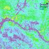
Geospatial data and analysis is critical for conservation, from planning to implementation and measuring success. Every day, mapping and spatial analysis are aiding conservation decisions, protected areas designation, habitat management on reserves and monitoring of wildlife populations, to name but a few examples. The Geospatial group focuses on all aspects of this field, from field surveys to remote sensing and data development/analysis to GIS systems.
How to Get Started
Want to learn more about how remote sensing is used in conservation? Check out the first two episodes of this season of Tech Tutors, where our Tutors answer the questions How do I use open source remote sensing data to monitor fishing? and How do I access and visualise open source remote sensing data in Google Earth Engine? You can also check out our Virtual Meetup Archive for a range of panels that overlap with Geospatial topics, or take a look at our Earth Observation 101 lecture series from Dr. Cristian Rossi.
Our Purpose
The WILDLABS Geospatial Group is for conservation practitioners, geospatial analysts, and academics that want to:
- Share geospatial resources, best practices, data, and ideas;
- Network amongst geospatial and data practitioners;
- Create peer learning opportunities;
- Promote the use of free and open-source geospatial software; and
- Improve the use of GIS software and geospatial analyses in conservation management and research.
Group curators
3point.xyz
Over 35 years of experience in biodiversity conservation worldwide, largely focused on forests, rewilding and conservation technology. I run my own business assisting nonprofits and agencies in the conservation community


- 7 Resources
- 69 Discussions
- 12 Groups
- @ahmedjunaid
- | He/His
Zoologist, Ecologist, Herpetologist, Conservation Biologist


- 75 Resources
- 7 Discussions
- 16 Groups
Fauna & Flora
Remote Sensing Scientist, Conservation Technology & Nature Markets @ Fauna & Flora - WILDLABS Geospatial Group Co-Lead


- 42 Resources
- 49 Discussions
- 9 Groups
No showcases have been added to this group yet.
- @beccadobrien
- | she/her
Undergraduate student studying mechanical engineering and environmental science at Lehigh University.
- 0 Resources
- 0 Discussions
- 4 Groups
IT specialist, Natural Resource Mamgement Researcher, Human-Wildlife-Conflict Manager and GIS student
- 0 Resources
- 0 Discussions
- 4 Groups
Drone Operator and Tech Developer


- 0 Resources
- 33 Discussions
- 9 Groups
World Wide Fund for Nature/ World Wildlife Fund (WWF)
- 0 Resources
- 0 Discussions
- 1 Groups
Conservationist currently working as UAS Remote Pilot & with ecoacoustics
- 0 Resources
- 5 Discussions
- 3 Groups
- @magali
- | she/her
Swedish University of Agricultural Sciences
Postdoctoral researcher at Swedish University of Agricultural Sciences
- 0 Resources
- 0 Discussions
- 16 Groups
- @mgmitche
- | he/him
University of British Columbia
- 0 Resources
- 0 Discussions
- 4 Groups
Faculty Manager for Higher Education. Lecturer in Animal Behaviour, Animal Welfare and Wildlife Conservation
- 0 Resources
- 0 Discussions
- 10 Groups
I am a ecologist and conservationist particularly excited about tech to aid biodiversity monitoring with a growing interest in analytics and AI. I am also a Project Manager at Rainforest Connection.
- 0 Resources
- 0 Discussions
- 8 Groups
- @cjturner
- | he/him
Computational Ecologist working on camera traps, audio, tracking and remote sensing.
- 0 Resources
- 0 Discussions
- 4 Groups
- @rgaston5
- | he/him
I am an educator, and a certified California Climate Steward. I have skills in machine learning and a passion for the environment and conservation

- 0 Resources
- 0 Discussions
- 13 Groups
- @matthew.boddy
- | He/Him
- 0 Resources
- 0 Discussions
- 7 Groups
Are you stuck on an AI or ML challenge in your conservation work? Apply now for the chance to receive tailored expert advice from data scientists! The deadline for applications is Monday 9 December 2024.
13 November 2024
Article highlighting how the EU's Space Programme is supporting conservation efforts across Europe and beyond, either by providing data products to institutions or by supporting researchers and conservationists working...
3 November 2024
Link
Paper describing the Sustainable Ecology and Economic Development (SEED) framework, which assesses multiple dimensions of biodiversity across plants, animals, and microbial taxa, and consolidates this into a single...
2 November 2024
deadtrees.earth is an open-access platform hosting more than a thousand centimeter-resolution orthophotos, more than 300,000 ha. Combined with Earth observation data and machine learning it will enable to uncover tree...
2 November 2024
The authors used the Continuous Degradation Detection and LandTrendr to map forest disturbance and regeneration, carbon sequestration and changes in habitats. This was coupled with eDNA from soil samples from...
2 November 2024
Link
The SEED Index can be used by any organisation to measure and report on biodiversity impacts. The index is currently in beta version and not publicly available and is currently being used by several pilot projects....
1 November 2024
Amirhossein Ahrari's Earth Engine Hub.
29 October 2024
Introducing the Earth Engine Dataset Explorer Empowered by Google Gemini - Open Geospatial Solutions
29 October 2024
Careers
WWF is looking for a Student Assistant: Geospatial Analyst (m/w/d) for data visualizations and monitoring systems, particularly using GLOBIL (with a focus on ESRI ArcGIS Online and ArcGIS Pro) in the Africa Department
28 October 2024
September 2025
October 2025
event
November 2025
event
event
March 2026
January 2023
131 Products
Recently updated products
| Description | Activity | Replies | Groups | Updated |
|---|---|---|---|---|
| In what ways can drones contribute to linking individuals, communities, and small-scale producers in rural areas, facilitating the support... |
|
Drones, Geospatial | 1 year 8 months ago | |
| @dmorris joined Variety Hour to give us 'a bunch of lightning talks inside a lightning talk'. Check out the recording to get a whirlwind... |
|
AI for Conservation, Drones, Geospatial | 1 year 8 months ago | |
| I'm registered with the TWS2023 app, so feel free to nudge me there as well |
|
Animal Movement, Geospatial, Software Development | 1 year 9 months ago | |
| Digital Earth Africa are doing fantastic work to make Earth Observation data free and accessible, delivering decision-ready products to the... |
|
East Africa Community, Geospatial | 1 year 10 months ago | |
| Stefano Puliti joined Variety Hour to share his work using 3D photogrammetric data from UAVs for pre- and post-harvest inventory of forest... |
|
Climate Change, Data Management & Mobilisation, Drones, Geospatial | 1 year 10 months ago | |
| Carly, that would be great! Thanks! I work with soundscapes and love the work of Rainforest Connection! I'll send you an email (@CUNY) to coordinate! |
|
Acoustics, AI for Conservation, Conservation Tech Training and Education, Drones, eDNA & Genomics, Emerging Tech, Geospatial | 2 years 2 months ago | |
| Do you have a wild animal tracking story that involves adventure or misadventure? Share it with us! From going around in circles for hours... |
|
Animal Movement, Citizen Science, Drones, Geospatial | 2 years 3 months ago | |
| I'm looking for any recommendations for any entry level/internship remote roles/companies in the United States that are focused in... |
|
AI for Conservation, Conservation Tech Training and Education, Early Career, Geospatial | 2 years 4 months ago | |
| Hi Jeremy, With a quick search I've found the paper linked below. It looks like equipments such as Livox MID are sufficient for plot-level analyses, but not for individual... |
|
Drones, Earth Observation 101 Community, Emerging Tech, Geospatial, Sensors | 2 years 4 months ago | |
| Indeed, I'll be there too! I like to meet new conservation friends with morning runs, so I will likely organize a couple of runs, maybe one right near the conference, and... |
|
Acoustics, AI for Conservation, Autonomous Camera Traps for Insects, Camera Traps, Geospatial | 2 years 4 months ago | |
| Thank you so much for your reply! I'll look in to this now :) |
|
Acoustics, Autonomous Camera Traps for Insects, Camera Traps, Data Management & Mobilisation, Drones, Geospatial, Software Development | 2 years 5 months ago | |
| Our project in very short is, setting up a sensor network for monitoring airborne biomass, mainly insects, birds and bats in near realtime, and to develop a forecast model to be... |
|
Autonomous Camera Traps for Insects, Animal Movement, Geospatial, Sensors | 2 years 5 months ago |


