Sensors already equip a range of tools to enhance monitoring capacity for conservation. Some of the higher bandwidth technologies, like camera traps and acoustic monitoring systems, have been essential elements of the conservation toolkit for decades, and thus have enough users that we've created dedicated WILDLABS groups to address them. But a whole range of lower bandwidth sensors beyond these core technologies are being increasingly integrated into conservation monitoring systems, and offer rich new insights into the wildlife and ecosystems we're all working to protect. As with many technologies, cost and access have historically been challenges to the adoption of new sensors, but with low-cost and open-source solutions on the rise, we're excited to see what the future of this space holds.
Getting Started with Sensors:
- Watch Shah Selbe's Tech Tutors episode on scaling FieldKit, an open-source conservation sensor toolbox, from a project to a successful conservation tech product.
- Check out our Virtual Meetup about Low-Cost, Open-Source Solutions in conservation tech, including a talk by Alasdair Davies on the Arribada Initiative's work with thermal sensors in early warning systems.
- For a more in-depth introduction, watch the first video in our datalogger mini-series: Freaklabs: How do I get started with Arduino?
In this group, you'll meet others who are using and innovating diverse sensors in their work, discuss ways to make sensors more effective & accessible for conservationists, learn about what sensors are already helping us accomplish in the field, and have the opportunity to ask and answer questions. Join this group to get started!
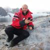
Header image: Emma Vogel, University of Tromsø
No showcases have been added to this group yet.
Botswana Predator Conservation Trust


- 0 Resources
- 85 Discussions
- 10 Groups
I work in conservation on integrating the technology out there for custom solutions for partners.
- 0 Resources
- 0 Discussions
- 22 Groups
- @adanger24
- | She/Her
Arribada Initiative
Senior Project Manager and Field Specialist

- 2 Resources
- 16 Discussions
- 10 Groups

- @pmarchetto
- | he/him
University of Minnesota
http://about.me/pete.marchetto
- 1 Resources
- 0 Discussions
- 3 Groups

National Geographic Society
Experience utilizing technology to inspire, educate, and create solutions to some of our biggest challenges. Currently, head of the National Geographic Society Exploration Technology Lab, overseeing the development and deployment of research and storytelling technologies.
- 0 Resources
- 1 Discussions
- 16 Groups
- @AthenaRycyk
- | she/her
- 0 Resources
- 0 Discussions
- 8 Groups

- @SamuelHertz
- | He/Him/His
I'm a PhD researcher at Royal Holloway University of London (Centre for GeoHumanities) researching modalities of sound-sensing technologies across climate and conservation sciences. Interested in ethics and histories of acoustic monitoring as well as new visualization methods.
- 0 Resources
- 3 Discussions
- 10 Groups
- 0 Resources
- 0 Discussions
- 4 Groups

- @rohikip
- | He/His/Him
A Techie with passion in biodiversity conservation.
- 0 Resources
- 0 Discussions
- 5 Groups

MSc Engineering / IoT Engineer / Nature Enthusiast
- 0 Resources
- 0 Discussions
- 8 Groups

Movement Ecologist studying the where, why, and how animals move throughout our world. Current work is investigating the movement and energetics of large neotropical bats in a changing environment with ephemeral resources.


- 0 Resources
- 23 Discussions
- 22 Groups

- @matt_hron
- | He/Him
Wildlife Protection Solutions (WPS)
Product Manager at Wildlife Protection Solutions


- 0 Resources
- 8 Discussions
- 8 Groups
Article

Technology is rapidly changing the way communities monitor wildlife movement and prevent or mitigate human-wildlife conflict. This case study from Appiko delves into field testing of the open source sensor warning...
25 February 2020
Article
HWC Tech Challenge Update: Thermal Elephant Alert System

Anne Dangerfield
The Arribada Initiative is back with an update on their thermal elephant alert system which aims to reduce human-elephant conflict (HEC). The success of their system rests on the ability of a camera to accurately...
17 February 2020
Funding

Applications are now open for a second round of the £10 million UK Seafood Innovation Fund to transform the future landscape of the seafood industry.
11 February 2020
Article
Plant-Powered Camera Trap Breakthrough
Alasdair Davies
Microbial fuel cells, developed by Plant-powered Camera Trap Challenge winners Plant-E, have been used successfully with Xnor.ai's energy harvesting camera technology to capture what are thought to be the world's first...
15 October 2019
Article
How do you weigh a live whale?

WILDLABS Team
How do we actually know a whale weighs 40 tonnes? After all, we can’t exactly capture an animal the size of a bus and simply put it on a scale. Fredrik Christiansen explains their new, non-invasive way of weighing...
9 October 2019
Article
Instant Detect 2.0 emerges
Sam Seccombe
In the past six months Instant Detect 2.0 has physically emerged, with the first prototype systems built and ready for testing at the start of April. The ZSL team is now well into their optimisation and hardening phase...
3 September 2019
Funding
ESA Kickstarter: Environmental Crimes

European Space Agency (ESA)
The European Space Agency’s “Environmental Crimes” thematic call offers support and funding of up to €60,000 per activity to companies looking to develop services tackling illegal water, air and land polution using...
22 August 2019
Article
ICCB 2019: 5 Key Discussions about the Future of Conservation Tech

Stephanie O'Donnell
Sharing failure, tech support for conservation, roaming mentors, conservation tech hype cycles and developing new road maps - participants in our tech workshops at ICCB 2019 shared an abundance of ideas for how to shape...
21 August 2019
Article
From the Field: Melissa Schiele
WILDLABS Admin
In this From the Field interview, we talk to Melissa Schiele, a tech whiz, marine ecologist, and conservationist at the Zoological Society of London. She shares with us about her work helping to develop the first-ever...
10 June 2019
Article
The WILDLABS TECH HUB is supporting technology solutions tackling the illegal wildlife trade, in collaboration with the Foreign & Commonwealth Office, Digital Catapult, Satellite Applications Catapult, Amazon Web...
4 June 2019
Article
Technology lab focused on wildlife protection opens on Ol Pejeta Conservancy
Ol Pejeta Conservancy
Ol Pejeta Conservancy partners with conservation and technology organisations to kick-start a research and innovation centre for wildlife conservation
31 May 2019
Funding
FLIR Conservation Discount Program

Teledyne FLIR
FLIR announces the launch of their Conservation Discount Program, which offers projects the opportunity to qualify for a 30% discount on select thermal, visible, and maritime products. Share your conservation plan and...
23 May 2019
August 2025
event

Louisa Richmond-Coggan
September 2025
event
Louisa Richmond-Coggan
March 2026

December 2023

November 2023
17 Products
Recently updated products
121 Products
3 R&D Projects
84 Organisations
Recently updated products
Recently updated R&D Projects
Recently updated organisations
| Description | Activity | Replies | Groups | Updated |
|---|---|---|---|---|
| Will your startup be involved in sensor networks for conservation? I'm very interested. Currently we create sensor networks for developmental infrastructure and agriculture... |
|
Sensors | 6 years 5 months ago | |
| Hi everyone. I'm Akiba and I'm an engineer by trade specializing in wireless sensor networks and communications. I generally work with groups like World Bank on... |
|
Sensors | 6 years 5 months ago | |
| Subcutaneous pittags that also read temperature (frustratingly) read only a limited range of temperatures - however, I hear that can be... |
|
Sensors | 6 years 6 months ago | |
| Hi Ted, This is all very interesting. The solution you describe seems eminently doable and in fact quite cheap. So doable and cheap that it may behoove one to... |
|
Sensors | 6 years 6 months ago | |
| Yes, I agree it's a tough problem - i'm certainly stumped ;) but thanks so much for your reply and counter question - the goal is to find these gillnets and... |
|
Sensors | 6 years 8 months ago | |
| Hi Tony, I'm leading a cross disciplinary group of researchers at Deakin University in Australia to build new technology for monitoring wildlife and engage citizen scientists... |
|
Sensors | 7 years 4 months ago | |
| The current project is in open plains. From a handler perspective the distance will be from 20m -100m. I will be working at night so it will be looking for me target, the Plains... |
|
Sensors | 7 years 4 months ago | |
| @hikinghack used twitter to flag a thread on hackteria that members of this group might be interested in about DIY time-lapse soil... |
|
Sensors | 7 years 4 months ago | |
| Also if you are still looking for a solution this was published earlier this year and gives recommendations for soundscape microphones : http://onlinelibrary.wiley.com/doi/10... |
+5
|
Sensors | 7 years 9 months ago | |
| If anything belongs in the 'have you seen this' group, it's this project: Researchers at Binghamton University have created... |
|
Sensors | 7 years 10 months ago | |
| The University of Washington is reporting that they've shattered the long-range communications barrier for devices that consume almost... |
|
Sensors | 7 years 11 months ago | |
| My own experience is with the FLIR iphone attachment, just informal testing, but hasn't been that great at finding animals. I also think it would work better in the... |
|
Sensors | 7 years 11 months ago |


HWC Tech Challenge Winners Announced
1 November 2017 12:00am
HWC Tech Challenge Update: Meet the Judges
20 October 2017 12:00am
Download New Conservation Tech Guidelines: Camera Traps, Acoustics and LiDAR
11 October 2017 12:00am
Kids, Drones & Science At The Water’s Edge
4 October 2017 12:00am
Saliva-powered paper battery
26 September 2017 2:55pm
DAS: A Scaleable Solution For Protected Area Management
26 September 2017 12:00am
How to lose a BRUV in 10 days
26 September 2017 12:00am
Elephant's Banquet

19 September 2017 12:00am
IoT breakthrough - applications for wildlife conservation?
15 September 2017 3:10pm
Thermal cameras and wildlife
26 July 2017 6:51pm
21 August 2017 12:17pm
Abstract here from the IMC Congress in Perth, they found the higher-res versions are much better than the less expensive (e.g. iphone) versions when it comes to finding animals.
Now you see me: How thermal imaging increases detection of cryptic nocturnal mammals in tropical regions
Avril Underwood1 , Mia Dehre-Miller2 1. James Cook University, Smithfield, Queensland, Australia 2.
University of Lancaster, Lancaster, United Kingdom Accurate measures of species abundance and distribution underpin effective wildlife management and conservation strategies. Obtaining these data is very challenging when researching the cryptic nocturnal arboreal mammals of in the dense forest of the Wet Tropics. Our research shows that using a hand-held thermal imager significantly increases the detection rate of all mid-sized arboreal mammals when compared to the most commonly used method of spotlighting. We determine the optimal environmental and mechanical parameters for thermal imaging, and we investigate ‘cost-versus-result’ of hand-held imaging devices currently available on the market. We suggest that hand-held thermal imaging is a great emerging technology for cryptic arboreal mammal detection across tropical forested regions and beyond.
21 August 2017 12:20pm
My own experience is with the FLIR iphone attachment, just informal testing, but hasn't been that great at finding animals. I also think it would work better in the early AM. In the evening there can still be a lot of rocks and trees still warm from the sun.
Funding Opportunity: Leverage space technology for wildlife protection
6 July 2017 12:56pm
Leverage Space Technology for Wildlife Protection with the European Space Agency Kick-start Grant
5 July 2017 12:00am
Trialing Audiomoth to detect the hidden threats under the canopies of Belize
 Andrew Hill
and 1 more
Andrew Hill
and 1 more
27 June 2017 12:00am
Biomaker Challenge - up to £1000 support for prototyping sensors and instrumentation related to biology
19 June 2017 3:46pm
19 June 2017 3:51pm
Hey Jenny,
Thanks for sharing this, looks really interesting! In addition to WILDLABS members potentially getting involved, it'd be great to hear about some of the projects that get developed through the challenge. It looks like they're all going to be shared openly on github! Perhaps you could highlight or direct folks here to any as they emerge that you think might be particularly relevant?
Steph
19 June 2017 4:03pm
Hi Steph
Sure - we'll have the projects confirmed by 30 June and I can highlight ones that might be of interest!
Jenny
From the Field: Eric Becker and designing sensors for wildlife
22 May 2017 12:00am
acoustics for Human-Wildlife Conflict Prevention, Anti-poaching, and more

27 April 2017 6:43pm
From the Field: Dr Raman Sukumar and Technology Developments Needed to Conserve Elephants
5 April 2017 12:00am
Lasers in the Jungle Somewhere: How Airborne LiDAR Reveals the Structure of Forests
 Phil Wilkes
4 April 2017 12:00am
Heat Maps
2 March 2016 3:18pm

31 March 2017 10:45am
Hi @AdamBloch
I'd like to know more about your setup. I'm monitoring temperatures on a nature reserve using an array of 100 iButton Thermocron temperature sensors. I'm interested in what the benefits of using Arduino and Raspberry Pi might be. I need to collect my sensors in and read through a USB device. Then there's the interpolation and plotting of the data, and I'm particularly interested in how you are filtering and querying your data i.e. 'selectable [time?] range'.
Thanks
31 March 2017 9:49pm
Hi Thomas
We are mapping a very small area in real time. The data rate is controlled by the time it take to read all the DS18B20s. The logger I use in the Octogons is using about 90 sensors and refreshes about every 5 to 15 seconds. The data is store as a CSV in series of files.
Best thing to do is drop me a PM and your number.
Many thanks
Adam
15 Risks and Opportunities for Global Conservation
31 March 2017 12:00am
From the Field: Paul Millhouser and tracking migrating kestrels with low cost, light based geolocators
29 March 2017 12:00am
The Noise Egg: Testing the Effects of Underwater Noise on Aquatic Animals
27 March 2017 12:00am
From the Field: María José Bolgeri and tech to alleviate Puma-Human conflict
22 March 2017 12:00am
Photogrammetry: mapping caves and other environments
19 January 2017 11:46am

8 March 2017 1:49pm
Hi Ollie,
You can do the photogrammetry without a drone. You just need a tripod and a camera. The drone is useful because it can move to locations automatically ensuring that you have correct overlap but in caves you obviously will not have the GPS signal you need for most off the shelf units to navigate.
Thom mentioned to me a device called a Zebedee, which should do what you are hoping for. I don't know anyone who has one though and I'm afraid I don't have a LiDAR unit to lend.
Tom
8 March 2017 1:54pm
A colleague showed me this last week - laser scanning in Nottingham's 'caves' - scroll down and check out the video.
http://tparchaeology.co.uk/caves/caveswebsite/index.htm
8 March 2017 2:03pm
For good measure, here's some cave survey porn of Hang Son Doong cave in China.
https://www.youtube.com/watch?v=tOH4gbW18Ts
#Tech4Wildlife Photo Challenge: Our favourites from 2016
1 March 2017 12:00am
A hive of activity – CAD designers are crafting an open future for bees
20 December 2016 12:00am
Conservation Leadership Programme 2017 Award
21 November 2016 12:00am
5 Smart Technologies That Will Crack Down On Wildlife Trafficking
14 November 2016 12:00am
Neotropical Migratory Bird Conservation Act grants via USFWS
8 November 2016 12:00am
How do Wildlife Crime Experts view Remote Sensing Technologies used to Combat Illegal Wildlife Crime?
7 November 2016 12:00am
26 July 2017 8:33pm
Oh, cool! It'd be interesting seeing if it could be used for tracking as well. I've used some handheld cameras and looked at footprints, but those disappeared pretty quickly.