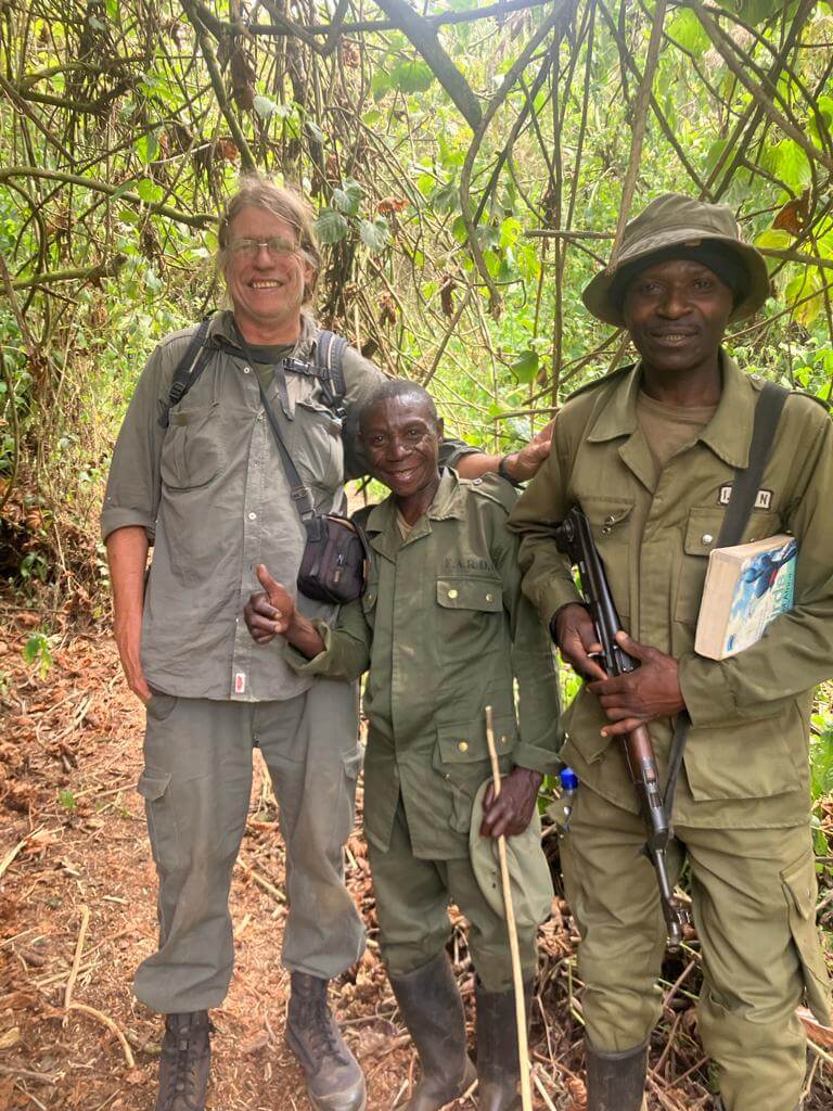
In recent years, drone technologies have been explored for a range of applications in conservation including (but not limited to) mapping, biodiversity inventories, antipoaching patrols, wildlife tracking, and fire monitoring. The rise of customizable, open-source drones like those of ArduPilot and OpenROV hold promise for more effective conservation applications, and combined with other monitoring sensors and devices, they are capable of collecting high-resolution data quickly, noninvasively, and at relatively low cost.
However, challenges remain in putting these tools to use. A recent paper reviewing 256 conservation drone projects highlighted some of these major obstacles, ranging from unintended social and ecological consequences of drone operations to still prohibitive costs, both in terms of hardware and in terms of storing and processing large volumes of data. The longstanding challenge of power/battery life remains as well.
If you're considering trying out drones for yourself, and want to explore the possibilities and understand the major conversations happening around this technology, check out these beginner's resources and conversations from across the WILDLABS platform:
Three Resources for Beginners:
- Conservation Technology User Guidelines Issue 5: Drones, World Wildlife Fund | Drones, best practices, ethics, regulations, case studies
- WILDLABS Virtual Meetup Recording: Drones, Craig Elder, Dr. Claire Burke, and Gabriel Levin | Drones, thermal camera, wildlife crime, ML, biologging
- New Paper: Drones and Bornean Orangutan Distribution, Sol Milne | Drones, data analysis, citizen science, community science, primates
Three Forum Threads for Beginners:
- Curious about radio-tracking with drones? | Wildlife Drones, Biologging (5 replies)
- Drones for GIS Best practice Document | Adrian Hughes, Drones (10 replies)
- WWF Conservation Technology Series: Drones in Conservation | Aurélie Shapiro, Drones (7 replies)
Three Tutorials for Beginners:
- How do I use a drone to capture radio-tracking data? | Debbie Saunders, Tech Tutors
- How do I choose the right drone for my conservation goals? | Shashank Srinivasan, Tech Tutors
- How do I strategically allocate drones for conservation? | Elizabeth Bondi, Tech Tutors
Want to know more about using drones, and learn from experts in the WILDLABS community? Make sure you join the conversation in our Drones group!
*Header photo: Parker Levinson, Point Blue Conservation Science

- @georg_strunck
- | he/him
Delft University of Technology & SPOTS | Strategic Protection Of Threatened Species
MSc Student in Aerospace/Robotics @TU_Delft | Engineer & Project Manager @StrategicProtectionOfThreatenedSpecies (SPOTS) | Robotics Engineer @BiodivX with @ETH Zürich for the xPrize rainforest competition

- 1 Resources
- 9 Discussions
- 10 Groups

- @felipeccalegari
- | he/him
Universidade Federal de Santa Catarina (UFSC)
Master student in Automation Engineering at Federal University of Santa Catarina (UFSC) in Brazil. Areas of interest: embedded systems, robotics, multiagent systems
- 0 Resources
- 1 Discussions
- 3 Groups

- @Frank_van_der_Most
- | He, him
RubberBootsData
Field data app developer, with an interest in funding and finance


- 54 Resources
- 177 Discussions
- 9 Groups
- 0 Resources
- 2 Discussions
- 1 Groups

- @TaliaSpeaker
- | She/her
WILDLABS & World Wide Fund for Nature/ World Wildlife Fund (WWF)
I'm the WILDLABS Research Specialist at WWF-US

- 23 Resources
- 62 Discussions
- 25 Groups

WILDLABS & Wildlife Conservation Society (WCS)
I'm the Bioacoustics Research Analyst at WILDLABS. I'm a marine biologist with particular interest in the acoustics behavior of cetaceans. I'm also a backend web developer, hoping to use technology to improve wildlife conservation efforts.


- 27 Resources
- 34 Discussions
- 34 Groups

- @SamuelNtimale
- | Him
Samuel Nti, a conservationist at APLORI, uses bioacoustics to protect endangered birds. His current work focuses on the African Grey Parrot in Nigeria, where he employs Passive Acoustic Monitoring (PAM) to inform conservation strategies.

- 0 Resources
- 1 Discussions
- 7 Groups

Worked as a mechanical engineer for a defence co, then software engineer, then for a research lab specialising in underwater robotics.

- 1 Resources
- 144 Discussions
- 16 Groups

- @carlybatist
- | she/her
ecoacoustics, biodiversity monitoring, nature tech


- 111 Resources
- 356 Discussions
- 19 Groups

- 0 Resources
- 0 Discussions
- 3 Groups
- @frankglujan
- | He/Him/His
- 0 Resources
- 0 Discussions
- 3 Groups

Senior Wildlife Research Scientist
- 0 Resources
- 0 Discussions
- 7 Groups
Article
Nature Tech for Biodiversity Sector Map launched!

Carly Batist and 1 more
Conservation International is proud to announce the launch of the Nature Tech for Biodiversity Sector Map, developed in partnership with the Nature Tech Collective!
1 April 2025
Link
deadtrees.earth

Elsa Carla De Grandi
An open database for accessing, contributing, analyzing, and visualizing remote sensing-based tree mortality data. Beta version
9 March 2025
Funding
Osa Conservation is launching our inaugural cohort of the ‘Susan Wojcicki Research Fellowship’ for 2025, worth up to $15,000 per awardee (award value dependent on project length and number of awards given each year)....
10 February 2025
Careers
SPOTS Internship Programme
Georg Strunck
Strategic Protection Of Threatened Species (NGO) is looking for engineering interns at the Dinokeng Game Reserve, South Africa
6 February 2025
Article

Over the years, a large number of developments have gone up in the area that I live in and the municipality is not doing what they should when it comes to upholding the laws that have been put in place to protect the...
20 January 2025
Careers
New PhD - Drones, seaweeds & climate change

Chris Yesson
A PhD opportunity for anyone interested in coastal drone surveys, seaweeds, climate change and the chance to do a whole bunch of different computer modelling including AI-driven species distribution modelling to assess...
30 December 2024
Link
AmazonTEC: 4D Technology for Biodiversity Monitoring in the Amazon (English)

Elsa Carla De Grandi
Interesting webinar on the use of advanced technologies(e.g. Artificial Intelligence, cloud computing, drones, camera traps and satellites) for biodiversity monitoring in the Amazon. Also available in Spanish.
25 November 2024
Careers
Computer Vision Developer

Ben Weinstein
We are hiring a computer vision developer at the University of Florida!
20 November 2024
Link
Great use of drones from Fauna&Flora's team
7 November 2024
Link
deadtrees.earth is an open-access platform hosting more than a thousand centimeter-resolution orthophotos, more than 300,000 ha. Combined with Earth observation data and machine learning it will enable to uncover tree...
2 November 2024
Careers

Seeking expressions of interest from PhD candidates to join the MAVE Lab at the University of Wollongong, NSW, Australia
26 August 2024
May 2025
event

Vanesa Reyes and 1 more
April 2025
event
Ben Weinstein
February 2025
event
Rick Spaulding
event

Wildlife Drones
33 Products
Recently updated products
| Description | Activity | Replies | Groups | Updated |
|---|---|---|---|---|
| Hi Simon,We (Reneco International Wildlife Consultants) have an ongoing collaboration with a local University (Abu Dhabi, UAE) for developing AI tools (cameratrap/drone... |
|
Acoustics, AI for Conservation, Animal Movement, Camera Traps, Citizen Science, Connectivity, Drones, Early Career, eDNA & Genomics, Marine Conservation, Protected Area Management Tools, Sensors | 4 months 1 week ago | |
| Thank you David, a phenomenal source! |
+10
|
Drones, Geospatial, Protected Area Management Tools | 4 months 2 weeks ago | |
| I've used both Dronelink and Litchi for flight planning with my DJI Mini SE - and then stitched in WebODM. Both apps support most DJI drones that have a suporting SDK. I'm not... |
|
Drones | 4 months 4 weeks ago | |
| Hi Matthew Wow, what an amazing project! It is incredible how you have managed to figure out some of the complexities of combining underwater imagery with UAV imagery. I am... |
|
Drones, Geospatial, Marine Conservation, Protected Area Management Tools | 5 months ago | |
| Hats off to your team for this absolute game-changing technology! We rescue stray and wild animals in Taiwan, and the bulk of our work is saving animals maimed by wire snares... |
+37
|
AI for Conservation, Drones, Emerging Tech, Human-Wildlife Conflict, Wildlife Crime | 6 months ago | |
| Adrian,Many thanks for v2.0 of the GIS best practices document. How does one obtain a copy of the RSPB code of practice B09 referenced in the best practices document? The link in... |
+8
|
Drones | 6 months 1 week ago | |
| Hi,I wonder if anyone could provide a synopsis of where drone tech currently sites for autonomous usage and AI implementation for surveys... |
|
Drones | 6 months 2 weeks ago | |
| No problem at all Yu (@JY) and good luck with your studies! Happy to discuss this and any other ideas any time.All the best,Rob |
+10
|
Sensors, Animal Movement, Connectivity, Drones, Open Source Solutions, Emerging Tech | 6 months 3 weeks ago | |
| 180m is indeed very high and from above. I think a 640x512 thermal sensor with a 70mm lens can see animals at at 180m from sideways and could recognise something as a deer, but... |
+11
|
Drones, Human-Wildlife Conflict | 7 months 1 week ago | |
| Hi @benweinstein !Surely a general detector might be very useful for detecting objects in aerial imagery! Maybe something similar to what MegaDetector does in camera trap images,... |
|
AI for Conservation, Open Source Solutions, Protected Area Management Tools, Drones, Geospatial | 8 months 1 week ago | |
| RealityCapture is now free to use for students, educators, and hobbyists and for companies making less than $1 million USD/year.Best regards!Steffen |
|
Drones | 9 months 1 week ago | |
| Hi all,maybe it helps 😉 My free manual 'Drones in Biomonitoring' - https://doi.org/10.5281/zenodo.8077113 can help to get (more) knowledge how to proceed easily and successfully... |
|
Drones, Marine Conservation, Wildlife Crime | 9 months 1 week ago |


Can RGB drone data & Machine Learning be of value in Conservation?
14 May 2025 12:52pm
'Boring Fund' Workshop: AI for Biodiveristy Monitoring in the Andes
5 February 2025 5:55pm
2 May 2025 2:59pm
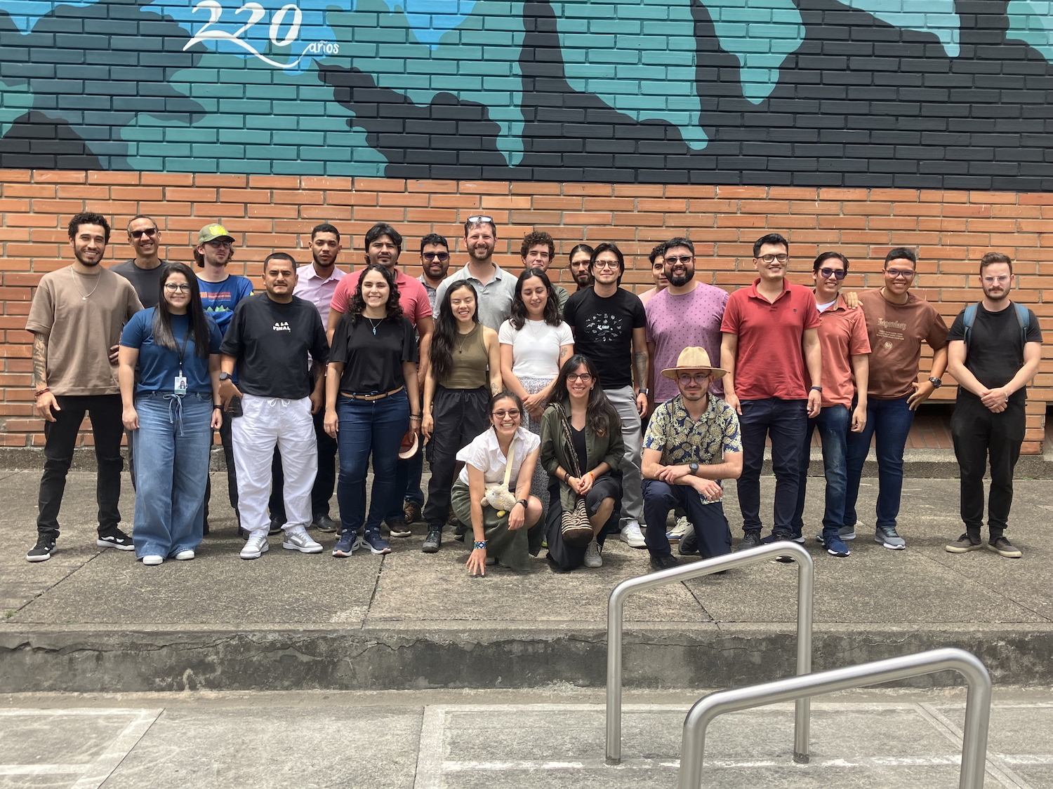
Hi everyone, following up here with a summary of our workshop!
The AI for Biodiversity Monitoring workshop brought together twenty-five participants to explore uses of machine learning for ecological monitoring. Sponsored by the WILDLABS ‘Boring Fund’, we were able to support travel and lodging for a four-day workshop at the University of Antioquia in Medelín, Colombia. The goal was to bring together ecologists interested in AI tools and data scientists interested in working on AI applications from Colombia and Ecuador. Participants were selected based on potential impact on their community, their readiness to contribute to the topic, and a broad category of representation, which balanced geographic origin, business versus academic experience, and career progression.
Before the workshop began I developed a website on github that laid out the aims of the workshop and provided a public focal point for uploading information. I made a number of technical videos, covering subjects like VSCODE + CoPilot, both to inform participants, as well as create an atmosphere of early and easy communication. The WhatsApp group, the youtube channel (link) of video introductions, and a steady drumbeat of short tutorial videos were key in establishing expectations for the workshop.
The workshop material was structured around data collection methods, Day 1) Introduction and Project Organization, Day 2) Camera Traps, Day 3) Bioacoustics, and Day 4) Airborne data. Each day I asked participants to install packages using conda, download code from github, and be active in supporting each other solving small technical problems. The large range of technical experience was key in developing peer support. I toyed with the idea of creating a juypterhub or joint cloud working space, but I am glad that I resisted; it is important for participants to see how to solve package conflicts and the many other myriad installation challenges on 25 different laptops.
We banked some early wins to help ease intimidation and create a good flow to technical training. I started with github and version control because it is broadly applicable, incredibly useful, and satisfying to learn. Using examples from my own work, I focused on github as a way both to contribute to machine learning for biology, as well as receive help. Building from these command line tools, we explored vscode + copilot for automated code completion, and had a lively discussion on how to balance utility of these new features with transparency and comprehension.
Days two, three and four flew by, with a general theme of existing foundational models, such as BirdNET for bioacoustics, Megadetector for Camera traps, DeepForest for airborne observation. A short presentation each morning was followed by a worked python example making predictions using new data, annotation using label-studio, and model developing with pytorch-lightning. There is a temptation to develop jupyter notebooks that outline perfect code step by step, but I prefer to let participants work through errors and have a live coding strategy. All materials are in Spanish and updated on the website. I was proud to see the level of joint support among participants, and tried to highlight these contributions to promote autonomy and peer teaching.
Sprinkled amongst the technical sessions, I had each participant create a two slide talk, and I would randomly select from the group to break up sessions and help stir conversation. I took it as a good sign that I was often quietly pressured by participants to select their talk in our next random draw. While we had general technical goals and each day had one or two main lectures, I tried to be nimble, allowing space for suggestions. In response to feedback, we rerouted an afternoon to discuss biodiversity monitoring goals and data sources. Ironically, the biologists in the room later suggested that we needed to get back to code, and the data scientists said it was great. Weaving between technical and domain expertise requires an openness to change.
Boiling down my takeaways from this effort, I think there are three broad lessons for future workshops.
- The group dynamic is everything. Provide multiple avenues for participants to communicate with each other. We benefited from a smaller group of dedicated participants compared to inviting a larger number.
- Keep the objectives, number of packages, and size of sample datasets to a minimum.
- Foster peer learning and community development. Give time for everyone to speak. Step in aggressively as the arbiter of the schedule in order to allow all participants a space to contribute.
I am grateful to everyone who contributed to this effort both before and during the event to make it a success. Particular thanks goes to Dr. Juan Parra for hosting us at the University of Antioquia, UF staff for booking travel, Dr. Ethan White for his support and mentorship, and Emily Jack-Scott for her feedback on developing course materials. Credit for the ideas behind this workshop goes to Dr. Boris Tinoco, Dr. Sara Beery for her efforts at CV4Ecology and Dr. Juan Sebastian Ulloa. My co-instructors Dr. Jose Ruiz and Santiago Guzman were fantastic, and I’d like to thank ARM through the WILDLABS Boring fund for its generous support.
2 May 2025 2:59pm
Reunión de la Comunidad Latinoamericana: Aplicaciones de Drones en el Monitoreo de Fauna
Vanesa Reyes
and 1 more
24 April 2025 4:08pm
Drone & ai use for uncovering illegal logging camps
21 April 2025 4:49am

21 April 2025 12:49pm
Hi Adam!
Sounds like you have your work cut out for you. I have not used radar systems or AI systems for this sort of detection, but there are methods using change detection models to visualise changes in forests where logging may be occuring between different dates using drone photogrammetry and GIS software. I have found these methods very effective when monitoring deforestation, especially because not only can you quickly visualise where deforestation has happened, but you can also quantify the damage at the same time. Let me know if you would like to learn more.
Kind regards
Sean Hill
Dual-/Multi-Use Technology Strategies

1 April 2025 11:46pm

15 April 2025 6:17pm
That is a great point and the current international trade climate has been making supply chain even more difficult. This also deeply affects US companies given much of the US goods manufacturing and assembly happening in China. Over the last few years, I have been seeing US hardware companies (e.g. drone platform and component OEMs) sourcing their goods from India, Turkey, Canada, and more recently in African and South American nations. Because of the last 3-to-5 years of increasingly restrictive and costly international hardware trade, there has been a emergence of specialized component manufacturers internationally. For European companies interested in providing hardware services to the US, I would suggest diversifying the supply chain beyond China. Given the current climate and trends, that added supply chain resilience may be a good idea, regardless of work with the US.

15 April 2025 7:36pm
This is more than the supply chain though. The point was the company itself cannot use any tech for anything from the 5x companies. So in my case my ISP is incompatible. Essentially I see the only companies making that kind of sacrifice are ones that want to devote themselves to defence only.
Of course. That’s US defense as a customer. European defence is fully on the table.
It’s just sad that it’s not restricted to defence. US government wildlife organisations cannot buy European tech unless that European company was pure in their eyes.
15 April 2025 8:37pm
True, the US ecosystem is a challenging space right now, for basically all sectors.
We should not let the US chaos prevent us from engaging with opportunities in other nations' multi-use markets. A company's ability and journey to tap into other markets is very unique to them (product, team, finances, infrastructure, agility), and some simply cannot adapt. There is no one size fits all (or even most) solution when it comes to multi-use strategies. It is important that we are systematic about evaluating the cost to adapt our product-service to a different market, and the value of new opportunities in that new market, without losing track of underlying conservation and social good needs.
Off-The-Shelf Drones & Open Source GIS Software for Dam Site Surveying?
15 April 2025 3:57pm
IR drone image processing: Pix4d vs Agisoft Metashape for Autel Drone
9 April 2025 6:06pm
Nature Tech for Biodiversity Sector Map launched!
Carly Batist
and 1 more
1 April 2025 1:41pm
4 April 2025 1:57pm
Using drone or other unmanned vehicle for DNA sampling on fresh elephant dung in a Baï, Congo Rainforest.

29 January 2024 9:44am

30 January 2024 9:01pm
Forgot to mention this wildlife drone group -


18 March 2025 4:00pm
Hi Antoine,
Maybe I am a bit late but stumbled across your post. We have built a system to collect DNA samples from the rainforest with a drone hovering above the canopy, and we lower a probe more than 40 meters down into the canopy. Something similar could be done for your case, and as the drone hovers above, the noise is somewhat reduced. Feel free to reach out if you want to further discuss this!
28 March 2025 9:14am
Hi @skirchgeorg , thanks for the additional info. We discuss again about this with my colleague and we were still hesitating with the drone, as it will still make some noise that will deter elephant away unless we can cover it with a natural sound. And it term of control drone are not the easiest, and some bird will also attack it (already have experience that in similar context). So after discussion we were more thinking about a rover camouflaged in elephant dung or something else, that will be able to bring back a piece of elephant dung for DNA analysis. This rover will only be able to access the dry part of the baï, but it would be easier to control and we could also attach a small rope in case of problems to bring it back to the platform. If you have any ideas to develop this rover, please contact me!
Mole-Rat Mystery. Can anyone help?
19 March 2025 3:25pm

20 March 2025 4:17pm
Hi Sean! I love that you are naturally curious and are pursuing really cool projects in your free time. I know absolutely nothing about cape dune mole rats (in fact, never heard of them prior to this post, but I will confess I was interested in the concept of a mole-rat mystery), but I did have some thoughts about where you might find more information-
It seems like the types of questions you are asking are pretty specific and niche. My first thought on how to find someone with expertise in these specific rodents was to go to their iNat page- there you can see the top observer and top identifier. Both individuals are active researchers, so I think reaching out to them on iNat or finding their e-mails from their respective organizations' sites might be a good way to get in touch.
I also did a quick search in Google Scholar in which I typed in only the scientific name and hit go. The two publications linked above caught my eye as potentially helpful in your search- particularly the first one. They excavated burrows and noted things like home range size, that males have more burrows than females, etc. I didn't go much beyond the abstracts but these seem like they might get you on the right tracks!
Happy ratting!
25 March 2025 8:36am
Good morning Vance
Thank you very much! I am looking into some papers that I was kindly directed to by Jocelyn Stalker ( her comment below) and am looking for ways to establish population dynamics just by looking at the mounds. Once I have figured this part out I should be able to correlate the information to the drone data. The Ground Sampling Distance (GSD) for this project is very small, 1.3cm per pixel. This has proven to be very useful because I am able to use the very fine 3D models to run change detections that pick up new heaps and vegetation reductions (which may be due to feeding) on a weekly basis. It helps not only visualise but also quantify where the most activity has occurred. I will keep you posted!
25 March 2025 8:47am
Good morning Jocelyn
Thank you very much for your comment, this is proving to be very useful advice and thank you so much for setting me on the right path!! This is very exciting!!
They are the most extra ordinary little creatures and as I don't know much about them either, I thought I'd try learn as much as I can (not just through literature, but through my own observations as well). I walk past these mounds daily and am always intrigued when I see more mounds and really enjoy watching them actively push the dune sand up to the surface (you don't see the wee fellas but you can watch the sand move as they burrow away). One afternoon while flying my drone (I was quantifying the changes in sediment deposition and erosion volumes in the estuary after a flood that was soon followed by a super high tide), I had a heap between my legs and all of a sardine it starts moving! So that sparked my curiosity even further.
I will keep you posted on my findings and thank you again for the papers and the direction! It is greatly appreciated!!
Drone for Studying Migratory Birds - Research Input
9 October 2024 4:55pm
18 February 2025 10:42pm
Hi! I would be interested to learn more about your project. Would you send me your contact email? Mine is melisa.simic@nuveen.com - We are infrastructure investors globally working with both clean energy and diversified infra assets.
Thanks, Melisa
24 February 2025 4:24am
Hi Melisa,
I have emailed you the project idea. Hope to hear from you soon. My email address is: Geometry Dash Lite jonathonreese0924@gmail.com
21 March 2025 3:25pm
Hi Nikita,
If you haven't already, I'd recommend reaching out to the folks at the Cornell Ornithology lab. They're really glued into all things bird. In particular, I remember seeing a presentation years ago about their project birdcasting, which was measuring bird migration via radar. One of their next steps was to connect small scale behavior to large scale movement data, and it sounds like your drone project could help fill that gap.
Cheers,
Brandon
Drone Photogrammetry & GIS Introduction (Foundation) Course
 Sean Hill
and 1 more
Sean Hill
and 1 more
18 March 2025 12:47pm
deadtrees.earth
9 March 2025 11:14am
deadtrees.earth
An open database for accessing, contributing and visualizing remote sensing-based tree mortality data.

How much does it cost to incorporate Machine Learning into your drone GIS analysis process?
28 February 2025 8:44am
Applications are open for the Sustainability Leadership Recognition in Robotics!
12 February 2025 4:50pm
Tropical fieldwork funding! Up to $15,000 -Susan Wojcicki Fellowship
10 February 2025 7:01pm
SPOTS Internship Programme
6 February 2025 3:38pm
🌍 explorer.land Beginners Webinar: Create your first project and funding opportunity

6 February 2025 1:05pm
Webinar: Wildlife Drones’ Dragonfly – Revolutionizing VHF Tracking Technology
3 February 2025 4:31am
1st International Conference on Drones and Unmanned Systems (DAUS' 2025)
28 January 2025 5:29pm

7 February 2025 6:51pm
Can/Should UAVs Be The Answer To Urbanisation & Wildlife Conflicts
20 January 2025 11:00am
BIOSPACE 2025
Drone specific GIS training online for Conservationists
9 January 2025 11:12am


Thesis Collaboration
4 January 2025 5:15pm

7 January 2025 12:32pm
Hi Simon,
Did you already contact INBO? Both biologging and citizen science are big themes at INBO. Last year we had a master thesis on camera trapping invasive muntjac. You can send me a private message for more info!

14 January 2025 3:30pm
Hi Simon,
We're a biologging start-up based in Antwerp and are definitely open to collaborate if you're interested. We've got some programs going on with local zoo's. Feel free to send me a DM if you'd like to know more.
15 January 2025 8:30am
Hi Simon,
We (Reneco International Wildlife Consultants) have an ongoing collaboration with a local University (Abu Dhabi, UAE) for developing AI tools (cameratrap/drone images and video analyses) and biomimetic robots applied to conservation (e.g https://www.sciencedirect.com/science/article/pii/S1574954124004813 ). We also have a genetic team working on eDNA. Field experience could be possible, in UAE or Morocco.
Feel free to write me back if you may be interested and would like to know more
Webinar: Drone-based VHF tracking for Wildlife Research and Management
9 January 2025 11:45pm
DeepForest Code Walkthrough - Airborne Machine Learning for Biodiversity Monitoring
6 January 2025 3:24pm
Recommended Hardware to stitch together Drone Imagery into Orthomosaics
25 November 2024 6:25am
21 December 2024 5:21am
This site may be of use for WebODM and photogrammetry using UAVs, as it focuses purely on processing that type of data and the hardware required. It also covers Conservation and Agriculture analysis and training using open source GIS and 3D point cloud software. Follow the links below:
https://www.geowingacademy.com
Hope this helps.

3 January 2025 3:41am
Hi @willrippon, I've worked with 3D reconstruction systems (software and hardware) for over 10 years now, and lately I've been really pleasantly surprised by Pix4D.
Here is a demo for a landscape survey my company just did.
Here is a 300 MB orthomosaic we just got as well.
Here is the hardware workflow described in detail.
On top of the drone imagery, we did "post-processing kinematics" (PPK) of the drone images (a very important thing to do, otherwise photogrammetry quality really suffers). I'm happy to discuss workflow further, and plan to release open source code and services.
If nothing else, go with Pix4D.

6 January 2025 7:40am
Thank you David, a phenomenal source!
New PhD - Drones, seaweeds & climate change
30 December 2024 11:33am
UAV flight planning software recommendations?
16 December 2024 7:30am

20 December 2024 1:37am
I believe map pilot pro allows for mapping with the DJI mini or another app I've heard people use is called map-creator. I think the later is a bit harder to get up and running. Third option is to take pictures the best you can in a double grid format and then use a stitching program to analyze the results. Pix4D and Agisoft are commercial options meanwhile OpenDroneMap is open source and has a lot of functionality. I ran into a similar problem when trying to use a DJI mavic air and they hadn't released an SDK.
22 December 2024 8:12am
Hi Chris! Yes, I use Drone Harmony. Although not free, the Basics package is very reasonably prices and allows for quite a good variety of flight mission planning options. It also runs a variety of DJI drones including the Mini and other Mini Models
23 December 2024 8:40pm
I've used both Dronelink and Litchi for flight planning with my DJI Mini SE - and then stitched in WebODM. Both apps support most DJI drones that have a suporting SDK. I'm not aware of any solutions that support any DJI drones without an SDK - and the more recent mini models doesnt have published SDKs since it seems DJI is limiting it to their enterprise level drones only.
Hope this helps!
Heinrich
8 February 2025 4:29pm
Hey @benweinstein , this is really great. I bet there are better ways to find bofedales (puna fens) currently than what existed back in 2010. I'll share this with the Audubon Americas team.