Who We Are
Geospatial data and analysis is critical for conservation, from planning to implementation and measuring success. Every day, mapping and spatial analysis are aiding conservation decisions, protected areas designation, habitat management on reserves and monitoring of wildlife populations, to name but a few examples. The Geospatial group focuses on all aspects of this field, from field surveys to remote sensing and data development/analysis to GIS systems.
How to Get Started
Want to learn more about how remote sensing is used in conservation? Check out the first two episodes of this season of Tech Tutors, where our Tutors answer the questions How do I use open source remote sensing data to monitor fishing? and How do I access and visualise open source remote sensing data in Google Earth Engine? You can also check out our Virtual Meetup Archive for a range of panels that overlap with Geospatial topics, or take a look at our Earth Observation 101 lecture series from Dr. Cristian Rossi.
Our Purpose
The WILDLABS Geospatial Group is for conservation practitioners, geospatial analysts, and academics that want to:
- Share geospatial resources, best practices, data, and ideas;
- Network amongst geospatial and data practitioners;
- Create peer learning opportunities;
- Promote the use of free and open-source geospatial software; and
- Improve the use of GIS software and geospatial analyses in conservation management and research.
Group curators
3point.xyz
Over 35 years of experience in biodiversity conservation worldwide, largely focused on forests, rewilding and conservation technology. I run my own business assisting nonprofits and agencies in the conservation community


- 7 Resources
- 69 Discussions
- 12 Groups
- @ahmedjunaid
- | He/His
Zoologist, Ecologist, Herpetologist, Conservation Biologist


- 75 Resources
- 7 Discussions
- 16 Groups
Fauna & Flora
Remote Sensing Scientist, Conservation Technology & Nature Markets @ Fauna & Flora - WILDLABS Geospatial Group Co-Lead


- 42 Resources
- 49 Discussions
- 9 Groups
No showcases have been added to this group yet.
- @ana-alcantara
- | She/her
Postgraduate Biology student interested in bioacoustics, conservation biology and biodiversity
- 0 Resources
- 2 Discussions
- 10 Groups
- @SamuelHertz
- | He/Him/His
I'm a PhD researcher at Royal Holloway University of London (Centre for GeoHumanities) researching modalities of sound-sensing technologies across climate and conservation sciences. Interested in ethics and histories of acoustic monitoring as well as new visualization methods.
- 0 Resources
- 3 Discussions
- 10 Groups
- @stienheremans
- | she/her
Remote sensing researcher for environmental monitoring and nature conservation/restoration
- 0 Resources
- 1 Discussions
- 5 Groups
Movement Ecologist studying the where, why, and how animals move throughout our world. Current work is investigating the movement and energetics of large neotropical bats in a changing environment with ephemeral resources.


- 0 Resources
- 23 Discussions
- 22 Groups
- @matt_hron
- | He/Him
Wildlife Protection Solutions (WPS)
Product Manager at Wildlife Protection Solutions


- 0 Resources
- 8 Discussions
- 8 Groups
- @tomwhite101
- | He/Him
Agroecology Geek
- 0 Resources
- 0 Discussions
- 12 Groups
BSc Forest Engineering, MSc GIS Sciences, Drone researcher

- 2 Resources
- 11 Discussions
- 5 Groups
University of British Columbia
Postdoc at UBC, exploring how drones enhance wildlife conservation using thermal cameras & AI tools to refine monitoring of large mammal populations in Canada & compare these approaches to traditional methods.
- 0 Resources
- 0 Discussions
- 7 Groups
- 0 Resources
- 0 Discussions
- 6 Groups
- @Kathinja
- | He
A Geography Graduate with a keen interest in Geographic Information systems(GIS), a climate enthusiast, sustainable development, conservation effort and green technologies
- 0 Resources
- 1 Discussions
- 7 Groups
Martin Wainaina Chege is a registered Geomatics Expert with experience in GIS software development, Remote sensing, Surveying, and Environmental and Social Impact Assessment (ESIA) with theoretical knowledge, technical and practical skills in IoT, Software Engineering, data


- 1 Resources
- 7 Discussions
- 5 Groups
Cornell University


- 0 Resources
- 0 Discussions
- 12 Groups
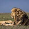
Location intelligence helps Born Free Kenya understand where communities and lions are in conflict. Outreach to fortify cattle corrals is guided by smart maps and spatial analysis.
17 August 2023
WCS is seeking a Conservation Technology Specialist to join their work in the Okapi Wildlife Reserve.
11 August 2023
We're looking for an enthusiastic early career individual looking to develop their GIS, remote sensing, and capacity building skills.
24 July 2023
ESRI and IUCN have teamed up to launch a StoryMap competition. Storytellers are invited to share stories on a range of conservation topics including technological innovation, ecological corridors and initiatives by...
17 July 2023
Here's an interesting new paper in Nature about how new techniques in machine learning and satellite remote sensing are allowing researchers to monitor and count large populations of migratory terrestrial mammals like...
11 July 2023
We've published a paper on the role of low-code Earth observation tools in the sustainability transition. It covers how different roles in a business like analysts and executives can benefit from this tech and how it...
30 June 2023
Climate Impact Partners are looking for a Due Diligence Technical Specialist to join their supply-side team for an opportunity to carry out DD on projects, at a leading provider of high-quality carbon credit programmes.
27 June 2023
JICA, Japan’s International Cooperation Agency is seeking a digital partner with a proven track record in conservation technology as we launch a pilot project to test technologies to mitigate human-elephant conflict in...
19 June 2023
If you have a strong background in GIS, a passion for environmental sustainability, and the desire to contribute to the world's carbon neutrality, this is a great opportunity for you!
15 June 2023
Careers
With a focus on using and combining vessel tracking data, other satellite derived datasets and big data methods and AI generated estimates related to vessel identity and activity, the Fisheries Analyist with Global...
15 June 2023
Come work with us! WILDLABS and Fauna & Flora are seeking an intern to help develop the movement ecology content on the Inventory - our wiki-inspired database of conservation technology. Accepting applications until...
6 June 2023
The Future Forest Company (FFC) team are looking for an enthusiastic, early career data and GIS administrator to join them. The role will manage spatial and operational data, with a particular focus on carbon from...
31 May 2023
September 2025
October 2025
event
November 2025
event
event
March 2026
November 2023
event
131 Products
Recently updated products
| Description | Activity | Replies | Groups | Updated |
|---|---|---|---|---|
| Hello Sir, Thank yo so much for sharing such an insightful message, as you said I have got some wonderful resources from other community members, so yes, just want to get... |
+17
|
Geospatial | 10 months 3 weeks ago | |
| That is great |
|
Geospatial | 10 months 3 weeks ago | |
| This is great, thanks for sharing Vance. It looks very comprehensive and includes geemap. Amazing! This will save a lot of time and headaches. Would be great to have some reviews... |
|
Geospatial | 10 months 3 weeks ago | |
| Hi Phil, Thanks for sharing - this is really interesting work! Seems like a cool integration of ground-based (or ocean-based) data and satellite data, with a community... |
|
Geospatial, Acoustics, Camera Traps, eDNA & Genomics | 11 months ago | |
| Monitoring may be the most written about but least implemented (properly) topic in conservation. It primarily comes down to three reasons:... |
|
Geospatial | 11 months 1 week ago | |
| Hi there! Funnily enough, I have been attending ARSET Trainings for years - I think I've participated in about 80% of the ones they have offered over that time - they are awesome... |
|
Geospatial | 11 months 2 weeks ago | |
| Thank you so much for your advice.🙏 |
|
Geospatial | 11 months 2 weeks ago | |
| Hi @benweinstein !Surely a general detector might be very useful for detecting objects in aerial imagery! Maybe something similar to what MegaDetector does in camera trap images,... |
|
AI for Conservation, Open Source Solutions, Protected Area Management Tools, Drones, Geospatial | 11 months 2 weeks ago | |
| Very interesting topic |
|
Citizen Science, Community Base, Open Source Solutions, Geospatial | 1 year ago | |
| Wonderfully |
|
Geospatial | 1 year ago | |
| Thanks!I'm definitely looking at Smart and EarthRanger for overall management eventually, but for now I just want to track what we have better - especially as a base map to... |
|
Geospatial, Data Management & Mobilisation | 1 year 1 month ago | |
| @cmwainaina please take a look |
|
Animal Movement, AI for Conservation, Camera Traps, Connectivity, Data Management & Mobilisation, East Africa Community, Emerging Tech, Ethics of Conservation Tech, Human-Wildlife Coexistence, Marine Conservation, Protected Area Management Tools, Geospatial, Sensors, Software Development | 1 year 1 month ago |
Cheap Space, DIY Imaging and Big Data = Good News for Conservation
16 November 2015 7:48pm
From Data Collection to Decisions
6 November 2015 12:00am


