Group curators

Vance Russell
3point.xyz

Ahmed Junaid
- @ahmedjunaid
- | He/His

Elsa Carla De Grandi
Fauna & Flora
Who We Are
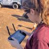
Geospatial data and analysis is critical for conservation, from planning to implementation and measuring success. Every day, mapping and spatial analysis are aiding conservation decisions, protected areas designation, habitat management on reserves and monitoring of wildlife populations, to name but a few examples. The Geospatial group focuses on all aspects of this field, from field surveys to remote sensing and data development/analysis to GIS systems.
How to Get Started
Want to learn more about how remote sensing is used in conservation? Check out the first two episodes of this season of Tech Tutors, where our Tutors answer the questions How do I use open source remote sensing data to monitor fishing? and How do I access and visualise open source remote sensing data in Google Earth Engine? You can also check out our Virtual Meetup Archive for a range of panels that overlap with Geospatial topics, or take a look at our Earth Observation 101 lecture series from Dr. Cristian Rossi.
Our Purpose
The WILDLABS Geospatial Group is for conservation practitioners, geospatial analysts, and academics that want to:
- Share geospatial resources, best practices, data, and ideas;
- Network amongst geospatial and data practitioners;
- Create peer learning opportunities;
- Promote the use of free and open-source geospatial software; and
- Improve the use of GIS software and geospatial analyses in conservation management and research.
Group curators
3point.xyz
Over 35 years of experience in biodiversity conservation worldwide, largely focused on forests, rewilding and conservation technology. I run my own business assisting nonprofits and agencies in the conservation community


- 7 Resources
- 69 Discussions
- 12 Groups
- @ahmedjunaid
- | He/His
Zoologist, Ecologist, Herpetologist, Conservation Biologist


- 75 Resources
- 7 Discussions
- 16 Groups
Fauna & Flora
Remote Sensing Scientist, Conservation Technology & Nature Markets @ Fauna & Flora - WILDLABS Geospatial Group Co-Lead

- 42 Resources
- 49 Discussions
- 9 Groups
No showcases have been added to this group yet.

- 0 Resources
- 0 Discussions
- 1 Groups

- @rosco
- | He/Him
Ross is a specialist in the capture and analysis of remotely sensed data for conservation.
- 1 Resources
- 0 Discussions
- 2 Groups
- @Sarvagya
- | He/Him
- 0 Resources
- 0 Discussions
- 7 Groups
Conservation Science Coordinator for the Giraffe Conservation FoundationCo-Chair of IUCN Giraffe and Okapi Specialist Group
- 0 Resources
- 1 Discussions
- 5 Groups
Working in relation to ecosystem services
- 0 Resources
- 0 Discussions
- 8 Groups
Passionate advocate for nature and experienced communicator, looking to explore opportunities to leverage technology in wildlife and marine conservation
- 0 Resources
- 0 Discussions
- 7 Groups

- @Alex.S
- | She/Her
MSc Marine Biologist and Data Scientist, Co-Founder and CSO & CTO of Galene Pathways
- 0 Resources
- 0 Discussions
- 8 Groups
The Nature Conservancy
- 0 Resources
- 1 Discussions
- 3 Groups
- @valeria
- | she/her
Studio Pixel
AI integration architect, AI product manager. I've built the front-end of this website 😁
- 0 Resources
- 3 Discussions
- 13 Groups
- @Harperinos
- | he/him
'Diploma of Conservation & Ecosystem Management' student at TAFE NSW Australia.
- 0 Resources
- 2 Discussions
- 6 Groups
- @Angele
- | She/Her
Working with IPLCs and applying data/geospatial tools for a conservation/carbon forestry project in the Philippines 🌿
- 0 Resources
- 0 Discussions
- 8 Groups
- 0 Resources
- 0 Discussions
- 16 Groups
Careers
The NCEAS invites applications for a temporary Data Fellow to engage in data science projects relating to environmental science in deserts of California. These projects will include assisting in the organization &...
9 July 2022
Careers
Postdoc: Environmental Remote Sensing

Carly Batist
Professor Nathalie Seddon, Professor Yadvinder Malhi (University of Oxford)
30 June 2022
Careers
Applications are invited for a Research Associate to join Dr Emily Lines' UKRI Future Leaders Fellowship (FLF) project "Next generation forest dynamics modelling using remote sensing data" (University of Cambridge)....
30 June 2022
Careers
Tammy Robinson-Smythe, Stellenbosch University
30 June 2022
Careers
Research Associate in Data Fusion for Forest Monitoring and Modelling

Stephanie O'Donnell
Applications are invited for a Research Associate to join Dr Emily Lines' UKRI Future Leaders Fellowship (FLF) project "Next generation forest dynamics modelling using remote sensing data". This is an interdisciplinary...
15 June 2022
Article

This study presents a comprehensive comparison of point clouds from four systems, linear and Geiger-mode LiDAR from manned aircraft and multi-beam LiDAR on unmanned aerial vehicle (UAV), and in-house developed Backpack...
13 June 2022
Article
New remote sensing papers/datasets
Carly Batist
Near real-time global 10 m land cover mapping via Dynamic World; combining Sentinel-1 & -2 data for tree species classification; detecting elephants from drone imagery; Ecuador's satellite monitoring for illegal...
13 June 2022
Article
Julia Martínez Pardo et al., Published in Biological Conservation
4 June 2022
Careers
Multiple ML & ecology positions open at Pachama
Carly Batist
Positions include machine learning data engineer, machine learning product manager, director of engineering, forest analyst
4 June 2022
Careers
Postdoc: evaluation of tropical forest restoration
Carly Batist
Dr. Karen Holl's group at the University of California, Santa Cruz
4 June 2022
Funding
Global Forest Watch Small Grants Fund
Carly Batist
Global Forest Watch's Small Grants Fund is now open for applications for the 2023 grant cycle. Deadline is August 1.
1 June 2022
Careers
Climate scientist: Storms

WILDLABS Team
Climate X are seeking an enthusiastic and capable climate scientist to quantify climate change-related risks and physical impacts of tropical and temperate storms.
10 May 2022
September 2025
event

Ideal Workplace Solutions
October 2025
event

Lacey Hughey and 3 more
November 2025

event

Brigitta Keeves
March 2026

April 2023

131 Products
Recently updated products
| Description | Activity | Replies | Groups | Updated |
|---|---|---|---|---|
| A nice work from @dmorris! See his LK post. "Lots of information in the conservation literature is represented in maps (e.g., the... |
|
AI for Conservation, Geospatial | 4 months 3 weeks ago | |
| Yep see you on friday |
+3
|
Geospatial, Acoustics, AI for Conservation, Camera Traps, Citizen Science, Community Base, Data Management & Mobilisation, Emerging Tech, Open Source Solutions, Protected Area Management Tools | 5 months ago | |
| Yep we are working on it 1/ segment 2/remote unwanted ecosytem3/get local potential habitat4/generate5/add to picture |
|
Geospatial, AI for Conservation, Data Management & Mobilisation, Open Source Solutions, Software Development | 5 months ago | |
| All sound, would be nice if there were only 5, though! |
|
AI for Conservation, Citizen Science, Data Management & Mobilisation, Emerging Tech, Ethics of Conservation Tech, Funding and Finance, Geospatial, Open Source Solutions, Software Development | 5 months ago | |
| Good morning JocelynThank you very much for your comment, this is proving to be very useful advice and thank you so much for setting me on the right path!! This is very exciting!!... |
|
Animal Movement, Citizen Science, Human-Wildlife Coexistence, Marine Conservation, Drones, Community Base, Geospatial | 5 months ago | |
| Means so much. Thank you, @CathyNj. |
|
Geospatial | 5 months ago | |
| Hello! I'm wondering whether there's anyone on here who would be able to offer me some guidance on storing spatial data in Microsoft Azure... |
|
Geospatial | 7 months 2 weeks ago | |
| Thank you! I will follow up by email. |
+8
|
Animal Movement, Conservation Dogs, East Africa Community, Geospatial, Sensors, Women in Conservation Tech Programme (WiCT) | 5 months 2 weeks ago | |
| Thanks @VAR1 great insights! Funny you mentioned the honey thing, @hikinghack said the same in response on the GOSH forum. I think the point I'm trying to make with the vegan... |
|
Open Source Solutions, AI for Conservation, Conservation Tech Training and Education, Ethics of Conservation Tech, Geospatial, Software Development | 5 months 3 weeks ago | |
| How much does it cost to incorporate machine learning into your conservation drone geospatial analysis? How does it speed up your workflow... |
|
Conservation Tech Training and Education, Drones, Geospatial, Open Source Solutions, Sensors, Software Development | 6 months ago | |
| Hi Dan, Not right now but I can envision many uses. A key problem in RS is data streams for validation and training of ML models, its really not yet a solved problem. Any... |
|
Emerging Tech, AI for Conservation, Animal Movement, Build Your Own Data Logger Community, Camera Traps, Connectivity, Conservation Tech Training and Education, Data Management & Mobilisation, Geospatial, Sensors | 6 months 1 week ago | |
| And if you are new to GFW...this new glossary that was added recently is very helpful to understand some key terms.Check it out here! |
|
Geospatial | 6 months 1 week ago |


