Group curators

Vance Russell
3point.xyz

Ahmed Junaid
- @ahmedjunaid
- | He/His

Elsa Carla De Grandi
Fauna & Flora
Who We Are
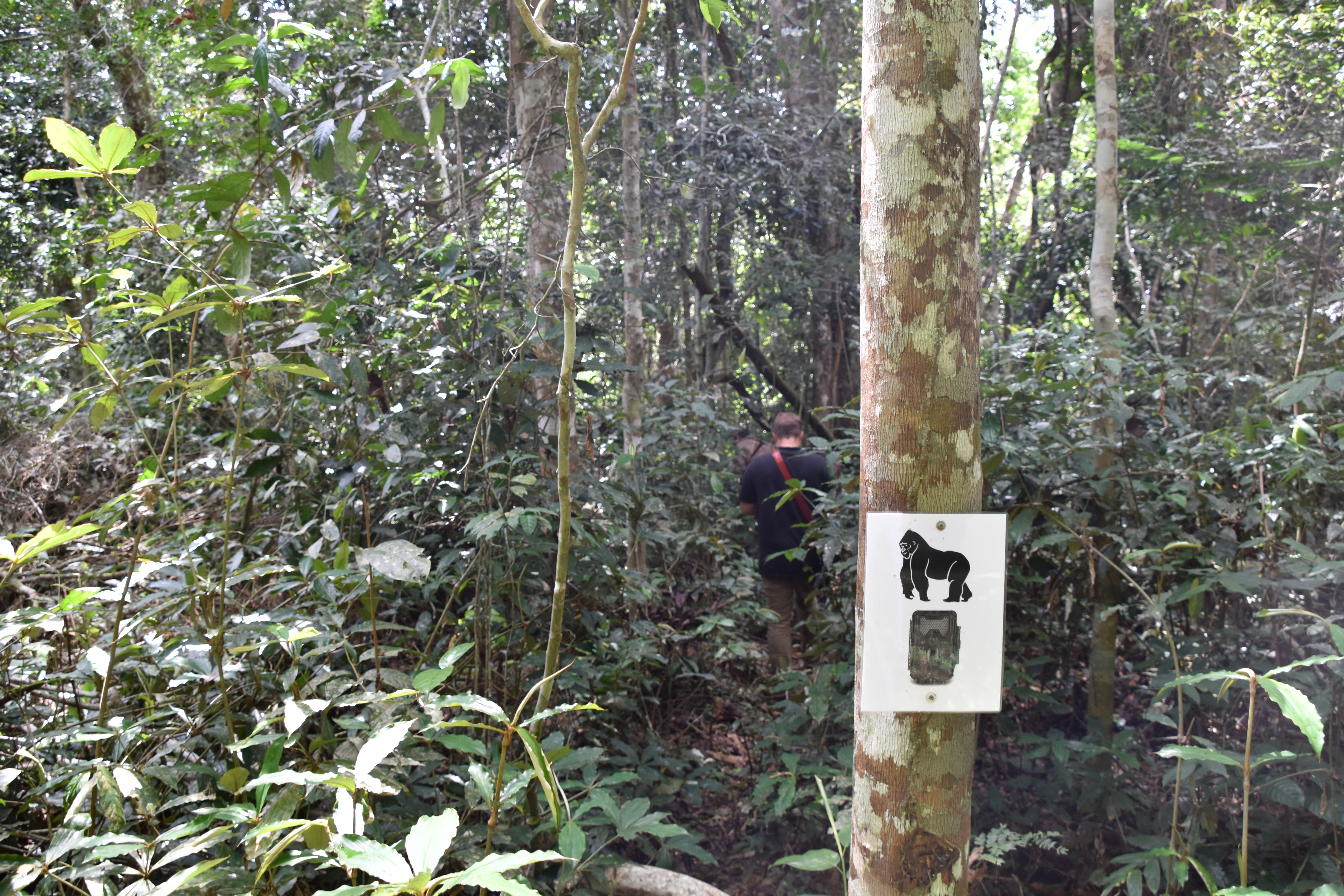
Geospatial data and analysis is critical for conservation, from planning to implementation and measuring success. Every day, mapping and spatial analysis are aiding conservation decisions, protected areas designation, habitat management on reserves and monitoring of wildlife populations, to name but a few examples. The Geospatial group focuses on all aspects of this field, from field surveys to remote sensing and data development/analysis to GIS systems.
How to Get Started
Want to learn more about how remote sensing is used in conservation? Check out the first two episodes of this season of Tech Tutors, where our Tutors answer the questions How do I use open source remote sensing data to monitor fishing? and How do I access and visualise open source remote sensing data in Google Earth Engine? You can also check out our Virtual Meetup Archive for a range of panels that overlap with Geospatial topics, or take a look at our Earth Observation 101 lecture series from Dr. Cristian Rossi.
Our Purpose
The WILDLABS Geospatial Group is for conservation practitioners, geospatial analysts, and academics that want to:
- Share geospatial resources, best practices, data, and ideas;
- Network amongst geospatial and data practitioners;
- Create peer learning opportunities;
- Promote the use of free and open-source geospatial software; and
- Improve the use of GIS software and geospatial analyses in conservation management and research.
Group curators
3point.xyz
Over 35 years of experience in biodiversity conservation worldwide, largely focused on forests, rewilding and conservation technology. I run my own business assisting nonprofits and agencies in the conservation community


- 7 Resources
- 69 Discussions
- 12 Groups
- @ahmedjunaid
- | He/His
Zoologist, Ecologist, Herpetologist, Conservation Biologist


- 75 Resources
- 7 Discussions
- 16 Groups
Fauna & Flora
Remote Sensing Scientist, Conservation Technology & Nature Markets @ Fauna & Flora - WILDLABS Geospatial Group Co-Lead

- 42 Resources
- 49 Discussions
- 9 Groups
No showcases have been added to this group yet.
Ranger Campus
- 0 Resources
- 3 Discussions
- 6 Groups
- @adamsteer
- | Dr/He/Him
Researcher and consultant focused on snow, ice and landscapes, drone pilot, lidar and airborne remote sensing analyst. Based in Australia, thinks a lot about connected systems in mountain and polar landscapes. Open source geospatial specialist.
- 0 Resources
- 2 Discussions
- 4 Groups
Alberta Biodiversity Monitoring Institute (ABMI) & SENSR
We track changes in wildlife and their habitats in Alberta, working collaboratively to provide ongoing, relevant, scientifically credible information.


- 2 Resources
- 0 Discussions
- 4 Groups

- 0 Resources
- 0 Discussions
- 5 Groups
- @sroilo
- | she/her
- 0 Resources
- 0 Discussions
- 4 Groups

- @Muzna
- | She, Her
Muzna Kashaf is a dedicated herpetologist who recently achieved her MPhil, showcasing her commitment to advancing knowledge in the field. Her research focus lies in amphibians, and she has utilized Geographic Information Systems (GIS) to enhance precision of her studies.

- 0 Resources
- 6 Discussions
- 2 Groups

- @AngelMassay
- | Miss
A GoodManager, a conservationist, an ecologist

- 0 Resources
- 5 Discussions
- 5 Groups

- @stevef
- | he/him
Tech Matters
Project Director, Terraso.org (1000 Landscapes for 1 Billion People): open source software for farmers, ranchers & communities.
- 0 Resources
- 2 Discussions
- 4 Groups

- @lucytallents
- | She/Her
VerdantLearn
Sociable e-learning for conservation capacity building

- 4 Resources
- 6 Discussions
- 4 Groups

- 0 Resources
- 0 Discussions
- 3 Groups
St. Lawrence University
Professor of Biology at St. Lawrence University
- 0 Resources
- 2 Discussions
- 12 Groups

- @Edonga
- | He/His
Paul Edonga is from the Indigenous Pastoralist Tribes of Northern Kenya. A seasoned Leader in indigenous-led conservation of Endangered Beisa Oryx, African Small Antelopes their habitats & Dryland Forests. He's the founder of Save Beisa Oryx Community Resilience Trust-SBOC
- 0 Resources
- 1 Discussions
- 11 Groups
Link
The library enables to derive biophyiscal maps with a few lines of code (only requirements: region of interest, temporal domain and satellite sensor). All processing runs in the cloud using the openEO API and hence no...
20 October 2024
Link
CoastSat
20 October 2024
Link
stagg (R package).
20 October 2024
Link
Spatial Statistics for Data Science: Theory and Practice with R. (Book).
20 October 2024
Link
arcgisbinding (R package).
20 October 2024
Article
GEO COP16 Pavillion
Elsa Carla De Grandi
Oct, 21 - 31 2024 (Blue Zone - Cali, Colombia)
18 October 2024
Article
LEAPs and bounds

Cassie Anderson
How better spatial data reduces nature risk for business
14 October 2024
Link
MAAP #217: Carbon across the Amazon (part 2): Peak Carbon Areas
Elsa Carla De Grandi
The report showcases how remote sensing, Planet Forest Carbon Diligence product, can be used to identify peak carbon areas. Peak carbon areas could be excellent candidates for the HIFOR initiative, a new financing...
11 October 2024
September 2025
event

Ideal Workplace Solutions
October 2025
event

Lacey Hughey and 3 more
November 2025

event

Brigitta Keeves
March 2026

December 2023

event

Lucas Mwaura
131 Products
Recently updated products
| Description | Activity | Replies | Groups | Updated |
|---|---|---|---|---|
| Hey MGatta, I'm working with adehabitatLt as well, i have a good paper on spatial referencing your data and changing your coordinates to UTM, if you want it (by C.J.... |
|
Geospatial | 8 years 8 months ago | |
| Hello all, I came across this website featuring free vector and raster datasets. Feel free to use it! |
|
Geospatial | 8 years 9 months ago | |
| Now the course is officially over, I wonder how people found it? Too difficult, too easy or just right? |
|
Geospatial | 8 years 10 months ago | |
| I'm not affiliated with Google or this event, but I thought it would be of interest to the community. I have previously attended and it... |
|
Geospatial | 9 years 2 months ago | |
| Things just got a whole lot easier for those of us at universities who train students to use drones as tools for conservation. Many... |
|
Geospatial | 9 years 3 months ago | |
| Another option is OruxMaps, free for android, not very intuitive but very powerful. But it's important to bear in mind that phone GPS accuracy can be lower than... |
|
Geospatial | 9 years 4 months ago | |
| ZSL is holding a remote sensing symposium on the 29th April, 2016: Space - the final frontier for biodiversity monitoring?... |
|
Geospatial | 9 years 4 months ago | |
| Hello all, This blog immediately make me think of our community and the possibilities for one of our members to provide a solution.... |
|
Geospatial | 9 years 5 months ago | |
| Thank you. I am doing pre reading and Information gathering, so I'll know what to expect and be prepared. Thank you for your kind answer Stephanie. |
|
Geospatial | 9 years 5 months ago | |
| Hello all - this paper looks highly relevant to this thread. "Satellite alerts track deforestation in real time: System uses... |
|
Geospatial | 9 years 6 months ago | |
| Advance Object-Based Classification of Delta Region Sindh. A project completed by COGE team. If you have any queries please contact :... |
|
Geospatial | 9 years 6 months ago | |
| Greetings all! I just received this invitation from Google. Feel free to distribute to your colleages. Applications due by March 15.... |
|
Geospatial | 9 years 6 months ago |


Training Course: Quantitative Analysis of Marine & Coastal Drone Data
 Duke Marine Lab
29 April 2020 12:00am
Talking Tracking with Xerius

23 April 2020 12:00am
WILDLABS Tech Hub: WWF PandaSat

13 April 2020 12:00am
WILDLABS Community Call Recording: Rainforest X-PRIZE
30 March 2020 12:00am
Mapping to Save our Planet's Biodiversity
26 March 2020 12:07pm
Esri - Mapping to Save our Planet's Biodiversity

19 March 2020 10:46am
Competition: Plastic Data Challenge
 Ellie Warren
3 March 2020 12:00am
Hawai'i Conservation Conference
 Hawaiʻi Conservation Alliance
28 February 2020 12:00am
ICEI2020: 11th International Conference on Ecological Informatics
 ICEI 2020
14 February 2020 12:00am
Contour maps, Mapbox and (Q)GIS

4 September 2019 3:05pm
Instant Detect 2.0 emerges

3 September 2019 12:00am
ESA Kickstarter: Environmental Crimes

22 August 2019 12:00am
Conservation and Technology Conference
29 July 2019 12:00am
Meetup: Machine Learning/AI on Earth Observation Data (23 July, London)
21 June 2019 12:00am
Technology companies, FCO, and conservation NGOs come together to scale technology solutions to end wildlife crime
4 June 2019 12:00am
Conservation remote sensing webinar series
5 October 2018 7:40am
3 June 2019 11:20am
CBI and SCGIS have been running a second series of webinars this year. You can find recordings of all the previous webinars signposted here.
Of note, see:
- Planetary-scale monitoring with Google Earth Engine
-
The Potential of GEDI Lidar for Biodiversity Conservation Applications
The next upcioming webinar is Integrating Remote Sensing With Conservation Analysis Workflows on June 11, 10:00 PDT (register here).
WILDLABS TECH HUB Showcase
 WILDLABS Team
17 May 2019 12:00am
Meet the WILDLABS TECH HUB Winners
13 May 2019 12:00am
Google 2019 Geo for Good Summit—apply before May 3
22 April 2019 6:43pm
FOSS4G 2019
12 April 2019 9:36am
#Tech4Wildlife Photo Challenge: Our Favourites from 2019
3 March 2019 12:00am
Eye on Earth Symposium Online: All 36 sessions will be webcast globally

5 October 2018 10:36am
18 February 2019 10:37am
Following the successful Eye on Earth Symposium at the end of October, the team has announced that video recordings of all 35 sessions are now available.
They've also shared a recording of the Global Environmental Education Partnership webinar: http://bit.ly/EoeWebinars
Sumatran Forest Type Maps and Data
9 January 2019 5:43pm

14 January 2019 10:26am
Just to throw a couple options out there:
The hanson map, which you can download from:
Global Land Analysis and Discovery
You could also make your own map from the raw satellite data but that is a bit more involved.
Tom
A technologist's journey to protect wildlife: The reality and potential of conservation technology (recorded talk)

22 November 2018 12:00am
GIS Day 2018
14 November 2018 7:48pm
WILDLABS Virtual Meetup Recording: Next Generation Wildlife Tracking
WILDLABS Team
12 November 2018 12:00am
Invitation to Contribute to the ISPRS SC Newsletter

28 August 2018 3:12pm
13 September 2018 3:24pm
Hi Sheryl,
This sounds great, thank you for sharing! As you may be aware, we had the UK National Earth Observation Conference 2018 here in the UK just last week (and you can see the abstracts here).
I'll share your call for submissions with colleagues in the Cambridge conservation community, noting your September 21st deadline.
Best wishes,
Thom
18 September 2018 11:58am
Hi Thom,
Thanks a lot for the response! The abstracts were very interesting and I hope we can share more of the work from you and your colleagues.
Please feel free to send me a message or an email regarding this matter.
All the best and thanks,
Sheryl
NASA Webinar: Change Detection for Land Cover

14 September 2018 3:55pm
Next Generation Animal Tracking Ideation Challenge

14 September 2018 12:00am
Compendium of guidance on key global databases related to biodiversity related conventions
13 September 2018 3:38pm
16 November 2023 1:11am