Group curators

Vance Russell

Ahmed Junaid
- @ahmedjunaid
- | He/His

Elsa Carla De Grandi
Fauna & Flora
Who We Are
Geospatial data and analysis is critical for conservation, from planning to implementation and measuring success. Every day, mapping and spatial analysis are aiding conservation decisions, protected areas designation, habitat management on reserves and monitoring of wildlife populations, to name but a few examples. The Geospatial group focuses on all aspects of this field, from field surveys to remote sensing and data development/analysis to GIS systems.
How to Get Started
Want to learn more about how remote sensing is used in conservation? Check out the first two episodes of this season of Tech Tutors, where our Tutors answer the questions How do I use open source remote sensing data to monitor fishing? and How do I access and visualise open source remote sensing data in Google Earth Engine? You can also check out our Virtual Meetup Archive for a range of panels that overlap with Geospatial topics, or take a look at our Earth Observation 101 lecture series from Dr. Cristian Rossi.
Our Purpose
The WILDLABS Geospatial Group is for conservation practitioners, geospatial analysts, and academics that want to:
- Share geospatial resources, best practices, data, and ideas;
- Network amongst geospatial and data practitioners;
- Create peer learning opportunities;
- Promote the use of free and open-source geospatial software; and
- Improve the use of GIS software and geospatial analyses in conservation management and research.
Group curators

Over 35 years of experience in biodiversity conservation worldwide, largely focused on forests, rewilding and conservation technology. I run my own business assisting nonprofits and agencies in the conservation community


- 5 Resources
- 62 Discussions
- 12 Groups
- @ahmedjunaid
- | He/His
Zoologist, Ecologist, Herpetologist, Conservation Biologist


- 63 Resources
- 7 Discussions
- 26 Groups

Fauna & Flora
Remote Sensing Scientist, Conservation Technology & Nature Markets @ Fauna & Flora - WILDLABS Geospatial Group Co-Lead

- 34 Resources
- 28 Discussions
- 8 Groups

- 0 Resources
- 0 Discussions
- 13 Groups

- 0 Resources
- 0 Discussions
- 10 Groups

Spanish veterinarian interested in wildlife conservation
- 0 Resources
- 0 Discussions
- 14 Groups
- @dhruv
- | He/Him
- 0 Resources
- 2 Discussions
- 5 Groups
Conservation Biologist


- 2 Resources
- 16 Discussions
- 7 Groups

University of Hull
Researcher, conservation ecologist, and data analyst
- 0 Resources
- 0 Discussions
- 1 Groups

- @Fatuma
- | She/Her
I aim to transition my career towards conservation technology after gaining two years of experience in the tech industry.
- 0 Resources
- 0 Discussions
- 14 Groups

Software engineer
- 0 Resources
- 3 Discussions
- 4 Groups
I am an Ecologist working at the intersection of conservation and technology. Looking forward to better understand the use of GIS, Drones, Camera Traps and Bioacoutics in conservation & restoration.
- 0 Resources
- 0 Discussions
- 2 Groups

- 0 Resources
- 0 Discussions
- 9 Groups

- @jennamkline
- | She/Her
PhD Student @ tOSU, Autonomous Drones for Collective Animal Behavior Studies
- 0 Resources
- 0 Discussions
- 4 Groups
Forest / landscape restoration consultant
- 0 Resources
- 0 Discussions
- 3 Groups
Link
Collaring Elephants and Post Release Monitoring
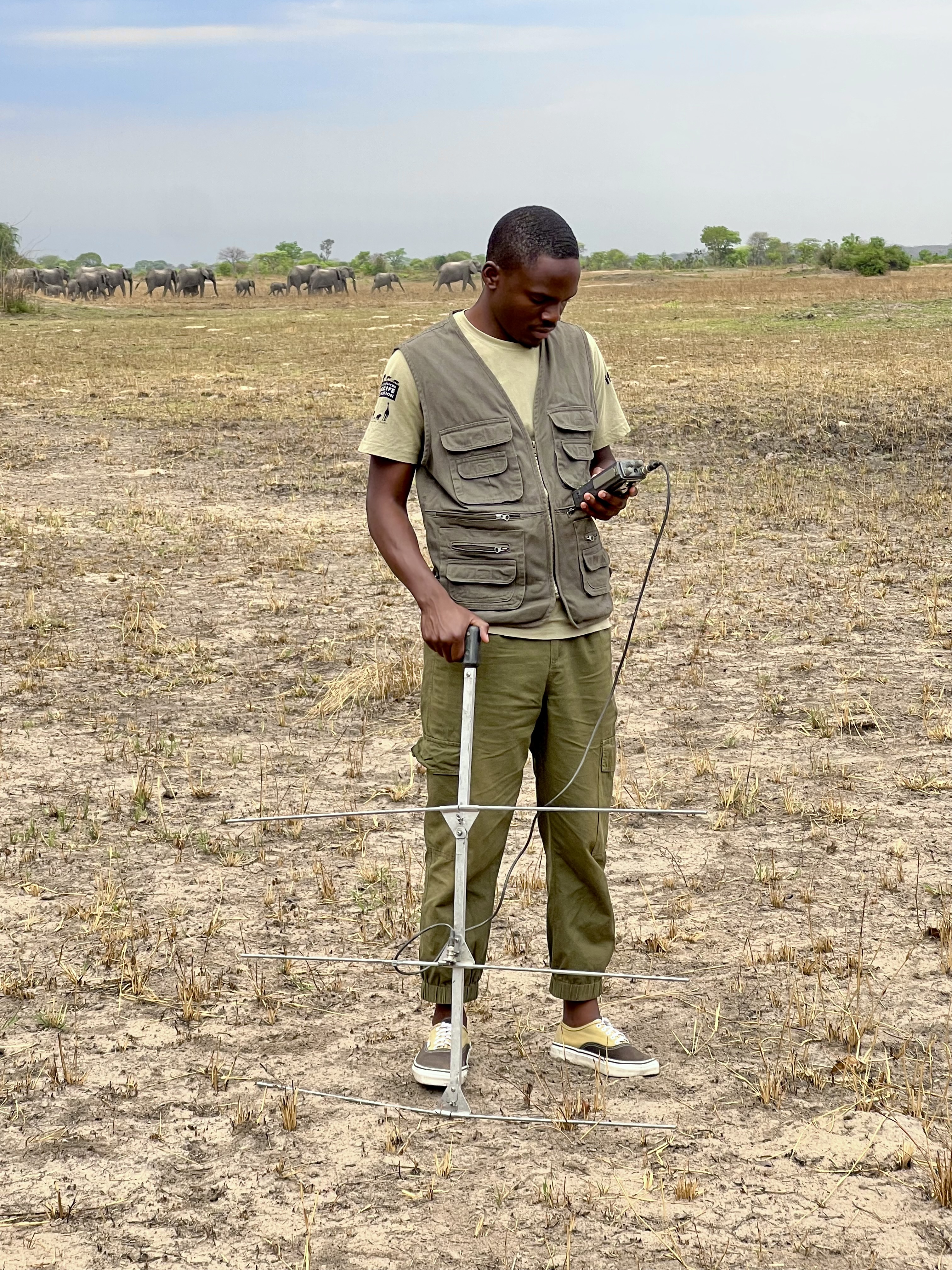
Kasi Amor Kalande
This leads to an exciting blog we did recently, it also includes a spatial map indicating elephant movement tracks of an orphaned elephant who self released himself into the wild (Kafue National Park). Cartography was...
28 January 2025
Careers
Geospatial Guru: Mapping a Better Future

Elsa Carla De Grandi
Remote, United Kingdom
27 January 2025
Link
Early Wildfire Smoke Detection Method Based on EDA

Ahmed Junaid
https://doi.org/10.3390/rs16244684
27 January 2025
https://doi.org/10.1098/rstb.2023.0327
26 January 2025
Link
Nature Climate Change (2025).
26 January 2025
Link

Updated version of the Spatial Database of Planted Trees (SDPT), which differentiates planted forests and tree crops from primary and secondary natural forests. Update has double the number of countries covered
25 January 2025
Link
New Data Provides First Global Annual Picture of Cultivated and Natural Grasslands

Elsa Carla De Grandi
The Land & Carbon Lab developed a new dataset that provides global maps of grassland extent annually from 2000 - 2022 at a 30 m resolution. These maps are critical for tracking changes in grassland ecosystems,...
25 January 2025
Article

Over the years, a large number of developments have gone up in the area that I live in and the municipality is not doing what they should when it comes to upholding the laws that have been put in place to protect the...
20 January 2025
Special Issue: Remote Sensing of Solar Radiation Absorbed by Land Surfaces
19 January 2025
Careers

The Department of Wildlife, Fish, and Environmental Studies (WFE), SLU, Umeå, is looking for a postdoc with strong interests in wildlife conservation technology.
15 January 2025
Link
Google Earth Engine Tutorial-100: Heatwave Mapping
Ahmed Junaid
Google Earth Engine with Amirhossein Ahrari
15 January 2025
June 2025
event

Joel Masselink
October 2025
event

Lacey Hughey and 3 more
November 2025

November 2023


126 Products
Recently updated products
| Description | Activity | Replies | Groups | Updated |
|---|---|---|---|---|
| Stefano Puliti joined Variety Hour to share his work using 3D photogrammetric data from UAVs for pre- and post-harvest inventory of forest... |
|
Climate Change, Data management and processing tools, Drones, Geospatial | 1 year 7 months ago | |
| Carly, that would be great! Thanks! I work with soundscapes and love the work of Rainforest Connection! I'll send you an email (@CUNY) to coordinate! |
|
Acoustics, AI for Conservation, Conservation Tech Training and Education, Drones, eDNA & Genomics, Emerging Tech, Geospatial | 1 year 11 months ago | |
| Do you have a wild animal tracking story that involves adventure or misadventure? Share it with us! From going around in circles for hours... |
|
Animal Movement, Citizen Science, Drones, Geospatial | 2 years ago | |
| I'm looking for any recommendations for any entry level/internship remote roles/companies in the United States that are focused in... |
|
AI for Conservation, Conservation Tech Training and Education, Early Career, Geospatial | 2 years 1 month ago | |
| Hi Jeremy, With a quick search I've found the paper linked below. It looks like equipments such as Livox MID are sufficient for plot-level analyses, but not for individual... |
|
Drones, Earth Observation 101 Community, Emerging Tech, Geospatial, Sensors | 2 years 1 month ago | |
| Indeed, I'll be there too! I like to meet new conservation friends with morning runs, so I will likely organize a couple of runs, maybe one right near the conference, and... |
|
Acoustics, AI for Conservation, Autonomous Camera Traps for Insects, Camera Traps, Geospatial | 2 years 1 month ago | |
| Thank you so much for your reply! I'll look in to this now :) |
|
Acoustics, Autonomous Camera Traps for Insects, Camera Traps, Data management and processing tools, Drones, Geospatial, Software Development | 2 years 1 month ago | |
| Our project in very short is, setting up a sensor network for monitoring airborne biomass, mainly insects, birds and bats in near realtime, and to develop a forecast model to be... |
|
Autonomous Camera Traps for Insects, Animal Movement, Geospatial, Sensors | 2 years 2 months ago | |
| Dear @gcamara , thank you so much for your elaborate reply. I am afraid, I am still overlooking something. Do I understand correctly, that the relationship between EO and local... |
|
Geospatial | 2 years 2 months ago | |
| I'm curious to understand how people are using satellite data. What problems does satellite imagery solve for you?... |
|
Geospatial, Software Development | 2 years 2 months ago | |
| Hi all,I've been quickly developing in-house drone services in the UK for Providence Ecological and have found some useful information for building a workflow with Rich... |
+8
|
Geospatial, Drones | 2 years 2 months ago | |
| Oh good call! I'll add that to our events calendar as well :) |
|
Geospatial, Sensors | 2 years 3 months ago |


Indonesian Peatlands and the Need for New Monitoring Technologies

20 March 2016 6:15pm
Geographic Information System Equipment
9 March 2016 4:30pm
10 March 2016 12:36pm
Thank you. I am doing pre reading and Information gathering, so I'll know what to expect and be prepared.
Thank you for your kind answer Stephanie.
Disruptive Technology: Embracing the Transformative Impacts of Software on Society
10 March 2016 12:00am
Mapping Reduced-Impact Logging with Lidar

8 March 2016 12:00am
New paper in Nature on Landsat data to reduce deforestation
25 February 2016 10:15am
Advance Remote sensing classification
17 February 2016 4:33pm
Google Earth Engine User Summit · June 2016

12 February 2016 7:09pm
Upcoming GIS and Remote Sensing Courses
9 February 2016 12:00am
GIS Storytelling: How Story Maps can harness the power of maps and geography to promote conservation

12 January 2016 2:54pm
Satellite imagery grants from Digital Globe Foundation

28 December 2015 3:22pm
ArcGIS subscriptions through ESRI Conservation Program grants
28 December 2015 2:50pm
Google Earth Outreach and Geo for Good conference
24 December 2015 8:47pm
Achieving Moonshots: Advancing Humankind and Preserving Nature
22 December 2015 12:00am
Cheap Space, DIY Imaging and Big Data
21 December 2015 12:00am
MapBiomas: New mapping platform will track annual deforestation in Brazil
17 December 2015 8:44pm
Cheap Space, DIY Imaging and Big Data = Good News for Conservation
16 November 2015 7:48pm
From Data Collection to Decisions
6 November 2015 12:00am
10 March 2016 11:46am
Hi Felix,
Thanks for sharing your question! I would have thought your course adviser might be the best person to advise about what equipment you would be required to take the course. However, GIS applications usually require access to a computer, a GIS program like ArcGIS or MapInfo, and access to information like satellite imagery or other data layers that are used by your GIS program. These should be provided by your university course - most universities have GIS labs where they teach you how to use the programs without the requirement to invest in equipment while learning.
Cheers,
Stephanie