Group curators

Vance Russell

Ahmed Junaid
- @ahmedjunaid
- | He/His

Elsa Carla De Grandi
Fauna & Flora
Who We Are
Geospatial data and analysis is critical for conservation, from planning to implementation and measuring success. Every day, mapping and spatial analysis are aiding conservation decisions, protected areas designation, habitat management on reserves and monitoring of wildlife populations, to name but a few examples. The Geospatial group focuses on all aspects of this field, from field surveys to remote sensing and data development/analysis to GIS systems.
How to Get Started
Want to learn more about how remote sensing is used in conservation? Check out the first two episodes of this season of Tech Tutors, where our Tutors answer the questions How do I use open source remote sensing data to monitor fishing? and How do I access and visualise open source remote sensing data in Google Earth Engine? You can also check out our Virtual Meetup Archive for a range of panels that overlap with Geospatial topics, or take a look at our Earth Observation 101 lecture series from Dr. Cristian Rossi.
Our Purpose
The WILDLABS Geospatial Group is for conservation practitioners, geospatial analysts, and academics that want to:
- Share geospatial resources, best practices, data, and ideas;
- Network amongst geospatial and data practitioners;
- Create peer learning opportunities;
- Promote the use of free and open-source geospatial software; and
- Improve the use of GIS software and geospatial analyses in conservation management and research.
Group curators

Over 35 years of experience in biodiversity conservation worldwide, largely focused on forests, rewilding and conservation technology. I run my own business assisting nonprofits and agencies in the conservation community


- 5 Resources
- 62 Discussions
- 12 Groups
- @ahmedjunaid
- | He/His
Zoologist, Ecologist, Herpetologist, Conservation Biologist


- 63 Resources
- 7 Discussions
- 26 Groups

Fauna & Flora
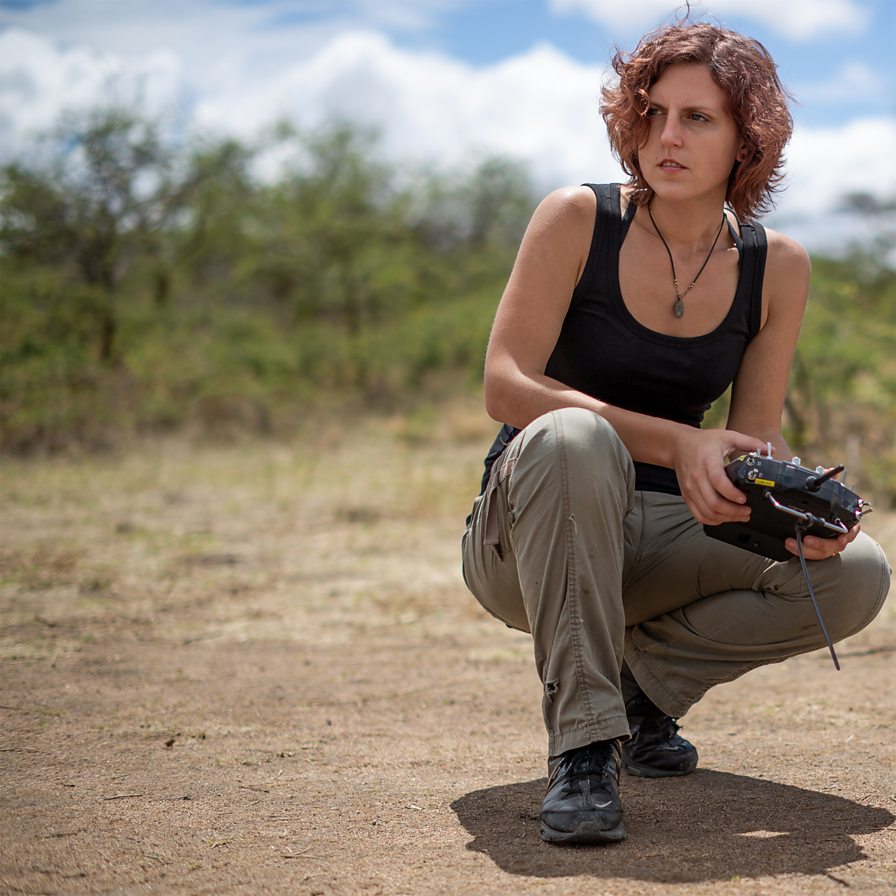
Remote Sensing Scientist, Conservation Technology & Nature Markets @ Fauna & Flora - WILDLABS Geospatial Group Co-Lead

- 34 Resources
- 28 Discussions
- 8 Groups

- @hannahrisser
- | She/her
CEH
- 0 Resources
- 0 Discussions
- 10 Groups

- @Mathilde
- | she/her
Natural Solutions
Engineer, I work for a web development company on web application projects for biodiversity conservation. I'm especially interested by camera traps, teledetection and DeepLearning subjects.
- 0 Resources
- 0 Discussions
- 11 Groups

Max Planck Institute of Animal Behavior
Behavioral Ecologist
- 1 Resources
- 1 Discussions
- 14 Groups

Data scientist with expertise in Computer vision and remote sensing and a passion to work for the environment.
- 0 Resources
- 2 Discussions
- 3 Groups

Rainforest Trust


- 0 Resources
- 11 Discussions
- 7 Groups

Wildlife Drones
Wildlife Drones has developed the world’s most innovative radio animal-tracking system using drones so you can track your radio-tagged animals like never before.


- 18 Resources
- 8 Discussions
- 32 Groups

I am an Impact Monitoring Officer in a REDD+ Project in Zambia.
- 0 Resources
- 0 Discussions
- 1 Groups
- 0 Resources
- 0 Discussions
- 6 Groups

International Union for the Conservation of Nature (IUCN)
Key Biodiversity Areas Programme Officer, IUCN

- 0 Resources
- 89 Discussions
- 8 Groups

- @jakefaber
- | he/him
Upstream Tech

- 0 Resources
- 0 Discussions
- 4 Groups
- 0 Resources
- 0 Discussions
- 1 Groups

British Antarctic Survey
Machine learning researcher at the British Antarctic Survey
- 0 Resources
- 0 Discussions
- 5 Groups
Careers
Conservation Technology Specialist

Wildlife Conservation Society (WCS)
WCS is seeking a Conservation Technology Specialist to join their work in the Okapi Wildlife Reserve.
11 August 2023
Careers
Deadline Approaching: GIS Capacity Internship
Meredith Palmer
We're looking for an enthusiastic early career individual looking to develop their GIS, remote sensing, and capacity building skills.
24 July 2023
Article
Conservation StoryMap competition

Adrian Hughes
ESRI and IUCN have teamed up to launch a StoryMap competition. Storytellers are invited to share stories on a range of conservation topics including technological innovation, ecological corridors and initiatives by...
17 July 2023
Link

Here's an interesting new paper in Nature about how new techniques in machine learning and satellite remote sensing are allowing researchers to monitor and count large populations of migratory terrestrial mammals like...
11 July 2023
Link

We've published a paper on the role of low-code Earth observation tools in the sustainability transition. It covers how different roles in a business like analysts and executives can benefit from this tech and how it...
30 June 2023
Careers
Due Diligence Technical Specialist - Climate Impact Partners

Esther Githinji
Climate Impact Partners are looking for a Due Diligence Technical Specialist to join their supply-side team for an opportunity to carry out DD on projects, at a leading provider of high-quality carbon credit programmes.
27 June 2023
Funding

JICA, Japan’s International Cooperation Agency is seeking a digital partner with a proven track record in conservation technology as we launch a pilot project to test technologies to mitigate human-elephant conflict in...
19 June 2023
Careers
GIS Application Specialist in Nairobi, DGB Group
Esther Githinji
If you have a strong background in GIS, a passion for environmental sustainability, and the desire to contribute to the world's carbon neutrality, this is a great opportunity for you!
15 June 2023
Careers
Fisheries Analyst (Pacific)

Global Fishing Watch
With a focus on using and combining vessel tracking data, other satellite derived datasets and big data methods and AI generated estimates related to vessel identity and activity, the Fisheries Analyist with Global...
15 June 2023
Careers

Come work with us! WILDLABS and Fauna & Flora are seeking an intern to help develop the movement ecology content on the Inventory - our wiki-inspired database of conservation technology. Accepting applications until...
6 June 2023
Careers
Natural Capital GIS & Data Administrator
Esther Githinji
The Future Forest Company (FFC) team are looking for an enthusiastic, early career data and GIS administrator to join them. The role will manage spatial and operational data, with a particular focus on carbon from...
31 May 2023
Link

Climasens’ platform is now being used by Australian Councils to support disaster resilience efforts. It’s inaugural product, HeatSens, is being used to bridge the gap between emergency management and climate change...
30 May 2023
June 2025

event

Joel Masselink
October 2025
event

Lacey Hughey and 3 more
November 2025

November 2023

126 Products
Recently updated products
| Description | Activity | Replies | Groups | Updated |
|---|---|---|---|---|
| We will be conducting in-person demos of our cutting-edge drone technology in the US this year! 🇺🇸 If you're interested in experiencing... |
|
Animal Movement, Drones, Geospatial, Software Development | 1 year 3 months ago | |
| Am working on similar AI challenge at the moment. Hoping to translate my workflow to wolves in future if needed. We all are little overstretched but it there is no pressing... |
|
Camera Traps, AI for Conservation, Build Your Own Data Logger Community, Data management and processing tools, Marine Conservation, Protected Area Management Tools, Geospatial | 1 year 3 months ago | |
| Real nice video. I'll have another look in the weekend in detail. |
+10
|
Acoustics, Community Base, Protected Area Management Tools, Geospatial, Sensors | 1 year 3 months ago | |
| Hi!I would take a look at Although developed for camera trap imagery, it is by no means restricted to such.Cheers,Lars |
|
Camera Traps, Community Base, Data management and processing tools, Drones, Emerging Tech, Geospatial, Software Development | 1 year 3 months ago | |
| Thank you for this! Will take a look. |
|
Climate Change, Conservation Tech Training and Education, East Africa Community, Geospatial | 1 year 4 months ago | |
| Appreciate that Lars! |
+20
|
Animal Movement, Geospatial | 1 year 4 months ago | |
| Hi Eva, Me and my colleagues run a small NGO based on Yogyakarta in Indonesia, although our projects are spread around the country. One of our active project is working with... |
|
Community Base, Animal Movement, Citizen Science, Climate Change, Human-Wildlife Conflict, Marine Conservation, Geospatial | 1 year 5 months ago | |
| I am not an acoustics person but train and deploy canines in the field. Are you looking for something that records sniff rate and patterns? For GPS I just use a Garmin... |
|
Acoustics, Animal Movement, Geospatial | 1 year 5 months ago | |
| In what ways can drones contribute to linking individuals, communities, and small-scale producers in rural areas, facilitating the support... |
|
Drones, Geospatial | 1 year 5 months ago | |
| @dmorris joined Variety Hour to give us 'a bunch of lightning talks inside a lightning talk'. Check out the recording to get a whirlwind... |
|
AI for Conservation, Drones, Geospatial | 1 year 5 months ago | |
| I'm registered with the TWS2023 app, so feel free to nudge me there as well |
|
Animal Movement, Geospatial, Software Development | 1 year 6 months ago | |
| Digital Earth Africa are doing fantastic work to make Earth Observation data free and accessible, delivering decision-ready products to the... |
|
East Africa Community, Geospatial | 1 year 7 months ago |