Group curators

Vance Russell

Ahmed Junaid
- @ahmedjunaid
- | He/His

Elsa Carla De Grandi
Fauna & Flora
Who We Are
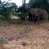
Geospatial data and analysis is critical for conservation, from planning to implementation and measuring success. Every day, mapping and spatial analysis are aiding conservation decisions, protected areas designation, habitat management on reserves and monitoring of wildlife populations, to name but a few examples. The Geospatial group focuses on all aspects of this field, from field surveys to remote sensing and data development/analysis to GIS systems.
How to Get Started
Want to learn more about how remote sensing is used in conservation? Check out the first two episodes of this season of Tech Tutors, where our Tutors answer the questions How do I use open source remote sensing data to monitor fishing? and How do I access and visualise open source remote sensing data in Google Earth Engine? You can also check out our Virtual Meetup Archive for a range of panels that overlap with Geospatial topics, or take a look at our Earth Observation 101 lecture series from Dr. Cristian Rossi.
Our Purpose
The WILDLABS Geospatial Group is for conservation practitioners, geospatial analysts, and academics that want to:
- Share geospatial resources, best practices, data, and ideas;
- Network amongst geospatial and data practitioners;
- Create peer learning opportunities;
- Promote the use of free and open-source geospatial software; and
- Improve the use of GIS software and geospatial analyses in conservation management and research.
Group curators

Over 35 years of experience in biodiversity conservation worldwide, largely focused on forests, rewilding and conservation technology. I run my own business assisting nonprofits and agencies in the conservation community


- 5 Resources
- 62 Discussions
- 12 Groups
- @ahmedjunaid
- | He/His
Zoologist, Ecologist, Herpetologist, Conservation Biologist


- 63 Resources
- 7 Discussions
- 26 Groups

Fauna & Flora
Remote Sensing Scientist, Conservation Technology & Nature Markets @ Fauna & Flora - WILDLABS Geospatial Group Co-Lead

- 34 Resources
- 28 Discussions
- 8 Groups

- @catwasp
- | She/her
- 0 Resources
- 0 Discussions
- 19 Groups
- 0 Resources
- 0 Discussions
- 4 Groups
- @thomasmutonhori
- | TM
Ecologist
- 0 Resources
- 0 Discussions
- 4 Groups

- @Naomi25
- | she/her
Naomi Mkama Njarabi, a Tanzanian conservation ecologist and nature enthusiast, is currently pursuing a Master of Science in Biodiversity Conservation at the University of Dar es Salaam, following her completion of a Bachelor's degree in Wildlife Management
- 0 Resources
- 0 Discussions
- 4 Groups
- 0 Resources
- 0 Discussions
- 5 Groups
- @MoniqueWSheSS
- | She
Wildlife enthusiast and Research assistant
- 0 Resources
- 0 Discussions
- 2 Groups
Data Science | Remote Sensing | GIS | Geospatial Cloud Computing | Big Data
- 0 Resources
- 0 Discussions
- 4 Groups

Wildlife Conservation Society (WCS)

- 1 Resources
- 0 Discussions
- 6 Groups

- @KKAREGA
- | him
- 0 Resources
- 0 Discussions
- 1 Groups
- 0 Resources
- 3 Discussions
- 11 Groups
Wildlife conservation enthusiast, looking to gain more experience & knowledge
- 0 Resources
- 0 Discussions
- 4 Groups
- @NevilleCLS
- | He/Him
CLS (Collecte Localisation Satellites)
- 0 Resources
- 1 Discussions
- 14 Groups
Article
Modern GIS: Moving from Desktop to Cloud

Vance Russell
Modern GIS is open technology, scalable, and interoperable. How do you implement it? [Header image: kepler.gl]
12 March 2025
Link
Hansen Global Forest Change Dataset
Vance Russell
The deadtrees.earth dataset that Elsa shared earlier this week is an excellent, albeit grimly named dataset! Here's another for global forest forest change derived from Landsat imagery. Click the link at the bottom to...
11 March 2025
Link
deadtrees.earth

Elsa Carla De Grandi
An open database for accessing, contributing, analyzing, and visualizing remote sensing-based tree mortality data. Beta version
9 March 2025
Link

spAbundance (R package).
9 March 2025
Link
Businesses sharing data through GBIF

Elsa Carla De Grandi
List of companies that are publishing biodiversity data through GBIF
8 March 2025
Link
RRphylogeography
8 March 2025
Funding
Arctic Community Wildlife Grants Program
World Wide Fund for Nature/ World Wildlife Fund (WWF)
WWF's Arctic Community Wildlife Grants program supports conservation, stewardship, and research initiatives that focus on coastal Arctic ecology, community sustainability, and priority Arctic wildlife, including polar...
7 March 2025
Careers
Wildlife Monitoring Internship 2025

Alex Rood
The Smithsonian’s National Zoo and Conservation Biology Institute (SNZCBI) is seeking an intern to assist with multiple projects related to conservation technology for wildlife monitoring. SNZCBI scientists collect data...
3 March 2025
Careers
Postdoc in bird modelling and remote sensing
Alberta Biodiversity Monitoring Institute
Building species-specific habitat models for forest bird species using state of the art methods and remote sensing layers
28 February 2025
Link
GIFT (R package).
25 February 2025
Link
APCalign (R package).
25 February 2025
Link
StratPal (R package).
24 February 2025
June 2025

event

Joel Masselink
October 2025
event

Lacey Hughey and 3 more
November 2025

September 2023

event

Stephanie O'Donnell
event

Cassie Anderson
126 Products
Recently updated products
| Description | Activity | Replies | Groups | Updated |
|---|---|---|---|---|
| http://news.mongabay.com/2015/12/mapbiomas-new-mapping-platform-will-track-annual-deforestation-in-brazil/ New mapping... |
|
Geospatial, Latin America Community | 9 years 5 months ago | |
| Watch footage here of John Amos, President of Sky Truth, speaking on Cheap Space, DIY Imaging and Big Data... |
|
Geospatial | 9 years 6 months ago |

