Group curators

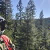
Vance Russell
3point.xyz

Ahmed Junaid
- @ahmedjunaid
- | He/His

Elsa Carla De Grandi
Fauna & Flora
Who We Are
Geospatial data and analysis is critical for conservation, from planning to implementation and measuring success. Every day, mapping and spatial analysis are aiding conservation decisions, protected areas designation, habitat management on reserves and monitoring of wildlife populations, to name but a few examples. The Geospatial group focuses on all aspects of this field, from field surveys to remote sensing and data development/analysis to GIS systems.
How to Get Started
Want to learn more about how remote sensing is used in conservation? Check out the first two episodes of this season of Tech Tutors, where our Tutors answer the questions How do I use open source remote sensing data to monitor fishing? and How do I access and visualise open source remote sensing data in Google Earth Engine? You can also check out our Virtual Meetup Archive for a range of panels that overlap with Geospatial topics, or take a look at our Earth Observation 101 lecture series from Dr. Cristian Rossi.
Our Purpose
The WILDLABS Geospatial Group is for conservation practitioners, geospatial analysts, and academics that want to:
- Share geospatial resources, best practices, data, and ideas;
- Network amongst geospatial and data practitioners;
- Create peer learning opportunities;
- Promote the use of free and open-source geospatial software; and
- Improve the use of GIS software and geospatial analyses in conservation management and research.
Group curators
3point.xyz
Over 35 years of experience in biodiversity conservation worldwide, largely focused on forests, rewilding and conservation technology. I run my own business assisting nonprofits and agencies in the conservation community


- 7 Resources
- 69 Discussions
- 12 Groups
- @ahmedjunaid
- | He/His
Zoologist, Ecologist, Herpetologist, Conservation Biologist


- 75 Resources
- 7 Discussions
- 16 Groups
Fauna & Flora
Remote Sensing Scientist, Conservation Technology & Nature Markets @ Fauna & Flora - WILDLABS Geospatial Group Co-Lead

- 42 Resources
- 49 Discussions
- 9 Groups
No showcases have been added to this group yet.

- @msouthee
- | She / her
Lead Geospatial Analyst/Programmer at Wildlife Conservation Society Canada
- 0 Resources
- 0 Discussions
- 3 Groups

Siro is an GIS/Remote Sensing expert with over 8years of experience in modeling spatial priorities in consrvation space through spatial plans . He is keen in using spatial data science to secure-conserve and protect ecologically significant areas globaly.
- 0 Resources
- 0 Discussions
- 6 Groups
- @Aoife_Göppert
- | She/ Her
PhD research student at Queen's University Belfast, a QUADRAT DTP funded project.
- 0 Resources
- 0 Discussions
- 10 Groups
I'm new to wildlife technology but really want to get more involved in learning about the various technologies out there for wildlife and land surveys. I currently work in consulting and trying to find away to incorporate these applications to my job.
- 0 Resources
- 0 Discussions
- 7 Groups
I'm a GIS and Remote Sensing specialist with a focus on conservation, currently working as a Visual Data Scientist. I'm passionate about leveraging AI tools to enhance conservation and environmental management efforts.
- 0 Resources
- 0 Discussions
- 6 Groups
- @Aurora
- | she/her
I'm a PhD student and the main topic of my research project is large carnivores' activity rhythms. I am passionate about statistical modeling, specifically through a Bayesian approach.
- 0 Resources
- 1 Discussions
- 6 Groups


- 1 Resources
- 0 Discussions
- 4 Groups
Global Biodiversity Information Facility (GBIF)
- 1 Resources
- 3 Discussions
- 6 Groups

- @kimgavin
- | she/her
- 0 Resources
- 0 Discussions
- 9 Groups
- @Wismer_Cherono
- | She/Her
Senior Research Scientist and conservationist with a key interest in the conservation of birds through research.
- 0 Resources
- 0 Discussions
- 5 Groups
- 0 Resources
- 1 Discussions
- 1 Groups

- @ahmed_fuad
- | he/him
CEO & Co-Founder of SpaceIn. Using geospatial data and computer systems to tackle environmental issues.
- 0 Resources
- 0 Discussions
- 3 Groups
Link
https://doi.org/10.1111/nph.20405
29 January 2025
Link
Collaring Elephants and Post Release Monitoring

Kasi Amor Kalande
This leads to an exciting blog we did recently, it also includes a spatial map indicating elephant movement tracks of an orphaned elephant who self released himself into the wild (Kafue National Park). Cartography was...
28 January 2025
Careers
Geospatial Guru: Mapping a Better Future
Elsa Carla De Grandi
Remote, United Kingdom
27 January 2025
Link
Early Wildfire Smoke Detection Method Based on EDA
Ahmed Junaid
https://doi.org/10.3390/rs16244684
27 January 2025
https://doi.org/10.1098/rstb.2023.0327
26 January 2025
Link
Nature Climate Change (2025).
26 January 2025
Link

Updated version of the Spatial Database of Planted Trees (SDPT), which differentiates planted forests and tree crops from primary and secondary natural forests. Update has double the number of countries covered
25 January 2025
Link
New Data Provides First Global Annual Picture of Cultivated and Natural Grasslands
Elsa Carla De Grandi
The Land & Carbon Lab developed a new dataset that provides global maps of grassland extent annually from 2000 - 2022 at a 30 m resolution. These maps are critical for tracking changes in grassland ecosystems,...
25 January 2025
Article

Over the years, a large number of developments have gone up in the area that I live in and the municipality is not doing what they should when it comes to upholding the laws that have been put in place to protect the...
20 January 2025
Special Issue: Remote Sensing of Solar Radiation Absorbed by Land Surfaces
19 January 2025
Careers

The Department of Wildlife, Fish, and Environmental Studies (WFE), SLU, Umeå, is looking for a postdoc with strong interests in wildlife conservation technology.
15 January 2025
September 2025
event

Ideal Workplace Solutions
October 2025
event

Lacey Hughey and 3 more
November 2025
event

Brigitta Keeves
March 2026

December 2022

131 Products
Recently updated products
| Description | Activity | Replies | Groups | Updated |
|---|---|---|---|---|
| Hello Sir, Thank yo so much for sharing such an insightful message, as you said I have got some wonderful resources from other community members, so yes, just want to get... |
+17
|
Geospatial | 10 months 3 weeks ago | |
| That is great |
|
Geospatial | 10 months 3 weeks ago | |
| This is great, thanks for sharing Vance. It looks very comprehensive and includes geemap. Amazing! This will save a lot of time and headaches. Would be great to have some reviews... |
|
Geospatial | 10 months 3 weeks ago | |
| Hi Phil, Thanks for sharing - this is really interesting work! Seems like a cool integration of ground-based (or ocean-based) data and satellite data, with a community... |
|
Geospatial, Acoustics, Camera Traps, eDNA & Genomics | 11 months ago | |
| Monitoring may be the most written about but least implemented (properly) topic in conservation. It primarily comes down to three reasons:... |
|
Geospatial | 11 months 1 week ago | |
| Hi there! Funnily enough, I have been attending ARSET Trainings for years - I think I've participated in about 80% of the ones they have offered over that time - they are awesome... |
|
Geospatial | 11 months 2 weeks ago | |
| Thank you so much for your advice.🙏 |
|
Geospatial | 11 months 2 weeks ago | |
| Hi @benweinstein !Surely a general detector might be very useful for detecting objects in aerial imagery! Maybe something similar to what MegaDetector does in camera trap images,... |
|
AI for Conservation, Open Source Solutions, Protected Area Management Tools, Drones, Geospatial | 11 months 2 weeks ago | |
| Very interesting topic |
|
Citizen Science, Community Base, Open Source Solutions, Geospatial | 1 year ago | |
| Wonderfully |
|
Geospatial | 1 year ago | |
| Thanks!I'm definitely looking at Smart and EarthRanger for overall management eventually, but for now I just want to track what we have better - especially as a base map to... |
|
Geospatial, Data Management & Mobilisation | 1 year 1 month ago | |
| @cmwainaina please take a look |
|
Animal Movement, AI for Conservation, Camera Traps, Connectivity, Data Management & Mobilisation, East Africa Community, Emerging Tech, Ethics of Conservation Tech, Human-Wildlife Coexistence, Marine Conservation, Protected Area Management Tools, Geospatial, Sensors, Software Development | 1 year 1 month ago |


