In recent years, drone technologies have been explored for a range of applications in conservation including (but not limited to) mapping, biodiversity inventories, antipoaching patrols, wildlife tracking, and fire monitoring. The rise of customizable, open-source drones like those of ArduPilot and OpenROV hold promise for more effective conservation applications, and combined with other monitoring sensors and devices, they are capable of collecting high-resolution data quickly, noninvasively, and at relatively low cost.
However, challenges remain in putting these tools to use. A recent paper reviewing 256 conservation drone projects highlighted some of these major obstacles, ranging from unintended social and ecological consequences of drone operations to still prohibitive costs, both in terms of hardware and in terms of storing and processing large volumes of data. The longstanding challenge of power/battery life remains as well.
If you're considering trying out drones for yourself, and want to explore the possibilities and understand the major conversations happening around this technology, check out these beginner's resources and conversations from across the WILDLABS platform:
Three Resources for Beginners:
- Conservation Technology User Guidelines Issue 5: Drones, World Wildlife Fund | Drones, best practices, ethics, regulations, case studies
- WILDLABS Virtual Meetup Recording: Drones, Craig Elder, Dr. Claire Burke, and Gabriel Levin | Drones, thermal camera, wildlife crime, ML, biologging
- New Paper: Drones and Bornean Orangutan Distribution, Sol Milne | Drones, data analysis, citizen science, community science, primates
Three Forum Threads for Beginners:
- Curious about radio-tracking with drones? | Wildlife Drones, Biologging (5 replies)
- Drones for GIS Best practice Document | Adrian Hughes, Drones (10 replies)
- WWF Conservation Technology Series: Drones in Conservation | Aurélie Shapiro, Drones (7 replies)
Three Tutorials for Beginners:
- How do I use a drone to capture radio-tracking data? | Debbie Saunders, Tech Tutors
- How do I choose the right drone for my conservation goals? | Shashank Srinivasan, Tech Tutors
- How do I strategically allocate drones for conservation? | Elizabeth Bondi, Tech Tutors
Want to know more about using drones, and learn from experts in the WILDLABS community? Make sure you join the conversation in our Drones group!
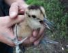
*Header photo: Parker Levinson, Point Blue Conservation Science
No showcases have been added to this group yet.

My main interest is in the application of geospatial technology for ecology and conservation

- 0 Resources
- 12 Discussions
- 6 Groups

- @jcaris
- | hi/him
Smith College & Cummings School of Veterinary Medicine at Tufts University
Senior Drone Data Scientist, Tufts University; Former Director of the Spatial Analysis Lab at Smith College. Teaching, learning, and collaborating with brilliant students & faculty
- 0 Resources
- 0 Discussions
- 9 Groups
Saint Louis Zoo
- 0 Resources
- 0 Discussions
- 13 Groups
University of Adelaide
- 0 Resources
- 10 Discussions
- 17 Groups
- 0 Resources
- 3 Discussions
- 4 Groups

Care for Wild Rhino Sanctuary
Technology Manager at Care for Wild Rhino Sanctuary


- 0 Resources
- 1 Discussions
- 7 Groups
Bay Area Older Adults
California Naturalist with Felidae and CDFW
- 0 Resources
- 6 Discussions
- 3 Groups

- 0 Resources
- 0 Discussions
- 8 Groups
Wildlife manager. Specialized in mammals, new technologies and abundance estimation
- 0 Resources
- 1 Discussions
- 5 Groups
- @catwasp
- | She/her
- 0 Resources
- 0 Discussions
- 19 Groups


- 1 Resources
- 12 Discussions
- 8 Groups
Ph.D Speech-Hearing Sciences; 3D Designer/Printer interested in building/testing/deploying standardized environmental recording platforms for scientists and engineers in developing countries.
- 0 Resources
- 0 Discussions
- 10 Groups
This paper explores the use of UAVs equipped with thermal and standard cameras to accurately count the group sizes of the Critically Endangered cao vit gibbon, highlighting how this technology can overcome the...
13 June 2023
Link

AirSeed has developed a unique approach to tackle climate change and restore biodiversity by combining drone technology, machine learning, and seed pod biotechnology to carry out planting that’s 25x faster than...
30 May 2023
Link
Using computer vision to understand bee vision

Ellie Warren
Here's an innovative project from the Harvey Mudd College Bee Lab that could help us understand how bees view their environments, and thus better protect bee habitat. This project uses computer vision and drone imagery...
5 May 2023
Link
Researchers use taxidermy bird drones to monitor wildlife

Stephanie O'Donnell
Interesting project - “Our main goal for this is to develop a nature-friendly drone concept for wildlife monitoring,” Hassanalian said. “Traditional drones are often disruptive to ecosystems due to issues such as sound...
26 April 2023
Careers
Hardware Lead - Biodiversity / Conservation

Ben Williamson
New role at Pivotal Earth
4 April 2023
Article

New paper in Journal of Animal Ecology
24 March 2023
Link
We used a combination of high-resolution satellite tracking (Fastloc-GPS), uncrewed aerial vehicle (UAV) surveys, and capture-mark-recapture approaches to assess the abundance of immature hawksbill (Eretmochelys...
21 March 2023
Article

Discover how drones are revolutionising conservation efforts and learn five essential tips to fly responsibly and minimise harm to wildlife, humans, and the environment.
14 March 2023
Careers
Proposals wanted for Innovation in Practice
Ellie Warren
The Innovation in Practice edition of Methods in Ecology and Evolution is still seeking proposals about conservation technology
6 March 2023
Interesting article that links to research on how technology has made studying moose populations easier, with particularly good explanation of what makes moose populations difficult to track.
22 February 2023
Careers
The Environmental Robotics Lab at ETH Zurich welcomes applications for a postdoctoral fellowship on robotics methods for the collection of environmental DNA to automate monitoring of biodiversity in terrestrial...
12 February 2023
Link
How daredevil drones find nearly extinct plants hiding in cliffs
Stephanie O'Donnell
Nice article about one of the Rainforest XPrize semifinalist teams - using drones to sample plant species. 'Nyberg and the National Tropical Botanical Garden (NTBG) team, working with the State of Hawaii's Division of...
10 February 2023
August 2025
event

Louisa Richmond-Coggan
September 2025
event
Louisa Richmond-Coggan
March 2026

October 2023

August 2023
event
Ellie Warren
July 2023
33 Products
Recently updated products
| Description | Activity | Replies | Groups | Updated |
|---|---|---|---|---|
| Hi Jeremy, With a quick search I've found the paper linked below. It looks like equipments such as Livox MID are sufficient for plot-level analyses, but not for individual... |
|
Drones, Earth Observation 101 Community, Emerging Tech, Geospatial, Sensors | 2 years 4 months ago | |
| Thank you so much for your reply! I'll look in to this now :) |
|
Acoustics, Autonomous Camera Traps for Insects, Camera Traps, Data management and processing tools, Drones, Geospatial, Software Development | 2 years 4 months ago | |
| I couldn't agree more with both of these comments tom! I'm reading hundreds (literally hundreds) of applications for open WILDLABS roles at the moment, and the ones that stand out... |
+2
|
AI for Conservation, Drones, Early Career, Sensors | 2 years 4 months ago | |
| Hi all,I've been quickly developing in-house drone services in the UK for Providence Ecological and have found some useful information for building a workflow with Rich... |
+8
|
Geospatial, Drones | 2 years 5 months ago | |
| Hi folks, @Lars_Holst_Hansen asked this over on twitter and hasn't had any replies yet, so I thought it might be something that... |
|
Drones | 2 years 5 months ago | |
| Bluesky have a commercial tree crown dataset available covering most of Great Britain (England, Wales and parts of Scotland). There is a canopy layer with approximate outlines of... |
|
AI for Conservation, Drones | 2 years 6 months ago | |
| My original background is in ecology and conservation, and am now in the elected leadership of the Gathering for Open Science Hardware which convenes researchers developing open... |
|
AI for Conservation, Animal Movement, Camera Traps, Conservation Tech Training and Education, Data management and processing tools, Drones, Emerging Tech, Sensors | 2 years 6 months ago | |
| Hey Sol, The only way for you to collect information from a GPS tag attached to a FAD is if that tag transmits that data to the drone. Unfortunately most receiver packages... |
|
Drones, Emerging Tech, Open Source Solutions | 2 years 8 months ago | |
| Thanks so much!! |
|
Acoustics, AI for Conservation, Animal Movement, Camera Traps, Community Base, Data management and processing tools, Drones, eDNA & Genomics, Emerging Tech, Open Source Solutions, Geospatial, Software Development | 2 years 10 months ago | |
| Hey all!I am Ayush, a core team member of my school's Robotics Club (Center For Innovation, Indian Institute of Technology, Madras). There... |
|
Drones, Sensors, Wildlife Crime, Early Career | 3 years 1 month ago | |
| @gracieermi & I are happy to announce the latest update to the Conservation Tech Directory, bringing our total resources in the... |
|
Acoustics, AI for Conservation, Animal Movement, Camera Traps, Community Base, Data management and processing tools, Drones, eDNA & Genomics, Geospatial, Software Development | 3 years 1 month ago | |
| Some folks doing work in this space - Wildlife Drones, Conservation Drones, UAV Wild, AfricanDrones, Oceans Unmanned, Geonadir. |
|
Drones, AI for Conservation, Citizen Science, eDNA & Genomics, Emerging Tech | 3 years 1 month ago |