In recent years, drone technologies have been explored for a range of applications in conservation including (but not limited to) mapping, biodiversity inventories, antipoaching patrols, wildlife tracking, and fire monitoring. The rise of customizable, open-source drones like those of ArduPilot and OpenROV hold promise for more effective conservation applications, and combined with other monitoring sensors and devices, they are capable of collecting high-resolution data quickly, noninvasively, and at relatively low cost.
However, challenges remain in putting these tools to use. A recent paper reviewing 256 conservation drone projects highlighted some of these major obstacles, ranging from unintended social and ecological consequences of drone operations to still prohibitive costs, both in terms of hardware and in terms of storing and processing large volumes of data. The longstanding challenge of power/battery life remains as well.
If you're considering trying out drones for yourself, and want to explore the possibilities and understand the major conversations happening around this technology, check out these beginner's resources and conversations from across the WILDLABS platform:
Three Resources for Beginners:
- Conservation Technology User Guidelines Issue 5: Drones, World Wildlife Fund | Drones, best practices, ethics, regulations, case studies
- WILDLABS Virtual Meetup Recording: Drones, Craig Elder, Dr. Claire Burke, and Gabriel Levin | Drones, thermal camera, wildlife crime, ML, biologging
- New Paper: Drones and Bornean Orangutan Distribution, Sol Milne | Drones, data analysis, citizen science, community science, primates
Three Forum Threads for Beginners:
- Curious about radio-tracking with drones? | Wildlife Drones, Biologging (5 replies)
- Drones for GIS Best practice Document | Adrian Hughes, Drones (10 replies)
- WWF Conservation Technology Series: Drones in Conservation | Aurélie Shapiro, Drones (7 replies)
Three Tutorials for Beginners:
- How do I use a drone to capture radio-tracking data? | Debbie Saunders, Tech Tutors
- How do I choose the right drone for my conservation goals? | Shashank Srinivasan, Tech Tutors
- How do I strategically allocate drones for conservation? | Elizabeth Bondi, Tech Tutors
Want to know more about using drones, and learn from experts in the WILDLABS community? Make sure you join the conversation in our Drones group!
*Header photo: Parker Levinson, Point Blue Conservation Science
No showcases have been added to this group yet.

Hello, I am working as Enterprise Solution Architect with Department of Conservation, New Zealand Government. I am keen to learn the progresses and advancements made in the conservation space. This will provide us the starting point to collaborate and implement the technology.Tkx
- 0 Resources
- 7 Discussions
- 11 Groups

- 0 Resources
- 0 Discussions
- 9 Groups

- @mphamilton
- | he/him
University of California
retired Field Station Director, very early adopter of conservation technologies
- 0 Resources
- 1 Discussions
- 14 Groups

Fauna & Flora
- 0 Resources
- 0 Discussions
- 6 Groups

Rewilding Rhodopes Foundation
- 0 Resources
- 2 Discussions
- 4 Groups

- 0 Resources
- 2 Discussions
- 1 Groups
- @mja78
- | He/Him
- 0 Resources
- 1 Discussions
- 3 Groups

- @guitarfishmasum
- | He/His
Wildlife Conservation Society (WCS)
Wildlife Biologist and Marine Conservationist
- 0 Resources
- 0 Discussions
- 18 Groups
- @BartCh
- | he
I am a science assistant doing research in semi-open nature-reserves, and monitoring grazing livestock as a main managing tool, thereby using tracking devices.
- 0 Resources
- 0 Discussions
- 5 Groups
- @BioVipa
- | Him
Natural Resources Engineer. Birdwatcher and citizen science lover, data science enthusiast.
Wanting to learn more ways to use technology for conservation.
- 0 Resources
- 0 Discussions
- 10 Groups
Software developer with a focus on machine learning, my background is in environmental science. In my free time I love going into nature and photographing it. The intersection between wildlife conservation and tech interests me a lot so I'm here to learn more.
- 0 Resources
- 0 Discussions
- 3 Groups
- 0 Resources
- 0 Discussions
- 1 Groups
Article
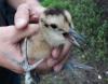
Kākāpō Dreaming: A Wildlife Drones Adventure

Wildlife Drones
What is it like to track endangered species using drones? In this blog post from Wildlife Drones, Dr. Debbie Saunders travels to New Zealand to track the Kākāpō, an extemely rare and elusive bird of which approximately...
8 July 2020
Article
Connecting to MBARI's Deep-Sea Instruments
Monterey Bay Aquarium Research Institute (MBARI)
The Monterey Bay Aquarium Research Institute's MARS ocean observatory may someday make conducting deep-sea research more accessible and affordable thanks to Deep-Sea Connect, their new wireless system engineered to ...
31 March 2020
Community Announcement
WILDLABS Community Call Recording: Rainforest X-PRIZE

WILDLABS Admin
Our second WILDLABS Community Call took place on April 1st to continue the discussion started by Ben Tregenna in our Data Science group, in which he suggested the idea of submitting a collaborative entry to the X-Prize...
30 March 2020
Article
#Tech4Wildlife 2020 Photo Challenge In Review

WILDLABS Team
2020 marked our fifth year holding our annual #Tech4Wildlife Photo Challenge, and our community made it a milestone to remember. Conservationists took to Twitter last week to share their best high-tech snapshots from...
4 March 2020
Funding

The 2020 Tusk Awards are now accepting nominations of outstanding individuals who have made a significant impact on conservation in Africa. These nominations offer the rare and exciting opportunity to honor your peers...
3 March 2020
Article
How do you weigh a live whale?
WILDLABS Team
How do we actually know a whale weighs 40 tonnes? After all, we can’t exactly capture an animal the size of a bus and simply put it on a scale. Fredrik Christiansen explains their new, non-invasive way of weighing...
9 October 2019
Article
From the Field: Melissa Schiele
WILDLABS Admin
In this From the Field interview, we talk to Melissa Schiele, a tech whiz, marine ecologist, and conservationist at the Zoological Society of London. She shares with us about her work helping to develop the first-ever...
10 June 2019
Article
Canopy height mapping with drones

Tom Swinfield
Tom Swinfield and colleagues at the Forest Ecology and Conservation Group have assessed the quality of three dimensional forest models produced from drone surveys, and conclude that concerns about their quality for...
31 May 2019
Article
In this blog, Laure Joanny adds her perspectives to an ongoing discussion that we've been seeing in the community about conservation tech and it's relationship to e-waste. How do we tackle the challenge of battery waste...
3 May 2019
Article
#Tech4Wildlife Photo Challenge: Our Favourites from 2019
WILDLABS Team
Happy World Wildlife Day! To celebrate, this week we've asked our community to share photos showing how they are using tech in the field or the lab, using the #Tech4Wildlife hashtag.
3 March 2019
Article
Using Swiss AI and Drones to Count African Wildlife
WILDLABS Team
After a promising first run in Namibia, a Swiss project could aid savanna conservation using drones and automatic image analysis.
18 February 2019
Article
Getting up close and personal with Antarctica's orcas
WILDLABS Team
In this case study, Science Reporter Jamie Morton tells the story of how Kiwi scientists are teaming up with a local underwater robotics company to gain world-first insights into the lives of whales in Antarctica.
4 February 2019
August 2025
event

Louisa Richmond-Coggan
September 2025
event
Louisa Richmond-Coggan
March 2026

November 2019

April 2019
33 Products
Recently updated products
| Description | Activity | Replies | Groups | Updated |
|---|---|---|---|---|
| Hats off to your team for this absolute game-changing technology! We rescue stray and wild animals in Taiwan, and the bulk of our work is saving animals maimed by wire snares... |
+37
|
AI for Conservation, Drones, Emerging Tech, Human-Wildlife Coexistence, Wildlife Crime | 8 months 3 weeks ago | |
| Adrian,Many thanks for v2.0 of the GIS best practices document. How does one obtain a copy of the RSPB code of practice B09 referenced in the best practices document? The link in... |
+8
|
Drones | 9 months ago | |
| Hi,I wonder if anyone could provide a synopsis of where drone tech currently sites for autonomous usage and AI implementation for surveys... |
|
Drones | 9 months 1 week ago | |
| No problem at all Yu (@JY) and good luck with your studies! Happy to discuss this and any other ideas any time.All the best,Rob |
+10
|
Sensors, Animal Movement, Connectivity, Drones, Open Source Solutions, Emerging Tech | 9 months 2 weeks ago | |
| 180m is indeed very high and from above. I think a 640x512 thermal sensor with a 70mm lens can see animals at at 180m from sideways and could recognise something as a deer, but... |
+11
|
Drones, Human-Wildlife Coexistence | 10 months ago | |
| Hi @benweinstein !Surely a general detector might be very useful for detecting objects in aerial imagery! Maybe something similar to what MegaDetector does in camera trap images,... |
|
AI for Conservation, Open Source Solutions, Protected Area Management Tools, Drones, Geospatial | 11 months ago | |
| RealityCapture is now free to use for students, educators, and hobbyists and for companies making less than $1 million USD/year.Best regards!Steffen |
|
Drones | 1 year ago | |
| Hi all,maybe it helps 😉 My free manual 'Drones in Biomonitoring' - https://doi.org/10.5281/zenodo.8077113 can help to get (more) knowledge how to proceed easily and successfully... |
|
Drones, Marine Conservation, Wildlife Crime | 1 year ago | |
| Hi all,maybe it helps 😉 My free manual 'Drones in Biomonitoring' - https://doi.org/10.5281/zenodo.8077113 can help to get (more) knowledge how to proceed easily and successfully... |
+2
|
Drones | 1 year ago | |
| Thank you for elaborating, @evebohnett ! And for the heads ups! |
+22
|
Camera Traps, Drones | 1 year 3 months ago | |
| We will be conducting in-person demos of our cutting-edge drone technology in the US this year! 🇺🇸 If you're interested in experiencing... |
|
Animal Movement, Drones, Geospatial, Software Development | 1 year 6 months ago | |
| Hi Danilo. you seem very passionate about this initiative which is a good start.It is an interesting coincidence that I am starting another project for the coral reefs in the... |
|
Acoustics, AI for Conservation, Animal Movement, Camera Traps, Citizen Science, Climate Change, Community Base, Connectivity, Drones, Emerging Tech, Human-Wildlife Coexistence, Open Source Solutions, Sensors, Software Development, Wildlife Crime, Funding and Finance | 1 year 6 months ago |