In recent years, drone technologies have been explored for a range of applications in conservation including (but not limited to) mapping, biodiversity inventories, antipoaching patrols, wildlife tracking, and fire monitoring. The rise of customizable, open-source drones like those of ArduPilot and OpenROV hold promise for more effective conservation applications, and combined with other monitoring sensors and devices, they are capable of collecting high-resolution data quickly, noninvasively, and at relatively low cost.
However, challenges remain in putting these tools to use. A recent paper reviewing 256 conservation drone projects highlighted some of these major obstacles, ranging from unintended social and ecological consequences of drone operations to still prohibitive costs, both in terms of hardware and in terms of storing and processing large volumes of data. The longstanding challenge of power/battery life remains as well.
If you're considering trying out drones for yourself, and want to explore the possibilities and understand the major conversations happening around this technology, check out these beginner's resources and conversations from across the WILDLABS platform:
Three Resources for Beginners:
- Conservation Technology User Guidelines Issue 5: Drones, World Wildlife Fund | Drones, best practices, ethics, regulations, case studies
- WILDLABS Virtual Meetup Recording: Drones, Craig Elder, Dr. Claire Burke, and Gabriel Levin | Drones, thermal camera, wildlife crime, ML, biologging
- New Paper: Drones and Bornean Orangutan Distribution, Sol Milne | Drones, data analysis, citizen science, community science, primates
Three Forum Threads for Beginners:
- Curious about radio-tracking with drones? | Wildlife Drones, Biologging (5 replies)
- Drones for GIS Best practice Document | Adrian Hughes, Drones (10 replies)
- WWF Conservation Technology Series: Drones in Conservation | Aurélie Shapiro, Drones (7 replies)
Three Tutorials for Beginners:
- How do I use a drone to capture radio-tracking data? | Debbie Saunders, Tech Tutors
- How do I choose the right drone for my conservation goals? | Shashank Srinivasan, Tech Tutors
- How do I strategically allocate drones for conservation? | Elizabeth Bondi, Tech Tutors
Want to know more about using drones, and learn from experts in the WILDLABS community? Make sure you join the conversation in our Drones group!
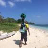
*Header photo: Parker Levinson, Point Blue Conservation Science
No showcases have been added to this group yet.

Conservation Director, Texas with National Audubon Society
- 0 Resources
- 4 Discussions
- 3 Groups
Margo Supplies - Wildlife Technology


- 0 Resources
- 43 Discussions
- 3 Groups

I am a scientist with research background in evolutionary-ecological genomics and have impact at the senate level to prevent a government viral biocontrol release. UK based and looking to connect with passionate dreamers ready to shift paradigms
- 0 Resources
- 3 Discussions
- 9 Groups

- @LauraKloepper
- | she/her
Associate Professor at the University of New Hampshire. Our research aims to uncover behavioral principles underlying acoustic sensing, inspire the design of active sensing technology, and improve population monitoring for animal conservation.
- 1 Resources
- 3 Discussions
- 5 Groups

Tech-Driven Conservation with a Wild Twist

- 0 Resources
- 1 Discussions
- 8 Groups
- 0 Resources
- 0 Discussions
- 14 Groups

Zoological Society London (ZSL)
Technical Project Manager in ZSL's Conservation Technology Unit


- 2 Resources
- 26 Discussions
- 7 Groups
- @Thorondor
- | He/Him
AI engineering working on cutting edge AI research and product for detecting objects. Big wildlife and conservation enthusiast and amateur wildlife photographer.
- 0 Resources
- 0 Discussions
- 2 Groups

Currently a data scientist in industry working on mechanistic models of risk, previously worked on modeling coral reefs. I am interested in the potential for emerging technologies and new ideas to help us solve environmental crises.
- 0 Resources
- 0 Discussions
- 14 Groups

- @Kasi
- | He/him
Game Rangers International
Kasi Amor Kalande is a young conservationist with experience in elephant movement research, GIS, and conservation technology.
- 1 Resources
- 0 Discussions
- 7 Groups
- @Phillip_Swart
- | He
I'm a conservationist working in the Vulture conservation space in South Africa with a huge passion for technology.
- 0 Resources
- 0 Discussions
- 17 Groups
- @Prabisha
- | she/her
Dedicated research scientist with over 8 years of experience in cartography, spatial analysis, and statistical modeling to tackle environmental, public health, and socio-economic challenges. Passionate about leveraging geospatial technology to drive impactful solutions.
- 0 Resources
- 0 Discussions
- 12 Groups
Article
Kākāpō Dreaming: A Wildlife Drones Adventure

Wildlife Drones
What is it like to track endangered species using drones? In this blog post from Wildlife Drones, Dr. Debbie Saunders travels to New Zealand to track the Kākāpō, an extemely rare and elusive bird of which approximately...
8 July 2020
Article
Connecting to MBARI's Deep-Sea Instruments
Monterey Bay Aquarium Research Institute (MBARI)
The Monterey Bay Aquarium Research Institute's MARS ocean observatory may someday make conducting deep-sea research more accessible and affordable thanks to Deep-Sea Connect, their new wireless system engineered to ...
31 March 2020
Community Announcement
WILDLABS Community Call Recording: Rainforest X-PRIZE

WILDLABS Admin
Our second WILDLABS Community Call took place on April 1st to continue the discussion started by Ben Tregenna in our Data Science group, in which he suggested the idea of submitting a collaborative entry to the X-Prize...
30 March 2020
Article
#Tech4Wildlife 2020 Photo Challenge In Review

WILDLABS Team
2020 marked our fifth year holding our annual #Tech4Wildlife Photo Challenge, and our community made it a milestone to remember. Conservationists took to Twitter last week to share their best high-tech snapshots from...
4 March 2020
Funding

The 2020 Tusk Awards are now accepting nominations of outstanding individuals who have made a significant impact on conservation in Africa. These nominations offer the rare and exciting opportunity to honor your peers...
3 March 2020
Article
How do you weigh a live whale?
WILDLABS Team
How do we actually know a whale weighs 40 tonnes? After all, we can’t exactly capture an animal the size of a bus and simply put it on a scale. Fredrik Christiansen explains their new, non-invasive way of weighing...
9 October 2019
Article
From the Field: Melissa Schiele
WILDLABS Admin
In this From the Field interview, we talk to Melissa Schiele, a tech whiz, marine ecologist, and conservationist at the Zoological Society of London. She shares with us about her work helping to develop the first-ever...
10 June 2019
Article
Canopy height mapping with drones

Tom Swinfield
Tom Swinfield and colleagues at the Forest Ecology and Conservation Group have assessed the quality of three dimensional forest models produced from drone surveys, and conclude that concerns about their quality for...
31 May 2019
Article
In this blog, Laure Joanny adds her perspectives to an ongoing discussion that we've been seeing in the community about conservation tech and it's relationship to e-waste. How do we tackle the challenge of battery waste...
3 May 2019
Article
#Tech4Wildlife Photo Challenge: Our Favourites from 2019
WILDLABS Team
Happy World Wildlife Day! To celebrate, this week we've asked our community to share photos showing how they are using tech in the field or the lab, using the #Tech4Wildlife hashtag.
3 March 2019
Article
Using Swiss AI and Drones to Count African Wildlife
WILDLABS Team
After a promising first run in Namibia, a Swiss project could aid savanna conservation using drones and automatic image analysis.
18 February 2019
Article
Getting up close and personal with Antarctica's orcas
WILDLABS Team
In this case study, Science Reporter Jamie Morton tells the story of how Kiwi scientists are teaming up with a local underwater robotics company to gain world-first insights into the lives of whales in Antarctica.
4 February 2019
August 2025
event

Louisa Richmond-Coggan
September 2025
event
Louisa Richmond-Coggan
March 2026

July 2024
April 2024
event

Wildlife Drones
event
Wildlife Drones
33 Products
Recently updated products
| Description | Activity | Replies | Groups | Updated |
|---|---|---|---|---|
| want to join 2025 contest for humpback whale photos in Juneo Alaska of Kelp |
|
Citizen Science, Conservation Tech Training and Education, Drones, Emerging Tech, Geospatial, Human-Wildlife Coexistence, Marine Conservation, Open Source Solutions | 9 hours 40 minutes ago | |
| This is awesome!! |
|
Conservation Tech Training and Education, Drones, Emerging Tech, Geospatial, Open Source Solutions | 1 day 1 hour ago | |
| Thank you for sharing. Would love to learn bit more about the data workflow. Last year I tired to using QGIS and few existing models to count the birds from orthomosaics of... |
|
Drones, Latin America Community | 2 weeks 5 days ago | |
| G-DiNC 2026: Global Drones in Nature Conservation Symposium & ExpoNairobi & Naivasha, Kenya | March 3–6,... |
|
Drones, AI for Conservation, Conservation Tech Training and Education, Emerging Tech, Marine Conservation, Sensors | 4 weeks 1 day ago | |
| 15 years ago I had to rebuild the dams on a game reserve I was managing due to flood damage and neglect. How I wished there was an easier,... |
|
Drones, Conservation Tech Training and Education, Data management and processing tools, Emerging Tech, Geospatial, Open Source Solutions | 3 months 4 weeks ago | |
| I create ocean exploration and marine life content on YouTube, whether it be recording nautilus on BRUVs, swimming with endangered bowmouth... |
|
Acoustics, AI for Conservation, Animal Movement, Camera Traps, Citizen Science, Drones, Emerging Tech, Marine Conservation, Sensors, Sustainable Fishing Challenges, Wildlife Crime | 1 month 2 weeks ago | |
| Thank you for your reply, ChadI meant 10 as a whole, indeed. Perhaps you see your post in one group, but since it is tagged for all groups, I assumed you meant 10 in total.In your... |
|
Acoustics, AI for Conservation, Animal Movement, Camera Traps, Citizen Science, Climate Change, Community Base, Connectivity, Drones, eDNA & Genomics, Emerging Tech, Funding and Finance, Geospatial, Human-Wildlife Coexistence, Software Development, Wildlife Crime | 1 month 3 weeks ago | |
| Thank you for your comment Chris! Using these tools has made a huge difference in the way we can monitor and manage Invasive Alien Vegetation. I hope you are able to integrate... |
|
AI for Conservation, Citizen Science, Conservation Tech Training and Education, Drones, Geospatial, Human-Wildlife Coexistence, Open Source Solutions | 1 month 3 weeks ago | |
| I would love to hear updates on this if you have a mailing list or list of intersted parties! |
|
AI for Conservation, Community Base, Drones, Latin America Community, Marine Conservation, Open Source Solutions, Software Development | 2 months ago | |
| True, the US ecosystem is a challenging space right now, for basically all sectors. We should not let the US chaos prevent us from engaging with opportunities in other... |
|
AI for Conservation, Camera Traps, Connectivity, Drones, Emerging Tech, Ethics of Conservation Tech, Marine Conservation, Sensors | 3 months 4 weeks ago | |
| Not the same equipment, but at work I have used Metashape with DJI drones with an IR sensor (Mavic 3 Thermal, Matrice 3DT, Matrice 4T, etc) and the workflow to create IR maps... |
|
Drones | 2 months 2 weeks ago | |
| Hi all! I recently did a little case study using RGB drone data and machine learning to quantify plant health in strawberries. I wanted to... |
|
Citizen Science, Conservation Tech Training and Education, Drones, Geospatial | 3 months ago |


Online Course: Drones for Land Trust Monitoring and Management with Duke Marine Robotics & Remote Sensing Lab
25 January 2018 12:00am
Technology Empowered Conservation Lecture Series

18 January 2018 12:00am
"harvesting" camera traps, bioacoustic sensors via drones
3 November 2017 4:12pm
17 November 2017 2:31am
I've seen a couple of papers on similar capabilities, both with airborne drones as well as underwater drones, so there've been folks working on it. @emjay has a good point that the sensor nodes need to support this, which could be a bit tricky depending on your tolerance for battery life. What types of sensors are you thinking about supporting?

21 December 2017 3:48am
Hi Chris,
Your project sounds interesting! How's it coming along?
I'm based in the SF Bay Area. I don't have much drone experience, but it's something that I've been looking into recently. I'm currently working on a face recgnition system for brown bears with a bear researcher in BC, Canada. The goal is to identify bears on the data from camera traps to monitor populations and such. Currently the data is only collected a few times a season.
I agree with @emjay that the ground assets may be an issue. Do you have any thoughts on that front?
In any case, if you have some time in the coming weeks, I'd be happy to get together in the coming weeks to talk it over.
Ed
Drones: the pros and cons for community-based monitoring

10 December 2017 12:43pm
How The San Diego Zoo Is Using AI And Drones To Save Polar Bears
30 November 2017 12:00am
Kids, Drones & Science At The Water’s Edge
4 October 2017 12:00am
New paper on using drones in challenging environments
24 August 2017 9:04am

24 August 2017 4:57pm
Excellent - started reading this yesterday. This is a very timely and pertinent paper. Thanks for sharing.
Drone Tracker
23 August 2017 6:47am
24 August 2017 2:54am
Hi Lot,
Thank you for your input. Currently we are the end user instead of developer. That means, we are still using commercial drone like DJI series. However the link that you give absolutely useful for our upcoming innovation plans.
Since we still using commercial type quadcopter, I'm looking for stand alone tracker that work as seperate system from the drone. In other words, this tracker will not be affected should the drone system crash.
So far me and my team come across this device
http://www.dronesmadeeasy.com/Marco-Polo-Drone-Tracker-RF-Recovery-p/marco_polo_1.htm
Unfortunately, the radio signal frequency range so far not approved by Malaysian authority. So, I'm looking for other option.
Anyone in this forum have other option/ opinion?
Regards,
Mazidi
24 August 2017 6:51am
Hi Mazidi,
A couple of options;
- Marco Polo. http://eurekaproducts.com/rc-model-tracking-and-recovery/
I know of people who have relocated their machine using this device.
- Conventional VHF for wildlife tracking. old but solid technology.
Also have a look at commercial / open source devices used for model rockets.
regards
MJ
EDIT: I see that you have already identified Marco Polo.
24 August 2017 1:15pm
Hi Mazidi, all the systems that I recommended are separate systems with their own GPS, not connected to the drone.
Just the last one was the only finished product.
Good luck. Please tell us if you found something good and cheap!
A first-person account of the capture of a tiger in Pilibhit: Four elephants and a bulldozer, as seen from a drone

10 August 2017 12:00am
[ARCHIVE] Funding Opportunity: Leverage space technology for wildlife protection

6 July 2017 12:58pm
[ARCHIVE] OpenAerialMap
19 June 2017 10:54am
28 June 2017 5:27pm
For those who couldn't make it to the webinar, there's a recording at https://drive.google.com/file/d/0B0smOWFNRzuoLXpPSWREUnE2YzA/view. What do people think? Is this the future of aerial imagery data management?
Best Practice for Using Drones for Conservation: Let's create a living guidelines document
3 February 2017 10:13am
3 April 2017 8:45am
There's also GitLab. Again, it's probably not perfect as it's designed for coding, but I'm currently using it with a conference organising committee.
3 April 2017 9:44am
I personally think a wiki would be best.

23 June 2017 5:23pm
People in this thread might be interested in this special issue of remote sensing in ecology and conservation, looking for papers on "New Approaches to Citizen Science". Submissions close 15th July
http://zslpublications.onlinelibrary.wiley.com/hub/journal/10.1002/(ISSN)2056-3485/journal-menu/call-for-papers.html
OpenDroneMap
3 April 2017 9:24am
8 April 2017 5:56pm
Hi Thomas,
I tested it with some success, Pix4D offers more quality but ODM is doing the job quite well.
Since the process is quite demanding I will recomend you to execute ODM nativelly without virtual machine.
Maybe you can go directly for webODM:
https://github.com/OpenDroneMap/WebODM
19 June 2017 10:51am
Thanks @Lot ; I did try looking at WebODM but I even found this to be quite a convoluted process to get running. I've just volunteered as a tester for a new Windows one-click install for WebODM, so I'll take a look this week and feed back on this thread.
19 June 2017 11:20am
Cool! Thanks @Tomas Starnes.
Meanwhile, http://precisionmapper.com/ has adopted the freemium model, so the first 60 maps by year are free, It's not open source but its free. I tried and works well, the 2d maps are perfect, the 3D digital model of terrain it's not the best but it's ok.
Ground Control Points

19 May 2017 2:49pm
30 May 2017 8:47am
Hey @ahughes_rspb , thanks for starting this thread! It would be really useful to share experience on GCPs in particular. We're about to start experimenting by processing images with and without GCPs, but I expect that others are ahead of us with this. I'm particularly interested in point 4 - how much to GCPs affect the vertical accuracy of DSMs? Any advice?
From the Field: Eric Becker and designing sensors for wildlife
22 May 2017 12:00am
UAV for surveying river dolphins in the Amazon
14 February 2017 5:40pm
7 April 2017 4:00pm
Many thanks Tom. Your tips were very useful.
Have a look on the video with subtitles.
https://vimeo.com/208864580
By the way, conservationdrones is a partner and will work on the algorithm.
Cheers
7 April 2017 4:04pm
Many thanks indeed.
Please have a look at this video: https://vimeo.com/208864580
here you can see how we are working on the project.
Cheers
26 April 2017 2:50pm
Hi Marcelo,
To improve autonomy, you'll either need less weight on your drone, better batteries, or what about a fixed wing aircraft? Look at the parrot disco - it's much cheaper than the eBee, and you can outfit it with a downward facing camera instead of the forward, though it seems from your video, the one it has is fine). Those things can fly much longer than copters.
best,
aurélie
Aerial seeding with drones
19 April 2017 1:09pm

19 April 2017 2:35pm
This is really fascinating! This could also be potentially useful as a way to distribute vaccines for wildlife and livestock!
Drone training for forestry and conservation
27 March 2017 3:33pm
27 March 2017 5:04pm
Great link, thanks for sharing!
28 March 2017 10:03am
Thanks for sharing, @Lot
Adding a little more info in case anyone was interested but didn't click through - also, earlybird tickets are still available.
WORKSHOP & TRAINING:
Drone applications in sustainable natural resource management
When: 15th to 19th May, 2017
Where: Palangka Raya, Central Kalimantan, Indonesia
For whom: Members of forestry companies, governmental environmental institutions, non-profit organizations and university research departments, as well as students.
@TWhitten this may be of interest for Indonesia team members using drones?
#Tech4Wildlife Photo Challenge: Our favourites from 2016
1 March 2017 12:00am
Operational guidance

26 January 2017 1:58pm
20 February 2017 10:47am
Hi Jane,
Thanks for sharing the work the Research Data Alliance is develooing. It sounds complementary to the guidelines our community has started collaboratively developing. You can see where these guidelines are at over here in this thread. It would be great to have your experience (and that of your colleagues) as part of these guidelines, so we invite you to come and join in that process of building out these guidelines and keeping them alive.
Thanks for sharing the invitation to join your kick off meeting in April - will that be held in Barcelona, 5-7 April, 2017? I'm keen to explore how we could align our efforts as it sounds like what you're proposing is more detailed than what we're envisaging, and with a complementary focus. I agree, it would be great to ensure the conservation community perspective is build into your plans, and WILDLABS is keen to help facilate that. At the very least, the guidelines I've mentioned above should be at a point then that they might be useful to feed into your kick off meeting. If you have any more information or specific asks as the date gets closer, please do share them here.
Cheers,
Steph
20 February 2017 12:13pm
Hi @twhitten ,
Over in the other thread looking at developing best practise user guidelines @Jeremy+Lindsell shared a doc that might very well provide the template you're looking for. The Univeristy of Exeter dronelab research group (led by Karen Anderson) has developed a template for researchers using drones to help them meet CAA operating standards.
You can download the PDF here:
http://www.tandfonline.com/doi/suppl/10.1080/01431161.2017.1286059/suppl_file/tres_a_1286059_sm2155.pdf
And a Word version here:
http://www.tandfonline.com/doi/suppl/10.1080/01431161.2017.1286059/suppl_file/tres_a_1286059_sm2164.docx
Thanks Jeremy!
Cheers,
Stephanie
20 February 2017 12:21pm
Hi @twhitten
The British Model Flying Association provide a specialist insurance for drone operators who are not using them as a hobby nor for commercial purposes ("aerial work"). The category is termed "data, development and demonstration" and is recognised by UK Civil Aviation Authority as a legitimate mode of opeation that doesn't fit the current binary legislation of hobby or commercial. The insurance covers worldwide liability for operation. Most other drone insurance avilable assumes you are commercial, doing "aerial work" by CAA definition, and have a formal CAA licence.
BMFA are also a good source of information about current UK Gov and EU discussions on further legistlation re drones (registering all users for eg).
Best
Jeremy
Remotely Piloted Aircraft System Applications in Conservation and Ecology
10 February 2017 12:54pm
Cambridge Meetup, 9th February 2017: Contribute to the first draft of the 'Getting Started Using Drones Guidelines'
7 February 2017 3:25pm
Data request: improving drone forest quality assessments
20 January 2017 10:57am
Using Parrot technology to save the Sequoias

12 December 2016 4:56pm
5 January 2017 12:33am
Please note that they main use is Parrot sequoia multi spectral sensor, and not specifically Parrot drones.
I think they mainly use 3DR Solo drone for make the mapping of the sequoia.
5 January 2017 10:05am
Thanks for the link, @jprobert ! Parrot Education Blog's own link also here for reference http://edu.parrot.com/blog/2016/12/06/parrot-pix4d-team-forest-canopy-biologists-study-giant-sequoias/
Parrot/Pix4D Climate innovation grant
6 December 2016 4:36pm
Experience with DJI drones?
23 March 2016 3:45pm
13 April 2016 10:32am
Hi Jprobert.
I don't have experience with DJI drones but I do have quite a bit of experience with 3DR and drones in general.
What are you using the drones for? Get in touch if you'd like some advice.
Tom
27 November 2016 11:20pm
Hi Jprobert,
I have been trying to use my Phanton 3 proffessional together with Pix4Dmapper to trial out some forest mapping in Principe Island.
if you are interested check it out the interview I give to CNN Inside Africa about how drones and 3D mapping technologies are bringing our knowledge of Principe island’s forests into the 21st Century.
http://edition.cnn.com/videos/world/2016/11/07/inside-africa-sao-tome-and-principe-biosphere-b.cnn
“How Sao Tome and Principe embraced ecotourism: Sao Tome and Principe is promoting small-scale, high-end tourism, preserving the island's ecosystems so they can be enjoyed for years to come. Source: CNN”
Also If you want know more about the use of drones for conservation check the full story at FFI website:
http://www.fauna-flora.org/putting-principe-back-on-the-map-with-3d-technology/
Regards,
Felipe Spina
Linkedin: https://www.linkedin.com/in/felipe-spina-avino-91716193
Conservation Leadership Programme 2017 Award
21 November 2016 12:00am
Neotropical Migratory Bird Conservation Act grants via USFWS
8 November 2016 12:00am
How do Wildlife Crime Experts view Remote Sensing Technologies used to Combat Illegal Wildlife Crime?
7 November 2016 12:00am
Vaccine delivery for black footed ferret recovery

18 October 2016 5:10pm
15 November 2017 7:05pm
NASA/NOAA did something like this with microbuoys for ocean temp sensing in the arctic - drone deploys (drops) micrbuoys and repeatedly returns to fly over fetching data over the following days and weeks
http://www.arcticobservingsummit.org/sites/arcticobservingsummit.org/files/Bradley_Microbuoys_AOS.pdf
Do you have a specific use case /location in mind?
If we could find research funding I'd be interested, I can fly &build UAS but this is also an interesting data management opportunity which I'm very interested in.
Perhaps you could mod the Ardupilot tracking antenna system if really needed but if you're flying in the vicinity with line of sight I bet you don't even need to aim the antenna