Who We Are
Geospatial data and analysis is critical for conservation, from planning to implementation and measuring success. Every day, mapping and spatial analysis are aiding conservation decisions, protected areas designation, habitat management on reserves and monitoring of wildlife populations, to name but a few examples. The Geospatial group focuses on all aspects of this field, from field surveys to remote sensing and data development/analysis to GIS systems.
How to Get Started
Want to learn more about how remote sensing is used in conservation? Check out the first two episodes of this season of Tech Tutors, where our Tutors answer the questions How do I use open source remote sensing data to monitor fishing? and How do I access and visualise open source remote sensing data in Google Earth Engine? You can also check out our Virtual Meetup Archive for a range of panels that overlap with Geospatial topics, or take a look at our Earth Observation 101 lecture series from Dr. Cristian Rossi.
Our Purpose
The WILDLABS Geospatial Group is for conservation practitioners, geospatial analysts, and academics that want to:
- Share geospatial resources, best practices, data, and ideas;
- Network amongst geospatial and data practitioners;
- Create peer learning opportunities;
- Promote the use of free and open-source geospatial software; and
- Improve the use of GIS software and geospatial analyses in conservation management and research.
Group curators
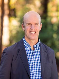
Over 35 years of experience in biodiversity conservation worldwide, largely focused on forests, rewilding and conservation technology. I run my own business assisting nonprofits and agencies in the conservation community


- 5 Resources
- 62 Discussions
- 12 Groups
- @ahmedjunaid
- | He/His
Zoologist, Ecologist, Herpetologist, Conservation Biologist


- 63 Resources
- 7 Discussions
- 26 Groups
Fauna & Flora
Remote Sensing Scientist, Conservation Technology & Nature Markets @ Fauna & Flora - WILDLABS Geospatial Group Co-Lead


- 34 Resources
- 28 Discussions
- 8 Groups
- 0 Resources
- 0 Discussions
- 17 Groups
Saint Louis Zoo
- 0 Resources
- 0 Discussions
- 13 Groups
- @diyaquanauts
- | he / him
Digital nomad, software developer, running mechatronic engineering firm in Seychelles to assist ocean conservation groups.

- 0 Resources
- 10 Discussions
- 9 Groups
- 0 Resources
- 0 Discussions
- 10 Groups
University of Adelaide

- 0 Resources
- 10 Discussions
- 17 Groups
- @pbull
- | he/him
DrivenData
Engineer and AI for Good leader working on bringing machine learning tools to social impact organizations.

- 0 Resources
- 1 Discussions
- 8 Groups
- @ronanwallace
- | He/Him
Research scientist developing conservation technology in environmental monitoring and cultural preservation.
- 0 Resources
- 0 Discussions
- 5 Groups
Care for Wild Rhino Sanctuary
Technology Manager at Care for Wild Rhino Sanctuary


- 0 Resources
- 1 Discussions
- 7 Groups
- 0 Resources
- 0 Discussions
- 8 Groups
Allen Institute for AI
Communications for EarthRanger and Skylight


- 8 Resources
- 5 Discussions
- 10 Groups
TerrOïko
PhD Student in statistical ecology
- 0 Resources
- 0 Discussions
- 7 Groups
TerrOïko
R&D Engineer
- 0 Resources
- 0 Discussions
- 6 Groups
Professor Nathalie Seddon, Professor Yadvinder Malhi (University of Oxford)
30 June 2022
Applications are invited for a Research Associate to join Dr Emily Lines' UKRI Future Leaders Fellowship (FLF) project "Next generation forest dynamics modelling using remote sensing data" (University of Cambridge)....
30 June 2022
Careers
Tammy Robinson-Smythe, Stellenbosch University
30 June 2022
Applications are invited for a Research Associate to join Dr Emily Lines' UKRI Future Leaders Fellowship (FLF) project "Next generation forest dynamics modelling using remote sensing data". This is an interdisciplinary...
15 June 2022
This study presents a comprehensive comparison of point clouds from four systems, linear and Geiger-mode LiDAR from manned aircraft and multi-beam LiDAR on unmanned aerial vehicle (UAV), and in-house developed Backpack...
13 June 2022
Near real-time global 10 m land cover mapping via Dynamic World; combining Sentinel-1 & -2 data for tree species classification; detecting elephants from drone imagery; Ecuador's satellite monitoring for illegal...
13 June 2022
Julia Martínez Pardo et al., Published in Biological Conservation
4 June 2022
Positions include machine learning data engineer, machine learning product manager, director of engineering, forest analyst
4 June 2022
Dr. Karen Holl's group at the University of California, Santa Cruz
4 June 2022
Global Forest Watch's Small Grants Fund is now open for applications for the 2023 grant cycle. Deadline is August 1.
1 June 2022
Careers
Climate X are seeking an enthusiastic and capable climate scientist to quantify climate change-related risks and physical impacts of tropical and temperate storms.
10 May 2022
Looking for biodiversity data? New review paper has an overview of biodiversity information portals, both global and country-specific
9 May 2022
June 2025
event
event
October 2025
event
November 2025
November 2023
event
October 2023
event
event
September 2023
event
126 Products
Recently updated products
| Description | Activity | Replies | Groups | Updated |
|---|---|---|---|---|
| Hi Matthew Wow, what an amazing project! It is incredible how you have managed to figure out some of the complexities of combining underwater imagery with UAV imagery. I am... |
|
Drones, Geospatial, Marine Conservation, Protected Area Management Tools | 5 months ago | |
| Thankyou so much. I'll definitely apply these solutions |
|
Geospatial | 5 months 1 week ago | |
| Very helpful. |
|
Geospatial | 5 months 2 weeks ago | |
| This is a thread for anyone who has questions about AI for Conservation Office Hours 2025.We're once again teaming up with Dan Morris from... |
|
Acoustics, AI for Conservation, Camera Traps, Community Base, Geospatial | 6 months 1 week ago | |
| I actually made some models with some learners and it is helpful with lower primary. Great idea. Hadn't thought of mentioning that. |
|
East Africa Community, Climate Change, Geospatial | 7 months ago | |
| Hi Heinrich,The chapter is here. Feedback welcome! |
|
Geospatial | 7 months 1 week ago | |
| You're welcome, Liz! |
|
Geospatial | 7 months 2 weeks ago | |
| Hello Sir, Thank yo so much for sharing such an insightful message, as you said I have got some wonderful resources from other community members, so yes, just want to get... |
+17
|
Geospatial | 7 months 2 weeks ago | |
| That is great |
|
Geospatial | 7 months 3 weeks ago | |
| This is great, thanks for sharing Vance. It looks very comprehensive and includes geemap. Amazing! This will save a lot of time and headaches. Would be great to have some reviews... |
|
Geospatial | 7 months 3 weeks ago | |
| Hi Phil, Thanks for sharing - this is really interesting work! Seems like a cool integration of ground-based (or ocean-based) data and satellite data, with a community... |
|
Geospatial, Acoustics, Camera Traps, eDNA & Genomics | 7 months 4 weeks ago | |
| Monitoring may be the most written about but least implemented (properly) topic in conservation. It primarily comes down to three reasons:... |
|
Geospatial | 8 months 1 week ago |


