Group curators

Vance Russell

Ahmed Junaid
- @ahmedjunaid
- | He/His

Elsa Carla De Grandi
Fauna & Flora
Who We Are
Geospatial data and analysis is critical for conservation, from planning to implementation and measuring success. Every day, mapping and spatial analysis are aiding conservation decisions, protected areas designation, habitat management on reserves and monitoring of wildlife populations, to name but a few examples. The Geospatial group focuses on all aspects of this field, from field surveys to remote sensing and data development/analysis to GIS systems.
How to Get Started
Want to learn more about how remote sensing is used in conservation? Check out the first two episodes of this season of Tech Tutors, where our Tutors answer the questions How do I use open source remote sensing data to monitor fishing? and How do I access and visualise open source remote sensing data in Google Earth Engine? You can also check out our Virtual Meetup Archive for a range of panels that overlap with Geospatial topics, or take a look at our Earth Observation 101 lecture series from Dr. Cristian Rossi.
Our Purpose
The WILDLABS Geospatial Group is for conservation practitioners, geospatial analysts, and academics that want to:
- Share geospatial resources, best practices, data, and ideas;
- Network amongst geospatial and data practitioners;
- Create peer learning opportunities;
- Promote the use of free and open-source geospatial software; and
- Improve the use of GIS software and geospatial analyses in conservation management and research.
Group curators

Over 35 years of experience in biodiversity conservation worldwide, largely focused on forests, rewilding and conservation technology. I run my own business assisting nonprofits and agencies in the conservation community


- 5 Resources
- 62 Discussions
- 12 Groups
- @ahmedjunaid
- | He/His
Zoologist, Ecologist, Herpetologist, Conservation Biologist


- 63 Resources
- 7 Discussions
- 26 Groups

Fauna & Flora
Remote Sensing Scientist, Conservation Technology & Nature Markets @ Fauna & Flora - WILDLABS Geospatial Group Co-Lead

- 34 Resources
- 28 Discussions
- 8 Groups

Aeracoop & Dronecoria
Computer engineer, Drone Pilot, Seed researcher, Wild Tech Maker


- 3 Resources
- 37 Discussions
- 11 Groups

- @Durgananda
- | He
- 0 Resources
- 0 Discussions
- 20 Groups

Earth Logic LLC
- 2 Resources
- 1 Discussions
- 1 Groups

Natural Solutions
- 0 Resources
- 13 Discussions
- 10 Groups

Chartered Geographer and Fellow of the Royal Geographical Society. 35 years in GIS, currently Nature Products Lead at CreditNature. Main interests: biogeography, biodiversity, ecosystem integrity, ecosystem services, rewilding, nature tech, nature fintech.

- 0 Resources
- 1 Discussions
- 3 Groups

- @hjayanto
- | He/Him
KONKLUSI (Kolaborasi Inklusi Konservasi - Yayasan)
Your friendly Indo-Crocky-Croc


- 0 Resources
- 44 Discussions
- 17 Groups

- @MStarking
- | she/her/hers
Ecologist and conservation researcher, currently an Assistant Professor at University of Michigan-Flint, research areas include landscape ecology, forestry and wildlife interactions, wildlife habitat relationships, spatial ecology, GIS.
- 0 Resources
- 1 Discussions
- 15 Groups

- 0 Resources
- 0 Discussions
- 1 Groups

Wildlife Conservation Society (WCS)
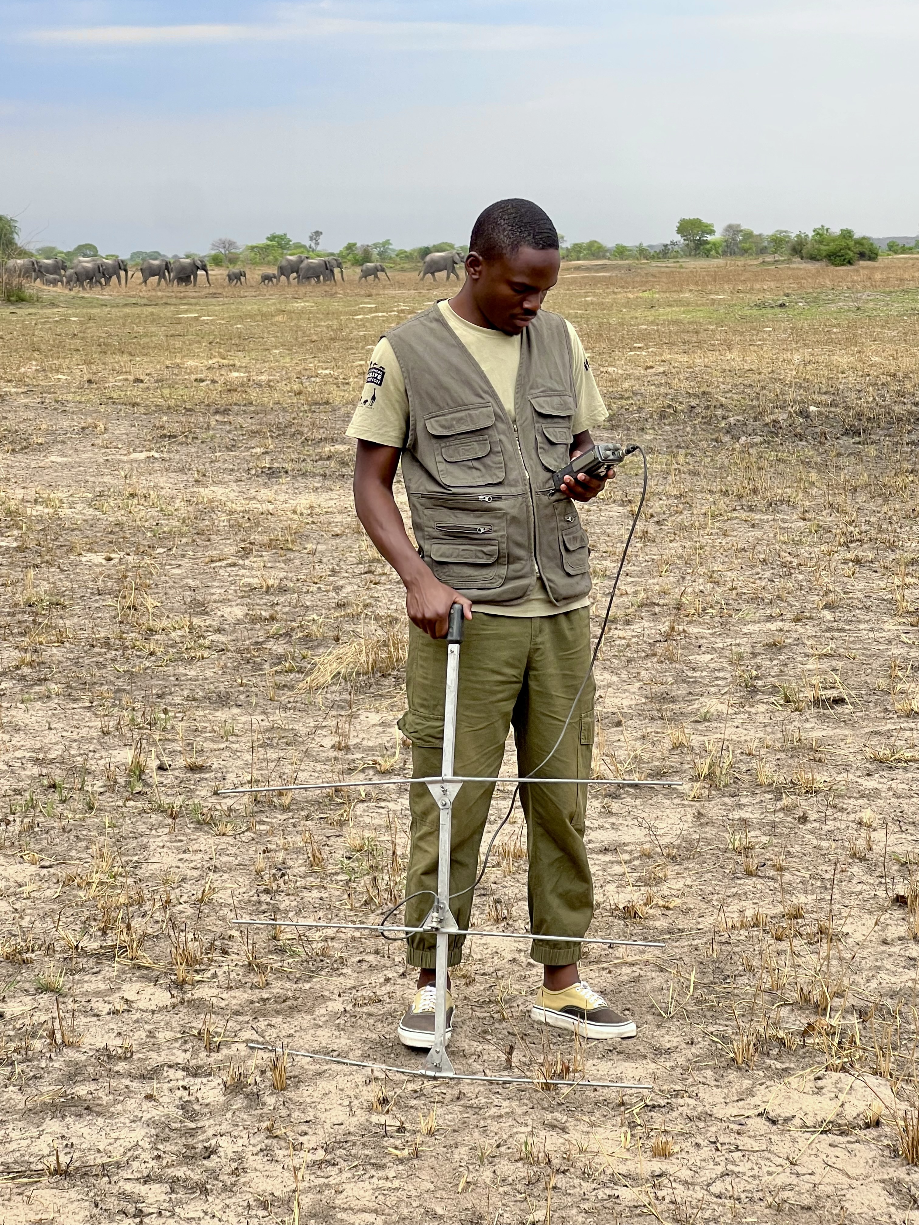
I am a devoted conservationist, natural resource management enthusiast interested in Elephant and Pangolin species and passionate about linking communities with environmental conservation
- 1 Resources
- 0 Discussions
- 13 Groups

Software Developer, Teacher and Technical Trainer. Passionate about using tech for good
- 0 Resources
- 7 Discussions
- 7 Groups

Technical Specialist at FFI: loves data management, maps, remote sensing & GIS for conservation


- 2 Resources
- 2 Discussions
- 9 Groups

- @rowan
- | they / them
Octophin Digital
Jack of all Trades. I've been a zoo keeper, a conservation geneticist and a web developer who specialises in conservation projects and orgs.
- 1 Resources
- 5 Discussions
- 15 Groups
Link
Collaring Elephants and Post Release Monitoring
Kasi Amor Kalande
This leads to an exciting blog we did recently, it also includes a spatial map indicating elephant movement tracks of an orphaned elephant who self released himself into the wild (Kafue National Park). Cartography was...
28 January 2025
Careers
Geospatial Guru: Mapping a Better Future

Elsa Carla De Grandi
Remote, United Kingdom
27 January 2025
Link
Early Wildfire Smoke Detection Method Based on EDA

Ahmed Junaid
https://doi.org/10.3390/rs16244684
27 January 2025
https://doi.org/10.1098/rstb.2023.0327
26 January 2025
Link
Nature Climate Change (2025).
26 January 2025
Link

Updated version of the Spatial Database of Planted Trees (SDPT), which differentiates planted forests and tree crops from primary and secondary natural forests. Update has double the number of countries covered
25 January 2025
Link
New Data Provides First Global Annual Picture of Cultivated and Natural Grasslands

Elsa Carla De Grandi
The Land & Carbon Lab developed a new dataset that provides global maps of grassland extent annually from 2000 - 2022 at a 30 m resolution. These maps are critical for tracking changes in grassland ecosystems,...
25 January 2025
Article

Over the years, a large number of developments have gone up in the area that I live in and the municipality is not doing what they should when it comes to upholding the laws that have been put in place to protect the...
20 January 2025
Special Issue: Remote Sensing of Solar Radiation Absorbed by Land Surfaces
19 January 2025
Careers

The Department of Wildlife, Fish, and Environmental Studies (WFE), SLU, Umeå, is looking for a postdoc with strong interests in wildlife conservation technology.
15 January 2025
Link
Google Earth Engine Tutorial-100: Heatwave Mapping
Ahmed Junaid
Google Earth Engine with Amirhossein Ahrari
15 January 2025
June 2025
event

Joel Masselink
October 2025
event

Lacey Hughey and 3 more
November 2025

January 2025
event

Ben Weinstein
December 2024
November 2024
event

Cassie Anderson
126 Products
Recently updated products
| Description | Activity | Replies | Groups | Updated |
|---|---|---|---|---|
| We will be conducting in-person demos of our cutting-edge drone technology in the US this year! 🇺🇸 If you're interested in experiencing... |
|
Animal Movement, Drones, Geospatial, Software Development | 1 year 3 months ago | |
| Am working on similar AI challenge at the moment. Hoping to translate my workflow to wolves in future if needed. We all are little overstretched but it there is no pressing... |
|
Camera Traps, AI for Conservation, Build Your Own Data Logger Community, Data management and processing tools, Marine Conservation, Protected Area Management Tools, Geospatial | 1 year 3 months ago | |
| Real nice video. I'll have another look in the weekend in detail. |
+10
|
Acoustics, Community Base, Protected Area Management Tools, Geospatial, Sensors | 1 year 3 months ago | |
| Hi!I would take a look at Although developed for camera trap imagery, it is by no means restricted to such.Cheers,Lars |
|
Camera Traps, Community Base, Data management and processing tools, Drones, Emerging Tech, Geospatial, Software Development | 1 year 3 months ago | |
| Thank you for this! Will take a look. |
|
Climate Change, Conservation Tech Training and Education, East Africa Community, Geospatial | 1 year 4 months ago | |
| Appreciate that Lars! |
+20
|
Animal Movement, Geospatial | 1 year 4 months ago | |
| Hi Eva, Me and my colleagues run a small NGO based on Yogyakarta in Indonesia, although our projects are spread around the country. One of our active project is working with... |
|
Community Base, Animal Movement, Citizen Science, Climate Change, Human-Wildlife Conflict, Marine Conservation, Geospatial | 1 year 5 months ago | |
| I am not an acoustics person but train and deploy canines in the field. Are you looking for something that records sniff rate and patterns? For GPS I just use a Garmin... |
|
Acoustics, Animal Movement, Geospatial | 1 year 5 months ago | |
| In what ways can drones contribute to linking individuals, communities, and small-scale producers in rural areas, facilitating the support... |
|
Drones, Geospatial | 1 year 5 months ago | |
| @dmorris joined Variety Hour to give us 'a bunch of lightning talks inside a lightning talk'. Check out the recording to get a whirlwind... |
|
AI for Conservation, Drones, Geospatial | 1 year 5 months ago | |
| I'm registered with the TWS2023 app, so feel free to nudge me there as well |
|
Animal Movement, Geospatial, Software Development | 1 year 6 months ago | |
| Digital Earth Africa are doing fantastic work to make Earth Observation data free and accessible, delivering decision-ready products to the... |
|
East Africa Community, Geospatial | 1 year 7 months ago |


Fellowship Opportunity: Planet Labs and Taylor Geospatial Institute 🚀
11 January 2025 5:37pm
DeepForest Code Walkthrough - Airborne Machine Learning for Biodiversity Monitoring
6 January 2025 3:24pm
Recommended Hardware to stitch together Drone Imagery into Orthomosaics

25 November 2024 6:25am

3 January 2025 3:41am
Hi @willrippon, I've worked with 3D reconstruction systems (software and hardware) for over 10 years now, and lately I've been really pleasantly surprised by Pix4D.
Here is a demo for a landscape survey my company just did.
Here is a 300 MB orthomosaic we just got as well.
Here is the hardware workflow described in detail.
On top of the drone imagery, we did "post-processing kinematics" (PPK) of the drone images (a very important thing to do, otherwise photogrammetry quality really suffers). I'm happy to discuss workflow further, and plan to release open source code and services.
If nothing else, go with Pix4D.

6 January 2025 7:40am
Thank you David, a phenomenal source!
Photogrammetry of Coral Reef Breakwaters

20 December 2024 1:11am

22 December 2024 8:35am
Hi Matthew
Wow, what an amazing project! It is incredible how you have managed to figure out some of the complexities of combining underwater imagery with UAV imagery. I am sure that was a fascinating learning experience.
I cannot help you with Points 1 and 3 but can suggest using Orfeo Toolbox for your segmentation process in Point 2. It integrates with QGIS and is open source. It will work with your UAV ortho maps if there is enough visible detail of the corals. You will be able to build and train your own model in order to accurately segment you reef. It takes a bit of know how to us the Machine Learning algorithms but once you get the hang of it it becomes immensely powerful. I will be building an online course on how to build your own machine learning processing algorithms in 2025 using this brilliant package. Once segmented you can save out the shapefiles and use them to segment and define your 3D point clouds in Agisoft.
Alternatively, look into using Picterra Geospatial AI. It is cloud based and much simpler to use but you may need to compress your imagery or point clouds in order to upload them given the file size you mentioned above. (Although they probable do allow for large uploads these days, I used Picterra in the past and it was brilliant!). Also i am not sure if it works with point clouds directly but have a look
I hope this helps. Great project!
Postdoc on camera trapping, remote sensing, and AI for wildlife studies
18 December 2024 2:14pm
FEISTY Fortran library and R package to integrate fish and fisheries with biogeochemical models
Query Regarding ArcMap
15 November 2024 2:21pm

12 December 2024 1:19pm
Sure
12 December 2024 1:20pm
I'll see that but I actually prefer ArcMap so that's why
12 December 2024 1:22pm
Thankyou so much. I'll definitely apply these solutions
Advancements and Applications of Drone-Integrated Geographic Information System Technology—A Review
Is there relation between Economic GDP and Geospatial tools?
12 November 2024 9:54am
2 December 2024 11:16am
Thank you so much Vance, this is very helpful information.
2 December 2024 11:23am
This's insightful idea, thanks Tim.
2 December 2024 11:23am
Very helpful.
Made 4 Geek
30 November 2024 7:29am
Made 4 Geek - YouTube
My YouTube channel aims to share tutorial videos, to make it easy to understand.

Geospatial Analysis using Python and QGIS Training Workshop

29 November 2024 12:30pm
Basics to Mastery: The Ultimate Course on Statistical Methods in R
27 November 2024 4:17pm
Online Course: Statistical Methods in R
The Ultimate Course to Quickly Master Statistical Methods in R - Instructor: Joachim Schork - Statistics Globe

High-resolution sensors and deep learning models for tree resource monitoring
25 November 2024 9:14pm
High-resolution sensors and deep learning models for tree resource monitoring | Nature Reviews Electrical Engineering
Trees contribute to carbon dioxide absorption through biomass, regulate the climate, support biodiversity, enhance soil, air and water quality, and offer economic and health benefits. Traditionally, tree monitoring on continental and global scales has focused on forest cover, whereas assessing biomass and species diversity, as well as trees outside closed-canopy forests, has been challenging. A new generation of commercial and public satellites and sensors provide high-resolution spatial and temporal optical data that can be used to identify trees as objects. Technologies from the field of artificial intelligence, such as convolutional neural networks and vision transformers, can go beyond detecting these objects as two-dimensional representations, and support characterization of the three-dimensional structure of objects, such as canopy height and wood volume, via contextual learning from two-dimensional images. These advancements enable reliable characterization of trees, their structure, biomass and diversity both inside and outside forests. Furthermore, self-supervision and foundation models facilitate large-scale applications without requiring extensive amounts of labels. Here, we summarize these advances, highlighting their application towards consistent tree monitoring systems that can assess carbon stocks, attribute losses and gains to underlying drivers and, ultimately, contribute to climate change mitigation. Trees are crucial for Earth’s ecosystems, aiding in carbon absorption, climate regulation and biodiversity support. High-resolution satellite sensors and artificial intelligence enable detailed tree monitoring at national and continental levels, simplifying biomass assessment, national reporting and climate change mitigation efforts.

AmazonTEC: 4D Technology for Biodiversity Monitoring in the Amazon (English)
25 November 2024 8:33pm
Technology solutions used by countries in UNFCCC reference levels
25 November 2024 8:11pm

Geospatial Scientist at Treeconomy
18 November 2024 10:02pm
GIS Day
18 November 2024 4:13pm
GIS Day | November 19, 2025
Celebrate GIS excellence on GIS Day. Use our free resources to plan activities that teach, motivate, and inspire others to explore all that GIS can do.

TorchGeo: Deep Learning With Geospatial Data
16 November 2024 5:20pm
[2111.08872] TorchGeo: Deep Learning With Geospatial Data
Abstract page for arXiv paper 2111.08872: TorchGeo: Deep Learning With Geospatial Data

21 December 2024 5:21am
This site may be of use for WebODM and photogrammetry using UAVs, as it focuses purely on processing that type of data and the hardware required. It also covers Conservation and Agriculture analysis and training using open source GIS and 3D point cloud software. Follow the links below:
https://www.geowingacademy.com
Hope this helps.