This group is home to the protected area management tools that bring data collection, analysis, and reporting together to enable frontline conservation work in real-time. These integrated systems include many tools and topics related to other community groups, so if you're interested in this space make sure to check out our Sensors and Connectivity groups as well.
Resources for Getting Started:
- Watch the recording of our virtual meetup on Networked Sensors for Security and Human-Wildlife Conflict Prevention, including talks from WWF, SmartParks, and Sensing Clues.
- Check out this Introduction to SMART on our YouTube channel.
- Hear about the work Wildlife Protection Solutions is doing in this space.
- Watch Ted Schmidt's lunchtime lecture on Tech Readiness and Protected Area Management Tools.
- For a marine perspective, watch Max Schofield's Tech Tutors episode: How do I use open access remote sensing data to monitor fishing?
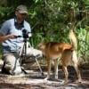
Header image: Save the Elephants
No showcases have been added to this group yet.

- @Dauson_M
- | Mr
Dauson Msumange is a social enterpreneur, founder and director of Tanzania Eco-Tech And Conservation Hub (TEACH).

- 0 Resources
- 1 Discussions
- 23 Groups

- @Freaklabs
- | He/Him
Freaklabs
I'm an engineer and product designer working in conservation technology. I specialize in technology for landscape restoration and wildlife behavioral ecology.


- 1 Resources
- 307 Discussions
- 20 Groups
African Parks
- 0 Resources
- 0 Discussions
- 10 Groups
- @crazybirdguy
- | Him
Field Biologist at Yayasan Cikananga Konservasi Terpadu, Indonesia, with experience and interest mainly in ornithology, citizen science and bioaccoustic

- 0 Resources
- 10 Discussions
- 12 Groups

Soil science, droughts effect of poverty, human rights advocate, wage equality in Europe, Drones in Digital Education


- 4 Resources
- 11 Discussions
- 18 Groups

- @Anandi7316
- | she / her
Ecologist, Doctoral researcher @ ARI-Pune | Biodiversity- rock outcrops ecology
- 0 Resources
- 0 Discussions
- 8 Groups

- @nancyalice
- | she/her
Design x Climate Action

- 0 Resources
- 0 Discussions
- 10 Groups
- 0 Resources
- 0 Discussions
- 18 Groups

I'm a PhD student at UW working with the Smithsonian and Center for One Health Research. I develop models to predict and explain zoonotic disease patterns, with a strong emphasis on how these diseases impact wildlife populations and communities sharing the same landscape.
- 0 Resources
- 13 Discussions
- 12 Groups

Forester/ Ecologist with a Master’s Degree in the department of Range science - Wildlife and Fresh water fisheries.
- 0 Resources
- 0 Discussions
- 11 Groups

- @MandyEyrich
- | She/Her
University of Florida (UF)
Bridging industries with 15+ years of cross-sector expertise specializing in user-centric technology and product strategy, UX research, UX/UI design, process optimization, and end-to-end agile product development moving from ideation to iteration.
- 0 Resources
- 0 Discussions
- 26 Groups

Sustainability Manager for CERES Tag LTD. An animal health company; animal monitoring, conservation, & anti-poaching/ rural crime. Wildlife, livestock, equine & companion. #CeresTrace #CeresWild #CeresRanch


- 2 Resources
- 20 Discussions
- 23 Groups
Article

The partnership will support the Global South with the development, planning and management of marine protected areas (MPAs) in the high seas.
22 September 2023
Careers
Conservation Technology Specialist

Wildlife Conservation Society (WCS)
WCS is seeking a Conservation Technology Specialist to join their work in the Okapi Wildlife Reserve.
11 August 2023
Article
#Tech4Wildlife Photo Challenge: Judges' Panel Honorees

WILDLABS Team
Please join us in celebrating this year’s top #Tech4Wildlife Photo Challenge Honorees as chosen by our panel of leading conservation organization judges, and enjoy the story contained within these entries about how our...
4 August 2023
Careers

Support wildlife NGO teams learn from and use SMART data to adapt their management practices
24 July 2023
Article
CCIPH: Empowering Communities in Biodiversity Efforts

Center for Conservation Innovation Philippines Inc.
In this Conservation Tech Showcase case study from the Center for Conservation Innovation Philippines Inc. (CCIPH), you’ll learn how uses technology to conduct critical biodiversity assessments and empower local...
13 July 2023
Link

"Artificial Intelligence could be the solution needed to effectively monitor and safeguard vast landscapes across Africa that, up until now, have been protected solely by patrolling." Read Tusk's latest Medium blog on...
12 July 2023
Article
Osa Conservation: A Multi-Tech Toolbox of Solutions

Osa Conservation
In this Conservation Tech Showcase case study from Osa Conservation, you’ll learn about how technology is aiding their long-term efforts to prevent wildlife crime, protect critical species, and build a climate-adaptive...
22 June 2023
Funding

JICA, Japan’s International Cooperation Agency is seeking a digital partner with a proven track record in conservation technology as we launch a pilot project to test technologies to mitigate human-elephant conflict in...
19 June 2023
Article
CyberTracker: Streamlining Data Capture
CyberTracker
In this Conservation Tech Showcase case study from CyberTracker, you’ll learn how this software application is revolutionizing the data collection processes and enhancing efficiency in the field.
15 June 2023
Article
Big Life Foundation: Improving Connectivity to Fight Wildlife Crime
Big Life Foundation
In this Conservation Tech Showcase case study from Big Life Foundation, you’ll learn about their successes using EarthRanger and LoRaWAN Smart Parks Solution technologies to monitor wildlife in East Africa.
8 June 2023
Article
Data Visualization in Service of Coral Reefs in Micronesia

Andrzej Białaś
This Data4Good project has led to immediate conservation impacts for many islands and many different resources. We hope that this project will inspire others to use data science and technology to solve the conservation...
17 May 2023
Funding
Deadline Approaching: Conservation Tech Award

Jordan Steward
Are you using or creating tech to protect wildlife? We want to support your organization through two $15,000 grants!
15 May 2023
October 2024

September 2024
9 Products
Recently updated products
| Description | Activity | Replies | Groups | Updated |
|---|---|---|---|---|
| Congratulations! My first hydromoth was just arrived yesterday and so excited! Looking forward for the update from your project!!! |
|
Acoustics, Animal Movement, Climate Change, Conservation Tech Training and Education, Data management and processing tools, Emerging Tech, Open Source Solutions, Protected Area Management Tools, Sensors, Software Development, Latin America Community | 1 year 3 months ago | |
| Unless you are planning on making a mesh network between nodes then the total distance spanning the location of all the nodes is important to know, not just the intra node... |
|
Sensors, Protected Area Management Tools | 1 year 5 months ago | |
| Real nice video. I'll have another look in the weekend in detail. |
+10
|
Acoustics, Community Base, Protected Area Management Tools, Geospatial, Sensors | 1 year 6 months ago | |
| Fire detection is a sort of broad idea. Usually people detect the products of fire, and most often this is smoke.Many home fire detectors in the US use a radioactive source... |
|
Community Base, Conservation Tech Training and Education, Data management and processing tools, Ethics of Conservation Tech, Human-Wildlife Coexistence, Open Source Solutions, Protected Area Management Tools, Sensors, Wildlife Crime | 1 year 6 months ago | |
| Thanks Aude, very useful. Will reach out to them! |
|
Early Career, Acoustics, eDNA & Genomics, Marine Conservation, Protected Area Management Tools | 1 year 7 months ago | |
| My suggestion would probably be a 3D printer and Solder Station with a stock of common components. With those two things you can solve most problems. |
|
Community Base, Emerging Tech, Marine Conservation, Protected Area Management Tools, Sensors | 1 year 8 months ago | |
| Hey Stephanie,Thanks a lot! Sorry I missed your message but of course I can ask our users about their experience with sensors! |
|
Animal Movement, Human-Wildlife Coexistence, Marine Conservation, Protected Area Management Tools | 1 year 10 months ago | |
| Have you tried or considered Garmin Inreach or Zoleo trackers?I have experience with Garmin Inreach in relatively rugged terrain in Greenland (probably not as steep as what you... |
|
Connectivity, Emerging Tech, Protected Area Management Tools | 1 year 10 months ago | |
| Alina has been a longtime friend of WILDLABS, and has been incredibly generous about sharing her knowledge as a Tech Tutor, an expert... |
|
East Africa Community, Protected Area Management Tools | 1 year 11 months ago | |
| Hi Lev,We always need more hands in conservation, from whichever field! Engineering, computer science, AI/ML, ecology, environmental science, communications, statisticians, etc.... |
|
Community Base, Data management and processing tools, Marine Conservation, Protected Area Management Tools | 2 years 1 month ago | |
| Marine Monitor (M2) LLC is a small, focused company building scalable vessel monitoring solutions to support Marine Conservation. We are... |
|
Marine Conservation, Protected Area Management Tools, Software Development | 2 years 2 months ago | |
| Hello all! Bluspark is a plateform that allows natural area managers such as natural parks or reserves to optimize their day to day... |
|
Citizen Science, Community Base, Connectivity, Conservation Tech Training and Education, Ethics of Conservation Tech, Protected Area Management Tools, Software Development | 2 years 3 months ago |


Understanding the Application of SMART in Measuring Law Enforcement Performance in Protected Areas.

22 July 2024 2:25pm
24 July 2024 6:40pm
Also thanks for letting me know about Lilyxu and others you mentioned, i will reach out to them.

31 July 2024 6:33pm
Keep digging Sarah!!
Move BON Development: Follow up discussion

19 June 2024 12:02pm

11 July 2024 10:14pm
You can catch up on the recording at that same link to the June Variety Hour! Lacey's fabulous talk starts around the 9:40 mark :)
12 July 2024 5:38am
Hi Talia!
I feel like the topic is so broad that it might help to put some constraints around things, see what works, and then broaden those out. I have a lot of ideas regarding the data monitoring and collection side based on the other sensor and observation networks we've set up in the past.
There may also be some potential scope to incorporate things like data collection and integrated monitoring to the Build Your Own Datalogger series where the system is updated to feed data into the observation network.
It'd probably take a bit of discussion and coordination. Let me know if interested. I'm fine to jump on a call or discuss via email too.

22 July 2024 9:24pm
@cmwainaina please take a look
Enter to win a free thermal camera!

26 June 2024 5:38pm
NEW PUBLICATION ALERT!

17 June 2024 11:33am

17 June 2024 12:57pm
17 June 2024 7:40pm
Fauna & Flora: Bridging geospatial data and people together for enhanced conservation management
17 April 2024 11:31am
13 June 2024 8:51pm
This is amazing! Thank you for sharing. I'm speaking on this topic at the National Center for Ecological Analysis and Synthesis in October. If you have any other resources on this topic, let me know! Closing the loop for "Science to Action" is a huge part of the work we do so I'm always looking to learn.
16 June 2024 3:32pm
Tagging @Chelsea_Smith so she sees this :)
Conservation Technology for Human-Wildlife Conflict in Non-Protected Areas: Advice on Generating Evidence

22 January 2024 11:36pm

4 February 2024 8:16am
Hi Amit,
The most important thing is that the livestock owners contact you as soon as possible after finding the carcass. We commonly do two things if they contact us on the same day or just after the livestock was killed:
- Use CyberTracker (or similar software) on an Android smart phone to record all tracks, bite marks, feeding pattern and any other relevant signs of the reason for the loss with pictures and GPS coordinates. [BTW, Compensation is a big issue -- What do you do if the livestock was stolen? What do you do if a domestic animal killed the livestock? What if it died from disease or natural causes and was scavenged upon by carnivores afterwards?]
- In the case of most cats, they would hide the prey (or just mark it by covering it with grass or branches and urinating in the area). In this case you can put up a camera trap on the carcass to capture the animal when it returns to its kill (Reconyx is good if you can afford it - we use mostly Cuddeback with white flash). This will normally only work if the carcass is fresh (so other predators would not be able to smell it and not know where it is yet), so the camera only has to be up for 3-5 days max.
This is not really high-tech, but can be very useful to not only establish which predator was responsible (or if a predator was responsible), but also to record all the evidence for that.
13 June 2024 8:58pm
Hey Amit,
This is a great question; from our work, we've seen people do a couple of things. We've even seen people using Ring doorbell footage in urban areas as evidence.
The best thing we've seen is matching the community needs with existing infrastructure:
- Are there existing cameras you can leverage, like the doorbell cameras?
- Can public participation monitoring service this, i.e. public submitted photos and videos?
It also totally depends on the wildlife species you're working with, the interaction, damages, etc. If you've found any good solutions, let me know. I'd love to share that information with our clients here who have constant bear problems.

14 June 2024 9:09am
In that case, you might want to keep an eye on the project from @Lars_Holst_Hansen
I have been working hard on this camera based polar bear alarm with Kim Hendrikse and other collaborators including Zoologisk Have in Copenhagen - where the system is now beeing tested. | Lars Holst Hansen | 17 comments
I have been working hard on this camera based polar bear alarm with Kim Hendrikse and other collaborators including Zoologisk Have in Copenhagen - where the system is now beeing tested. I hope to field test it at Zackenberg Research Station next year. | 17 comments on LinkedIn

Are you attending SMART Global Congress 2024?

22 February 2024 11:13am
20 March 2024 4:32pm
Here is a quick report of what we have learnt there:

21 March 2024 9:48pm
Awesome, thanks for the summary!

8 June 2024 7:43am
Hey @antoineede ,
I am not sure about that yet video recordings are available or not but you can visit this: SMART Global Congress 2024 | BluePrism
May be here you will get some of the recorded videos to watch.
ICI calls for €20-25M project applications for Colombia

5 June 2024 5:50pm
Open Software Engineer Position at Land Conservation Software Company
5 June 2024 4:37pm
New WILDLABS Funding & Finance group
5 June 2024 3:24pm
5 June 2024 4:14pm

6 June 2024 1:38am
6 June 2024 4:16am
Apply! 2024 Conservation Tech Award
3 June 2024 3:51pm
NCTFJ call for JM$ 500-5000K proposals
26 May 2024 5:05pm
Share Your Work in a Conservation Technology Video

17 May 2024 9:06pm
WILDLABS AWARDS 2024 - Underwater Passive Acoustic Monitoring (UPAM) for threatened Andean water frogs
30 March 2024 3:54pm

5 April 2024 12:13pm
Congratulations, very exciting! Keep us updated!

7 April 2024 6:09pm
This is so cool @Mauricio_Akmentins - congrats and look forward to seeing your project evolve!

1 May 2024 5:17pm
Congratulations! My first hydromoth was just arrived yesterday and so excited! Looking forward for the update from your project!!!
The Inventory User Guide

1 May 2024 12:46pm
Introducing The Inventory!
1 May 2024 12:46pm
22 July 2024 10:55am
23 July 2024 2:05pm
23 July 2024 2:53pm
Hiring Chief Engineer at Conservation X Labs

1 May 2024 12:19pm
Job Opening: Associate Curator of International Conservation at North Carolina Zoo

29 April 2024 9:17pm
Backend Software Architect, EarthRanger (Contract Opportunity)

27 April 2024 7:24pm
Program Manager: Integrating movement and camera trap data with international conservation policy
22 April 2024 10:16pm
Postdoc: Biologging & Camera Trap Data Integration
22 April 2024 10:10pm
Early Warning Systems for Human-Wildlife Conflict, Zoonotic Spillover, and Other Conservation Challenges
17 April 2024 5:43pm
The Variety Hour: 2024 Lineup
22 March 2024 4:30pm
SMART Global Congress 2024: A quick summary
19 March 2024 6:42pm
Here's what you missed at World Wildlife Day 2024
7 March 2024 9:02pm
15 March 2024 2:42pm

A Sensor-Based Approach to Studying Animal Behavior in Light Pollution Research
24 February 2024 9:33pm
27 February 2024 12:38pm
Thanks for helping me!
For now, I'll be testing with mains power (220V). The final prototype needs to be functional using solar panel.
The main system will be a Raspberry Pi, as the Brain of this project, receiving and storage all the measurements from the other devices, controlling the system. The measurement devices will be a microcontroller (still searching for which one to use) with differents sensor, such Lux sensor like TSL2561 or 2591, AudioMoth to record animals sounds, temperature and some other measurements.
For synchronization, must be effective, because the measurements must be or have the same time, so the storage data from differents devices can be grouped by it's timestamp and have full control for animals and fauna. So, probably it will be a lot of data per day.
The distance between each devices I haven't study yet, consider 20 meters within each device.

27 February 2024 1:49pm
Beware that the AudioMoth in itself will drift. It can be hooked up with a GPS to allow for GPS time synchronization, though.
https://www.openacousticdevices.info/gps-sync

27 February 2024 3:11pm
Unless you are planning on making a mesh network between nodes then the total distance spanning the location of all the nodes is important to know, not just the intra node distance.
If you have a Raspberry Pi as a main master node then you could install my sbts-aru project as a base project and you would get a sub-microsecond master time base by default as well as the GPS synchronizes the main system time with typically less than 0.1 microsecond, and SD card corruption resilience due to the in-memory overlayFS architecture.
If the total distance was 20m across all nodes, then the approach above could also combined the audio gathering capability as the sbts-aru project does audio logging as it would be within 20m of an audiomoth anyway, then you also have time-synchonized audio. If the distance is spanning 100m for example and it's just the intranode distance that is 20m then everything is somewhat different with respect to synchronization.
SMART Global Congress 2024
22 February 2024 11:00am
SMART Partnership Director
21 February 2024 4:32pm
Southern African Wildlife Management Association Conference 2024
6 February 2024 12:20pm
24 July 2024 6:30pm
Thank you very much Carly Batist for the suggestion! I haven't reached out to the SMART folks yet, but I will. Getting contacts and case studies from them sounds very helpful to me.