In recent years, drone technologies have been explored for a range of applications in conservation including (but not limited to) mapping, biodiversity inventories, antipoaching patrols, wildlife tracking, and fire monitoring. The rise of customizable, open-source drones like those of ArduPilot and OpenROV hold promise for more effective conservation applications, and combined with other monitoring sensors and devices, they are capable of collecting high-resolution data quickly, noninvasively, and at relatively low cost.
However, challenges remain in putting these tools to use. A recent paper reviewing 256 conservation drone projects highlighted some of these major obstacles, ranging from unintended social and ecological consequences of drone operations to still prohibitive costs, both in terms of hardware and in terms of storing and processing large volumes of data. The longstanding challenge of power/battery life remains as well.
If you're considering trying out drones for yourself, and want to explore the possibilities and understand the major conversations happening around this technology, check out these beginner's resources and conversations from across the WILDLABS platform:
Three Resources for Beginners:
- Conservation Technology User Guidelines Issue 5: Drones, World Wildlife Fund | Drones, best practices, ethics, regulations, case studies
- WILDLABS Virtual Meetup Recording: Drones, Craig Elder, Dr. Claire Burke, and Gabriel Levin | Drones, thermal camera, wildlife crime, ML, biologging
- New Paper: Drones and Bornean Orangutan Distribution, Sol Milne | Drones, data analysis, citizen science, community science, primates
Three Forum Threads for Beginners:
- Curious about radio-tracking with drones? | Wildlife Drones, Biologging (5 replies)
- Drones for GIS Best practice Document | Adrian Hughes, Drones (10 replies)
- WWF Conservation Technology Series: Drones in Conservation | Aurélie Shapiro, Drones (7 replies)
Three Tutorials for Beginners:
- How do I use a drone to capture radio-tracking data? | Debbie Saunders, Tech Tutors
- How do I choose the right drone for my conservation goals? | Shashank Srinivasan, Tech Tutors
- How do I strategically allocate drones for conservation? | Elizabeth Bondi, Tech Tutors
Want to know more about using drones, and learn from experts in the WILDLABS community? Make sure you join the conversation in our Drones group!
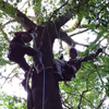
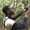
*Header photo: Parker Levinson, Point Blue Conservation Science
No showcases have been added to this group yet.

- @serena.le
- | she/her
Conservation tech enthusiast
- 0 Resources
- 0 Discussions
- 24 Groups
- @johnjoseph
- | He/Him
I am a mechanical engineer with diverse industry experience and a passion for innovative technology. As a technology and engineering entrepreneur, I focus on creating solutions that blend advanced engineering with a commitment to nature and forest conservation.
- 0 Resources
- 0 Discussions
- 10 Groups

- @lampros
- | He/Him
I am a Data and Remote Sensing Analyst specializing in programming (R, Python) at Monopteryx, contributor to open-source projects related to machine-, deep-learning, remote sensing and interested in Biodiversity
- 0 Resources
- 4 Discussions
- 10 Groups


- 0 Resources
- 2 Discussions
- 8 Groups

WildTrack
Research, development and implementation of non-invasive montoring for endangered species


- 1 Resources
- 25 Discussions
- 11 Groups
My research focuses on using Next-Generation Sequencing (NGS) to study endangered species, including carnivores, chiropterans (bats), and lizards, as well as their microbiomes.
- 1 Resources
- 4 Discussions
- 19 Groups

- @iagosilvestre
- | he/him
Universidade Federal de Santa Catarina (UFSC)
I'm a Ph.D. Student in Automation and System Engineering Program from the Federal University of Santa Catarina-Brazil. My main research interests are Multiagent Systems and Embedded Systems.

- 0 Resources
- 1 Discussions
- 4 Groups
Master's @ Georgia Tech - Computer Science
- 0 Resources
- 1 Discussions
- 1 Groups

- @georg_strunck
- | he/him
Delft University of Technology & SPOTS | Strategic Protection Of Threatened Species
MSc Student in Aerospace/Robotics @TU_Delft | Engineer & Project Manager @StrategicProtectionOfThreatenedSpecies (SPOTS) | Robotics Engineer @BiodivX with @ETH Zürich for the xPrize rainforest competition
- 1 Resources
- 9 Discussions
- 10 Groups

- @felipeccalegari
- | he/him
Universidade Federal de Santa Catarina (UFSC)
Master student in Automation Engineering at Federal University of Santa Catarina (UFSC) in Brazil. Areas of interest: embedded systems, robotics, multiagent systems
- 0 Resources
- 1 Discussions
- 3 Groups
- 0 Resources
- 2 Discussions
- 1 Groups
- @SamuelNtimale
- | Him
Samuel Nti, a conservationist at APLORI, uses bioacoustics to protect endangered birds. His current work focuses on the African Grey Parrot in Nigeria, where he employs Passive Acoustic Monitoring (PAM) to inform conservation strategies.

- 0 Resources
- 1 Discussions
- 7 Groups
Link

Great use of drones from Fauna&Flora's team
7 November 2024
Link

deadtrees.earth is an open-access platform hosting more than a thousand centimeter-resolution orthophotos, more than 300,000 ha. Combined with Earth observation data and machine learning it will enable to uncover tree...
2 November 2024

Careers
Seeking expressions of interest from PhD candidates to join the MAVE Lab at the University of Wollongong, NSW, Australia
26 August 2024
Funding
The Resilient Futures Technology Grant Program by DroneDeploy.org is dedicated to fostering radical inclusion in urgent solutions. Our mission is to enhance outcomes for underresourced populations by prioritizing...
26 August 2024
Article
Join us in celebrating this year’s Judging Panele Award winners!
19 August 2024
Article

Join us in celebrating this year’s Community Choice Award winners!
15 August 2024
Article
Vote for your favorite submissions that best demonstrate conservation impact, novel innovation/discovery, and strong storytelling of the work and the sector.
12 August 2024
Article
Handbook 'Drones in Biomonitoring & Nature Conservation'

Steffen Döring
The use of drones can contribute in various ways to increase the effectiveness of monitoring, reduce costs, and minimize disturbances. This manual has been specifically developed to support conservation efforts and to...
27 June 2024
Link
Handbook 'Drones in Biomonitoring & Nature Conservation'
Steffen Döring
The use of drones can contribute in various ways to increase the effectiveness of monitoring, reduce costs, and minimize disturbances. This manual has been developed to support conservation efforts and to help make the...
27 June 2024
Article
Enter to win a free thermal camera!

Alex Rood
WILDLABS is partnering with FLIR to give away a FLIR ONE Edge Pro to 5 community members.
26 June 2024
Article
Case Study: Drone-based radio-tracking of Eastern Bandicoots

Wildlife Drones
Wildlife Drones was deployed by Zoos Victoria in a trial project tracking captive-bred Eastern Barred Bandicoots that were tagged and released into the wild
14 June 2024
August 2025
event

Louisa Richmond-Coggan
September 2025
event
Louisa Richmond-Coggan
March 2026

January 2025
event
Wildlife Drones
event

Ben Weinstein
December 2024
event

Agripina Cletus and 1 more
October 2024
33 Products
Recently updated products
| Description | Activity | Replies | Groups | Updated |
|---|---|---|---|---|
| want to join 2025 contest for humpback whale photos in Juneo Alaska of Kelp |
|
Citizen Science, Conservation Tech Training and Education, Drones, Emerging Tech, Geospatial, Human-Wildlife Coexistence, Marine Conservation, Open Source Solutions | 8 hours 38 minutes ago | |
| This is awesome!! |
|
Conservation Tech Training and Education, Drones, Emerging Tech, Geospatial, Open Source Solutions | 1 day ago | |
| Thank you for sharing. Would love to learn bit more about the data workflow. Last year I tired to using QGIS and few existing models to count the birds from orthomosaics of... |
|
Drones, Latin America Community | 2 weeks 5 days ago | |
| G-DiNC 2026: Global Drones in Nature Conservation Symposium & ExpoNairobi & Naivasha, Kenya | March 3–6,... |
|
Drones, AI for Conservation, Conservation Tech Training and Education, Emerging Tech, Marine Conservation, Sensors | 4 weeks 1 day ago | |
| 15 years ago I had to rebuild the dams on a game reserve I was managing due to flood damage and neglect. How I wished there was an easier,... |
|
Drones, Conservation Tech Training and Education, Data management and processing tools, Emerging Tech, Geospatial, Open Source Solutions | 3 months 4 weeks ago | |
| I create ocean exploration and marine life content on YouTube, whether it be recording nautilus on BRUVs, swimming with endangered bowmouth... |
|
Acoustics, AI for Conservation, Animal Movement, Camera Traps, Citizen Science, Drones, Emerging Tech, Marine Conservation, Sensors, Sustainable Fishing Challenges, Wildlife Crime | 1 month 2 weeks ago | |
| Thank you for your reply, ChadI meant 10 as a whole, indeed. Perhaps you see your post in one group, but since it is tagged for all groups, I assumed you meant 10 in total.In your... |
|
Acoustics, AI for Conservation, Animal Movement, Camera Traps, Citizen Science, Climate Change, Community Base, Connectivity, Drones, eDNA & Genomics, Emerging Tech, Funding and Finance, Geospatial, Human-Wildlife Coexistence, Software Development, Wildlife Crime | 1 month 3 weeks ago | |
| Thank you for your comment Chris! Using these tools has made a huge difference in the way we can monitor and manage Invasive Alien Vegetation. I hope you are able to integrate... |
|
AI for Conservation, Citizen Science, Conservation Tech Training and Education, Drones, Geospatial, Human-Wildlife Coexistence, Open Source Solutions | 1 month 3 weeks ago | |
| I would love to hear updates on this if you have a mailing list or list of intersted parties! |
|
AI for Conservation, Community Base, Drones, Latin America Community, Marine Conservation, Open Source Solutions, Software Development | 2 months ago | |
| True, the US ecosystem is a challenging space right now, for basically all sectors. We should not let the US chaos prevent us from engaging with opportunities in other... |
|
AI for Conservation, Camera Traps, Connectivity, Drones, Emerging Tech, Ethics of Conservation Tech, Marine Conservation, Sensors | 3 months 4 weeks ago | |
| Not the same equipment, but at work I have used Metashape with DJI drones with an IR sensor (Mavic 3 Thermal, Matrice 3DT, Matrice 4T, etc) and the workflow to create IR maps... |
|
Drones | 2 months 2 weeks ago | |
| Hi all! I recently did a little case study using RGB drone data and machine learning to quantify plant health in strawberries. I wanted to... |
|
Citizen Science, Conservation Tech Training and Education, Drones, Geospatial | 3 months ago |


Here's what you missed at World Wildlife Day 2024
7 March 2024 9:02pm
Machine Learning Postdoc Position, Understory

29 February 2024 11:56pm
Wildlife Drones will be hosting in-person demos in the U.S.
12 February 2024 3:32am
Passionate engineer offering funding and tech solutions pro-bono.

23 January 2024 12:06pm

26 January 2024 3:18pm
Hi Krasi! Greetings from Brazil!
That's a cool journey you've started! Congratulations. And I felt like theSearchLife resonates with the work I'm involved round here. In a nutshell, I live at the heart of the largest remaining of Atlantic forest in the planet - one of the most biodiverse biomes that exist. The subregion where I live is named after and bathed by the "Rio Sagrado" (Sacred River), a magnificent water body with a very rich cultural significance to the region (it has served as a safe zone for fleeing slaves). Well, the river and the entire bioregion is currently under the threat of a truly devastating railroad project which, to say the least is planned to cut through over 100 water springs!
In face of that the local community (myself included) has been mobilizing to raise awareness of the issue and hopefully stop this madness (fueled by strong international forces). One of the ways we've been fighting this is through the seeking of the recognition of the sacred river as an entity of legal rights, who can manifest itself in court, against such threats. And to illustrate what this would look like, I've been developing this AI (LLM) powered avatar for the river, which could maybe serve as its human-relatable voice. An existing prototype of such avatar is available here. It has been fine-tuned with over 20 scientific papers on the Sacred River watershed.
And right now myself and other are mobilizing to manifest the conditions/resources to develop a next version of the avatar, which would include remote sensing capacities so the avatar is directly connected to the river and can possibly write full scientific reports on its physical properties (i.e. water quality) and the surrounding biodiversity. In fact, myself and 3 other members of the WildLabs community have just applied to the WildLabs Grant program in order to accomplish that. Hopefully the results are positive.
Finally, it's worth mentioning that our mobilization around providing an expression medium for the river has been multimodal, including the creation of a shortfilm based on theatrical mobilizations we did during a fest dedicated to the river and its surrounding more-than-human communities. You can check that out here:
Let's chat if any of that catches your interest!
Cheers!
2 February 2024 1:22pm
Hi Danilo. you seem very passionate about this initiative which is a good start.
It is an interesting coincidence that I am starting another project for the coral reefs in the Philipines which also requires water analytics so I can probably work on both projects at the same time.
Let's that have a call and discuss, will send you a pm with my contact details
There is a tech glitch and I don't get email notifications from here.
Reasonable price for drone pilot (south africa)?

27 January 2023 11:20am
16 January 2024 12:21pm
Hello Stephanie,
I am not sure if you are still monitoring this thread, but if you need any information, please let me know. I have flown drones for a couple of years in Zimbabwe and South Africa in conservation and anti-poaching operations. I would be happy to answer any questions you may have.
Regarding the £500-700 range you mentioned, it seems waaaayyyy overpriced. Those rates are usually charged by lawyers and accountants in South Africa.
If you have found the information you were seeking, I wish you all the best.
Quin
26 January 2024 10:39pm
Hi Steph,
I think everyone below has summarised it pretty well.
A couple of comments to add.
Select your pilot well - We offer drone flying services. This wasn't our intention, initially, however we have determined that there are many drone pilots, but fewer who do it really well. Having said that, we work predominantly with animal tracking equipment, not just flying straight line vectors, if this is what you are undertaking.
In Australia, fees to become a pilot are about $5,000 AUD, and a reasonable commercial drone with changeable payload capability costs around $20,000- $30,000 AUD, and then as is suggested below, there are insurance and factoring in repairs and maintenance, and of course eventual replacement costs, travel, an hourly rate as wages etc. Obviously, the day rates you have listed aren't profit, they include cost.
Paul
Wildlife Drones
28 January 2024 4:59pm
Hi, I have used a commercial company for drone work for my PhD and they were willing to give me a significant discount for research purposes. One thing to consider is that in SA a drone pilot requires a pilots license and there is quite some red tape to go through which does make it much more complex than just going out and buying a drone oneself. The price you mention seems on the high side to me but I'm not sure if that already includes the drone, sensors, flight permissions, travel of the pilot to and from your location and any other costs.
Need advice - image management and tagging

12 January 2024 7:55pm
15 January 2024 8:47pm
Interesting, Iʻll give it a shot. Looks like this could save me some time.
Thanks for the explanation @wade!

24 January 2024 5:16pm
I have no familiarity with Lightroom, but the problem you describe seems like a pretty typical data storage and look up issue. This is the kind of problem that many software engineers deal with on a daily bases. In almost every circumstance this class of problem is solved using a database.
In fact, a potentially useful analysis is that the Lightroom database is not providing the feature set you need.
It seems likely that you are not looking for a software development project, and setting up you own DB would certainly require some effort, but if this is a serious issue for your work, you hope to scale your work up, or bring many other participants into your project, it might make sense to have an information system that better fits your needs.
There are many different databases out there optimized for different sorts of things. For this I might suggest taking a look at MongoDB with GridFS for a couple of reasons.
- It looks like you meta data is in JSON format. Many DBs are JSON compatible, but Mongo is JSON native. It is especially good at storing and retrieving JSON data. Its JSON search capabilities are excellent and easy to use. It looks like you could export your data directly from Lightroom into Mongo, so it might be pretty easy actually.
- Mongo with the GridFS package is an excellent repository for arbitrarily large image files.
- It is straightforward to make a Mongo database accessible via a website.
- They are open source (in a manner of speaking) and you can run it for free.
Disclaimer: I used to work for MongoDB. I don't anymore and I have no vested interest at all, but they make a great product that would really crush this whole class of problem.

25 January 2024 8:32am
Hi!
I would take a look at
Although developed for camera trap imagery, it is by no means restricted to such.
Cheers,
Lars
Cutting edge plant conservation
9 January 2024 7:33am
9 January 2024 4:56pm

9 January 2024 7:10pm
Come for the trees and geese, stay for the AI: using computer vision for urban forestry and wildlife monitoring
13 December 2023 5:58pm
Drone mapping at scale: capturing, processing, and distributing aerial imagery in Virunga National Park
13 December 2023 5:31pm
Ekobot WEAI robot - autonomous weeding at farm scale
29 November 2023 12:11am
Mother plucker: Steel fingers guided by AI pluck weeds rapidly and autonomously - Ars Technica
Robot that uses AI to pull weeds may reduce poisonous herbicide use by 70% for some crops.

ICOTEQ launch TAGRANGER® system of products

23 November 2023 1:25pm
AWMS Conference 2023
Catch up with The Variety Hour: November 2023
16 November 2023 12:59pm
Insight; a secure online platform designed for sharing experiences of conservation tool use.

7 November 2023 1:01pm
5 Trailblazing Wildlife Monitoring Tech Solutions across East Africa. What Monitoring Technologies are you using?

25 October 2023 12:40pm
Restoring the Mara Elephant Population Using Coexistence Tech Solutions with Mara Elephant Project's Wilson Sairowua
20 October 2023 1:31pm

27 May 2024 3:54pm
28 May 2024 8:12am
How 3D Technologies are Reshaping Forest Ecology and Conservation
6 October 2023 1:13pm
Conservation Innovation Manager

27 September 2023 11:08pm
CIEEM 2023 Autumn Conference: Modernising Ecology: Techniques and Approaches
5 September 2023 1:59pm
Sustained Effort: Carbon Footprints and Capacity

9 August 2023 10:00am
#Tech4Wildlife Photo Challenge: Judges' Panel Honorees

4 August 2023 10:00am
Mapping seagrass with drones and AI

4 August 2023 2:00am
Mapping seagrass with machine learning and drones - GeoNadir
Drone mapping combined with machine learning is providing a new level of detail for mapping seagrass extent on the Great Barrier Reef.

#Tech4Wildlife Photo Challenge: Community Choice Honorees
3 August 2023 10:00am
Workshop on the use of information and communications technology for conservation in Central Asia
1 August 2023 11:50pm
Wildlife Conservation Drones & Technologies Summit 2023

16 July 2023 10:04pm
Project Spotlight: Monitoring tropical freshwater fish in Kakadu National Park with drones, underwater cameras and AI
12 July 2023 3:40pm
12 July 2023 3:58pm
During Andrew's talk, @dmorris put out a call in the chat that might be relevant to folks catching up on the video, so I'll drop it here too:
Re: Andrew's fish work... part of the reason I got in touch with Andrew a few weeks ago is that I'm trying to keep track of public datasets and public models for marine video that have basically this gestalt (video where fish look fishy-ish). I think we're getting close to enough public data to train a general-purpose model that will work well across ecosystems. My running list of datasets is here:
https://lila.science/otherdatasets#images-marine-fish
Let me know if folks know of others!
There are also a grand total of two public models that I'm aware of that sort of fall into this category... one is Andrew's:
https://github.com/ajansenn/KakaduFishAI
The other is:
https://github.com/warplab/megafishdetector
If folks know of other publicly-available models, let me know about those too!
2023 Canon Oceania Grants - Environmental Grant AU$5,000
7 July 2023 1:47pm
Osa Conservation: A Multi-Tech Toolbox of Solutions
22 June 2023 10:42am
15 March 2024 2:42pm