In recent years, drone technologies have been explored for a range of applications in conservation including (but not limited to) mapping, biodiversity inventories, antipoaching patrols, wildlife tracking, and fire monitoring. The rise of customizable, open-source drones like those of ArduPilot and OpenROV hold promise for more effective conservation applications, and combined with other monitoring sensors and devices, they are capable of collecting high-resolution data quickly, noninvasively, and at relatively low cost.
However, challenges remain in putting these tools to use. A recent paper reviewing 256 conservation drone projects highlighted some of these major obstacles, ranging from unintended social and ecological consequences of drone operations to still prohibitive costs, both in terms of hardware and in terms of storing and processing large volumes of data. The longstanding challenge of power/battery life remains as well.
If you're considering trying out drones for yourself, and want to explore the possibilities and understand the major conversations happening around this technology, check out these beginner's resources and conversations from across the WILDLABS platform:
Three Resources for Beginners:
- Conservation Technology User Guidelines Issue 5: Drones, World Wildlife Fund | Drones, best practices, ethics, regulations, case studies
- WILDLABS Virtual Meetup Recording: Drones, Craig Elder, Dr. Claire Burke, and Gabriel Levin | Drones, thermal camera, wildlife crime, ML, biologging
- New Paper: Drones and Bornean Orangutan Distribution, Sol Milne | Drones, data analysis, citizen science, community science, primates
Three Forum Threads for Beginners:
- Curious about radio-tracking with drones? | Wildlife Drones, Biologging (5 replies)
- Drones for GIS Best practice Document | Adrian Hughes, Drones (10 replies)
- WWF Conservation Technology Series: Drones in Conservation | Aurélie Shapiro, Drones (7 replies)
Three Tutorials for Beginners:
- How do I use a drone to capture radio-tracking data? | Debbie Saunders, Tech Tutors
- How do I choose the right drone for my conservation goals? | Shashank Srinivasan, Tech Tutors
- How do I strategically allocate drones for conservation? | Elizabeth Bondi, Tech Tutors
Want to know more about using drones, and learn from experts in the WILDLABS community? Make sure you join the conversation in our Drones group!
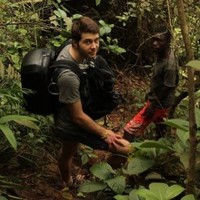
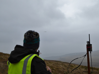
*Header photo: Parker Levinson, Point Blue Conservation Science

Conservation Director, Texas with National Audubon Society
- 0 Resources
- 4 Discussions
- 3 Groups
Margo Supplies - Wildlife Technology


- 0 Resources
- 39 Discussions
- 3 Groups

I am a scientist with research background in evolutionary-ecological genomics and have impact at the senate level to prevent a government viral biocontrol release. UK based and looking to connect with passionate dreamers ready to shift paradigms
- 0 Resources
- 3 Discussions
- 9 Groups

- @LauraKloepper
- | she/her
Associate Professor at the University of New Hampshire. Our research aims to uncover behavioral principles underlying acoustic sensing, inspire the design of active sensing technology, and improve population monitoring for animal conservation.
- 1 Resources
- 3 Discussions
- 5 Groups

Tech-Driven Conservation with a Wild Twist

- 0 Resources
- 1 Discussions
- 8 Groups
- 0 Resources
- 0 Discussions
- 14 Groups

Zoological Society London (ZSL)
Technical Project Manager in ZSL's Conservation Technology Unit


- 2 Resources
- 26 Discussions
- 7 Groups
- @Thorondor
- | He/Him
AI engineering working on cutting edge AI research and product for detecting objects. Big wildlife and conservation enthusiast and amateur wildlife photographer.
- 0 Resources
- 0 Discussions
- 2 Groups

Currently a data scientist in industry working on mechanistic models of risk, previously worked on modeling coral reefs. I am interested in the potential for emerging technologies and new ideas to help us solve environmental crises.
- 0 Resources
- 0 Discussions
- 14 Groups

- @Kasi
- | He/him
Game Rangers International
Kasi Amor Kalande is a young conservationist with experience in elephant movement research, GIS, and conservation technology.
- 1 Resources
- 0 Discussions
- 7 Groups
- @Phillip_Swart
- | He
I'm a conservationist working in the Vulture conservation space in South Africa with a huge passion for technology.
- 0 Resources
- 0 Discussions
- 18 Groups
- @Prabisha
- | she/her
Dedicated research scientist with over 8 years of experience in cartography, spatial analysis, and statistical modeling to tackle environmental, public health, and socio-economic challenges. Passionate about leveraging geospatial technology to drive impactful solutions.
- 0 Resources
- 0 Discussions
- 12 Groups
Article
Nature Tech for Biodiversity Sector Map launched!

Carly Batist and 1 more
Conservation International is proud to announce the launch of the Nature Tech for Biodiversity Sector Map, developed in partnership with the Nature Tech Collective!
1 April 2025
Link
deadtrees.earth

Elsa Carla De Grandi
An open database for accessing, contributing, analyzing, and visualizing remote sensing-based tree mortality data. Beta version
9 March 2025
Funding
Osa Conservation is launching our inaugural cohort of the ‘Susan Wojcicki Research Fellowship’ for 2025, worth up to $15,000 per awardee (award value dependent on project length and number of awards given each year)....
10 February 2025
Careers
SPOTS Internship Programme
Georg Strunck
Strategic Protection Of Threatened Species (NGO) is looking for engineering interns at the Dinokeng Game Reserve, South Africa
6 February 2025
Article

Over the years, a large number of developments have gone up in the area that I live in and the municipality is not doing what they should when it comes to upholding the laws that have been put in place to protect the...
20 January 2025
Careers
New PhD - Drones, seaweeds & climate change

Chris Yesson
A PhD opportunity for anyone interested in coastal drone surveys, seaweeds, climate change and the chance to do a whole bunch of different computer modelling including AI-driven species distribution modelling to assess...
30 December 2024
Link
AmazonTEC: 4D Technology for Biodiversity Monitoring in the Amazon (English)

Elsa Carla De Grandi
Interesting webinar on the use of advanced technologies(e.g. Artificial Intelligence, cloud computing, drones, camera traps and satellites) for biodiversity monitoring in the Amazon. Also available in Spanish.
25 November 2024
Careers
Computer Vision Developer

Ben Weinstein
We are hiring a computer vision developer at the University of Florida!
20 November 2024
Link
Great use of drones from Fauna&Flora's team
7 November 2024
Link
deadtrees.earth is an open-access platform hosting more than a thousand centimeter-resolution orthophotos, more than 300,000 ha. Combined with Earth observation data and machine learning it will enable to uncover tree...
2 November 2024
Careers

Seeking expressions of interest from PhD candidates to join the MAVE Lab at the University of Wollongong, NSW, Australia
26 August 2024
August 2024
July 2024
event

Wildlife Drones
33 Products
Recently updated products
| Description | Activity | Replies | Groups | Updated |
|---|---|---|---|---|
| Hi all! I recently did a little case study using RGB drone data and machine learning to quantify plant health in strawberries. I wanted to... |
|
Citizen Science, Conservation Tech Training and Education, Drones, Geospatial | 1 week 1 day ago | |
|
|
Latin America Community, Acoustics, AI for Conservation, Camera Traps, Drones, Early Career | 2 weeks 6 days ago | ||
| Hi Adam! Sounds like you have your work cut out for you. I have not used radar systems or AI systems for this sort of detection, but there are methods using change detection... |
|
AI for Conservation, Drones, Wildlife Crime | 1 month ago | |
| True, the US ecosystem is a challenging space right now, for basically all sectors. We should not let the US chaos prevent us from engaging with opportunities in other... |
|
AI for Conservation, Camera Traps, Connectivity, Drones, Emerging Tech, Ethics of Conservation Tech, Marine Conservation, Sensors | 1 month 1 week ago | |
| 15 years ago I had to rebuild the dams on a game reserve I was managing due to flood damage and neglect. How I wished there was an easier,... |
|
Drones, Conservation Tech Training and Education, Data management and processing tools, Emerging Tech, Geospatial, Open Source Solutions | 1 month 1 week ago | |
| My organization has been using our Autel EVO Ⅱ Dual 640T drone, equipped with a FLIR Long Wave Infrared (LWIR) sensor to map temperature... |
|
Drones | 1 month 1 week ago | |
| Hi @skirchgeorg , thanks for the additional info. We discuss again about this with my colleague and we were still hesitating with the drone, as it will still make some noise that... |
|
Drones, eDNA & Genomics | 1 month 3 weeks ago | |
| Good morning JocelynThank you very much for your comment, this is proving to be very useful advice and thank you so much for setting me on the right path!! This is very exciting!!... |
|
Animal Movement, Citizen Science, Human-Wildlife Conflict, Marine Conservation, Drones, Community Base, Geospatial | 1 month 4 weeks ago | |
| Hi Nikita, If you haven't already, I'd recommend reaching out to the folks at the Cornell Ornithology lab. They're really glued into all things bird. In particular, I... |
|
Animal Movement, Drones, Emerging Tech, Human-Wildlife Conflict | 2 months ago | |
| How much does it cost to incorporate machine learning into your conservation drone geospatial analysis? How does it speed up your workflow... |
|
Conservation Tech Training and Education, Drones, Geospatial, Open Source Solutions, Sensors, Software Development | 2 months 3 weeks ago | |
| We just wanted to share this news outside the core robotics community - hoping to connect more with conservationists, researchers,... |
|
AI for Conservation, Drones | 3 months 1 week ago | |
| @cmwainaina check this out |
|
Drones, Conservation Tech Training and Education, Geospatial | 4 months ago |


Able to Provide Movement Detection Software For Live Feed Video
16 January 2020 5:15am
15 March 2020 5:15pm
Hi Jessi,
I can check on the regulations for the specific area that is planned for a wildlife sanctuary in Zimbabwe. What altitude does the drone need to operate in? Does it require communications with any ground-based facility?
Ruth
15 March 2020 11:40pm
Hi Ruth,
Thanks for your email.
Essentially the software is only an advantage if the drones are being flown at altitudes that provide a wide area and less visible detail (i.e. if the operator flies at 3000ft (instead of 1000ft) it will cover 9x the area and see very small detail (which the software can pick up but the human eye may miss). In addition the software needs video feed from a computer (it sort of overlays the video) so it is only useful for drones that are able to relay decent quality video feed to a ground control station where an operator is viewing it live.
I have been advised that the drones that this is most useful for are likely to be at least 5kg (ie not the small toy ones that give video to a tablet).
I hope that helps? Please feel free to ask anything else and I will see what I can find out,
Jessi
#Tech4Wildlife 2020 Photo Challenge In Review

4 March 2020 12:00am
Call for Nominations: Tusk Conservation Awards

3 March 2020 12:00am
Hawai'i Conservation Conference
 Hawaiʻi Conservation Alliance
28 February 2020 12:00am
New Conservation Dataset with Thermal Infrared Images from Drones
26 February 2020 6:48pm
Drone Reforestation Tech for everyone
24 February 2020 12:04pm
Hacking Climate Change - Coaction on Climate Crisis
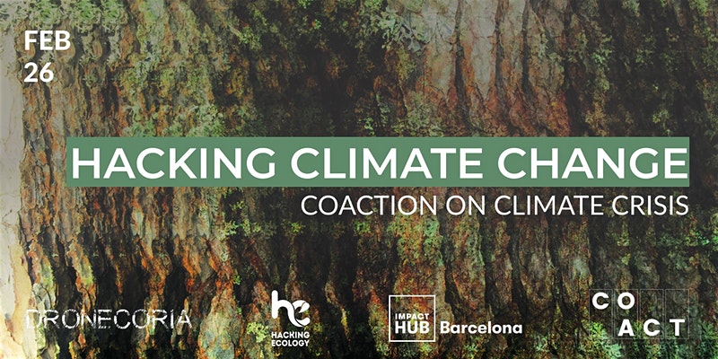 COACT
COACT
20 February 2020 12:00am
Habitat Restoration in the Pennines, UK
30 January 2020 8:48am
LIDAR USA sensor
14 January 2020 12:38pm
Thermal imaging, drones, and loggerhead sea turtles: a #tech4wildlife case study using FLIR's new Duo Pro R camera

21 September 2018 3:21pm
24 December 2019 6:42am
Rob thanks for the offer, sorry about delay in reply work has been in way. I have spoken to our coordinator here and we would be interested in borrowing flair 640 to see if it helps locate. Let me know he best way to get in touch.

2 January 2020 5:10pm
Hi thermal people,
Just a quick heads up, but I am exploring some of Seek Thermal's (ex FLIR engineers I believe) new Mosaic Core modules by having a play with their developer's kit. I'll report back once I receive the equipment, but their intention is to release 320 x 240 cameras at very low cost. Note - they won't sell them individually, so a reseller will be necessary, but if they are cost effective at this resolution it could prove excellent for wildlife conservation use.
https://www.thermal.com/uploads/1/0/1/3/101388544/mosaic_core_specification_sheet.pdf
Cheers,
Alasdair
2 January 2020 6:12pm
Cheers Al, and looking forward to hearing more about them. I am, as we speak, editing some thermal videos of wallaby behaviour near roads, specifically in relation to devices that activate lights and sounds when a car is approaching (activated by vehicle headlights at night). Used a Flir 640R, but I reckon half that resolution would still be fine. Unfortunately, not much support for the devices themselves working as a deterrent/warning (although I have some ideas on how they could with additional stimuli), but the thermal camera works great for non-invasive observations!
Image Processing Advice
22 October 2018 11:53am

13 November 2018 12:09pm
I just thought I would mention that i've been talking to Sol about his issue and also around multispectral and thermal sensors. No solution as yet to the issue but Sol will share some of his data with us so we can take a look.

28 November 2019 1:45am
Just wanted to mention I found a solution to my georeferencing issue. You can use the 'geosphere' package in R to identify the coordinates of specific coordinates in each image, based on the position of the central coordinate, bearing and distance to target pixel.
Feel free to drop me a line if you want a hand doing this!
28 November 2019 8:53am
Really useful to know about that package, thanks
[ARCHIVE] Virtual Meetup Discussion: Drones
19 November 2019 3:04pm
[ARCHIVE] WILDLABS Virtual Meetup Invitation: Drones
18 November 2019 4:35pm
WILDLABS Virtual Meetup Recording: Drones
 WILDLABS Team
9 November 2019 12:00am
How do you weigh a live whale?

9 October 2019 12:00am
Aerial Seeding with drones: reforestation Workshop in Brazil next November
2 September 2019 4:51pm
Tips to create a reforestation platform.
25 August 2019 11:37pm
[ARCHIVE] Promises and Pitfalls of Conservation Drones webinar (June 6)

3 June 2019 11:37am

22 August 2019 5:14pm
Is the webinar recorded and uploaded somewhere?

22 August 2019 5:24pm
It is indeed. You can watch it here:
https://consbio.org/products/webinars/scgis-webinar-promises-and-pitfalls-conservation-drones
I'll also see if we can add it to our resources area for ease of access. Leave it with me.
Workshop: Drones in the Coastal Zone
13 August 2019 12:00am
From the Field: Melissa Schiele
10 June 2019 12:00am
SALE: WingCopter HeavyLift drone, LiDAR, Multispektral camera, NextVision NightHawk
5 June 2019 10:20am
Circular Polarising Filters for the Mavic 2 Pro

29 April 2019 2:36pm

8 May 2019 7:23pm
I like the stuff Polar Pro puts out. I think they are some of the best you can get and it is what I use.

4 June 2019 3:31pm
Thank you for the tip! Shall try and pick up a set soon.
Drone flight in Indonesia
16 April 2019 12:08pm
17 April 2019 4:14pm
Hi Sophie,
The best thing would be to get in contact with the Department of Civil Aviation in the Indonesian state you're working in. You're right that you can fly without a permit for at low altitude in most places, but there may be diferent restrictions if the drone is used for research purposes so its worth checking. I received a license for drone work in Sabah (Malaysian Borneo) and they mainly wanted to know the drone specs, activities, flight coordinates, dates and if possible, times. The only restriction they gave us was to fly below 300 m,
There is usually a lot of back and forth between departments about who is ultimately responsible but they should be able to get it processed, as there are groups in Kalimantan using drones pretty regularly. Please let me know if you have any issues or need any other info.
Best wishes,
Sol
18 April 2019 5:07pm
Thanks so much Sol! How long did it take you to get permission to fly? And were there any costs associated with getting the permit?
4 June 2019 1:33pm
Hi Sophie,
Sorry- I only just saw your reply!
It took about 3 months to get it through the department of civil aviation, but this doesn't mean much, because the Indonesian system may be pretty different. It cost 250RM (£50) for each drone.
Cheers,
Sol
Canopy height mapping with drones

31 May 2019 12:00am
Technology for Wildlife and the Looming Spectre of E-Waste
3 May 2019 12:00am
WILDLABS Virtual Meetup: Low Cost, Open-Source Solutions
WILDLABS Team
18 March 2019 12:00am
#Tech4Wildlife Photo Challenge: Our Favourites from 2019
3 March 2019 12:00am
Using Swiss AI and Drones to Count African Wildlife
18 February 2019 12:00am
Getting up close and personal with Antarctica's orcas
4 February 2019 12:00am
Drones with thermal imaging
21 January 2019 10:34am
11 March 2020 3:22am
Hi Ruth,
Thanks for your reply and the suggestion.
I contacted air shepherd and a few similar groups a few moths ago and they were all saying they are not interested due to the difficult drone regulations. Hopefully the regulations are not as arduous in Zimbabwe?
Please don't hesitate to ask if there is any technical information or assistance that I can provide to help with your project,
Jessi Hargrave