In recent years, drone technologies have been explored for a range of applications in conservation including (but not limited to) mapping, biodiversity inventories, antipoaching patrols, wildlife tracking, and fire monitoring. The rise of customizable, open-source drones like those of ArduPilot and OpenROV hold promise for more effective conservation applications, and combined with other monitoring sensors and devices, they are capable of collecting high-resolution data quickly, noninvasively, and at relatively low cost.
However, challenges remain in putting these tools to use. A recent paper reviewing 256 conservation drone projects highlighted some of these major obstacles, ranging from unintended social and ecological consequences of drone operations to still prohibitive costs, both in terms of hardware and in terms of storing and processing large volumes of data. The longstanding challenge of power/battery life remains as well.
If you're considering trying out drones for yourself, and want to explore the possibilities and understand the major conversations happening around this technology, check out these beginner's resources and conversations from across the WILDLABS platform:
Three Resources for Beginners:
- Conservation Technology User Guidelines Issue 5: Drones, World Wildlife Fund | Drones, best practices, ethics, regulations, case studies
- WILDLABS Virtual Meetup Recording: Drones, Craig Elder, Dr. Claire Burke, and Gabriel Levin | Drones, thermal camera, wildlife crime, ML, biologging
- New Paper: Drones and Bornean Orangutan Distribution, Sol Milne | Drones, data analysis, citizen science, community science, primates
Three Forum Threads for Beginners:
- Curious about radio-tracking with drones? | Wildlife Drones, Biologging (5 replies)
- Drones for GIS Best practice Document | Adrian Hughes, Drones (10 replies)
- WWF Conservation Technology Series: Drones in Conservation | Aurélie Shapiro, Drones (7 replies)
Three Tutorials for Beginners:
- How do I use a drone to capture radio-tracking data? | Debbie Saunders, Tech Tutors
- How do I choose the right drone for my conservation goals? | Shashank Srinivasan, Tech Tutors
- How do I strategically allocate drones for conservation? | Elizabeth Bondi, Tech Tutors
Want to know more about using drones, and learn from experts in the WILDLABS community? Make sure you join the conversation in our Drones group!
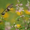
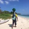
*Header photo: Parker Levinson, Point Blue Conservation Science
Ecodash.ai is an artificial intelligence platform for ecological modeling, design, and restoration.

- 0 Resources
- 4 Discussions
- 7 Groups
- 0 Resources
- 1 Discussions
- 6 Groups

Zoological Society London (ZSL)
I am a benthic ecologist using low-cost tech to explore seabed habitats in temperate and cold water.

- 1 Resources
- 10 Discussions
- 4 Groups

- @Tim_Hofmeester
- | he/him
Swedish University of Agricultural Sciences
Researcher studying human-wildlife coexistence -- Camera trapper
- 4 Resources
- 1 Discussions
- 5 Groups
- @CourtneyShuert
- | she/her
I am a behavioural ecologist and eco-physiologist interested in individual differences in marine mammals and other predators

- 0 Resources
- 7 Discussions
- 9 Groups

- @mattaudette
- | he, him, his
Software Tester and Test Automator at Wildlife Protection Solutions
- 0 Resources
- 1 Discussions
- 24 Groups

- @williams
- | He/Him
I am a conservationist specializing in endangered species, particularly vultures. As the Endangered Species Conservation Coordinator/Co-Founder at Biota Conservation Hub Foundation (BiotaCHF), I have conducted extensive research/conservation of vultures and other water birds.
- 0 Resources
- 0 Discussions
- 14 Groups
Wildlife Protection Solutions (WPS)
- 0 Resources
- 0 Discussions
- 8 Groups
- @KathHecht
- | she/her
I am a biologist/ecologist without concrete specialisation. New Zealand's unique but fragile flora & fauna have taught me the importance of increasing awareness with locals and visitors alike. This is my constant motivator.
- 0 Resources
- 0 Discussions
- 10 Groups

- @aniyaz533
- | Niyaz
A keen willdlife biologist looking forward to work on Otters ecology in Himalayan landscape
- 0 Resources
- 0 Discussions
- 5 Groups

- @kricherds
- | she/her
Technologist. Civic Science Fellow & Data Inclusion Specialist at OEDP.
- 0 Resources
- 0 Discussions
- 14 Groups

- 0 Resources
- 0 Discussions
- 6 Groups
Article
Nature Tech for Biodiversity Sector Map launched!

Carly Batist and 1 more
Conservation International is proud to announce the launch of the Nature Tech for Biodiversity Sector Map, developed in partnership with the Nature Tech Collective!
1 April 2025
Link
deadtrees.earth

Elsa Carla De Grandi
An open database for accessing, contributing, analyzing, and visualizing remote sensing-based tree mortality data. Beta version
9 March 2025
Funding
Osa Conservation is launching our inaugural cohort of the ‘Susan Wojcicki Research Fellowship’ for 2025, worth up to $15,000 per awardee (award value dependent on project length and number of awards given each year)....
10 February 2025
Careers
SPOTS Internship Programme
Georg Strunck
Strategic Protection Of Threatened Species (NGO) is looking for engineering interns at the Dinokeng Game Reserve, South Africa
6 February 2025
Article

Over the years, a large number of developments have gone up in the area that I live in and the municipality is not doing what they should when it comes to upholding the laws that have been put in place to protect the...
20 January 2025
Careers
New PhD - Drones, seaweeds & climate change

Chris Yesson
A PhD opportunity for anyone interested in coastal drone surveys, seaweeds, climate change and the chance to do a whole bunch of different computer modelling including AI-driven species distribution modelling to assess...
30 December 2024
Link
AmazonTEC: 4D Technology for Biodiversity Monitoring in the Amazon (English)

Elsa Carla De Grandi
Interesting webinar on the use of advanced technologies(e.g. Artificial Intelligence, cloud computing, drones, camera traps and satellites) for biodiversity monitoring in the Amazon. Also available in Spanish.
25 November 2024
Careers
Computer Vision Developer

Ben Weinstein
We are hiring a computer vision developer at the University of Florida!
20 November 2024
Link
Great use of drones from Fauna&Flora's team
7 November 2024
Link
deadtrees.earth is an open-access platform hosting more than a thousand centimeter-resolution orthophotos, more than 300,000 ha. Combined with Earth observation data and machine learning it will enable to uncover tree...
2 November 2024
Careers

Seeking expressions of interest from PhD candidates to join the MAVE Lab at the University of Wollongong, NSW, Australia
26 August 2024
July 2024
event

Wildlife Drones
33 Products
Recently updated products
| Description | Activity | Replies | Groups | Updated |
|---|---|---|---|---|
| Hi all! I recently did a little case study using RGB drone data and machine learning to quantify plant health in strawberries. I wanted to... |
|
Citizen Science, Conservation Tech Training and Education, Drones, Geospatial | 1 week 1 day ago | |
|
|
Latin America Community, Acoustics, AI for Conservation, Camera Traps, Drones, Early Career | 2 weeks 6 days ago | ||
| Hi Adam! Sounds like you have your work cut out for you. I have not used radar systems or AI systems for this sort of detection, but there are methods using change detection... |
|
AI for Conservation, Drones, Wildlife Crime | 1 month ago | |
| True, the US ecosystem is a challenging space right now, for basically all sectors. We should not let the US chaos prevent us from engaging with opportunities in other... |
|
AI for Conservation, Camera Traps, Connectivity, Drones, Emerging Tech, Ethics of Conservation Tech, Marine Conservation, Sensors | 1 month 1 week ago | |
| 15 years ago I had to rebuild the dams on a game reserve I was managing due to flood damage and neglect. How I wished there was an easier,... |
|
Drones, Conservation Tech Training and Education, Data management and processing tools, Emerging Tech, Geospatial, Open Source Solutions | 1 month 1 week ago | |
| My organization has been using our Autel EVO Ⅱ Dual 640T drone, equipped with a FLIR Long Wave Infrared (LWIR) sensor to map temperature... |
|
Drones | 1 month 1 week ago | |
| Hi @skirchgeorg , thanks for the additional info. We discuss again about this with my colleague and we were still hesitating with the drone, as it will still make some noise that... |
|
Drones, eDNA & Genomics | 1 month 3 weeks ago | |
| Good morning JocelynThank you very much for your comment, this is proving to be very useful advice and thank you so much for setting me on the right path!! This is very exciting!!... |
|
Animal Movement, Citizen Science, Human-Wildlife Conflict, Marine Conservation, Drones, Community Base, Geospatial | 1 month 4 weeks ago | |
| Hi Nikita, If you haven't already, I'd recommend reaching out to the folks at the Cornell Ornithology lab. They're really glued into all things bird. In particular, I... |
|
Animal Movement, Drones, Emerging Tech, Human-Wildlife Conflict | 2 months ago | |
| How much does it cost to incorporate machine learning into your conservation drone geospatial analysis? How does it speed up your workflow... |
|
Conservation Tech Training and Education, Drones, Geospatial, Open Source Solutions, Sensors, Software Development | 2 months 3 weeks ago | |
| We just wanted to share this news outside the core robotics community - hoping to connect more with conservationists, researchers,... |
|
AI for Conservation, Drones | 3 months 1 week ago | |
| @cmwainaina check this out |
|
Drones, Conservation Tech Training and Education, Geospatial | 4 months ago |


Viral bear video shows how drones threaten wildlife – and what to do about it

22 November 2018 12:00am
Infrared filters for drone cameras

3 August 2017 11:17am

23 May 2018 9:41am
Hi Thom,
Did you have any luck with the DIY sensor?
Sam
10 November 2018 11:40am
If you need a piece of exposed (black) film then please get in touch. I still take "real" slides and have a few black frames at start and end of each roll of film.
Drones, Orangutans, and Strangler Figs in Malaysian Borneo

22 October 2018 12:00am
Multispectral Cameras

27 September 2018 2:38pm
Underwater Robot Trained to Kill Coral-Destroying Reef Starfish

18 September 2018 12:00am
Thermal imaging, drones, and sea turtles: a case study using FLIR’s new Duo Pro R camera
23 August 2018 12:00am
Drone Applications in Water Quality Research?

14 March 2018 4:42pm

16 March 2018 5:49am
Hi Ned,
Thank you so much for your response!
I absolutely agree- going out and testing flights over water at different angles and times of the day would be best. I'll look into a polarizing filter. I have spoken with some colleagues who recommend flying between noon and 3pm, and also that a cloudy day with diffused light can actually be quite helpful to avoid glint. I will look into the oil spill mapping - sounds very interesting. I've also heard that drones are sometimes restricted from oil spill regions due to risks of battery-caused fires (if the drones fall into the water).
Ved! Fantastic idea. I used to work with him down at Ames, so I will certainly reach out. Thank you for the reminder!
Cheers,
Chippie
6 June 2018 6:48pm
Hi CHippie - I am wondering how your thoughts are progressing on this topic? Please let us know an update.
Thanks
Michael
9 June 2018 12:10am
Hi Michael!
Thanks so much for following up. I have yet to really get my feet wet with drones & algal blooms (my water quality issue of interest at the moment), but what I gathered from my literature review is that hyperspectral cameras are a much more precise option than multispectral cameras for algal identification. I'm hoping to try out a red-edge camera to see if there is anything spectrally interesting, as I do not currently have access to a hyperspectral camera. For the time being, I am hoping to play with a MicaSense camera over wet habitat and see if anything can be observed. I'll keep you posted if I find anything of interest!
Thanks,
Chippie
From drone swarms to tree batteries, new tech is revolutionising ecology and conservation
 Euan Ritchie
and 1 more
Euan Ritchie
and 1 more
9 May 2018 12:00am
Tethered UAVs
14 March 2018 4:29pm

27 April 2018 11:46pm
Thanks - I did look into blimps but the helium problem is a big one for remote work. I do have a couple UAVs but the area I work is tricky (airport, waterdrome, and helicopter landing with occasional ships that carry helicopters). my hope was for a tethered solution that could run for longer than the 20min battery life of a drone. thanks for the info.
27 April 2018 11:53pm
thanks I adnt thought of kites - I will have to test one in the field this year. I imagined one of the advantages of a tethered UAV is that I can parasitize all the camera elements (gimble stabilization, pan/tilt/zoom, and real time viewing of the imagery). Maybe I could just secure a cheap UAV under a kite... I wonder how I choose the correct kite size.
28 April 2018 5:13pm
hi Stephen,
Kites have gimbals too (ranging from simple strings to metal rigs) and you can connect to a camera much like a drone. In my case I have a gimbal hanging on a string, and to connect to my camera I get live connection and can change settings with the GoPro app! this website has lots of info - size of the kite depends on payload (some people fly SLRs!) and wind.
Www.kapshop.com
Eddy Expedition Log: Characterizing Eddies
23 April 2018 12:00am
Eddy Expedition Log: Chasing Eddies
10 April 2018 12:00am
Eddy Expedition Log: Setting Off to Explore Eddies
3 April 2018 12:00am
#Tech4Wildlife Photo Challenge 2018: Our Top 10
3 March 2018 12:00am
Online Course: Drones for Land Trust Monitoring and Management with Duke Marine Robotics & Remote Sensing Lab
25 January 2018 12:00am
Technology Empowered Conservation Lecture Series
18 January 2018 12:00am
"harvesting" camera traps, bioacoustic sensors via drones
3 November 2017 4:12pm

15 November 2017 7:05pm
NASA/NOAA did something like this with microbuoys for ocean temp sensing in the arctic - drone deploys (drops) micrbuoys and repeatedly returns to fly over fetching data over the following days and weeks
http://www.arcticobservingsummit.org/sites/arcticobservingsummit.org/files/Bradley_Microbuoys_AOS.pdf
Do you have a specific use case /location in mind?
If we could find research funding I'd be interested, I can fly &build UAS but this is also an interesting data management opportunity which I'm very interested in.
Perhaps you could mod the Ardupilot tracking antenna system if really needed but if you're flying in the vicinity with line of sight I bet you don't even need to aim the antenna
17 November 2017 2:31am
I've seen a couple of papers on similar capabilities, both with airborne drones as well as underwater drones, so there've been folks working on it. @emjay has a good point that the sensor nodes need to support this, which could be a bit tricky depending on your tolerance for battery life. What types of sensors are you thinking about supporting?

21 December 2017 3:48am
Hi Chris,
Your project sounds interesting! How's it coming along?
I'm based in the SF Bay Area. I don't have much drone experience, but it's something that I've been looking into recently. I'm currently working on a face recgnition system for brown bears with a bear researcher in BC, Canada. The goal is to identify bears on the data from camera traps to monitor populations and such. Currently the data is only collected a few times a season.
I agree with @emjay that the ground assets may be an issue. Do you have any thoughts on that front?
In any case, if you have some time in the coming weeks, I'd be happy to get together in the coming weeks to talk it over.
Ed
Drones: the pros and cons for community-based monitoring

10 December 2017 12:43pm
How The San Diego Zoo Is Using AI And Drones To Save Polar Bears
30 November 2017 12:00am
Kids, Drones & Science At The Water’s Edge
4 October 2017 12:00am
New paper on using drones in challenging environments
24 August 2017 9:04am

24 August 2017 4:57pm
Excellent - started reading this yesterday. This is a very timely and pertinent paper. Thanks for sharing.
Drone Tracker

23 August 2017 6:47am
24 August 2017 2:54am
Hi Lot,
Thank you for your input. Currently we are the end user instead of developer. That means, we are still using commercial drone like DJI series. However the link that you give absolutely useful for our upcoming innovation plans.
Since we still using commercial type quadcopter, I'm looking for stand alone tracker that work as seperate system from the drone. In other words, this tracker will not be affected should the drone system crash.
So far me and my team come across this device
http://www.dronesmadeeasy.com/Marco-Polo-Drone-Tracker-RF-Recovery-p/marco_polo_1.htm
Unfortunately, the radio signal frequency range so far not approved by Malaysian authority. So, I'm looking for other option.
Anyone in this forum have other option/ opinion?
Regards,
Mazidi
24 August 2017 6:51am
Hi Mazidi,
A couple of options;
- Marco Polo. http://eurekaproducts.com/rc-model-tracking-and-recovery/
I know of people who have relocated their machine using this device.
- Conventional VHF for wildlife tracking. old but solid technology.
Also have a look at commercial / open source devices used for model rockets.
regards
MJ
EDIT: I see that you have already identified Marco Polo.

24 August 2017 1:15pm
Hi Mazidi, all the systems that I recommended are separate systems with their own GPS, not connected to the drone.
Just the last one was the only finished product.
Good luck. Please tell us if you found something good and cheap!
A first-person account of the capture of a tiger in Pilibhit: Four elephants and a bulldozer, as seen from a drone

10 August 2017 12:00am
[ARCHIVE] Funding Opportunity: Leverage space technology for wildlife protection

6 July 2017 12:58pm
[ARCHIVE] OpenAerialMap
19 June 2017 10:54am
28 June 2017 5:27pm
For those who couldn't make it to the webinar, there's a recording at https://drive.google.com/file/d/0B0smOWFNRzuoLXpPSWREUnE2YzA/view. What do people think? Is this the future of aerial imagery data management?
Best Practice for Using Drones for Conservation: Let's create a living guidelines document
3 February 2017 10:13am
3 April 2017 8:45am
There's also GitLab. Again, it's probably not perfect as it's designed for coding, but I'm currently using it with a conference organising committee.

3 April 2017 9:44am
I personally think a wiki would be best.

23 June 2017 5:23pm
People in this thread might be interested in this special issue of remote sensing in ecology and conservation, looking for papers on "New Approaches to Citizen Science". Submissions close 15th July
http://zslpublications.onlinelibrary.wiley.com/hub/journal/10.1002/(ISSN)2056-3485/journal-menu/call-for-papers.html
OpenDroneMap
3 April 2017 9:24am
8 April 2017 5:56pm
Hi Thomas,
I tested it with some success, Pix4D offers more quality but ODM is doing the job quite well.
Since the process is quite demanding I will recomend you to execute ODM nativelly without virtual machine.
Maybe you can go directly for webODM:
https://github.com/OpenDroneMap/WebODM
19 June 2017 10:51am
Thanks @Lot ; I did try looking at WebODM but I even found this to be quite a convoluted process to get running. I've just volunteered as a tester for a new Windows one-click install for WebODM, so I'll take a look this week and feed back on this thread.
19 June 2017 11:20am
Cool! Thanks @Tomas Starnes.
Meanwhile, http://precisionmapper.com/ has adopted the freemium model, so the first 60 maps by year are free, It's not open source but its free. I tried and works well, the 2d maps are perfect, the 3D digital model of terrain it's not the best but it's ok.
Ground Control Points
19 May 2017 2:49pm
30 May 2017 8:47am
Hey @ahughes_rspb , thanks for starting this thread! It would be really useful to share experience on GCPs in particular. We're about to start experimenting by processing images with and without GCPs, but I expect that others are ahead of us with this. I'm particularly interested in point 4 - how much to GCPs affect the vertical accuracy of DSMs? Any advice?
From the Field: Eric Becker and designing sensors for wildlife
22 May 2017 12:00am
UAV for surveying river dolphins in the Amazon
14 February 2017 5:40pm
7 April 2017 4:00pm
Many thanks Tom. Your tips were very useful.
Have a look on the video with subtitles.
https://vimeo.com/208864580
By the way, conservationdrones is a partner and will work on the algorithm.
Cheers
7 April 2017 4:04pm
Many thanks indeed.
Please have a look at this video: https://vimeo.com/208864580
here you can see how we are working on the project.
Cheers
26 April 2017 2:50pm
Hi Marcelo,
To improve autonomy, you'll either need less weight on your drone, better batteries, or what about a fixed wing aircraft? Look at the parrot disco - it's much cheaper than the eBee, and you can outfit it with a downward facing camera instead of the forward, though it seems from your video, the one it has is fine). Those things can fly much longer than copters.
best,
aurélie
Aerial seeding with drones
19 April 2017 1:09pm

19 April 2017 2:35pm
This is really fascinating! This could also be potentially useful as a way to distribute vaccines for wildlife and livestock!
22 August 2017 3:09am
Although not for NDVI but worth a mention for anyone looking at converting a camera into IR only.
I have had sucess using a DIY filter made out of blank processed camera film from a disposable camera. So long as you can still find somewhere to process the film (or do it yourself) you just cut the processed film (negatives) and replace the digital cameras IR filter (placed over the cameras sensor). This will simply turn the camera into an IR camera only so won't fit your requirement for NDVI but thought that it is worth posting if others are looking at converting a camera or Go-Pro into an IR camera.