Group curators

Elsa Carla De Grandi
Fauna & Flora

Catherine Breen
- @cbreen
- | she/her
Tanner Corless Smith
- @tcsmith
- | he/him
Who We Are
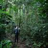
Geospatial data and analysis is critical for conservation, from planning to implementation and measuring success. Every day, mapping and spatial analysis are aiding conservation decisions, protected areas designation, habitat management on reserves and monitoring of wildlife populations, to name but a few examples. The Geospatial group focuses on all aspects of this field, from field surveys to remote sensing and data development/analysis to GIS systems.
The ability to visualize and analyze spatial data underpins many areas of conservation, this group may serve as a landing point and gateway for those new to conservation technology. Through promotion of learning resources, and aforementioned groups of overlapping interest, this group can expand the horizons of newcomers and deepen the knowledge of veterans.
How to Get Started
Want to learn more about how remote sensing is used in conservation? Check out the first two episodes of this season of Tech Tutors, where our Tutors answer the questions How do I use open source remote sensing data to monitor fishing? and How do I access and visualise open source remote sensing data in Google Earth Engine? You can also check out our Virtual Meetup Archive for a range of panels that overlap with Geospatial topics, or take a look at our Earth Observation 101 lecture series from Dr. Cristian Rossi.
Our Purpose
The WILDLABS Geospatial Group is for conservation practitioners, geospatial analysts, and academics who want to:
- Share geospatial resources, best practices, data, and ideas;
- Network amongst geospatial and data practitioners;
- Create peer learning opportunities;
- Promote the use of free and open-source geospatial software; and
- Improve the use of GIS software and geospatial analyses in conservation management and research.
Group curators
Fauna & Flora
Remote Sensing Scientist, Conservation Technology & Nature Markets @ Fauna & Flora - WILDLABS Geospatial Group Co-Lead


- 42 Resources
- 49 Discussions
- 9 Groups
- @cbreen
- | she/her
wildlife ecologist and snow scientist
- 0 Resources
- 0 Discussions
- 4 Groups
- @tcsmith
- | he/him
I am a conservation biologist interested in modeling social-ecological systems.
- 0 Resources
- 0 Discussions
- 11 Groups
No showcases have been added to this group yet.
WILDLABS & Wildlife Conservation Society (WCS)
I'm the Bioacoustics Research Analyst at WILDLABS. I'm a marine biologist with particular interest in the acoustics behavior of cetaceans. I'm also a backend web developer, hoping to use technology to improve wildlife conservation efforts.


- 41 Resources
- 38 Discussions
- 34 Groups
- 0 Resources
- 0 Discussions
- 5 Groups

- @Javan_INITIAM
- | He/Him/His
INITIAM - Initiative Technologique Intelligente Améliorée / Enhanced Smart Technology Initiative & World Wide Fund for Nature/ World Wildlife Fund (WWF)
Javan BUTIRA is a young Congolese leader committed to technological innovation, sustainable development, and social entrepreneurship. As the Principal Coordinator and Executive Director of INITIAM (Enhanced Intelligent Technological Initiative), I lead several innov projects.

- 1 Resources
- 5 Discussions
- 28 Groups
My name is Sean Hill and I have been using off the shelf consumer drones and open source photogrammetry and Geographic Information Systems Software (GIS) since 2019 for conservation purposes. As of 2024 I have started an online training platform called GeoWing Academy


- 1 Resources
- 23 Discussions
- 6 Groups

- @HeinrichS
- | he/him
Conservation tech geek, custodian (some say owner) and passionate protector of African wildlife, business systems analyst.

- 0 Resources
- 29 Discussions
- 6 Groups

- @carlybatist
- | she/her
ecoacoustics, biodiversity monitoring, nature tech


- 113 Resources
- 361 Discussions
- 19 Groups
- @tcsmith
- | he/him
I am a conservation biologist interested in modeling social-ecological systems.
- 0 Resources
- 0 Discussions
- 11 Groups

- @LeanneTough
- | She/Her
GIS Specialist working for WWT, the charity for wetlands and wildlife
- 0 Resources
- 1 Discussions
- 2 Groups

- @jennamkline
- | She/Her
Imageomics Institute & ABC Global Climate Center
PhD Student @ OSU, Edge AI for Adaptive Animal Ecology Field Studies

- 1 Resources
- 7 Discussions
- 7 Groups
- @rhys
- | He/Him
Imperial College London & CEH

- 0 Resources
- 0 Discussions
- 17 Groups

- @ahmedjunaid
- | He/His
Zoologist, Ecologist, Herpetologist, Conservation Biologist


- 75 Resources
- 7 Discussions
- 16 Groups

- @cpagniel
- | Dr/she/her/elle
Dr. Camille Pagniello leads the Marine Innovation Lab for Leading-edge Oceanography (MILLO) in the Department of Ocean and Resources Engineering at the School of Ocean and Earth Science and Technology (SOEST), University of Hawaiʻi at Mānoa.
- 2 Resources
- 0 Discussions
- 13 Groups
Link
The library enables to derive biophyiscal maps with a few lines of code (only requirements: region of interest, temporal domain and satellite sensor). All processing runs in the cloud using the openEO API and hence no...
20 October 2024
Link
CoastSat
20 October 2024
Link
stagg (R package).
20 October 2024
Link
Spatial Statistics for Data Science: Theory and Practice with R. (Book).
20 October 2024
Link
arcgisbinding (R package).
20 October 2024
Article
GEO COP16 Pavillion
Elsa Carla De Grandi
Oct, 21 - 31 2024 (Blue Zone - Cali, Colombia)
18 October 2024
Article
LEAPs and bounds

Cassie Anderson
How better spatial data reduces nature risk for business
14 October 2024
Link
MAAP #217: Carbon across the Amazon (part 2): Peak Carbon Areas
Elsa Carla De Grandi
The report showcases how remote sensing, Planet Forest Carbon Diligence product, can be used to identify peak carbon areas. Peak carbon areas could be excellent candidates for the HIFOR initiative, a new financing...
11 October 2024
NASA ARSET Fundamentals of Remote Sensing


NASA ARSET Fundamentals of Remote Sensing
NASA ARSET Fundamentals of Remote Sensing


Drone Photogrammetry & GIS Intermediate Course

Drone Photogrammetry & GIS Intermediate Course
Drone Photogrammetry & GIS Intermediate Course
Drone Photogrammetry & GIS Advanced Course

Drone Photogrammetry & GIS Advanced Course
Drone Photogrammetry & GIS Advanced Course
Drone Photogrammetry & GIS Introduction (Foundation) Course
Drone Photogrammetry & GIS Introduction (Foundation) Course
Drone Photogrammetry & GIS Introduction (Foundation) Course
GIS E-learning Course 1: What is GIS and why should you care?


GIS E-learning Course 1: What is GIS and why should you care?
GIS E-learning Course 1: What is GIS and why should you care?


GIS E-learning Course 2: Introduction to QGIS
GIS E-learning Course 2: Introduction to QGIS
GIS E-learning Course 2: Introduction to QGIS


GIS E-learning Course 4: Becoming Confident in Spatial Analysis & Geoprocessing
GIS E-learning Course 4: Becoming Confident in Spatial Analysis & Geoprocessing
GIS E-learning Course 4: Becoming Confident in Spatial Analysis & Geoprocessing

GIS E-learning Course 3: Introduction to ArcGIS Pro
GIS E-learning Course 3: Introduction to ArcGIS Pro
GIS E-learning Course 3: Introduction to ArcGIS Pro
September 2025
event

Ideal Workplace Solutions
October 2025
event

Lacey Hughey and 3 more
November 2025

event

Brigitta Keeves
March 2026

July 2025
event
Elsa Carla De Grandi and 2 more
event

Ginevra Bellini
June 2025
event

Joel Masselink
event
Nalini
131 Products
Recently updated products
| Description | Activity | Replies | Groups | Updated |
|---|---|---|---|---|
| I'm a software developer with the British Trust for Ornithology (BTO), working on online map-based applications for bird surveys (e.g. BirdTrack). My main focus is the... |
|
Geospatial | 8 years 7 months ago | |
| Hey MGatta, I'm working with adehabitatLt as well, i have a good paper on spatial referencing your data and changing your coordinates to UTM, if you want it (by C.J.... |
|
Geospatial | 8 years 8 months ago | |
| Hello all, I came across this website featuring free vector and raster datasets. Feel free to use it! |
|
Geospatial | 8 years 9 months ago | |
| Now the course is officially over, I wonder how people found it? Too difficult, too easy or just right? |
|
Geospatial | 8 years 10 months ago | |
| I'm not affiliated with Google or this event, but I thought it would be of interest to the community. I have previously attended and it... |
|
Geospatial | 9 years 2 months ago | |
| Things just got a whole lot easier for those of us at universities who train students to use drones as tools for conservation. Many... |
|
Geospatial | 9 years 3 months ago | |
| Another option is OruxMaps, free for android, not very intuitive but very powerful. But it's important to bear in mind that phone GPS accuracy can be lower than... |
|
Geospatial | 9 years 4 months ago | |
| ZSL is holding a remote sensing symposium on the 29th April, 2016: Space - the final frontier for biodiversity monitoring?... |
|
Geospatial | 9 years 4 months ago | |
| Hello all, This blog immediately make me think of our community and the possibilities for one of our members to provide a solution.... |
|
Geospatial | 9 years 5 months ago | |
| Thank you. I am doing pre reading and Information gathering, so I'll know what to expect and be prepared. Thank you for your kind answer Stephanie. |
|
Geospatial | 9 years 5 months ago | |
| Hello all - this paper looks highly relevant to this thread. "Satellite alerts track deforestation in real time: System uses... |
|
Geospatial | 9 years 6 months ago | |
| Advance Object-Based Classification of Delta Region Sindh. A project completed by COGE team. If you have any queries please contact :... |
|
Geospatial | 9 years 6 months ago |


New Group Proposal: Systems Builders & PACIM Designers

18 June 2025 2:52pm

19 June 2025 1:43pm
Thank you for your reply, Chad
I meant 10 as a whole, indeed. Perhaps you see your post in one group, but since it is tagged for all groups, I assumed you meant 10 in total.
In your first post you explain PACIM stands for "Projects, Assignments, Campaigns, Initiatives, Movements, and Systems", so I understood it as more than just projects. Obviously, many things can be packed into a project or called a project, but then, what does it mean that 'Projects' is part of the list?
Well, if you think 10 projects is doable, then don't let me stop you.

1 September 2025 2:51pm
hi chad, its great to hear from you_its really a great idea and impactful journey in our community
having experience in community-led conservation initiatives, working and leading in community based conservation @nature_embassy as the leader (found on insta and other social pages),
i will be glad to be part of the group, thankyou
Geospatial 2025-2026: Event Ideas and Community Needs
Tanner Corless Smith
and 2 more
29 August 2025 7:52pm
Anyone at Geo for Good NYC?

25 August 2025 12:06am
FOSS4G NA 2025
22 August 2025 2:18pm
Resource Conservation Technician
21 August 2025 7:46pm
Wildland Restoration Tech
21 August 2025 7:40pm
Online Ocean-Focused GIS Course

8 August 2025 2:53pm

20 August 2025 4:09pm
Very interesting. Thanks for sharing
Anyone using InVEST?
10 July 2025 1:31pm
7 August 2025 7:40pm
Elsa,
We have been working with InVEST for a number of years. We have found them helpful for conservation and scenario planning. Happy to share as helpful.
John
8 August 2025 2:23pm
Hi Elsa,
We have used InVEST for a pollinator project we supported (the crop pollination model - details here), and looking to using it more for marine and coastal applications so really appreciate the details you shared here!
Cheers,
Liz

20 August 2025 1:27am
We're going to try it for a NatCap assessment this year, but no previous experience with it.
QGIS Intro Course

18 August 2025 8:36am

Updates on Mole-Rat Mystery Drone Project
10 June 2025 10:21am
10 June 2025 6:04pm
Such a great case study!!
12 June 2025 11:33am
Thank you Elsa :)
14 August 2025 6:07am
want to join 2025 contest for humpback whale photos in Juneo Alaska of Kelp
WOOHOO ITS WORKING!! Tech finds undetected decades old Alien Invasive Parent Plants in indigenous forest!
24 July 2025 12:21pm
13 August 2025 2:06pm
This is awesome!!
AI for Conservation Office Hours: 2025 Review
 Jake Burton
and 1 more
Jake Burton
and 1 more
6 August 2025 2:16pm
The RCoE Geoportal
5 August 2025 9:33pm
RCoE Data Geoportal
Regional Centre of Excellence (RCoE) for Forests, Biodiversity and Seascape Ecosystems Management, its implemented by RCMRD & CIFOR

Trase and ClientEarth provide guidance on using geospatial data to enforce and comply with the EUDR
5 August 2025 9:07pm
Trase and ClientEarth provide guidance on using geospatial data to enforce and comply with the EUDR - Insights - Trase
Existing publicly available geospatial data can help companies and competent authorities meet the requirements of the EU deforestation regulation, according to a report by Trase commissioned by ClientEarth. But it is important that they are aware of how best to use it.

Global Forest maps for year 2020 in support to EUDR
5 August 2025 9:02pm

GIS and AI on deforestation and Climate Change

29 July 2025 3:10pm
29 July 2025 4:02pm
Hi Sebastine! Thanks for sharing this. What are you looking for from the WILDLABS community? (Collaborators, advice, networking, etc.)
5 August 2025 7:30pm
Would be interested to learn more! What data, software and tools are you using to build your models?
Remote Sensing for Forest Monitoring Event
5 August 2025 4:35pm
5 August 2025 7:00pm
3D Maps for conservation

1 August 2025 2:42pm
4 August 2025 6:17pm
Hi Olivier! I'm Alex from the WILDLABS community team. Thank you for sharing EcoTeka! I made a page for it on The Inventory, our wiki-style database of conservation technology tools, R&D projects, and organizations. The Inventory is an essential resource for people in the community to learn about what tools are available for their work.
As an owner of Ecoteka, I encourage you to edit this page to make it as accurate as possible! You can also become a "key contact" for EcoTeka so the WILDLABS community knows who to contact with any questions! To learn more about how to edit a page and become a key contact, read our user guide here. Reach out to myself or @JakeBurton for any troubleshooting needs!
Google AI model mines trillions of images to create maps of Earth ‘at any place and time’
2 August 2025 6:21pm
Google AI model mines trillions of images to create maps of Earth ‘at any place and time’
The system will save time spent on processing satellite data, researchers say — but they hope the tech firm will share more about how it works.

GeoCroissant Survey
28 July 2025 5:16pm

Jupyter Notebook: Aquatic Computer Vision

25 January 2024 5:50am
27 January 2024 4:07am
This definitely seems like the community to do it. I was looking at the thread about wolf detection and it seems like people here are no strangers to image classification. A little overwhelming to be quite honest 😂
While it would be incredible to have a powerful model that was capable of auto-classifying everything right away and storing all the detected creatures & correlated sensor data straight into a database - I wonder if in remote cases where power (and therefore cpu bandwidth), data storage, and network connectivity is at a premium if it would be more valuable to just be able to highlight moments of interest for lab analysis later? OR if you do you have cellular connection, you could download just those moments of interest and not hours and hours of footage?

27 January 2024 6:11am
Am working on similar AI challenge at the moment. Hoping to translate my workflow to wolves in future if needed.
We all are little overstretched but it there is no pressing deadlines, it should be possible to explore building efficient model for object detection and looking at suitable hardware for running these model on the edge.

28 July 2025 1:20pm
Wow this is amazing! This is how we integrate Biology and Information Technology.
July Geospatial Café Q&A
25 July 2025 5:53pm
25 July 2025 5:57pm
- I have question. As Dr Muhammad Rais mentioned ArcGis and QGIS for spatial analysis, map creating etc. If we can also done these analysis with python such as spatial analysis etc and sp, sf function in R for spatial analysis. So why everyone recommend ArcGis. And 2nd question about map of life. Can we download data from that for spatial analysis or habitat modeling.
25 July 2025 5:58pm
- Lovely to hear your work curating the Map of life @eliseb227. When uploading shapefiles, is it accurate to create a list of exhaustive species identified within a landscape which could see incidents of conflict. can we include community knowledge in this list?
28 July 2025 7:43am
Good question. Not sure everyone recommends ArcGIS anymore, but it is commonly used as a desktop GIS. However, it's not free. QGIS, R, and various Python packages are free. But you just need to know how to code to use them. In fact, using R and Python is often cleaner, faster, and puts you in touch with the data and how it's analyzed, much better than the 'clicky clicky' used in desktop packages. Most will use both desktop and code in the workflows. Among others, please see geemap.org, leafmap.org, and FOS geospatial tools for resources to get started and for a deeper dive. Additionally, please see the articles and discussions in this group.
PACE LAND DATA AND USER GROUP
8 July 2025 11:06am
8 July 2025 11:28am
The Jupyter notebook on projecting and formatting PACE OCI data is also available here!
21 July 2025 1:42pm
Very interesting! Thanks for posting this. I found the NASA ARSET Tutorial quite useful for an overview on PACE before delving into the data. Highly recommend it if you're new to hyperspectral and the PACE mission!

Geospatial Group Reflections 2024-2025
18 July 2025 2:53pm
21 July 2025 1:15pm
Wow great effort everyone! We wouldn't have been able to have such a successful group without all our members and our wonderful speakers @LeanneTough , Dr Kuria Thiongo, @idioguardi98 , @mayanisasi , Dr. Alice Catherine Hughes, Dr. Muhammad Rais, @eliseb227! Thanks for sharing your knowledge :)
Of course, special thanks to @VAR1 and @ahmedjunaid for being great co-leads for the past year! And to @alexrood for running the Group Leadership Programme! I am excited for what's ahead in the Geospatial group!
I would also love to hear any feedback :) and if you have found that any of our discussions & contributions have helped you with your work or simply inspired you let us know.
NASA ARSET Fundamentals of Remote Sensing
Suzanne Monthie
and 3 more
17 July 2025 10:15pm
G-DiNC 2026: Global Drones in Nature Conservation Symposium & Expo
16 July 2025 10:18am
19 June 2025 12:19pm
Hello again sir - PACIMs really mean 'projects' is the way I see it. Each part of the acronym can be seen as a project (if you have an assignment to do, you have a project really).
As for your query on 10 projects in 'this' group - I should ask for clarification if you mean particularly acoustics or in any group (I see now this is the acoustics thread after I selected all the groups for this post). If you are asking on acoustics, you're right - I am unsure on 10 as I am not too keen on acoustics yet. If you are asking 10 projects as a whole like 10 projects in the funding and finance group - I believe 10 to be a very reasonable number. Our projects we have co-created are for the most part replicable, rapidly deployable, quickly scalable, fundable through blended finance and more.
Thank you again for the feedback.