Group curators

Vance Russell
3point.xyz

Ahmed Junaid
- @ahmedjunaid
- | He/His

Elsa Carla De Grandi
Fauna & Flora
Who We Are
Geospatial data and analysis is critical for conservation, from planning to implementation and measuring success. Every day, mapping and spatial analysis are aiding conservation decisions, protected areas designation, habitat management on reserves and monitoring of wildlife populations, to name but a few examples. The Geospatial group focuses on all aspects of this field, from field surveys to remote sensing and data development/analysis to GIS systems.
How to Get Started
Want to learn more about how remote sensing is used in conservation? Check out the first two episodes of this season of Tech Tutors, where our Tutors answer the questions How do I use open source remote sensing data to monitor fishing? and How do I access and visualise open source remote sensing data in Google Earth Engine? You can also check out our Virtual Meetup Archive for a range of panels that overlap with Geospatial topics, or take a look at our Earth Observation 101 lecture series from Dr. Cristian Rossi.
Our Purpose
The WILDLABS Geospatial Group is for conservation practitioners, geospatial analysts, and academics that want to:
- Share geospatial resources, best practices, data, and ideas;
- Network amongst geospatial and data practitioners;
- Create peer learning opportunities;
- Promote the use of free and open-source geospatial software; and
- Improve the use of GIS software and geospatial analyses in conservation management and research.
Group curators
3point.xyz
Over 35 years of experience in biodiversity conservation worldwide, largely focused on forests, rewilding and conservation technology. I run my own business assisting nonprofits and agencies in the conservation community


- 7 Resources
- 69 Discussions
- 12 Groups
- @ahmedjunaid
- | He/His
Zoologist, Ecologist, Herpetologist, Conservation Biologist


- 75 Resources
- 7 Discussions
- 16 Groups
Fauna & Flora
Remote Sensing Scientist, Conservation Technology & Nature Markets @ Fauna & Flora - WILDLABS Geospatial Group Co-Lead

- 42 Resources
- 49 Discussions
- 9 Groups
No showcases have been added to this group yet.
- @CathyNj
- | She
Catherine Njore is a seasoned Cartographer with over 18yrs experience and specializing in children cartography. She recently designed a Cartography: Fun with Maps Program(CFMP); a program that assists children to learn how to draw, read and use maps effectively.
- 7 Resources
- 56 Discussions
- 6 Groups

Hello, I am a PhD student studying birds and box turtles!
- 0 Resources
- 0 Discussions
- 8 Groups
I am a conservation technology advisor with New Zealand's Department of Conservation. I have experience in developing remote monitoring tech, sensors, remote comms and data management.
- 0 Resources
- 0 Discussions
- 15 Groups
- @hmanning
- | they/them
- 0 Resources
- 0 Discussions
- 3 Groups

Technical Specialist at FFI: loves data management, maps, remote sensing & GIS for conservation


- 2 Resources
- 2 Discussions
- 9 Groups

- @sam.cope.king
- | she/her
ProtectedSeas
Marine Monitor (M2) Senior Scientist


- 0 Resources
- 1 Discussions
- 5 Groups

- @roxirisa
- | roxi
Biologist I consider myself a data scientist with a passion for nature and with an extensive experience in species distribution modeling, handling large data sets from different sources such as gbif, eBird, xeno-canto, Worldclim, Terraclimate, ocean color e NASA among others. But
- 0 Resources
- 0 Discussions
- 9 Groups
- @Halima_Hassan
- | She
Halima Hassan is a geographer, environmentalist, educator, and climate change activist who is passionate about bridging science, community, and conservation.
- 0 Resources
- 0 Discussions
- 6 Groups
- @a.zubiria
- | she/her
- 0 Resources
- 3 Discussions
- 11 Groups

- 0 Resources
- 0 Discussions
- 14 Groups

- 0 Resources
- 1 Discussions
- 7 Groups

- 0 Resources
- 0 Discussions
- 15 Groups
Article
Download Now: A Best Practice Guide to Satellite Technologies for Tracking Wildlife

WILDLABS Team and 1 more
The Zoological Society of London, with the support of WILDLABS and the UK Space Agency, are proud to publish this new guide to satellite technologies for tracking wildlife.
17 February 2023
Article
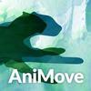
As part of the AniMove eLearning programme, you are now able to stream 2022 Animal movement & remote sensing course lectures opensource.
10 February 2023
Careers
Consultancy opportunity: Wildlife monitoring specialist

Anthony Dancer
Consultancy opportunity at ZSL for an experienced monitoring specialist to support species monitoring in rewilding landscapes across Europe
31 January 2023
Article

Meet the women and men supporting gender equality in conservation #tech. Here is a panel discussion the Women in Conservation Tech (WiCT) led in November 2022, during the EarthRanger User Conference (ERUC). Opening up...
30 January 2023
Link

An online portal to help governments, researchers, conservation advocates & others monitor activity throughout the world’s marine environment, as well as design & implement protected areas. The Marine Manager is...
13 January 2023
Link
The authors "tested the use of a thermal imager to assess the occupancy of enclosed nests, using nest-box populations of small passerines. Based on a thermal image of each nest box, observers were able to predict nest-...
13 January 2023
Careers
Conservation Technology Intern (Vietnam)

Meredith Palmer
WILDLABS and Fauna & Flora International are seeking an early career Vietnamese conservationist for 12-month paid internship position to grow and support the Southeast Asia regional community in our global...
11 January 2023
Careers
Join NASA’s harmful algal bloom ML challenge and win prizes!

Katie Wetstone
Using satellite imagery to detect and classify the severity of cyanobacteria blooms in small, inland water bodies.
15 December 2022

The International Space Station's GEDI instrument uses lasers to gather data on deforestation and impacts on atmospheric concentrations of carbon dioxide to highlight key areas to conserve.
2 December 2022
Careers
Spatial Data Analysis, TNC

The Nature Conservancy
Working with a team of conservation practioners, scientists, and technologists, the Spatial Data Analyst uses leading-edge earth observation data in new and effective ways to inform conservation practice locally,...
8 November 2022
Link
Opinion paper describing "how data acquired from remote sensing, citizen science & other monitoring approaches could feed in near-real time to an early warning system for biodiversity that integrates automated red-...
7 November 2022
Article

This SPACES paper aims to inspire the audience to use spatial intelligence as an enabler for integrated nature and climate action. It showcases ’emerging’ data sources and digital technology in the nature and climate...
28 October 2022
September 2025
event

Ideal Workplace Solutions
October 2025
event

Lacey Hughey and 3 more
November 2025

event

Brigitta Keeves
March 2026

September 2024


August 2024

131 Products
Recently updated products
| Description | Activity | Replies | Groups | Updated |
|---|---|---|---|---|
| I agree Adventina. I am also interested in "How has the climate variability affected the trend of BAT species in the ecosystem? and respond on their increase and (or) extinction.... |
|
Climate Change, Community Base, Geospatial, Women in Conservation Tech Programme (WiCT) | 6 months 2 weeks ago | |
| Kasi, Thanks for sharing the excellent blog on elephant collaring. The map at the end was interesting. Did you do further... |
|
Geospatial | 6 months 4 weeks ago | |
| We're extending the survey deadline! Please don't forget to let us know if you would like to speak about your work at one of the future Geospatial community events. Many... |
|
Geospatial | 7 months ago | |
| @cmwainaina check this out |
|
Drones, Conservation Tech Training and Education, Geospatial | 7 months 1 week ago | |
| Thank you David, a phenomenal source! |
+10
|
Drones, Geospatial, Protected Area Management Tools | 7 months 3 weeks ago | |
| Hi Matthew Wow, what an amazing project! It is incredible how you have managed to figure out some of the complexities of combining underwater imagery with UAV imagery. I am... |
|
Drones, Geospatial, Marine Conservation, Protected Area Management Tools | 8 months ago | |
| Thankyou so much. I'll definitely apply these solutions |
|
Geospatial | 8 months 2 weeks ago | |
| Very helpful. |
|
Geospatial | 8 months 3 weeks ago | |
| This is a thread for anyone who has questions about AI for Conservation Office Hours 2025.We're once again teaming up with Dan Morris from... |
|
Acoustics, AI for Conservation, Camera Traps, Community Base, Geospatial | 9 months 1 week ago | |
| I actually made some models with some learners and it is helpful with lower primary. Great idea. Hadn't thought of mentioning that. |
|
East Africa Community, Climate Change, Geospatial | 10 months ago | |
| Hi Heinrich,The chapter is here. Feedback welcome! |
|
Geospatial | 10 months 2 weeks ago | |
| You're welcome, Liz! |
|
Geospatial | 10 months 3 weeks ago |


19th Australasian Vertebrate Pest Conference 2024
12 July 2024 12:42am
Data Manager, Conservation International

8 July 2024 2:40pm
Free and Open Source Software for Geospatial
5 July 2024 7:30pm
ForestSAT
5 July 2024 7:04pm
Change group name to Geospatial?
15 June 2024 7:21pm
2 July 2024 9:56am
Hi,
I agree with your reasons. The name change is in order.
4 July 2024 6:07am
Thanks, Cathy!
Fauna & Flora: Bridging geospatial data and people together for enhanced conservation management

17 April 2024 11:31am
13 June 2024 8:51pm
This is amazing! Thank you for sharing. I'm speaking on this topic at the National Center for Ecological Analysis and Synthesis in October. If you have any other resources on this topic, let me know! Closing the loop for "Science to Action" is a huge part of the work we do so I'm always looking to learn.
16 June 2024 3:32pm
Tagging @Chelsea_Smith so she sees this :)
Using Raster data?
23 April 2024 1:17pm
17 May 2024 1:42pm
Depending what you want to do, there are free services to annotate values for each point, interpolating between available time-location records in the RS data.
The EnvDATA Track Annotation Service on Movebank (use the "generic time-location records" option).
NASA's AppEEARS point extraction tool.
16 June 2024 5:35am
Thank you so much Sarah, I think time-location records will be do best.
16 June 2024 5:42am
Hi Vance,
I just wanted to assign landcover types to each point data. But you mentioning temporal change of landcover, that will be best analysis to do.
Thank you so much,
Sarah.
FOSS Geospatial Tools
Into Conservation: participating in wildlife research at Grumeti-Ikorongo Game reserves.
15 June 2024 7:08pm
17 June 2024 7:34pm
17 June 2024 7:35pm
17 June 2024 7:36pm
Case Study: Drone-based radio-tracking of Eastern Bandicoots
14 June 2024 3:53am
4 reasons to consider TNFD for nature reporting

12 June 2024 1:52pm
Fully funded PhD in AI biodiversity monitoring

11 June 2024 1:07pm
ICI calls for €20-25M project applications for Colombia

5 June 2024 5:50pm
New WILDLABS Funding & Finance group
5 June 2024 3:24pm
5 June 2024 4:14pm

6 June 2024 1:38am
6 June 2024 4:16am
Remote Sensing & GIS Group Leadership
8 May 2024 4:25pm
28 May 2024 5:42pm
Hi Cathy! Please check out the below article on group managers. Essentially, we're asking for a 12 month commitment of 1 hour a week (more or less) to promote engagement in WILDLABS groups by sparking conversations, engaging with people's content, and planning 1 virtual event a month to bring the community together. (This could be bringing a speaker in, or just having a 45 minute coffee call for people in the sector to get to know each other and share their work.)
As a group manager, you have the full support of the WILDLABS community team. We have a dedicated Slack channel, monthly calls to support you in your group management, and so much more.
Being a group manager is a great way to give back to the conservation tech community, steer conversations in the direction you think is important, foster a vibrant space for collaboration, and build your network. Shoot me an email if you're interested (alex.rood@wildlabs.net)! I'm happy to hop on a call to discuss more in-depth.
29 May 2024 5:43am
Hi Cathy, please check out what Alex sent and DM me if you're still interested in co-leading the group. Thanks.
Vance
31 May 2024 8:13am
Unfortunately I may fail to deliver so I cannot take it up. Am off net at times for two weeks straight.
But excited about everything GIS so I follow keenly.
Thank you for the explanation. 🤍
Samburu County Hazard Atlas
27 May 2024 6:31pm

Share Your Work in a Conservation Technology Video

17 May 2024 9:06pm
SCGIS Annual Conference: Conservation for Action
17 May 2024 7:30pm
The Inventory User Guide
1 May 2024 12:46pm
Introducing The Inventory!
1 May 2024 12:46pm
22 July 2024 10:55am

23 July 2024 2:05pm
23 July 2024 2:53pm
Hiring Chief Engineer at Conservation X Labs

1 May 2024 12:19pm
Delving into #tech4wildlife Innovation across East Africa with Sandra Maryanne & Catherine Njore
 CathyNj
and 2 more
CathyNj
and 2 more
30 April 2024 11:37am
Earth Blox dataset review: Meta Global Canopy Height (1m)
23 May 2024 7:23pm
27 May 2024 8:58am
Ecologist Postdoctoral Research Fellow
23 April 2024 4:32pm
Program Manager: Integrating movement and camera trap data with international conservation policy
22 April 2024 10:16pm
Postdoc: Biologging & Camera Trap Data Integration
22 April 2024 10:10pm
Starting a Conservation Technology Career with Vainess Laizer
16 April 2024 1:34pm
3 September 2024 6:02pm