This group is home to the protected area management tools that bring data collection, analysis, and reporting together to enable frontline conservation work in real-time. These integrated systems include many tools and topics related to other community groups, so if you're interested in this space make sure to check out our Sensors and Connectivity groups as well.
Resources for Getting Started:
- Watch the recording of our virtual meetup on Networked Sensors for Security and Human-Wildlife Conflict Prevention, including talks from WWF, SmartParks, and Sensing Clues.
- Check out this Introduction to SMART on our YouTube channel.
- Hear about the work Wildlife Protection Solutions is doing in this space.
- Watch Ted Schmidt's lunchtime lecture on Tech Readiness and Protected Area Management Tools.
- For a marine perspective, watch Max Schofield's Tech Tutors episode: How do I use open access remote sensing data to monitor fishing?
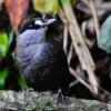
Header image: Save the Elephants
No showcases have been added to this group yet.

- @Dauson_M
- | Mr
Dauson Msumange is a social enterpreneur, founder and director of Tanzania Eco-Tech And Conservation Hub (TEACH).

- 0 Resources
- 1 Discussions
- 23 Groups

- @Freaklabs
- | He/Him
Freaklabs
I'm an engineer and product designer working in conservation technology. I specialize in technology for landscape restoration and wildlife behavioral ecology.


- 1 Resources
- 307 Discussions
- 20 Groups

African Parks
- 0 Resources
- 0 Discussions
- 10 Groups
- @crazybirdguy
- | Him
Field Biologist at Yayasan Cikananga Konservasi Terpadu, Indonesia, with experience and interest mainly in ornithology, citizen science and bioaccoustic

- 0 Resources
- 10 Discussions
- 12 Groups

Soil science, droughts effect of poverty, human rights advocate, wage equality in Europe, Drones in Digital Education


- 4 Resources
- 11 Discussions
- 18 Groups

- @Anandi7316
- | she / her
Ecologist, Doctoral researcher @ ARI-Pune | Biodiversity- rock outcrops ecology
- 0 Resources
- 0 Discussions
- 8 Groups

- @nancyalice
- | she/her
Design x Climate Action

- 0 Resources
- 0 Discussions
- 10 Groups
- 0 Resources
- 0 Discussions
- 18 Groups

I'm a PhD student at UW working with the Smithsonian and Center for One Health Research. I develop models to predict and explain zoonotic disease patterns, with a strong emphasis on how these diseases impact wildlife populations and communities sharing the same landscape.
- 0 Resources
- 13 Discussions
- 12 Groups

Forester/ Ecologist with a Master’s Degree in the department of Range science - Wildlife and Fresh water fisheries.
- 0 Resources
- 0 Discussions
- 11 Groups
- @MandyEyrich
- | She/Her
University of Florida (UF)
Bridging industries with 15+ years of cross-sector expertise specializing in user-centric technology and product strategy, UX research, UX/UI design, process optimization, and end-to-end agile product development moving from ideation to iteration.
- 0 Resources
- 0 Discussions
- 26 Groups

Sustainability Manager for CERES Tag LTD. An animal health company; animal monitoring, conservation, & anti-poaching/ rural crime. Wildlife, livestock, equine & companion. #CeresTrace #CeresWild #CeresRanch


- 2 Resources
- 20 Discussions
- 23 Groups
Careers
The Marine Innovation Lab for Leading-edge Oceanography develops hardware and software to expand the ocean observing network and for the sustainable management of natural resources. For Fall 2026, we are actively...
24 July 2025
Careers

The EarthRanger Team is looking for our next Technical Support Engineer to help drive conservation impact for users worldwide through our platform. EarthRanger is a software solution that helps conservationists make...
18 July 2025
Article
Nature Tech for Biodiversity Sector Map launched!

Carly Batist and 1 more
Conservation International is proud to announce the launch of the Nature Tech for Biodiversity Sector Map, developed in partnership with the Nature Tech Collective!
1 April 2025
Funding

Osa Conservation is launching our inaugural cohort of the ‘Susan Wojcicki Research Fellowship’ for 2025, worth up to $15,000 per awardee (award value dependent on project length and number of awards given each year)....
10 February 2025
Link
Collaring Elephants and Post Release Monitoring

Kasi Amor Kalande
This leads to an exciting blog we did recently, it also includes a spatial map indicating elephant movement tracks of an orphaned elephant who self released himself into the wild (Kafue National Park). Cartography was...
28 January 2025
Article

Over the years, a large number of developments have gone up in the area that I live in and the municipality is not doing what they should when it comes to upholding the laws that have been put in place to protect the...
20 January 2025
Careers
MS and PhD Opportunities in Ocean Engineering and Oceanography

Camille Pagniello
The Marine Innovation Lab for Leading-edge Oceanography develops hardware and software to expand the ocean observing network and for the sustainable management of natural resources. For Fall 2025, we are actively...
6 October 2024
Funding
The Connected Conservation is thrilled to announce our award's third round in collaboration with the Airbus Foundation. This award champions the use of cutting-edge satellite imagery to tackle biodiversity loss and...
30 September 2024
Article
Enter to win a free thermal camera!

Alex Rood
WILDLABS is partnering with FLIR to give away a FLIR ONE Edge Pro to 5 community members.
26 June 2024
Article
NEW PUBLICATION ALERT!

Consolata Gathoni Gitau
One of the most thrilling moments for any researcher is seeing their hard work published for the world to see. As part of the Women in Conservation Technology (WiCT) Kenya Cohort One, we not only learnt about the use of...
17 June 2024
Funding
ICI calls for €20-25M project applications for Colombia

Frank van der Most
The International Climate initiative, opened a call for €20-25M projects. It will fund one project in this call with relevance for landscape restoration.
5 June 2024

Use your Javascript and .NET skills to support land protection efforts.
5 June 2024
October 2024

September 2024
9 Products
Recently updated products
| Description | Activity | Replies | Groups | Updated |
|---|---|---|---|---|
| Hi everyone,I’m currently developing a multilingual, offline-friendly training program called ConTech Curriculum, designed... |
|
Autonomous Camera Traps for Insects, Camera Traps, Conservation Tech Training and Education, Protected Area Management Tools | 1 week 4 days ago | |
| Wondering if anyone here has come across good guidance/frameworks/best practices/etc. for baseline conservation data management (beyond... |
|
Data management and processing tools, Protected Area Management Tools | 1 week 6 days ago | |
| Wow this is amazing! This is how we integrate Biology and Information Technology. |
|
Camera Traps, AI for Conservation, Build Your Own Data Logger Community, Data management and processing tools, Marine Conservation, Protected Area Management Tools, Geospatial | 2 weeks 3 days ago | |
| HiThis is great! So just to double check - there is no way to join online? I would love to be part of this conference. Thanks, Els van Lavieren |
|
Community Base, Conservation Tech Training and Education, Data management and processing tools, Emerging Tech, Human-Wildlife Coexistence, Protected Area Management Tools, Wildlife Crime | 2 months 1 week ago | |
| Hi @iainmcnicol , welcome to WILDLABS! Thanks for posting this on here. I have shared with my colleagues at Fauna & Flora who have some experience (especially with the... |
|
Community Base, Geospatial, Protected Area Management Tools, Wildlife Crime | 4 months ago | |
| Hi Ryan, hmm, I had no idea there was a microphone named that. I thought about how it’s used to lure birds for netting, and I like Greek Mythology. I thought it was a perfect fit... |
|
Acoustics, Emerging Tech, Funding and Finance, Protected Area Management Tools, Software Development | 4 months 1 week ago | |
| My name is Frank Short and I am a PhD Candidate at Boston University in Biological Anthropology. I am currently doing fieldwork in Indonesia using machine-learning powered passive... |
|
Acoustics, AI for Conservation, Animal Movement, Data management and processing tools, Early Career, Emerging Tech, Ethics of Conservation Tech, Protected Area Management Tools, Software Development | 3 months ago | |
| Yep see you on friday |
+3
|
Geospatial, Acoustics, AI for Conservation, Camera Traps, Citizen Science, Community Base, Data management and processing tools, Emerging Tech, Open Source Solutions, Protected Area Management Tools | 4 months 2 weeks ago | |
| Hi Simon,We (Reneco International Wildlife Consultants) have an ongoing collaboration with a local University (Abu Dhabi, UAE) for developing AI tools (cameratrap/drone... |
|
Acoustics, AI for Conservation, Animal Movement, Camera Traps, Citizen Science, Connectivity, Drones, Early Career, eDNA & Genomics, Marine Conservation, Protected Area Management Tools, Sensors | 6 months 4 weeks ago | |
| Thank you David, a phenomenal source! |
+10
|
Drones, Geospatial, Protected Area Management Tools | 7 months 1 week ago | |
| Hi Matthew Wow, what an amazing project! It is incredible how you have managed to figure out some of the complexities of combining underwater imagery with UAV imagery. I am... |
|
Drones, Geospatial, Marine Conservation, Protected Area Management Tools | 7 months 3 weeks ago | |
| About the Centre for Sustainable Forests and Landscapes (CSFL)Galvanising research and teaching to deliver... |
|
Community Base, Climate Change, Conservation Tech Training and Education, Funding and Finance, Protected Area Management Tools | 8 months 3 weeks ago |


Understanding the Application of SMART in Measuring Law Enforcement Performance in Protected Areas.

22 July 2024 2:25pm
24 July 2024 6:40pm
Also thanks for letting me know about Lilyxu and others you mentioned, i will reach out to them.

31 July 2024 6:33pm
Keep digging Sarah!!
Move BON Development: Follow up discussion

19 June 2024 12:02pm

11 July 2024 10:14pm
You can catch up on the recording at that same link to the June Variety Hour! Lacey's fabulous talk starts around the 9:40 mark :)
12 July 2024 5:38am
Hi Talia!
I feel like the topic is so broad that it might help to put some constraints around things, see what works, and then broaden those out. I have a lot of ideas regarding the data monitoring and collection side based on the other sensor and observation networks we've set up in the past.
There may also be some potential scope to incorporate things like data collection and integrated monitoring to the Build Your Own Datalogger series where the system is updated to feed data into the observation network.
It'd probably take a bit of discussion and coordination. Let me know if interested. I'm fine to jump on a call or discuss via email too.

22 July 2024 9:24pm
@cmwainaina please take a look
Enter to win a free thermal camera!
26 June 2024 5:38pm
NEW PUBLICATION ALERT!
17 June 2024 11:33am
17 June 2024 12:57pm
17 June 2024 7:40pm
Fauna & Flora: Bridging geospatial data and people together for enhanced conservation management

17 April 2024 11:31am
13 June 2024 8:51pm
This is amazing! Thank you for sharing. I'm speaking on this topic at the National Center for Ecological Analysis and Synthesis in October. If you have any other resources on this topic, let me know! Closing the loop for "Science to Action" is a huge part of the work we do so I'm always looking to learn.
16 June 2024 3:32pm
Tagging @Chelsea_Smith so she sees this :)
Conservation Technology for Human-Wildlife Conflict in Non-Protected Areas: Advice on Generating Evidence

22 January 2024 11:36pm

4 February 2024 8:16am
Hi Amit,
The most important thing is that the livestock owners contact you as soon as possible after finding the carcass. We commonly do two things if they contact us on the same day or just after the livestock was killed:
- Use CyberTracker (or similar software) on an Android smart phone to record all tracks, bite marks, feeding pattern and any other relevant signs of the reason for the loss with pictures and GPS coordinates. [BTW, Compensation is a big issue -- What do you do if the livestock was stolen? What do you do if a domestic animal killed the livestock? What if it died from disease or natural causes and was scavenged upon by carnivores afterwards?]
- In the case of most cats, they would hide the prey (or just mark it by covering it with grass or branches and urinating in the area). In this case you can put up a camera trap on the carcass to capture the animal when it returns to its kill (Reconyx is good if you can afford it - we use mostly Cuddeback with white flash). This will normally only work if the carcass is fresh (so other predators would not be able to smell it and not know where it is yet), so the camera only has to be up for 3-5 days max.
This is not really high-tech, but can be very useful to not only establish which predator was responsible (or if a predator was responsible), but also to record all the evidence for that.
13 June 2024 8:58pm
Hey Amit,
This is a great question; from our work, we've seen people do a couple of things. We've even seen people using Ring doorbell footage in urban areas as evidence.
The best thing we've seen is matching the community needs with existing infrastructure:
- Are there existing cameras you can leverage, like the doorbell cameras?
- Can public participation monitoring service this, i.e. public submitted photos and videos?
It also totally depends on the wildlife species you're working with, the interaction, damages, etc. If you've found any good solutions, let me know. I'd love to share that information with our clients here who have constant bear problems.

14 June 2024 9:09am
In that case, you might want to keep an eye on the project from @Lars_Holst_Hansen
I have been working hard on this camera based polar bear alarm with Kim Hendrikse and other collaborators including Zoologisk Have in Copenhagen - where the system is now beeing tested. | Lars Holst Hansen | 17 comments
I have been working hard on this camera based polar bear alarm with Kim Hendrikse and other collaborators including Zoologisk Have in Copenhagen - where the system is now beeing tested. I hope to field test it at Zackenberg Research Station next year. | 17 comments on LinkedIn

Are you attending SMART Global Congress 2024?

22 February 2024 11:13am
20 March 2024 4:32pm
Here is a quick report of what we have learnt there:
21 March 2024 9:48pm
Awesome, thanks for the summary!

8 June 2024 7:43am
Hey @antoineede ,
I am not sure about that yet video recordings are available or not but you can visit this: SMART Global Congress 2024 | BluePrism
May be here you will get some of the recorded videos to watch.
ICI calls for €20-25M project applications for Colombia
5 June 2024 5:50pm
Open Software Engineer Position at Land Conservation Software Company
5 June 2024 4:37pm
New WILDLABS Funding & Finance group
5 June 2024 3:24pm

5 June 2024 4:14pm

6 June 2024 1:38am
6 June 2024 4:16am
Apply! 2024 Conservation Tech Award

3 June 2024 3:51pm
NCTFJ call for JM$ 500-5000K proposals
26 May 2024 5:05pm
Share Your Work in a Conservation Technology Video

17 May 2024 9:06pm
WILDLABS AWARDS 2024 - Underwater Passive Acoustic Monitoring (UPAM) for threatened Andean water frogs
30 March 2024 3:54pm

5 April 2024 12:13pm
Congratulations, very exciting! Keep us updated!

7 April 2024 6:09pm
This is so cool @Mauricio_Akmentins - congrats and look forward to seeing your project evolve!

1 May 2024 5:17pm
Congratulations! My first hydromoth was just arrived yesterday and so excited! Looking forward for the update from your project!!!
The Inventory User Guide

1 May 2024 12:46pm
Introducing The Inventory!
1 May 2024 12:46pm

22 July 2024 10:55am
23 July 2024 2:05pm
23 July 2024 2:53pm
Hiring Chief Engineer at Conservation X Labs

1 May 2024 12:19pm
Job Opening: Associate Curator of International Conservation at North Carolina Zoo

29 April 2024 9:17pm
Backend Software Architect, EarthRanger (Contract Opportunity)

27 April 2024 7:24pm
Program Manager: Integrating movement and camera trap data with international conservation policy
22 April 2024 10:16pm
Postdoc: Biologging & Camera Trap Data Integration
22 April 2024 10:10pm
Early Warning Systems for Human-Wildlife Conflict, Zoonotic Spillover, and Other Conservation Challenges
17 April 2024 5:43pm
The Variety Hour: 2024 Lineup
22 March 2024 4:30pm
SMART Global Congress 2024: A quick summary
19 March 2024 6:42pm
Here's what you missed at World Wildlife Day 2024
7 March 2024 9:02pm
15 March 2024 2:42pm

A Sensor-Based Approach to Studying Animal Behavior in Light Pollution Research
24 February 2024 9:33pm
27 February 2024 12:38pm
Thanks for helping me!
For now, I'll be testing with mains power (220V). The final prototype needs to be functional using solar panel.
The main system will be a Raspberry Pi, as the Brain of this project, receiving and storage all the measurements from the other devices, controlling the system. The measurement devices will be a microcontroller (still searching for which one to use) with differents sensor, such Lux sensor like TSL2561 or 2591, AudioMoth to record animals sounds, temperature and some other measurements.
For synchronization, must be effective, because the measurements must be or have the same time, so the storage data from differents devices can be grouped by it's timestamp and have full control for animals and fauna. So, probably it will be a lot of data per day.
The distance between each devices I haven't study yet, consider 20 meters within each device.

27 February 2024 1:49pm
Beware that the AudioMoth in itself will drift. It can be hooked up with a GPS to allow for GPS time synchronization, though.
https://www.openacousticdevices.info/gps-sync

27 February 2024 3:11pm
Unless you are planning on making a mesh network between nodes then the total distance spanning the location of all the nodes is important to know, not just the intra node distance.
If you have a Raspberry Pi as a main master node then you could install my sbts-aru project as a base project and you would get a sub-microsecond master time base by default as well as the GPS synchronizes the main system time with typically less than 0.1 microsecond, and SD card corruption resilience due to the in-memory overlayFS architecture.
If the total distance was 20m across all nodes, then the approach above could also combined the audio gathering capability as the sbts-aru project does audio logging as it would be within 20m of an audiomoth anyway, then you also have time-synchonized audio. If the distance is spanning 100m for example and it's just the intranode distance that is 20m then everything is somewhat different with respect to synchronization.
SMART Global Congress 2024
22 February 2024 11:00am
SMART Partnership Director
21 February 2024 4:32pm
Southern African Wildlife Management Association Conference 2024
6 February 2024 12:20pm
24 July 2024 6:30pm
Thank you very much Carly Batist for the suggestion! I haven't reached out to the SMART folks yet, but I will. Getting contacts and case studies from them sounds very helpful to me.