
Badges
Editing badges. Drag to reorder.


Groups joined
Discussions started
Discussion Comments
Chelsea Smith contributed to Product - "QGIS"
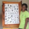
Chelsea Smith added a new Product - "QGIS"
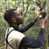
Chelsea Smith added a new Discussion - "Blurring of humans in camera trap data" to Camera Traps
Chelsea Smith commented on "Natural Lands Map V 1.0"
 8 months ago

Chelsea Smith added a new Discussion - "Camera traps for nesting birds" to Camera Traps
Groups
Group
- Group Stats
-


- 114
- 53
- Latest Discussion
- From Field to Funder: How to communicate impact?
- Latest Resource
- /
- Application of computer vision for off-highway vehicle route detection: A case study in Mojave desert tortoise habitat
Driving off-highway vehicles (OHVs), which contributes to habitat degradation and fragmentation, is a common recreational activity in the United States and other parts of the world, particularly in desert environments with fragile ecosystems. Although habitat degradation and mortality from the expansion of OHV networks are thought to have major impacts on desert species, comprehensive maps of OHV route networks and their changes are poorly understood. To better understand how OHV route networks have evolved in the Mojave Desert ecoregion, we developed a computer vision approach to estimate OHV route location and density across the range of the Mojave desert tortoise (Gopherus agassizii). We defined OHV routes as non-paved, linear features, including designated routes and washes in the presence of non-paved routes. Using contemporary (n = 1499) and historical (n = 1148) aerial images, we trained and validated three convolutional neural network (CNN) models. We cross-examined each model on sets of independently curated data and selected the highest performing model to generate predictions across the tortoise's range. When evaluated against a ‘hybrid’ test set (n = 1807 images), the final hybrid model achieved an accuracy of 77%. We then applied our model to remotely sensed imagery from across the tortoise's range and generated spatial layers of OHV route density for the 1970s, 1980s, 2010s, and 2020s. We examined OHV route density within tortoise conservation areas (TCA) and recovery units (RU) within the range of the species. Results showed an increase in the OHV route density in both TCAs (8.45%) and RUs (7.85%) from 1980 to 2020. Ordinal logistic regression indicated a strong correlation (OR = 1.01, P < 0.001) between model outputs and ground-truthed OHV maps from the study region. Our computer vision approach and mapped results can inform conservation strategies and management aimed at mitigating the adverse impacts of OHV activity on sensitive ecosystems.
Group
- Group Stats
-


- 601
- 323
- Latest Discussion
- Planet Imagery is no longer available on GFW
Group
- Group Stats
-


- 779
- 253
- Latest Discussion
- Overview of Image Analysis and Visualization from Camera traps
- Latest Resource
- /
- Nature Tech for Biodiversity Sector Map launched!
Conservation International is proud to announce the launch of the Nature Tech for Biodiversity Sector Map, developed in partnership with the Nature Tech Collective!
Group
- Group Stats
-


- 259
- 116
- Latest Discussion
- Can RGB drone data & Machine Learning be of value in Conservation?
- Latest Resource
- /
- What Are Innovative Technologies, and Why Should Conservationists Care?
Conservationists use tools like drones, satellites, and camera traps to monitor ecosystems and scale their impact. But new challenges like transparency, funding gaps, and engagement remain. Web 3.0 technologies offer solutions, but adoption can be complex. Understanding their benefits and barriers is key.
Group
- Group Stats
-


- 246
- 65
- Latest Discussion
- Ground Truth: How Are You Verifying What Maps Show?
- Latest Resource
- /
- Fires in the Serengeti: Burn Severity & Remote Sensing with Earth Engine
Fires in Serengeti and Masai Mara National Parks have burned massive areas this year. With Google Earth Engine, it's possible to quantify burn severity using the normalized burn ratio function, then calculate the total area burned by classification areas.
Group
- Group Stats
-


- 237
- 24
- Latest Discussion
- Beyond the Tech Hype / Más Allá del Hype Tecnológico
- Latest Resource
- /
- New WILDLABS Funding & Finance group
WildLabs will soon launch a 'Funding and Finance' group. What would be your wish list for such a group? Would you be interested in co-managing or otherwise helping out?
Bookmarks
Keep track of the resources that matter to you! Collections let you save, organise, and share content from all over the WILDLABS community. Create your first collection by clicking on the bookmark icon wherever you see it.
My Courses
These are your in-progress and completed courses. Explore more courses through our catalogue.
To find courses you have created, see your "My Draft Content" or "My Content" tabs.
Camera Trapping for Conservation
Introduction to Conservation Technology
Environmental DNA for Terrestrial Vertebrate Conservation
Settings
Chelsea Smith's Content
GIS E-learning Course 4: Becoming Confident in Spatial Analysis & Geoprocessing


GIS E-learning Course 4: Becoming Confident in Spatial Analysis & Geoprocessing
GIS E-learning Course 4: Becoming Confident in Spatial Analysis & Geoprocessing


GIS E-learning Course 3: Introduction to ArcGIS Pro
GIS E-learning Course 3: Introduction to ArcGIS Pro
GIS E-learning Course 3: Introduction to ArcGIS Pro
GIS E-learning Course 2: Introduction to QGIS
GIS E-learning Course 2: Introduction to QGIS
GIS E-learning Course 2: Introduction to QGIS


GIS E-learning Course 1: What is GIS and why should you care?
GIS E-learning Course 1: What is GIS and why should you care?
GIS E-learning Course 1: What is GIS and why should you care?


Discussion
Blurring of humans in camera trap data
Chelsea Smith
Hi All,I'm looking into tools that can be used to blur images containing humans from camera trap data. So far I've found people using standard photo editing software and come...
20 February 2025
Discussion
Camera traps for nesting birds
Chelsea Smith
Hi All,We have a team that wants to monitor bird nests with camera traps. They have piloted the Blazevideo 24MP*1296 Pixel video cameras with no night vision and a maximum...
24 July 2024
Chelsea Smith commented on "GIS E-learning Course 2: Introduction to QGIS course"