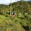
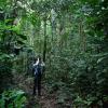
In recent years, drone technologies have been explored for a range of applications in conservation including (but not limited to) mapping, biodiversity inventories, antipoaching patrols, wildlife tracking, and fire monitoring. The rise of customizable, open-source drones like those of ArduPilot and OpenROV hold promise for more effective conservation applications, and combined with other monitoring sensors and devices, they are capable of collecting high-resolution data quickly, noninvasively, and at relatively low cost.
However, challenges remain in putting these tools to use. A recent paper reviewing 256 conservation drone projects highlighted some of these major obstacles, ranging from unintended social and ecological consequences of drone operations to still prohibitive costs, both in terms of hardware and in terms of storing and processing large volumes of data. The longstanding challenge of power/battery life remains as well.
If you're considering trying out drones for yourself, and want to explore the possibilities and understand the major conversations happening around this technology, check out these beginner's resources and conversations from across the WILDLABS platform:
Three Resources for Beginners:
- Conservation Technology User Guidelines Issue 5: Drones, World Wildlife Fund | Drones, best practices, ethics, regulations, case studies
- WILDLABS Virtual Meetup Recording: Drones, Craig Elder, Dr. Claire Burke, and Gabriel Levin | Drones, thermal camera, wildlife crime, ML, biologging
- New Paper: Drones and Bornean Orangutan Distribution, Sol Milne | Drones, data analysis, citizen science, community science, primates
Three Forum Threads for Beginners:
- Curious about radio-tracking with drones? | Wildlife Drones, Biologging (5 replies)
- Drones for GIS Best practice Document | Adrian Hughes, Drones (10 replies)
- WWF Conservation Technology Series: Drones in Conservation | Aurélie Shapiro, Drones (7 replies)
Three Tutorials for Beginners:
- How do I use a drone to capture radio-tracking data? | Debbie Saunders, Tech Tutors
- How do I choose the right drone for my conservation goals? | Shashank Srinivasan, Tech Tutors
- How do I strategically allocate drones for conservation? | Elizabeth Bondi, Tech Tutors
Want to know more about using drones, and learn from experts in the WILDLABS community? Make sure you join the conversation in our Drones group!
*Header photo: Parker Levinson, Point Blue Conservation Science
No showcases have been added to this group yet.

- @annavallery
- | she/her
Seabird biologist experienced in research and applied conservation. Dedicated to conducting and using innovative research to inform conservation decisions.

- 0 Resources
- 3 Discussions
- 7 Groups
WILDLABS & Wildlife Conservation Society (WCS)
I'm the Bioacoustics Research Analyst at WILDLABS. I'm a marine biologist with particular interest in the acoustics behavior of cetaceans. I'm also a backend web developer, hoping to use technology to improve wildlife conservation efforts.


- 41 Resources
- 38 Discussions
- 33 Groups

- @carlybatist
- | she/her
ecoacoustics, biodiversity monitoring, nature tech


- 113 Resources
- 361 Discussions
- 19 Groups
- @alexreyyap
- | Male
I am embedded AI systems developer based in Davao City, Philippines.
- 0 Resources
- 0 Discussions
- 5 Groups

- @TaliaSpeaker
- | She/her
WILDLABS & World Wide Fund for Nature/ World Wildlife Fund (WWF)
I'm the Executive Manager of WILDLABS at WWF


- 23 Resources
- 64 Discussions
- 31 Groups

- @bluevalhalla
- | he/him
BearID Project & Arm
Developing AI and IoT for wildlife


- 0 Resources
- 55 Discussions
- 8 Groups
- @CourtneyShuert
- | she/her
I am a behavioural ecologist and eco-physiologist interested in individual differences in marine mammals and other predators


- 0 Resources
- 12 Discussions
- 10 Groups

- @jennamkline
- | She/Her
Imageomics Institute & ABC Global Climate Center
PhD Student @ OSU, Edge AI for Adaptive Animal Ecology Field Studies
- 0 Resources
- 7 Discussions
- 6 Groups

Aeracoop & Dronecoria
Computer engineer, Drone Pilot, Seed researcher, Wild Tech Maker


- 3 Resources
- 37 Discussions
- 11 Groups
My name is Sean Hill and I have been using off the shelf consumer drones and open source photogrammetry and Geographic Information Systems Software (GIS) since 2019 for conservation purposes. As of 2024 I have started an online training platform called GeoWing Academy

- 1 Resources
- 23 Discussions
- 6 Groups

- @Frank_van_der_Most
- | He, him
RubberBootsData
Field data app developer, with an interest in funding and finance


- 57 Resources
- 188 Discussions
- 9 Groups

Monitoring and Evidence Manager, Kent Wildlife Trust

- 0 Resources
- 1 Discussions
- 6 Groups
This paper explores the use of UAVs equipped with thermal and standard cameras to accurately count the group sizes of the Critically Endangered cao vit gibbon, highlighting how this technology can overcome the...
13 June 2023
Link

AirSeed has developed a unique approach to tackle climate change and restore biodiversity by combining drone technology, machine learning, and seed pod biotechnology to carry out planting that’s 25x faster than...
30 May 2023
Link
Using computer vision to understand bee vision

Ellie Warren
Here's an innovative project from the Harvey Mudd College Bee Lab that could help us understand how bees view their environments, and thus better protect bee habitat. This project uses computer vision and drone imagery...
5 May 2023
Link
Researchers use taxidermy bird drones to monitor wildlife

Stephanie O'Donnell
Interesting project - “Our main goal for this is to develop a nature-friendly drone concept for wildlife monitoring,” Hassanalian said. “Traditional drones are often disruptive to ecosystems due to issues such as sound...
26 April 2023
Careers
Hardware Lead - Biodiversity / Conservation

Ben Williamson
New role at Pivotal Earth
4 April 2023
Article

New paper in Journal of Animal Ecology
24 March 2023
Link
We used a combination of high-resolution satellite tracking (Fastloc-GPS), uncrewed aerial vehicle (UAV) surveys, and capture-mark-recapture approaches to assess the abundance of immature hawksbill (Eretmochelys...
21 March 2023
Article

Discover how drones are revolutionising conservation efforts and learn five essential tips to fly responsibly and minimise harm to wildlife, humans, and the environment.
14 March 2023
Careers
Proposals wanted for Innovation in Practice
Ellie Warren
The Innovation in Practice edition of Methods in Ecology and Evolution is still seeking proposals about conservation technology
6 March 2023
Interesting article that links to research on how technology has made studying moose populations easier, with particularly good explanation of what makes moose populations difficult to track.
22 February 2023
Careers
The Environmental Robotics Lab at ETH Zurich welcomes applications for a postdoctoral fellowship on robotics methods for the collection of environmental DNA to automate monitoring of biodiversity in terrestrial...
12 February 2023
Link
How daredevil drones find nearly extinct plants hiding in cliffs
Stephanie O'Donnell
Nice article about one of the Rainforest XPrize semifinalist teams - using drones to sample plant species. 'Nyberg and the National Tropical Botanical Garden (NTBG) team, working with the State of Hawaii's Division of...
10 February 2023
Drone Photogrammetry & GIS Intermediate Course

Drone Photogrammetry & GIS Intermediate Course
Drone Photogrammetry & GIS Intermediate Course
Drone Photogrammetry & GIS Advanced Course
Drone Photogrammetry & GIS Advanced Course
Drone Photogrammetry & GIS Advanced Course
Drone Photogrammetry & GIS Introduction (Foundation) Course

Drone Photogrammetry & GIS Introduction (Foundation) Course
Drone Photogrammetry & GIS Introduction (Foundation) Course

August 2025
event

Louisa Richmond-Coggan
September 2025
event
Louisa Richmond-Coggan
March 2026

May 2025
event

Vanesa Reyes and 1 more
April 2025
event
Ben Weinstein
February 2025
event
Rick Spaulding
event

Léa Smadja
33 Products
Recently updated products
| Description | Activity | Replies | Groups | Updated |
|---|---|---|---|---|
| want to join 2025 contest for humpback whale photos in Juneo Alaska of Kelp |
|
Citizen Science, Conservation Tech Training and Education, Drones, Emerging Tech, Geospatial, Human-Wildlife Coexistence, Marine Conservation, Open Source Solutions | 8 hours 38 minutes ago | |
| This is awesome!! |
|
Conservation Tech Training and Education, Drones, Emerging Tech, Geospatial, Open Source Solutions | 1 day ago | |
| Thank you for sharing. Would love to learn bit more about the data workflow. Last year I tired to using QGIS and few existing models to count the birds from orthomosaics of... |
|
Drones, Latin America Community | 2 weeks 5 days ago | |
| G-DiNC 2026: Global Drones in Nature Conservation Symposium & ExpoNairobi & Naivasha, Kenya | March 3–6,... |
|
Drones, AI for Conservation, Conservation Tech Training and Education, Emerging Tech, Marine Conservation, Sensors | 4 weeks 1 day ago | |
| 15 years ago I had to rebuild the dams on a game reserve I was managing due to flood damage and neglect. How I wished there was an easier,... |
|
Drones, Conservation Tech Training and Education, Data management and processing tools, Emerging Tech, Geospatial, Open Source Solutions | 3 months 4 weeks ago | |
| I create ocean exploration and marine life content on YouTube, whether it be recording nautilus on BRUVs, swimming with endangered bowmouth... |
|
Acoustics, AI for Conservation, Animal Movement, Camera Traps, Citizen Science, Drones, Emerging Tech, Marine Conservation, Sensors, Sustainable Fishing Challenges, Wildlife Crime | 1 month 2 weeks ago | |
| Thank you for your reply, ChadI meant 10 as a whole, indeed. Perhaps you see your post in one group, but since it is tagged for all groups, I assumed you meant 10 in total.In your... |
|
Acoustics, AI for Conservation, Animal Movement, Camera Traps, Citizen Science, Climate Change, Community Base, Connectivity, Drones, eDNA & Genomics, Emerging Tech, Funding and Finance, Geospatial, Human-Wildlife Coexistence, Software Development, Wildlife Crime | 1 month 3 weeks ago | |
| Thank you for your comment Chris! Using these tools has made a huge difference in the way we can monitor and manage Invasive Alien Vegetation. I hope you are able to integrate... |
|
AI for Conservation, Citizen Science, Conservation Tech Training and Education, Drones, Geospatial, Human-Wildlife Coexistence, Open Source Solutions | 1 month 3 weeks ago | |
| I would love to hear updates on this if you have a mailing list or list of intersted parties! |
|
AI for Conservation, Community Base, Drones, Latin America Community, Marine Conservation, Open Source Solutions, Software Development | 2 months ago | |
| True, the US ecosystem is a challenging space right now, for basically all sectors. We should not let the US chaos prevent us from engaging with opportunities in other... |
|
AI for Conservation, Camera Traps, Connectivity, Drones, Emerging Tech, Ethics of Conservation Tech, Marine Conservation, Sensors | 3 months 4 weeks ago | |
| Not the same equipment, but at work I have used Metashape with DJI drones with an IR sensor (Mavic 3 Thermal, Matrice 3DT, Matrice 4T, etc) and the workflow to create IR maps... |
|
Drones | 2 months 2 weeks ago | |
| Hi all! I recently did a little case study using RGB drone data and machine learning to quantify plant health in strawberries. I wanted to... |
|
Citizen Science, Conservation Tech Training and Education, Drones, Geospatial | 3 months ago |


Updates on Mole-Rat Mystery Drone Project
10 June 2025 10:21am
12 June 2025 11:33am
Thank you Elsa :)
14 August 2025 6:07am
want to join 2025 contest for humpback whale photos in Juneo Alaska of Kelp
WOOHOO ITS WORKING!! Tech finds undetected decades old Alien Invasive Parent Plants in indigenous forest!
24 July 2025 12:21pm
13 August 2025 2:06pm
This is awesome!!
Tech4Nature Presents: 2025 Innovation Challenge Workshop Series - Registration Now Open!
6 August 2025 5:09pm
Tech4Nature Presents: 2025 Innovation Challenge Workshop Series - Registration Now Open!
6 August 2025 5:08pm
AI for Conservation Office Hours: 2025 Review
 Jake Burton
and 1 more
Jake Burton
and 1 more
6 August 2025 2:16pm
Counting aggregated animals in orthomosaics?
11 July 2025 8:51pm

26 July 2025 6:59am
Thank you for sharing. Would love to learn bit more about the data workflow.
Last year I tired to using QGIS and few existing models to count the birds from orthomosaics of wadding birds in Cambodia but gave after dismal results.
G-DiNC 2026: Global Drones in Nature Conservation Symposium & Expo
16 July 2025 10:18am
G-DiNC 2026: Global Drones in Nature Conservation Symposium & Expo
16 July 2025 10:11am
Assistant Project Manager - Ecological Restoration

10 July 2025 7:30pm
Drone Operations Manager
8 July 2025 2:15pm
Off-The-Shelf Drones & Open Source GIS Software for Dam Site Surveying?
15 April 2025 3:57pm
I WANT TO TELL YOUR STORY
29 June 2025 10:22am
Drone Photogrammetry & GIS Advanced Course
Sean Hill
and 1 more
24 June 2025 9:31am
Drone Photogrammetry & GIS Intermediate Course
Sean Hill
and 1 more
24 June 2025 9:31am
New Group Proposal: Systems Builders & PACIM Designers
18 June 2025 2:52pm
19 June 2025 9:08am
Hi Chad,
Thanks for the text. As I read it, PACIMs play a role in something else/bigger, but it doesn't explain what PACIMs are or what they look like. Now I've re-read your original post, I'm thinking, maybe I do understand, but then I feel the concept is too big ( an entire system can be part of a PACIM ? ) to get going within a WildLabs group. And you want to develop 10 PACIMS within a year through this group? Don't get me wrong, I am all for some systems change, but perhaps you're aiming too high.

19 June 2025 12:19pm
Hello again sir - PACIMs really mean 'projects' is the way I see it. Each part of the acronym can be seen as a project (if you have an assignment to do, you have a project really).
As for your query on 10 projects in 'this' group - I should ask for clarification if you mean particularly acoustics or in any group (I see now this is the acoustics thread after I selected all the groups for this post). If you are asking on acoustics, you're right - I am unsure on 10 as I am not too keen on acoustics yet. If you are asking 10 projects as a whole like 10 projects in the funding and finance group - I believe 10 to be a very reasonable number. Our projects we have co-created are for the most part replicable, rapidly deployable, quickly scalable, fundable through blended finance and more.
Thank you again for the feedback.
19 June 2025 1:43pm
Thank you for your reply, Chad
I meant 10 as a whole, indeed. Perhaps you see your post in one group, but since it is tagged for all groups, I assumed you meant 10 in total.
In your first post you explain PACIM stands for "Projects, Assignments, Campaigns, Initiatives, Movements, and Systems", so I understood it as more than just projects. Obviously, many things can be packed into a project or called a project, but then, what does it mean that 'Projects' is part of the list?
Well, if you think 10 projects is doable, then don't let me stop you.
How drones, AI & Open Source Software are being used to combat Alien Invasive Plants in South Africa
2 June 2025 10:08am
7 June 2025 9:36pm
Hi Ginevra, thank you! Its such a huge advantage to have tech tools available to us in conservation. Not just from an analysis point of view but also from a practical application view😊
17 June 2025 1:26am
Aloha, this is a great project. Thanks for sharing. I have been looking for ideas to integrate machine learning with some of the conservation work we are engaed in here on Kauai. Thank you
17 June 2025 11:00am
Thank you for your comment Chris! Using these tools has made a huge difference in the way we can monitor and manage Invasive Alien Vegetation. I hope you are able to integrate similar systems with your projects there. If you need any help, feel free to reach out!
Smart Drone to Tag Whales Project
8 June 2025 12:19pm

14 June 2025 12:19pm
I would love to hear updates on this if you have a mailing list or list of intersted parties!
Drone Imagery and Deep Learning enabling northern gannet counts

12 June 2025 9:52pm
Bass Rock Colony Counts - Scottish Seabird Centre
The Scottish Seabird Centre work in close collaboration with The University of Edinburgh School of Geosciences, The University of Edinburgh Airborne Research and Innovation Facility, UK Centre for Ecology & Hydrology, and Edinburgh Napier Centre for Conservation and Restoration Science to conduct count surveys of Northern Gannets breeding on Bass Rock.

Dual-/Multi-Use Technology Strategies
1 April 2025 11:46pm
15 April 2025 6:17pm
That is a great point and the current international trade climate has been making supply chain even more difficult. This also deeply affects US companies given much of the US goods manufacturing and assembly happening in China. Over the last few years, I have been seeing US hardware companies (e.g. drone platform and component OEMs) sourcing their goods from India, Turkey, Canada, and more recently in African and South American nations. Because of the last 3-to-5 years of increasingly restrictive and costly international hardware trade, there has been a emergence of specialized component manufacturers internationally. For European companies interested in providing hardware services to the US, I would suggest diversifying the supply chain beyond China. Given the current climate and trends, that added supply chain resilience may be a good idea, regardless of work with the US.

15 April 2025 7:36pm
This is more than the supply chain though. The point was the company itself cannot use any tech for anything from the 5x companies. So in my case my ISP is incompatible. Essentially I see the only companies making that kind of sacrifice are ones that want to devote themselves to defence only.
Of course. That’s US defense as a customer. European defence is fully on the table.
It’s just sad that it’s not restricted to defence. US government wildlife organisations cannot buy European tech unless that European company was pure in their eyes.
15 April 2025 8:37pm
True, the US ecosystem is a challenging space right now, for basically all sectors.
We should not let the US chaos prevent us from engaging with opportunities in other nations' multi-use markets. A company's ability and journey to tap into other markets is very unique to them (product, team, finances, infrastructure, agility), and some simply cannot adapt. There is no one size fits all (or even most) solution when it comes to multi-use strategies. It is important that we are systematic about evaluating the cost to adapt our product-service to a different market, and the value of new opportunities in that new market, without losing track of underlying conservation and social good needs.
IR drone image processing: Pix4d vs Agisoft Metashape for Autel Drone
9 April 2025 6:06pm
26 May 2025 5:08pm
Not the same equipment, but at work I have used Metashape with DJI drones with an IR sensor (Mavic 3 Thermal, Matrice 3DT, Matrice 4T, etc) and the workflow to create IR maps relies on metashape fromt TIFFs created using the DJI thermal SDK. There are a lot of considerations that will affect the final quality of the output:
- Flight speed should be low to avoid motion blur, the IR sensors are quite sensitive to that.
- high overlap is required for more homogenous ground features
- the processing settings in metashape play a key role - to avoid the "fishbowl" effect etc.
- Flight altitudes need to be consistent to avoid calibration issues.
I think it is worth giving it a shot in Metashape. From my experience, metashape tends to error out much less frequently. I reckon the forest scene might be the biggest challenge for you - given the low number of tie points etc. What are your flight settings ?
Can RGB drone data & Machine Learning be of value in Conservation?
14 May 2025 12:52pm
'Boring Fund' Workshop: AI for Biodiveristy Monitoring in the Andes
5 February 2025 5:55pm
8 February 2025 4:29pm
Hey @benweinstein , this is really great. I bet there are better ways to find bofedales (puna fens) currently than what existed back in 2010. I'll share this with the Audubon Americas team.
2 May 2025 2:59pm
Hi everyone, following up here with a summary of our workshop!
The AI for Biodiversity Monitoring workshop brought together twenty-five participants to explore uses of machine learning for ecological monitoring. Sponsored by the WILDLABS ‘Boring Fund’, we were able to support travel and lodging for a four-day workshop at the University of Antioquia in Medelín, Colombia. The goal was to bring together ecologists interested in AI tools and data scientists interested in working on AI applications from Colombia and Ecuador. Participants were selected based on potential impact on their community, their readiness to contribute to the topic, and a broad category of representation, which balanced geographic origin, business versus academic experience, and career progression.
Before the workshop began I developed a website on github that laid out the aims of the workshop and provided a public focal point for uploading information. I made a number of technical videos, covering subjects like VSCODE + CoPilot, both to inform participants, as well as create an atmosphere of early and easy communication. The WhatsApp group, the youtube channel (link) of video introductions, and a steady drumbeat of short tutorial videos were key in establishing expectations for the workshop.
The workshop material was structured around data collection methods, Day 1) Introduction and Project Organization, Day 2) Camera Traps, Day 3) Bioacoustics, and Day 4) Airborne data. Each day I asked participants to install packages using conda, download code from github, and be active in supporting each other solving small technical problems. The large range of technical experience was key in developing peer support. I toyed with the idea of creating a juypterhub or joint cloud working space, but I am glad that I resisted; it is important for participants to see how to solve package conflicts and the many other myriad installation challenges on 25 different laptops.
We banked some early wins to help ease intimidation and create a good flow to technical training. I started with github and version control because it is broadly applicable, incredibly useful, and satisfying to learn. Using examples from my own work, I focused on github as a way both to contribute to machine learning for biology, as well as receive help. Building from these command line tools, we explored vscode + copilot for automated code completion, and had a lively discussion on how to balance utility of these new features with transparency and comprehension.
Days two, three and four flew by, with a general theme of existing foundational models, such as BirdNET for bioacoustics, Megadetector for Camera traps, DeepForest for airborne observation. A short presentation each morning was followed by a worked python example making predictions using new data, annotation using label-studio, and model developing with pytorch-lightning. There is a temptation to develop jupyter notebooks that outline perfect code step by step, but I prefer to let participants work through errors and have a live coding strategy. All materials are in Spanish and updated on the website. I was proud to see the level of joint support among participants, and tried to highlight these contributions to promote autonomy and peer teaching.
Sprinkled amongst the technical sessions, I had each participant create a two slide talk, and I would randomly select from the group to break up sessions and help stir conversation. I took it as a good sign that I was often quietly pressured by participants to select their talk in our next random draw. While we had general technical goals and each day had one or two main lectures, I tried to be nimble, allowing space for suggestions. In response to feedback, we rerouted an afternoon to discuss biodiversity monitoring goals and data sources. Ironically, the biologists in the room later suggested that we needed to get back to code, and the data scientists said it was great. Weaving between technical and domain expertise requires an openness to change.
Boiling down my takeaways from this effort, I think there are three broad lessons for future workshops.
- The group dynamic is everything. Provide multiple avenues for participants to communicate with each other. We benefited from a smaller group of dedicated participants compared to inviting a larger number.
- Keep the objectives, number of packages, and size of sample datasets to a minimum.
- Foster peer learning and community development. Give time for everyone to speak. Step in aggressively as the arbiter of the schedule in order to allow all participants a space to contribute.
I am grateful to everyone who contributed to this effort both before and during the event to make it a success. Particular thanks goes to Dr. Juan Parra for hosting us at the University of Antioquia, UF staff for booking travel, Dr. Ethan White for his support and mentorship, and Emily Jack-Scott for her feedback on developing course materials. Credit for the ideas behind this workshop goes to Dr. Boris Tinoco, Dr. Sara Beery for her efforts at CV4Ecology and Dr. Juan Sebastian Ulloa. My co-instructors Dr. Jose Ruiz and Santiago Guzman were fantastic, and I’d like to thank ARM through the WILDLABS Boring fund for its generous support.
2 May 2025 2:59pm
Reunión de la Comunidad Latinoamericana: Aplicaciones de Drones en el Monitoreo de Fauna
Vanesa Reyes
and 1 more
24 April 2025 4:08pm
Drone & ai use for uncovering illegal logging camps
21 April 2025 4:49am
21 April 2025 12:49pm
Hi Adam!
Sounds like you have your work cut out for you. I have not used radar systems or AI systems for this sort of detection, but there are methods using change detection models to visualise changes in forests where logging may be occuring between different dates using drone photogrammetry and GIS software. I have found these methods very effective when monitoring deforestation, especially because not only can you quickly visualise where deforestation has happened, but you can also quantify the damage at the same time. Let me know if you would like to learn more.
Kind regards
Sean Hill
Nature Tech for Biodiversity Sector Map launched!
 Carly Batist
and 1 more
Carly Batist
and 1 more
1 April 2025 1:41pm
4 April 2025 1:57pm
Using drone or other unmanned vehicle for DNA sampling on fresh elephant dung in a Baï, Congo Rainforest.
29 January 2024 9:44am

30 January 2024 9:01pm
Forgot to mention this wildlife drone group -


18 March 2025 4:00pm
Hi Antoine,
Maybe I am a bit late but stumbled across your post. We have built a system to collect DNA samples from the rainforest with a drone hovering above the canopy, and we lower a probe more than 40 meters down into the canopy. Something similar could be done for your case, and as the drone hovers above, the noise is somewhat reduced. Feel free to reach out if you want to further discuss this!
28 March 2025 9:14am
Hi @skirchgeorg , thanks for the additional info. We discuss again about this with my colleague and we were still hesitating with the drone, as it will still make some noise that will deter elephant away unless we can cover it with a natural sound. And it term of control drone are not the easiest, and some bird will also attack it (already have experience that in similar context). So after discussion we were more thinking about a rover camouflaged in elephant dung or something else, that will be able to bring back a piece of elephant dung for DNA analysis. This rover will only be able to access the dry part of the baï, but it would be easier to control and we could also attach a small rope in case of problems to bring it back to the platform. If you have any ideas to develop this rover, please contact me!
Mole-Rat Mystery. Can anyone help?
19 March 2025 3:25pm
20 March 2025 4:17pm
Hi Sean! I love that you are naturally curious and are pursuing really cool projects in your free time. I know absolutely nothing about cape dune mole rats (in fact, never heard of them prior to this post, but I will confess I was interested in the concept of a mole-rat mystery), but I did have some thoughts about where you might find more information-
It seems like the types of questions you are asking are pretty specific and niche. My first thought on how to find someone with expertise in these specific rodents was to go to their iNat page- there you can see the top observer and top identifier. Both individuals are active researchers, so I think reaching out to them on iNat or finding their e-mails from their respective organizations' sites might be a good way to get in touch.
I also did a quick search in Google Scholar in which I typed in only the scientific name and hit go. The two publications linked above caught my eye as potentially helpful in your search- particularly the first one. They excavated burrows and noted things like home range size, that males have more burrows than females, etc. I didn't go much beyond the abstracts but these seem like they might get you on the right tracks!
Happy ratting!
25 March 2025 8:36am
Good morning Vance
Thank you very much! I am looking into some papers that I was kindly directed to by Jocelyn Stalker ( her comment below) and am looking for ways to establish population dynamics just by looking at the mounds. Once I have figured this part out I should be able to correlate the information to the drone data. The Ground Sampling Distance (GSD) for this project is very small, 1.3cm per pixel. This has proven to be very useful because I am able to use the very fine 3D models to run change detections that pick up new heaps and vegetation reductions (which may be due to feeding) on a weekly basis. It helps not only visualise but also quantify where the most activity has occurred. I will keep you posted!
25 March 2025 8:47am
Good morning Jocelyn
Thank you very much for your comment, this is proving to be very useful advice and thank you so much for setting me on the right path!! This is very exciting!!
They are the most extra ordinary little creatures and as I don't know much about them either, I thought I'd try learn as much as I can (not just through literature, but through my own observations as well). I walk past these mounds daily and am always intrigued when I see more mounds and really enjoy watching them actively push the dune sand up to the surface (you don't see the wee fellas but you can watch the sand move as they burrow away). One afternoon while flying my drone (I was quantifying the changes in sediment deposition and erosion volumes in the estuary after a flood that was soon followed by a super high tide), I had a heap between my legs and all of a sardine it starts moving! So that sparked my curiosity even further.
I will keep you posted on my findings and thank you again for the papers and the direction! It is greatly appreciated!!
Drone for Studying Migratory Birds - Research Input
9 October 2024 4:55pm
18 February 2025 10:42pm
Hi! I would be interested to learn more about your project. Would you send me your contact email? Mine is melisa.simic@nuveen.com - We are infrastructure investors globally working with both clean energy and diversified infra assets.
Thanks, Melisa
24 February 2025 4:24am
Hi Melisa,
I have emailed you the project idea. Hope to hear from you soon. My email address is: Geometry Dash Lite jonathonreese0924@gmail.com

21 March 2025 3:25pm
Hi Nikita,
If you haven't already, I'd recommend reaching out to the folks at the Cornell Ornithology lab. They're really glued into all things bird. In particular, I remember seeing a presentation years ago about their project birdcasting, which was measuring bird migration via radar. One of their next steps was to connect small scale behavior to large scale movement data, and it sounds like your drone project could help fill that gap.
Cheers,
Brandon
Drone Photogrammetry & GIS Introduction (Foundation) Course
Sean Hill
and 1 more
18 March 2025 12:47pm
deadtrees.earth
9 March 2025 11:14am
deadtrees.earth
An open database for accessing, contributing and visualizing remote sensing-based tree mortality data.

10 June 2025 6:04pm
Such a great case study!!