In recent years, drone technologies have been explored for a range of applications in conservation including (but not limited to) mapping, biodiversity inventories, antipoaching patrols, wildlife tracking, and fire monitoring. The rise of customizable, open-source drones like those of ArduPilot and OpenROV hold promise for more effective conservation applications, and combined with other monitoring sensors and devices, they are capable of collecting high-resolution data quickly, noninvasively, and at relatively low cost.
However, challenges remain in putting these tools to use. A recent paper reviewing 256 conservation drone projects highlighted some of these major obstacles, ranging from unintended social and ecological consequences of drone operations to still prohibitive costs, both in terms of hardware and in terms of storing and processing large volumes of data. The longstanding challenge of power/battery life remains as well.
If you're considering trying out drones for yourself, and want to explore the possibilities and understand the major conversations happening around this technology, check out these beginner's resources and conversations from across the WILDLABS platform:
Three Resources for Beginners:
- Conservation Technology User Guidelines Issue 5: Drones, World Wildlife Fund | Drones, best practices, ethics, regulations, case studies
- WILDLABS Virtual Meetup Recording: Drones, Craig Elder, Dr. Claire Burke, and Gabriel Levin | Drones, thermal camera, wildlife crime, ML, biologging
- New Paper: Drones and Bornean Orangutan Distribution, Sol Milne | Drones, data analysis, citizen science, community science, primates
Three Forum Threads for Beginners:
- Curious about radio-tracking with drones? | Wildlife Drones, Biologging (5 replies)
- Drones for GIS Best practice Document | Adrian Hughes, Drones (10 replies)
- WWF Conservation Technology Series: Drones in Conservation | Aurélie Shapiro, Drones (7 replies)
Three Tutorials for Beginners:
- How do I use a drone to capture radio-tracking data? | Debbie Saunders, Tech Tutors
- How do I choose the right drone for my conservation goals? | Shashank Srinivasan, Tech Tutors
- How do I strategically allocate drones for conservation? | Elizabeth Bondi, Tech Tutors
Want to know more about using drones, and learn from experts in the WILDLABS community? Make sure you join the conversation in our Drones group!
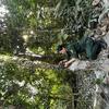
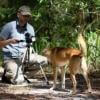
*Header photo: Parker Levinson, Point Blue Conservation Science
No showcases have been added to this group yet.

- @tomipiriyev
- | mr
I am maker , passionate in electronics, developer of Loko offline GPS tracker
- 0 Resources
- 6 Discussions
- 6 Groups

Fauna & Flora
Remote Sensing Scientist, Conservation Technology & Nature Markets @ Fauna & Flora - WILDLABS Geospatial Group Co-Lead


- 42 Resources
- 49 Discussions
- 9 Groups

Data scientist with expertise in Computer vision and remote sensing and a passion to work for the environment.
- 0 Resources
- 4 Discussions
- 5 Groups

Ecosystem Intelligence Lead at Wedgetail, living in Lutruwita/Tasmania
- 0 Resources
- 1 Discussions
- 7 Groups

- @ahmedjunaid
- | He/His
Zoologist, Ecologist, Herpetologist, Conservation Biologist


- 74 Resources
- 7 Discussions
- 25 Groups

- @Dauson_M
- | Mr
Dauson Msumange is a social enterpreneur, founder and director of Tanzania Eco-Tech And Conservation Hub (TEACH).

- 0 Resources
- 1 Discussions
- 23 Groups
Coach, consultant, volunteer, and donor


- 0 Resources
- 58 Discussions
- 12 Groups

Soil science, droughts effect of poverty, human rights advocate, wage equality in Europe, Drones in Digital Education


- 4 Resources
- 11 Discussions
- 18 Groups
- @KC
- | she/her
- 0 Resources
- 0 Discussions
- 8 Groups

I support humanitarian drone operations in the Global South and hope to do the same for ecology and conservation efforts. I specialise in drone: Safety, Operations, Regulations, and Airspace management
- 1 Resources
- 4 Discussions
- 1 Groups

Worked as a mechanical engineer for a defence co, then software engineer, then for a research lab specialising in underwater robotics.


- 1 Resources
- 144 Discussions
- 16 Groups

Aarhus University
Biologist and Research Technician working with ecosystem monitoring and research at Zackenberg Research Station in Greenland


- 19 Resources
- 272 Discussions
- 7 Groups
Careers
Fully funded PhD in AI biodiversity monitoring

Benno Simmons
Come and do the first research into responsible AI for biodiversity monitoring, developing ways to ensure these AIs are safe, unbiased and accountable.
11 June 2024
Article
New WILDLABS Funding & Finance group

Frank van der Most
WildLabs will soon launch a 'Funding and Finance' group. What would be your wish list for such a group? Would you be interested in co-managing or otherwise helping out?
5 June 2024
Funding
Apply! 2024 Conservation Tech Award

Jordan Steward
Now accepting applications for two $15,000 grants to help protect wildlife through cutting-edge, technology-driven efforts
3 June 2024
Article
Share Your Work in a Conservation Technology Video

Robin Marti Sarasa
Do you have photos and videos of your conservation tech work? We want to include them in a conservation technology showcase video
17 May 2024
Careers
Save the Elephants is seeking a Principal Investigator for our Elephant Collective Behaviour Project. This role will spearhead research initiatives using cutting-edge video analysis tools to study elephant group...
1 May 2024
Article
The Inventory User Guide

Jake Burton
Read in detail about how to use The Inventory, our new living directory of conservation technology tools, organisations, and R&D projects.
1 May 2024
Article
Introducing The Inventory!
Jake Burton
The Inventory is your one-stop shop for conservation technology tools, organisations, and R&D projects. Start contributing to it now!
1 May 2024
Careers

The Max Planck Institute of Animal Behavior at its sites in Constance and Radolfzell offers an international, interdisciplinary, and collaborative environment that opens up unique research opportunities. The goal of our...
13 March 2024
Article
Catch up on the conservation tech discussions and events that happened during World Wildlife Day 2024!
7 March 2024
Careers
Machine Learning Postdoc Position, Understory

Ross Davison
Join us to help prevent biodiversity loss! Understory is hiring a postdoc to lead R&D Development on generalizing Computer Vision models for vegetation identification across space/time/phenotypes.
29 February 2024
Article
Cutting edge plant conservation

Ben Nyberg
A game-changing new tool is helping conservationists working with critically endangered cliff plants
9 January 2024
A little off the typical path for Wildlabs - and probably not the sort of drone people typically think about here 😄 - but I find robotic agriculture very interesting, with the potential to greatly reduce use of poison...
29 November 2023
August 2025
event

Louisa Richmond-Coggan
September 2025
event
Louisa Richmond-Coggan
March 2026
February 2025
event

Léa Smadja
event

Wildlife Drones
33 Products
Recently updated products
| Description | Activity | Replies | Groups | Updated |
|---|---|---|---|---|
| want to join 2025 contest for humpback whale photos in Juneo Alaska of Kelp |
|
Citizen Science, Conservation Tech Training and Education, Drones, Emerging Tech, Geospatial, Human-Wildlife Coexistence, Marine Conservation, Open Source Solutions | 9 hours 40 minutes ago | |
| This is awesome!! |
|
Conservation Tech Training and Education, Drones, Emerging Tech, Geospatial, Open Source Solutions | 1 day 1 hour ago | |
| Thank you for sharing. Would love to learn bit more about the data workflow. Last year I tired to using QGIS and few existing models to count the birds from orthomosaics of... |
|
Drones, Latin America Community | 2 weeks 5 days ago | |
| G-DiNC 2026: Global Drones in Nature Conservation Symposium & ExpoNairobi & Naivasha, Kenya | March 3–6,... |
|
Drones, AI for Conservation, Conservation Tech Training and Education, Emerging Tech, Marine Conservation, Sensors | 4 weeks 1 day ago | |
| 15 years ago I had to rebuild the dams on a game reserve I was managing due to flood damage and neglect. How I wished there was an easier,... |
|
Drones, Conservation Tech Training and Education, Data management and processing tools, Emerging Tech, Geospatial, Open Source Solutions | 3 months 4 weeks ago | |
| I create ocean exploration and marine life content on YouTube, whether it be recording nautilus on BRUVs, swimming with endangered bowmouth... |
|
Acoustics, AI for Conservation, Animal Movement, Camera Traps, Citizen Science, Drones, Emerging Tech, Marine Conservation, Sensors, Sustainable Fishing Challenges, Wildlife Crime | 1 month 2 weeks ago | |
| Thank you for your reply, ChadI meant 10 as a whole, indeed. Perhaps you see your post in one group, but since it is tagged for all groups, I assumed you meant 10 in total.In your... |
|
Acoustics, AI for Conservation, Animal Movement, Camera Traps, Citizen Science, Climate Change, Community Base, Connectivity, Drones, eDNA & Genomics, Emerging Tech, Funding and Finance, Geospatial, Human-Wildlife Coexistence, Software Development, Wildlife Crime | 1 month 3 weeks ago | |
| Thank you for your comment Chris! Using these tools has made a huge difference in the way we can monitor and manage Invasive Alien Vegetation. I hope you are able to integrate... |
|
AI for Conservation, Citizen Science, Conservation Tech Training and Education, Drones, Geospatial, Human-Wildlife Coexistence, Open Source Solutions | 1 month 3 weeks ago | |
| I would love to hear updates on this if you have a mailing list or list of intersted parties! |
|
AI for Conservation, Community Base, Drones, Latin America Community, Marine Conservation, Open Source Solutions, Software Development | 2 months ago | |
| True, the US ecosystem is a challenging space right now, for basically all sectors. We should not let the US chaos prevent us from engaging with opportunities in other... |
|
AI for Conservation, Camera Traps, Connectivity, Drones, Emerging Tech, Ethics of Conservation Tech, Marine Conservation, Sensors | 3 months 4 weeks ago | |
| Not the same equipment, but at work I have used Metashape with DJI drones with an IR sensor (Mavic 3 Thermal, Matrice 3DT, Matrice 4T, etc) and the workflow to create IR maps... |
|
Drones | 2 months 2 weeks ago | |
| Hi all! I recently did a little case study using RGB drone data and machine learning to quantify plant health in strawberries. I wanted to... |
|
Citizen Science, Conservation Tech Training and Education, Drones, Geospatial | 3 months ago |


How much does it cost to incorporate Machine Learning into your drone GIS analysis process?
28 February 2025 8:44am
Applications are open for the Sustainability Leadership Recognition in Robotics!
12 February 2025 4:50pm
Tropical fieldwork funding! Up to $15,000 -Susan Wojcicki Fellowship

10 February 2025 7:01pm
SPOTS Internship Programme
6 February 2025 3:38pm
🌍 explorer.land Beginners Webinar: Create your first project and funding opportunity
6 February 2025 1:05pm
Webinar: Wildlife Drones’ Dragonfly – Revolutionizing VHF Tracking Technology
3 February 2025 4:31am
1st International Conference on Drones and Unmanned Systems (DAUS' 2025)
28 January 2025 5:29pm
Can/Should UAVs Be The Answer To Urbanisation & Wildlife Conflicts
20 January 2025 11:00am
BIOSPACE 2025
Drone specific GIS training online for Conservationists
9 January 2025 11:12am


Thesis Collaboration

4 January 2025 5:15pm

7 January 2025 12:32pm
Hi Simon,
Did you already contact INBO? Both biologging and citizen science are big themes at INBO. Last year we had a master thesis on camera trapping invasive muntjac. You can send me a private message for more info!

14 January 2025 3:30pm
Hi Simon,
We're a biologging start-up based in Antwerp and are definitely open to collaborate if you're interested. We've got some programs going on with local zoo's. Feel free to send me a DM if you'd like to know more.
15 January 2025 8:30am
Hi Simon,
We (Reneco International Wildlife Consultants) have an ongoing collaboration with a local University (Abu Dhabi, UAE) for developing AI tools (cameratrap/drone images and video analyses) and biomimetic robots applied to conservation (e.g https://www.sciencedirect.com/science/article/pii/S1574954124004813 ). We also have a genetic team working on eDNA. Field experience could be possible, in UAE or Morocco.
Feel free to write me back if you may be interested and would like to know more
Webinar: Drone-based VHF tracking for Wildlife Research and Management
9 January 2025 11:45pm
DeepForest Code Walkthrough - Airborne Machine Learning for Biodiversity Monitoring
6 January 2025 3:24pm
Recommended Hardware to stitch together Drone Imagery into Orthomosaics

25 November 2024 6:25am
21 December 2024 5:21am
This site may be of use for WebODM and photogrammetry using UAVs, as it focuses purely on processing that type of data and the hardware required. It also covers Conservation and Agriculture analysis and training using open source GIS and 3D point cloud software. Follow the links below:
https://www.geowingacademy.com
Hope this helps.

3 January 2025 3:41am
Hi @willrippon, I've worked with 3D reconstruction systems (software and hardware) for over 10 years now, and lately I've been really pleasantly surprised by Pix4D.
Here is a demo for a landscape survey my company just did.
Here is a 300 MB orthomosaic we just got as well.
Here is the hardware workflow described in detail.
On top of the drone imagery, we did "post-processing kinematics" (PPK) of the drone images (a very important thing to do, otherwise photogrammetry quality really suffers). I'm happy to discuss workflow further, and plan to release open source code and services.
If nothing else, go with Pix4D.

6 January 2025 7:40am
Thank you David, a phenomenal source!
New PhD - Drones, seaweeds & climate change
30 December 2024 11:33am
UAV flight planning software recommendations?
16 December 2024 7:30am

20 December 2024 1:37am
I believe map pilot pro allows for mapping with the DJI mini or another app I've heard people use is called map-creator. I think the later is a bit harder to get up and running. Third option is to take pictures the best you can in a double grid format and then use a stitching program to analyze the results. Pix4D and Agisoft are commercial options meanwhile OpenDroneMap is open source and has a lot of functionality. I ran into a similar problem when trying to use a DJI mavic air and they hadn't released an SDK.
22 December 2024 8:12am
Hi Chris! Yes, I use Drone Harmony. Although not free, the Basics package is very reasonably prices and allows for quite a good variety of flight mission planning options. It also runs a variety of DJI drones including the Mini and other Mini Models

23 December 2024 8:40pm
I've used both Dronelink and Litchi for flight planning with my DJI Mini SE - and then stitched in WebODM. Both apps support most DJI drones that have a suporting SDK. I'm not aware of any solutions that support any DJI drones without an SDK - and the more recent mini models doesnt have published SDKs since it seems DJI is limiting it to their enterprise level drones only.
Hope this helps!
Heinrich
Photogrammetry of Coral Reef Breakwaters
20 December 2024 1:11am
22 December 2024 8:35am
Hi Matthew
Wow, what an amazing project! It is incredible how you have managed to figure out some of the complexities of combining underwater imagery with UAV imagery. I am sure that was a fascinating learning experience.
I cannot help you with Points 1 and 3 but can suggest using Orfeo Toolbox for your segmentation process in Point 2. It integrates with QGIS and is open source. It will work with your UAV ortho maps if there is enough visible detail of the corals. You will be able to build and train your own model in order to accurately segment you reef. It takes a bit of know how to us the Machine Learning algorithms but once you get the hang of it it becomes immensely powerful. I will be building an online course on how to build your own machine learning processing algorithms in 2025 using this brilliant package. Once segmented you can save out the shapefiles and use them to segment and define your 3D point clouds in Agisoft.
Alternatively, look into using Picterra Geospatial AI. It is cloud based and much simpler to use but you may need to compress your imagery or point clouds in order to upload them given the file size you mentioned above. (Although they probable do allow for large uploads these days, I used Picterra in the past and it was brilliant!). Also i am not sure if it works with point clouds directly but have a look
I hope this helps. Great project!
AmazonTEC: 4D Technology for Biodiversity Monitoring in the Amazon (English)
25 November 2024 8:33pm
Mass Detection of Wildlife Snares Using Airborne Synthetic Radar

7 January 2024 6:50am
26 August 2024 1:14pm
Is thisvfunding grant an opportunity? https://www.dronedeploy.com/blog/expand-your-impact-with-a-grant-from-dronedeploy

24 October 2024 1:39am
Hi David, this is an incredible project. Would you be interested in sharing more of your experience with AI and wildlife conservation with my students? They are currently researching this, and would greatly benefit from speaking with a professional in the field. Thank you for considering!
21 November 2024 4:52pm
Hats off to your team for this absolute game-changing technology!
We rescue stray and wild animals in Taiwan, and the bulk of our work is saving animals maimed by wire snares and gin traps. We've become better at finding the devices, but still not good at all. There's simply too much difficult terrain to cover and we only have eyeballs and hiking sticks to find them. We know roughly where they are because the maimed stray dogs will eventually find their way onto a road and be reported to us. Then we close one of them, set up a trail camera, get the evidence of the poacher in the act of re-setting it, and get him prosecuted and shut down. But we need to be able to scale this greatly.
I've been using a thermal-imaging drone to locate stricken animals and am now considering buying another drone more suited to finding traps and snares. Some newer drones are able to navigate through forest without crashing into thin branches, so I've been looking into equipping one with LiDAR to see if that can detect the devices. But then I came across your YouTube channel and then this post about using airborne synthetic radar, and I'm incredibly excited to see where you might take this incredible technology.
How can we get our hands on the SAR you're using? It's 3 kg, right? I'm wondering if I could fit it to a suitable drone. If it works above forest canopy to detect traps and snares on the forest floor, then I can use a load-carrying drone instead of a light obstacle-avoidance drone.
If you made the SAR yourselves, then maybe think about crowdfunding for your project. I'd happily pledge funds if it meant I could get my hands on the kind of equipment you're using.
I can't tell you how happy I am thinking about all the animals' lives you'll save with this. Don't just remove the snares—gather evidence and put the poachers out of business too!
Catch Up with the East Africa Community Connect: December
 Agripina Cletus
and 1 more
Agripina Cletus
and 1 more
21 November 2024 4:40pm

23 November 2024 7:45pm
Computer Vision Developer
20 November 2024 10:39pm
Drones for GIS Best practice Document

31 March 2020 10:42am

27 November 2023 6:14pm
The link above does not seem to work but this does: https://wildlabs.net/sites/default/files/community/files/drones_for_gis_-_best_practice_v2.0.pdf

9 August 2024 1:09pm
Hi Nilaksha,
maybe this is interesting too 😉 My free manual 'Drones in Biomonitoring' - https://doi.org/10.5281/zenodo.8077113 can help to get (more) knowledge how to proceed easily and successfully 😉
It covers topics from buy to fly and data processing.
📖 The manual was developed to help authorities, landscape conservation / maintenance or nature conservation associations etc. in nature conservation to manage their growing monitoring tasks more effectively and cost-efficiently.
🛸 The use of drones can contribute in many ways to increasing the effectiveness of monitoring, reducing costs and minimizing disturbance - https://www.researchgate.net/profile/Steffen-Doering.
Best regards!
Steffen
10 November 2024 6:54am
Adrian,
Many thanks for v2.0 of the GIS best practices document. How does one obtain a copy of the RSPB code of practice B09 referenced in the best practices document? The link in the document does not work for me.
Thanks,
Rick

In what ways can drones contribute to linking individuals, communities, and small-scale producers in rural areas, facilitating the support of local food value chains
15 December 2023 3:44pm
Synopsis of current autonomous drone tech?

4 November 2024 8:15am
deadtrees.earth - An Open-Access and Interactive Database for Centimeter-Scale Aerial Imagery to Uncover Global Tree Mortality Dynamics
2 November 2024 9:00am
Can wireless charging technology be used for animal sensors?
17 October 2024 7:03am
23 October 2024 3:43pm
The results in the paper you mentioned are really exciting technology. It can really do a lot of things.
Thanks for your reply!
23 October 2024 4:00pm
Although this technology may not be mature now, and there are still many problems to be discussed and solved, I think it will have good application prospects.
Unfortunately, I am just an undergraduate student in China, and what I can do is very limited. Maybe in the future I can also do some similar research or what I want to do. Just like you, I am studying hard now.
Thank you very much for this forum and the professionals who responded to me. You have allowed me to see more perspectives and many things I didn't realize. Thank you very much!
28 October 2024 3:13pm
No problem at all Yu (@JY) and good luck with your studies! Happy to discuss this and any other ideas any time.
All the best,
Rob

Seeking Advice on Thermal Drones for Night-Time Elephant Observation

25 December 2023 9:53am

9 October 2024 6:07pm
When you say lower resolution do you also mean 640x480 resolution ? The drone Lars is referring to has that. Of course is higher than the budget of the inquirer. But I curious because things are changing. I have a 1280x1024 pixel thermal at the moment. Obviously anything but cheap.
14 October 2024 9:36am
@kimhendrikse Resolution is a term that can be confusing as it is applied to both the on-ground effective resolution: GSD (Ground Sampling Distance) as well as the resolution of the sensor. Ultimately the only thing that is important is if you can get the image quality that you need to be able to answer your research/management/security question. This is a result of the sensor resolution, the focal length of the lens and the distance from the object to the sensor. When there is a need to scan large areas drones need to fly higher to optimise battery life and ground covered and this reduces the effective resolution (GSD) regardless of which sensor you use. It depends on your needs if this is still sufficient or not. In my case, flying at 180m I have a GSD of 10.1cm which is enough to detect but not to classify animals.
14 October 2024 9:55am
180m is indeed very high and from above. I think a 640x512 thermal sensor with a 70mm lens can see animals at at 180m from sideways and could recognise something as a deer, but vertical I doubt it. In any case that's the specs of a handheld monocular I have and the distance that I see deer at that I believe could be recognised as deer.
I have a 1280x1024 pixel thermal camera here I will be testing but it's around 7x the price of the 640x512 one and quite a bit heavier.
Thanks for the details.
7 February 2025 6:51pm