Group curators

Pen-Yuan Hsing
- @Nycticebus_scientia
- | he/they
MammalWeb.org

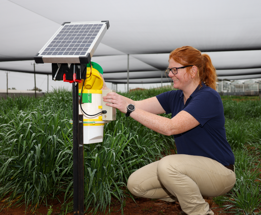
Amanda Matthes

Brianna Johns
- @briannajohns
- | she/they
Gathering for Open Science Hardware (GOSH)
Despite critical advancements in the tech solutions available to conservationists worldwide, many existing tools are cost-prohibitive in the landscapes that need them most. Additionally, those who create low-cost and open-source alternatives to pricey market tech often operate on tight budgets themselves, meaning they need more resources to promote their solutions to a broader market. We need increased communication around these solutions to highlight their availability, share lessons learned in their creation, and avoid duplication of efforts.
This group is a place to share low-cost, open-source devices for conservation; describe how they are used, including what needs they are addressing and how they fit into the wider conservation tech market; identify the obstacles in advancing the capacity of these technologies; and to discuss the future of these solutions, particularly their sustainability and how best to collaborate moving forward. We welcome contributions from both makers and users, whether active or prospective.
Here is how we see the current OSS space and how this group plans to change it by supporting both makers and users:
Many users do not appreciate the significant benefits of open-source tech. This group will educate users about the advantages and the need for open-source tech, specifically in the context of ecology work. We achieve this by stimulating regular discussions on the forum and by encouraging and supporting users to use open-source tools wherever possible.
Building OSS can be difficult. We want to support both established and potential makers who wish to develop OSS. The OSS group is a place where makers can find funding opportunities, ask current and potential users questions, and share their technologies.
Using OSS can be difficult. We also want to support adopters of OSS tech. We do this by offering a place for users to share challenges they face and crowdsource advice on things like technology choice or technical support.
Makers do not know what users want or need. The OSS group is a place that facilitates conversations between makers and users. This will give users a voice and ensure that makers are aware of the needs of users, enabling them to build better solutions.
The community is small and scattered. We want to grow an inclusive community of OSS practitioners. Our goal is to become the go-to place for discussions on the topic where people feel a sense of belonging.
Resources for getting started
- How do I use open source remote sensing data in Google Earth Engine? | Tech Tutors
- How do I use open source remote sensing data to monitor fishing? | Tech Tutors
- Low Cost, Open Source Solutions | Virtual Meetup
- What would an open source conservation technology toolkit look like? | Discussion
- December 2024 Open Source Solutions Community Call
Header image: Shawn F. McCracken
Group curators

- @Nycticebus_scientia
- | he/they
MammalWeb.org
Co-founded citizen science camera-trapping project with interest in developing 100% open source wildlife tech. Advocate for open science/open research. Community member of the Gathering for Open Science Hardware.


- 3 Resources
- 24 Discussions
- 3 Groups
trying to understand and improve the welfare of all animals that can suffer

- 4 Resources
- 6 Discussions
- 7 Groups

- @briannajohns
- | she/they
Gathering for Open Science Hardware (GOSH)
Interested in the application of open source technologies for conservation research.


- 9 Resources
- 4 Discussions
- 4 Groups

- @Halima_Hassan
- | She
Halima Hassan is a geographer, environmentalist, educator, and climate change activist who is passionate about bridging science, community, and conservation.
- 0 Resources
- 0 Discussions
- 6 Groups

- @DeepakSathyanarayan
- | he/his
Deepak is an experienced professional who has served in multiple leadership roles in technology, science, product development, and engineering programs. He has proven expertise in shaping and executing technology strategies across defense, space, health, and environment sectors.

- 0 Resources
- 5 Discussions
- 7 Groups

- 0 Resources
- 0 Discussions
- 14 Groups

- @martinyonga
- | He/His
a Research Entrepreneur always looking for ways to demonstrate the interconnectedness of nature & our livelihoods

- 0 Resources
- 0 Discussions
- 3 Groups

- 0 Resources
- 1 Discussions
- 7 Groups
- 0 Resources
- 0 Discussions
- 15 Groups
- @otgonbayartm
- | He / His
Many thanks to WILDLABS. This community aligns precisely with my professional interest in applying IT expertise to nature conservation.

- 0 Resources
- 1 Discussions
- 7 Groups

Aeracoop & Dronecoria
Computer engineer, Drone Pilot, Seed researcher, Wild Tech Maker


- 3 Resources
- 37 Discussions
- 11 Groups
- @briannajohns
- | she/they
Gathering for Open Science Hardware (GOSH)
Interested in the application of open source technologies for conservation research.
- 9 Resources
- 4 Discussions
- 4 Groups

- @sopara
- | She/her
- 0 Resources
- 0 Discussions
- 4 Groups

- @meredithspalmer
- | she/her
Yale University
Conservation, Innovation, Education

- 8 Resources
- 27 Discussions
- 9 Groups
- @Nycticebus_scientia
- | he/they
MammalWeb.org
Co-founded citizen science camera-trapping project with interest in developing 100% open source wildlife tech. Advocate for open science/open research. Community member of the Gathering for Open Science Hardware.
- 3 Resources
- 24 Discussions
- 3 Groups
Link
Weed-AI: Supporting the AI revolution in weed control
Amber Balfour-Cunningham
Weeds, by definition, are plants in the wrong place but Weed-AI is helping put weed image data in the right place. Weed-AI is an open source, searchable, weeds image data platform designed to facilitate the research and...
7 May 2025
Link
OpenAgTech newsletter: Bringing you the latest in open-source tech for agriculture.

Amber Balfour-Cunningham
Bringing you the latest in open-source technology for agriculture. This accompanies the Open Source Agriculture respository: Collating all open-source datasets, software tools and deployment platforms related to open-...
1 May 2025
Link
Open Source Agriculture Repository
Amber Balfour-Cunningham
Repository for all things open-source in agricultural technology (agritech) development by Guy Coleman. This accompanies the OpenSourceAg newsletter. Aiming to collate all open-source datasets and projects in agtech...
1 May 2025
Article
Fires in Serengeti and Masai Mara National Parks have burned massive areas this year. With Google Earth Engine, it's possible to quantify burn severity using the normalized burn ratio function, then calculate the total...
29 April 2025
Article
Nature Tech for Biodiversity Sector Map launched!

Carly Batist and 1 more
Conservation International is proud to announce the launch of the Nature Tech for Biodiversity Sector Map, developed in partnership with the Nature Tech Collective!
1 April 2025
Article
Modern GIS: Moving from Desktop to Cloud

Vance Russell
Modern GIS is open technology, scalable, and interoperable. How do you implement it? [Header image: kepler.gl]
12 March 2025
Article
Advancing Hierarchical Classification of Ocean Life

Lilli Wakinekona Carlsen
Join the FathomNet Kaggle Competition to show us how you would develop a model that can accurately classify varying taxonomic ranks!
4 March 2025
Article
Last month, we spent four days trekking through Cerro Hoya National Park in Panama, where we hiked from near sea level up to the cloud forest to deploy Mothboxes.
14 February 2025
Link
New paper - "acoupi integrates audio recording, AI-based data processing, data management, and real-time wireless messaging into a unified and configurable framework. We demonstrate the flexibility of acoupi by...
7 February 2025
Article

Over the years, a large number of developments have gone up in the area that I live in and the municipality is not doing what they should when it comes to upholding the laws that have been put in place to protect the...
20 January 2025
Article
Throughout November and December, the Mothbox team has been running field tests in Panama, cleaning up their data for post-processing, and starting an online shop with moth-themed merch!
19 December 2024
Article
Announcement of Project SPARROW

Zhongqi Miao
SPARROW: Solar-Powered Acoustics and Remote Recording Observation Watch
18 December 2024
May 2025

June 2025
event
Nalini
October 2025
event

Lacey Hughey and 3 more
September 2024
event
Vanesa Reyes

| Description | Activity | Replies | Groups | Updated |
|---|---|---|---|---|
| Yep we are working on it 1/ segment 2/remote unwanted ecosytem3/get local potential habitat4/generate5/add to picture |
|
Geospatial, AI for Conservation, Data management and processing tools, Open Source Solutions, Software Development | 1 month 3 weeks ago | |
| All sound, would be nice if there were only 5, though! |
|
AI for Conservation, Citizen Science, Data management and processing tools, Emerging Tech, Ethics of Conservation Tech, Funding and Finance, Geospatial, Open Source Solutions, Software Development | 1 month 4 weeks ago | |
| It's great to see so much interest in presenting at this webinar. We have also received interest through direct messages and meetings that we've happened to have had. Thank you... |
|
Open Source Solutions, Community Base, Funding and Finance | 2 months 2 weeks ago | |
| Thanks again for the interesting discussion everyone! Just a note that while I touched on it in my opening post above, there were still questions in this thread about what... |
+28
|
Open Source Solutions, AI for Conservation, Ethics of Conservation Tech, Software Development | 2 months 2 weeks ago | |
| Thanks @VAR1 great insights! Funny you mentioned the honey thing, @hikinghack said the same in response on the GOSH forum. I think the point I'm trying to make with the vegan... |
|
Open Source Solutions, AI for Conservation, Conservation Tech Training and Education, Ethics of Conservation Tech, Geospatial, Software Development | 2 months 2 weeks ago | |
| Sure, Akio! Happy to answer!1. Yes, something like that. The few existing i guess applied already for GPS collar (literally collar) that usually for big cats and some other big... |
|
Sensors, Animal Movement, Open Source Solutions | 2 months 2 weeks ago | |
| How much does it cost to incorporate machine learning into your conservation drone geospatial analysis? How does it speed up your workflow... |
|
Conservation Tech Training and Education, Drones, Geospatial, Open Source Solutions, Sensors, Software Development | 2 months 3 weeks ago | |
| Another question. Right now pretty much all camera traps trigger on either PIR sensors or small AI models. Small AI models would tend to have a limitation that they would... |
|
AI for Conservation, Camera Traps, Data management and processing tools, Open Source Solutions, Software Development | 3 months 1 week ago | |
| Hi Lorenzo,I highly recommend the OpenSoundscapes package (developed by the Kitzes Lab at U Pittsburgh) - there are workflows to build your own CNNs there, the documentation is... |
|
Acoustics, AI for Conservation, Animal Movement, Open Source Solutions | 3 months 2 weeks ago | |
| Thanks! I am familiar with EarthRanger but wasn't aware it could be used for behavioural data collection |
+6
|
Build Your Own Data Logger Community, Data management and processing tools, Open Source Solutions | 3 months 2 weeks ago | |
| Steve and I are looking to develop a low-cost benthic drift camera with a live video feed. Our hope is to use an acoustic modem to give us a low quality feed for navigation /... |
|
Marine Conservation, Build Your Own Data Logger Community, Connectivity, Emerging Tech, Open Source Solutions | 5 months ago | |
| Today, I'm really grateful for the chance to present at the first WILDLABS Open Source Solutions online community meeting. Here are two... |
|
Open Source Solutions | 5 months 2 weeks ago |


WCS Conservation Technology Webinar Series
23 August 2024 3:20pm

23 August 2024 8:30pm
WILDLABS Virtual Meetup: Bioacoustics Data Analysis and AI
22 August 2024 7:22pm
WILDLABS Virtual Meetup: Bioacoustics Data Networks and Platforms
22 August 2024 5:45pm
Project Spotlight: OpenFlexure Microscope
22 August 2024 11:04am
Community Choice Award Winners: 2024 #Tech4Wildlife Photo Challenge
15 August 2024 2:41am
Cast your vote in the #Tech4Wildlife Photo Challenge Community Choice Awards!
12 August 2024 1:46pm

12 August 2024 9:15pm

13 August 2024 11:26am
July 2024 OSS paper round-up
11 August 2024 11:25pm
Open Source Solutions Announcement: Introducing New OSS Group Leaders
 Brianna Johns
and 2 more
Brianna Johns
and 2 more
8 August 2024 3:24pm
Integrating Maps with VR/AR for Exploring Environmental Conservation and sensitization

3 August 2024 7:29am

3 August 2024 3:26pm
Very interesting topic
AI accelerator for nonprofits working in the Climate area
31 July 2024 3:01pm

31 July 2024 6:24pm
Great acomplishment!!!

1 August 2024 1:39pm
Thank you so much! Now everything is in the hands of amazing organizations and companies! But the first results of the Disaster Management cohort are bringing a very optimistic vision! :) I hope for the same in the Climate cohort!
Two-year Postdoc (extendable) in AI and Remote Sensing to Monitor Earthworms in the Field
16 July 2024 9:02am
Mega-OSH meetup!

11 August 2024 8:10am
20 August 2024 4:07pm
Keele University - KTP position
8 July 2024 5:07pm

Free and Open Source Software for Geospatial

5 July 2024 7:30pm
Global trials for "Reefie" the coral reef inspector

30 June 2024 12:52pm
FOSS Geospatial Tools

VIHAR-2024 deadline extension, June 30th (Interspeech satellite event)
5 June 2024 10:30am
5 June 2024 3:05pm
Thanks for sharing this @nkundiushuti ! I think this post would be better suited as an event, that way it will show up on the WILDLABS event calendar page. Let me know if you have any questions on how to make an event post! You just click the +Post button in the top right corner, then click "event."
7 June 2024 8:29am
hi Alex!! I already posted the event, I just wanted to posted an update: the deadline was extended.
7 June 2024 1:45pm
Fantastic!!
€4,000 travel grants for insect monitoring an AI
6 June 2024 4:49pm
New WILDLABS Funding & Finance group
5 June 2024 3:24pm
5 June 2024 4:14pm

6 June 2024 1:38am

6 June 2024 4:16am
Share Your Work in a Conservation Technology Video

17 May 2024 9:06pm
Travel grants for insect monitoring an AI
3 May 2024 5:20pm
CollarID: multimodal wearable sensor system for wild and domesticated dogs

3 May 2024 1:42am

3 May 2024 10:14am
Hi Patrick,
This is so cool, thanks for sharing! It's also a perfect example of what we were hoping to capture in the R&D section of the inventory - I've created a new entry for #CollarID so it's discoverable and so we can track how it evolves across any mentions in different posts/discussions that come up on WILDLABS. This thread appears on the listing, and I'll make you three the contacts for it too. But please do go in and update any of the info there as well!
Steph

3 May 2024 2:01pm
Hi Steph,
We appreciate the support! Thanks for the tag and your help managing the community!
Patrick
WILDLABS AWARDS 2024 - Underwater Passive Acoustic Monitoring (UPAM) for threatened Andean water frogs
30 March 2024 3:54pm

5 April 2024 12:13pm
Congratulations, very exciting! Keep us updated!

7 April 2024 6:09pm
This is so cool @Mauricio_Akmentins - congrats and look forward to seeing your project evolve!

1 May 2024 5:17pm
Congratulations! My first hydromoth was just arrived yesterday and so excited! Looking forward for the update from your project!!!
The Inventory User Guide

1 May 2024 12:46pm
Introducing The Inventory!
1 May 2024 12:46pm

22 July 2024 10:55am
23 July 2024 2:05pm
23 July 2024 2:53pm
Hiring Chief Engineer at Conservation X Labs

1 May 2024 12:19pm
Earth Blox dataset review: Meta Global Canopy Height (1m)

23 May 2024 7:23pm

27 May 2024 8:58am
Pytorch-Wildlife: A Collaborative Deep Learning Framework for Conservation (v1.0)
21 February 2024 10:30pm
26 February 2024 11:58pm
This is great, thank you so much @zhongqimiao ! I will check it out and looking forward for the upcoming tutorial!
17 April 2024 11:07am
Hi everyone! @zhongqimiao was kind enough to join Variety Hour last month to talk more about Pytorch-Wildlife, so the recording might be of interest to folks in this thread. Catch up here:
23 April 2024 9:48pm
Hi @zhongqimiao ,
Might you have faced such an issue while using mega detector
The conflict is caused by:pytorchwildlife 1.0.2.13 depends on torch==1.10.1pytorchwildlife 1.0.2.12 depends on torch==1.10.1pytorchwildlife 1.0.2.11 depends on torch==1.10.1
if yes how did you solve it, or might you have any ideas?
torch 1.10.1 doesn't seem to exist
WILDLABS AWARDS 2024 - No-code custom AI for camera trap species classification
5 April 2024 7:00pm
10 April 2024 3:55am
Happy to explain for sure. By Timelapse I mean images taken every 15 minutes, and sometimes the same seals (anywhere from 1 to 70 individuals) were in the image for many consecutive images.
17 April 2024 5:53pm
Got it. We should definitely be able to handle those images. That said, if you're just looking for counts, then I'd recommend running Megadetector which is an object detection model and outputs a bounding box around each animal.
21 April 2024 5:19pm
Hi, this is pretty interesting to me. I plan to fly a drone over wild areas and look for invasive species incursions. So feral hogs are especially bad, but in the Everglades there is a big invasion of huge snakes. In various areas there are big herds of wild horses that will eat themselves out of habitat also, just to name a few examples. Actually the data would probably be useful in looking for invasive weeds, that is not my focus but the government of Canada is thinking about it.
Does your research focus on photos, or can you analyze LIDAR? I don't really know what emitters are available to fly over an area, or which beam type would be best for each animal type. I know that some drones carry a LIDAR besides a camera for example. Maybe a thermal camera would be best to fly at night.
23 August 2024 7:04pm