Group curators

Vance Russell
3point.xyz

Ahmed Junaid
- @ahmedjunaid
- | He/His

Elsa Carla De Grandi
Fauna & Flora
Who We Are
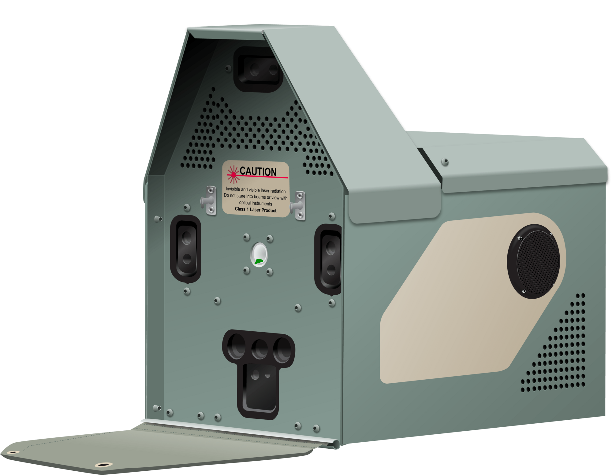
Geospatial data and analysis is critical for conservation, from planning to implementation and measuring success. Every day, mapping and spatial analysis are aiding conservation decisions, protected areas designation, habitat management on reserves and monitoring of wildlife populations, to name but a few examples. The Geospatial group focuses on all aspects of this field, from field surveys to remote sensing and data development/analysis to GIS systems.
How to Get Started
Want to learn more about how remote sensing is used in conservation? Check out the first two episodes of this season of Tech Tutors, where our Tutors answer the questions How do I use open source remote sensing data to monitor fishing? and How do I access and visualise open source remote sensing data in Google Earth Engine? You can also check out our Virtual Meetup Archive for a range of panels that overlap with Geospatial topics, or take a look at our Earth Observation 101 lecture series from Dr. Cristian Rossi.
Our Purpose
The WILDLABS Geospatial Group is for conservation practitioners, geospatial analysts, and academics that want to:
- Share geospatial resources, best practices, data, and ideas;
- Network amongst geospatial and data practitioners;
- Create peer learning opportunities;
- Promote the use of free and open-source geospatial software; and
- Improve the use of GIS software and geospatial analyses in conservation management and research.
Group curators
3point.xyz
Over 35 years of experience in biodiversity conservation worldwide, largely focused on forests, rewilding and conservation technology. I run my own business assisting nonprofits and agencies in the conservation community


- 7 Resources
- 69 Discussions
- 12 Groups
- @ahmedjunaid
- | He/His
Zoologist, Ecologist, Herpetologist, Conservation Biologist


- 75 Resources
- 7 Discussions
- 16 Groups
Fauna & Flora
Remote Sensing Scientist, Conservation Technology & Nature Markets @ Fauna & Flora - WILDLABS Geospatial Group Co-Lead

- 42 Resources
- 49 Discussions
- 9 Groups
No showcases have been added to this group yet.
- 0 Resources
- 0 Discussions
- 6 Groups
I created Snappy Mapper to make gathering geospatial data more accessible for everyone.

- 0 Resources
- 5 Discussions
- 12 Groups
Fauna & Flora
Remote Sensing Scientist, Conservation Technology & Nature Markets @ Fauna & Flora - WILDLABS Geospatial Group Co-Lead
- 42 Resources
- 49 Discussions
- 9 Groups
- @tcsmith
- | he/him
I am a conservation biologist interested in modeling social-ecological systems.
- 0 Resources
- 0 Discussions
- 11 Groups

- @Aurel
- | She/Her
Looking to reconcile biodiversity conservation and finance.

- 2 Resources
- 1 Discussions
- 10 Groups

- @Lysa001
- | she/her
Conservation Biologist
- 0 Resources
- 0 Discussions
- 15 Groups

Natural Solutions

- 0 Resources
- 17 Discussions
- 10 Groups

Data scientist with expertise in Computer vision and remote sensing and a passion to work for the environment.
- 0 Resources
- 4 Discussions
- 5 Groups

Smithsonian Institution
- 0 Resources
- 0 Discussions
- 13 Groups
Ecosystem Intelligence Lead at Wedgetail, living in Lutruwita/Tasmania
- 0 Resources
- 1 Discussions
- 7 Groups
- 0 Resources
- 0 Discussions
- 7 Groups
MSc student in wildlife management and conservation

- 0 Resources
- 2 Discussions
- 12 Groups
Article
A comprehensive review on biodiversity information portals

Stephanie O'Donnell
Looking for biodiversity data? New review paper has an overview of biodiversity information portals, both global and country-specific
9 May 2022
Careers

Fauna & Flora International is seeking a Technical Specialist with expertise in Remote Sensing to join their Conservation Technology team. Visit the FFI website for further details and how to apply. The closing...
22 March 2022
Careers
Fauna & Flora International is seeking a qualified candidate for the position of a Technical Specialist, Analytics to support and grow the use of spatial technologies and analyses for conservation planning and...
21 March 2022
Community Announcement
Apply now: Women in Conservation Technology Programme, Kenya
Stephanie O'Donnell
Are you an early career Kenyan conservationist looking to explore emerging conservation technologies while networking with a strong cohort of other female leaders? Apply now for our 6-month Women in Conservation Tech...
8 March 2022
Careers
Opportunity: Manager, Science Based Targets Forests
World Wide Fund for Nature/ World Wildlife Fund (WWF)
World Wildlife Fund US are now hiring a Manager for Science Based Targets Forests.
10 February 2022
Article
Choosing the right IoT connectivity solution

Ellie Warren
In this article, Swarm Technologies give a detailed analysis of the tradeoffs between the most common IoT connectivity solutions to improving food production, combating climate change, optimizing supply chains and many...
19 November 2021
Funding
Opportunity: GEO-Microsoft Planetary Computer Programme

Group on Earth Observations (GEO)
The GEO-Microsoft Planetary Computer Programme invites the GEO community to be among the early adopters of Microsoft's Planetary Computer. The Programme will support a number of 12-month projects that use The Planetary...
4 November 2021
Article
EarthRanger Announces Inaugural Conservation Tech Award Recipients

Allen Institute for AI
On 3rd November 2021, Earthranger Announced Giraffe Conservation Foundation and Lion Guardians as the inaugral Conservation Tech Award Recipients. The two organizations are Harnessing the Power of Technology to Protect...
3 November 2021
Article
Black Rock Forest (BRF) are recruiting a seasonal Wildlife Connectivity Technician. Visit their website for further details and how to apply. Hurry, applications close soon!
3 November 2021
Article
Driven by data: Improved protected area effectiveness in Royal Manas National Park, Bhutan
Society for Conservation Biology
The authors of this article analyze the use of The Spatial Monitoring and Reporting Tool (SMART) as a Law Enforcement Monitoring tool deployed in The Royal Manas National Park. The tool serves as a holistic approach to...
29 October 2021
Article
The need for speed in Sea Turtle Telemetry

Arribada Initiative
In this article, you will get a glimpse of how Arribada Initiative recognizes the advantages of incorporating SnapperGPS receivers into existing tag designs to acquire fast GPS fixes within the marine environment....
15 October 2021
Article
Allen Coral Atlas Completes First Global Coral Reef Maps

Allen Coral Atlas
The Allen Coral Atlas have completed the first global coral reef maps. Visit the Allen Coral Atlas website for more information. Header image: Coral Reef Image of the Ailinginae Atoll, Marshall Islands, Credit: Greg...
22 September 2021
September 2025
event

Ideal Workplace Solutions
October 2025
event

Lacey Hughey and 3 more
November 2025

event

Brigitta Keeves
March 2026

April 2025
event
Nalini
March 2025

131 Products
Recently updated products
| Description | Activity | Replies | Groups | Updated |
|---|---|---|---|---|
| In what ways can drones contribute to linking individuals, communities, and small-scale producers in rural areas, facilitating the support... |
|
Drones, Geospatial | 1 year 8 months ago | |
| @dmorris joined Variety Hour to give us 'a bunch of lightning talks inside a lightning talk'. Check out the recording to get a whirlwind... |
|
AI for Conservation, Drones, Geospatial | 1 year 8 months ago | |
| I'm registered with the TWS2023 app, so feel free to nudge me there as well |
|
Animal Movement, Geospatial, Software Development | 1 year 9 months ago | |
| Digital Earth Africa are doing fantastic work to make Earth Observation data free and accessible, delivering decision-ready products to the... |
|
East Africa Community, Geospatial | 1 year 10 months ago | |
| Stefano Puliti joined Variety Hour to share his work using 3D photogrammetric data from UAVs for pre- and post-harvest inventory of forest... |
|
Climate Change, Data Management & Mobilisation, Drones, Geospatial | 1 year 10 months ago | |
| Carly, that would be great! Thanks! I work with soundscapes and love the work of Rainforest Connection! I'll send you an email (@CUNY) to coordinate! |
|
Acoustics, AI for Conservation, Conservation Tech Training and Education, Drones, eDNA & Genomics, Emerging Tech, Geospatial | 2 years 2 months ago | |
| Do you have a wild animal tracking story that involves adventure or misadventure? Share it with us! From going around in circles for hours... |
|
Animal Movement, Citizen Science, Drones, Geospatial | 2 years 3 months ago | |
| I'm looking for any recommendations for any entry level/internship remote roles/companies in the United States that are focused in... |
|
AI for Conservation, Conservation Tech Training and Education, Early Career, Geospatial | 2 years 4 months ago | |
| Hi Jeremy, With a quick search I've found the paper linked below. It looks like equipments such as Livox MID are sufficient for plot-level analyses, but not for individual... |
|
Drones, Earth Observation 101 Community, Emerging Tech, Geospatial, Sensors | 2 years 4 months ago | |
| Indeed, I'll be there too! I like to meet new conservation friends with morning runs, so I will likely organize a couple of runs, maybe one right near the conference, and... |
|
Acoustics, AI for Conservation, Autonomous Camera Traps for Insects, Camera Traps, Geospatial | 2 years 4 months ago | |
| Thank you so much for your reply! I'll look in to this now :) |
|
Acoustics, Autonomous Camera Traps for Insects, Camera Traps, Data Management & Mobilisation, Drones, Geospatial, Software Development | 2 years 5 months ago | |
| Our project in very short is, setting up a sensor network for monitoring airborne biomass, mainly insects, birds and bats in near realtime, and to develop a forecast model to be... |
|
Autonomous Camera Traps for Insects, Animal Movement, Geospatial, Sensors | 2 years 5 months ago |


Connecting the Dots: Integrating Animal Movement Data into Global Conservation Frameworks
Lacey Hughey
and 3 more
30 April 2025 1:38am
Fires in the Serengeti: Burn Severity & Remote Sensing with Earth Engine
29 April 2025 6:16pm
10 June 2025 5:39pm
From Field to Funder: How to communicate impact?
16 April 2025 3:51pm

17 April 2025 5:04pm
Great questions @LeaOpenForests !
I don't have concrete answers since I am not a stakeholder in any project in particular. Based on experience with research on the potential for a similar one-stop-shop for science metrics, I would suggest that there is no simple solution: different actors do need and have different views on presenting and viewing impact. This means possible gaps between what one group of actors need and what the other is willing or able to produce. One can hope, search and aim for sufficient overlap, but I don't see how they would necessarily or naturally overlap.
Still, I would guess that if there are dimensions of overlap, they are time, space and actor-networks
28 April 2025 3:18pm
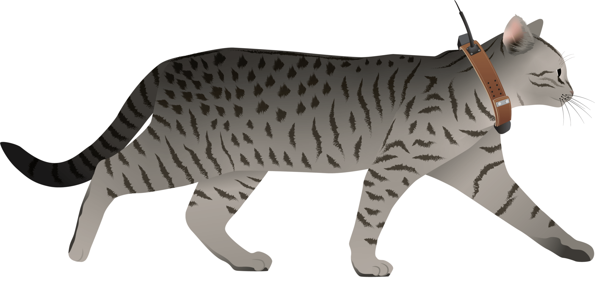
I have posted about this in a different group, but I love boosting the impact of my communication through use of visuals.
Free graphics relating to conservation technology and the environment are available at:
National Environmental Science Program Graphics Library
Graphics below of a feral cat with a tracking collar and a cat grooming trap are examples of symbols available courtesy of the NESP Resilient Landscapes Hub, nesplandscapes.edu.au.
UMCES Integration and Application Network Media Library
Geospatial Group Café April 22
21 April 2025 6:47pm
MyProgress: Advancing GIS and R programming skills.
20 April 2025 1:45pm
Enterprise Geospatial Undergraduate Intern

18 April 2025 2:50pm
Ground Truth: How Are You Verifying What Maps Show?
 Léa Smadja
and 1 more
Léa Smadja
and 1 more
16 April 2025 3:35pm
Geospatial Group Café (April)
Elsa Carla De Grandi
and 2 more
15 April 2025 11:38am
21 April 2025 4:59pm
23 April 2025 9:17am
11 June 2025 11:05am
Application of computer vision for off-highway vehicle route detection: A case study in Mojave desert tortoise habitat
8 April 2025 2:30pm
22 April 2025 11:05pm
22 April 2025 11:05pm
24 April 2025 9:24am
Airbus Foundation: Harnessing Aerospace Capabilities for Nature-Based Climate Resilience. EUR 10,000 + extras

4 April 2025 3:18pm
Ecology Georeferencing - A dataset

4 April 2025 2:59pm
Free Webinar by Nature FIRST: Bridging Ecology and ESG – Smarter Decisions with Knowledge Graphs
2 April 2025 10:59am
Multiple grants
28 March 2025 1:42pm
SCGIS International Conference: Geospatial Technology Innovations for Conservation

27 March 2025 6:35pm
Nature Tech Unconference - Anyone attending?
8 March 2025 12:11pm
15 March 2025 8:28am
Definitely!

21 March 2025 12:07pm
The Futures Wild team will be there :)
26 March 2025 7:54pm
Yep see you on friday
Generative AI for simulating landscapes before and after restoration activities

26 March 2025 1:59pm
26 March 2025 7:50pm
Yep we are working on it

1/ segment
2/remote unwanted ecosytem
3/get local potential habitat
4/generate
5/add to picture
Cloud-Native Geospatial Conference
26 March 2025 3:40pm
United Nations Open Source Principles

13 March 2025 4:13pm
25 March 2025 11:54am
All sound, would be nice if there were only 5, though!
Mole-Rat Mystery. Can anyone help?
19 March 2025 3:25pm
20 March 2025 4:17pm
Hi Sean! I love that you are naturally curious and are pursuing really cool projects in your free time. I know absolutely nothing about cape dune mole rats (in fact, never heard of them prior to this post, but I will confess I was interested in the concept of a mole-rat mystery), but I did have some thoughts about where you might find more information-
It seems like the types of questions you are asking are pretty specific and niche. My first thought on how to find someone with expertise in these specific rodents was to go to their iNat page- there you can see the top observer and top identifier. Both individuals are active researchers, so I think reaching out to them on iNat or finding their e-mails from their respective organizations' sites might be a good way to get in touch.
I also did a quick search in Google Scholar in which I typed in only the scientific name and hit go. The two publications linked above caught my eye as potentially helpful in your search- particularly the first one. They excavated burrows and noted things like home range size, that males have more burrows than females, etc. I didn't go much beyond the abstracts but these seem like they might get you on the right tracks!
Happy ratting!
25 March 2025 8:36am
Good morning Vance
Thank you very much! I am looking into some papers that I was kindly directed to by Jocelyn Stalker ( her comment below) and am looking for ways to establish population dynamics just by looking at the mounds. Once I have figured this part out I should be able to correlate the information to the drone data. The Ground Sampling Distance (GSD) for this project is very small, 1.3cm per pixel. This has proven to be very useful because I am able to use the very fine 3D models to run change detections that pick up new heaps and vegetation reductions (which may be due to feeding) on a weekly basis. It helps not only visualise but also quantify where the most activity has occurred. I will keep you posted!
25 March 2025 8:47am
Good morning Jocelyn
Thank you very much for your comment, this is proving to be very useful advice and thank you so much for setting me on the right path!! This is very exciting!!
They are the most extra ordinary little creatures and as I don't know much about them either, I thought I'd try learn as much as I can (not just through literature, but through my own observations as well). I walk past these mounds daily and am always intrigued when I see more mounds and really enjoy watching them actively push the dune sand up to the surface (you don't see the wee fellas but you can watch the sand move as they burrow away). One afternoon while flying my drone (I was quantifying the changes in sediment deposition and erosion volumes in the estuary after a flood that was soon followed by a super high tide), I had a heap between my legs and all of a sardine it starts moving! So that sparked my curiosity even further.
I will keep you posted on my findings and thank you again for the papers and the direction! It is greatly appreciated!!
Transitioning to GIS from Tech

17 March 2025 10:54am


Drone Photogrammetry & GIS Introduction (Foundation) Course
 Sean Hill
and 1 more
Sean Hill
and 1 more
18 March 2025 12:47pm
mapmixture: An R package and web app for spatial visualisation of admixture and population structure
Modern GIS: Moving from Desktop to Cloud
12 March 2025 7:10pm
Hansen Global Forest Change Dataset
11 March 2025 11:12am
Hansen Global Forest Change v1.11 (2000-2023) [deprecated] | Earth Engine Data Catalog | Google for Developers
Results from time-series analysis of Landsat images in characterizing global forest extent and change. The 'first' and 'last' bands are reference multispectral imagery from the first and last available years for Landsat spectral bands corresponding to red, NIR, SWIR1, and SWIR2. Reference composite imagery represents median observations from a set …

Data storage and Esri integration with Microsoft Azure

8 January 2025 10:30am
GPS collars for domestic dogs

20 January 2025 3:26am
20 February 2025 8:46pm
What are your parameters? Do you need yes no movement, which could be collected with an accelerometer and no lat-long data?
Movement on an XY grid once an hour within a tightly bounded area?
High resolution once per second data? Large geographic area?
Different technologies deliver ddifferent datasets. Sometimes, significantly!
10 March 2025 11:37am
Hi Stephanie, at https://Savannahtracking.com we develop and manufacture a variety of collars with sizes ranging from about 95 grams for Raptors, 200grams - 1200g for mammals, and collars for large mammals such as Elephants. We currently have collars deployed on Dingoes which are about the same size as domestic dogs, and I believe that a similar solution will be perfect for your needs.
Our GPS collars can be programmed to collect high resolution data (15-minute gps positions) with hourly uploads via iridium satellite to our server where you can view and download the data from our dedicated windows or MAC SDM platforms. We also have a view only android/ios app. All our collars have two-way satellite communication, Internet based downloading via the free accompanying Savannah Tracking data manager software, automated Google Earth links for visualization, fully user definable geo fencing allowing for point, line and polygon fences and automated app and mail alarms in case of zone violation.
Kindly reach out to us and we can discuss a bespoke solution for your tracking needs at info@savannahtracking.com
11 March 2025 3:31am
Thank you! I will follow up by email.
deadtrees.earth
9 March 2025 11:14am
deadtrees.earth
An open database for accessing, contributing and visualizing remote sensing-based tree mortality data.

1 May 2025 11:44am