Group curators

Vance Russell
3point.xyz

Ahmed Junaid
- @ahmedjunaid
- | He/His

Elsa Carla De Grandi
Fauna & Flora
Who We Are
Geospatial data and analysis is critical for conservation, from planning to implementation and measuring success. Every day, mapping and spatial analysis are aiding conservation decisions, protected areas designation, habitat management on reserves and monitoring of wildlife populations, to name but a few examples. The Geospatial group focuses on all aspects of this field, from field surveys to remote sensing and data development/analysis to GIS systems.
How to Get Started
Want to learn more about how remote sensing is used in conservation? Check out the first two episodes of this season of Tech Tutors, where our Tutors answer the questions How do I use open source remote sensing data to monitor fishing? and How do I access and visualise open source remote sensing data in Google Earth Engine? You can also check out our Virtual Meetup Archive for a range of panels that overlap with Geospatial topics, or take a look at our Earth Observation 101 lecture series from Dr. Cristian Rossi.
Our Purpose
The WILDLABS Geospatial Group is for conservation practitioners, geospatial analysts, and academics that want to:
- Share geospatial resources, best practices, data, and ideas;
- Network amongst geospatial and data practitioners;
- Create peer learning opportunities;
- Promote the use of free and open-source geospatial software; and
- Improve the use of GIS software and geospatial analyses in conservation management and research.
Group curators
3point.xyz
Over 35 years of experience in biodiversity conservation worldwide, largely focused on forests, rewilding and conservation technology. I run my own business assisting nonprofits and agencies in the conservation community


- 7 Resources
- 69 Discussions
- 12 Groups
- @ahmedjunaid
- | He/His
Zoologist, Ecologist, Herpetologist, Conservation Biologist


- 75 Resources
- 7 Discussions
- 16 Groups
Fauna & Flora
Remote Sensing Scientist, Conservation Technology & Nature Markets @ Fauna & Flora - WILDLABS Geospatial Group Co-Lead

- 42 Resources
- 49 Discussions
- 9 Groups
No showcases have been added to this group yet.
- 0 Resources
- 0 Discussions
- 6 Groups
I created Snappy Mapper to make gathering geospatial data more accessible for everyone.

- 0 Resources
- 5 Discussions
- 12 Groups
Fauna & Flora
Remote Sensing Scientist, Conservation Technology & Nature Markets @ Fauna & Flora - WILDLABS Geospatial Group Co-Lead
- 42 Resources
- 49 Discussions
- 9 Groups
- @tcsmith
- | he/him
I am a conservation biologist interested in modeling social-ecological systems.
- 0 Resources
- 0 Discussions
- 11 Groups

- @Aurel
- | She/Her
Looking to reconcile biodiversity conservation and finance.

- 2 Resources
- 1 Discussions
- 10 Groups

- @Lysa001
- | she/her
Conservation Biologist
- 0 Resources
- 0 Discussions
- 15 Groups

Natural Solutions

- 0 Resources
- 17 Discussions
- 10 Groups

Data scientist with expertise in Computer vision and remote sensing and a passion to work for the environment.
- 0 Resources
- 4 Discussions
- 5 Groups

Smithsonian Institution
- 0 Resources
- 0 Discussions
- 13 Groups

Ecosystem Intelligence Lead at Wedgetail, living in Lutruwita/Tasmania
- 0 Resources
- 1 Discussions
- 7 Groups
- 0 Resources
- 0 Discussions
- 7 Groups
MSc student in wildlife management and conservation

- 0 Resources
- 2 Discussions
- 12 Groups
Article
Download Now: A Best Practice Guide to Satellite Technologies for Tracking Wildlife

WILDLABS Team and 1 more
The Zoological Society of London, with the support of WILDLABS and the UK Space Agency, are proud to publish this new guide to satellite technologies for tracking wildlife.
17 February 2023
Article
As part of the AniMove eLearning programme, you are now able to stream 2022 Animal movement & remote sensing course lectures opensource.
10 February 2023
Careers
Consultancy opportunity: Wildlife monitoring specialist

Anthony Dancer
Consultancy opportunity at ZSL for an experienced monitoring specialist to support species monitoring in rewilding landscapes across Europe
31 January 2023
Article

Meet the women and men supporting gender equality in conservation #tech. Here is a panel discussion the Women in Conservation Tech (WiCT) led in November 2022, during the EarthRanger User Conference (ERUC). Opening up...
30 January 2023
Link

An online portal to help governments, researchers, conservation advocates & others monitor activity throughout the world’s marine environment, as well as design & implement protected areas. The Marine Manager is...
13 January 2023
Link
The authors "tested the use of a thermal imager to assess the occupancy of enclosed nests, using nest-box populations of small passerines. Based on a thermal image of each nest box, observers were able to predict nest-...
13 January 2023
Careers
Conservation Technology Intern (Vietnam)

Meredith Palmer
WILDLABS and Fauna & Flora International are seeking an early career Vietnamese conservationist for 12-month paid internship position to grow and support the Southeast Asia regional community in our global...
11 January 2023
Careers
Join NASA’s harmful algal bloom ML challenge and win prizes!

Katie Wetstone
Using satellite imagery to detect and classify the severity of cyanobacteria blooms in small, inland water bodies.
15 December 2022

The International Space Station's GEDI instrument uses lasers to gather data on deforestation and impacts on atmospheric concentrations of carbon dioxide to highlight key areas to conserve.
2 December 2022
Careers
Spatial Data Analysis, TNC

The Nature Conservancy
Working with a team of conservation practioners, scientists, and technologists, the Spatial Data Analyst uses leading-edge earth observation data in new and effective ways to inform conservation practice locally,...
8 November 2022
Link
Opinion paper describing "how data acquired from remote sensing, citizen science & other monitoring approaches could feed in near-real time to an early warning system for biodiversity that integrates automated red-...
7 November 2022
Article

This SPACES paper aims to inspire the audience to use spatial intelligence as an enabler for integrated nature and climate action. It showcases ’emerging’ data sources and digital technology in the nature and climate...
28 October 2022
September 2025
event

Ideal Workplace Solutions
October 2025
event

Lacey Hughey and 3 more
November 2025

event

Brigitta Keeves
March 2026

April 2025
event
Nalini
March 2025
131 Products
Recently updated products
| Description | Activity | Replies | Groups | Updated |
|---|---|---|---|---|
| I agree Adventina. I am also interested in "How has the climate variability affected the trend of BAT species in the ecosystem? and respond on their increase and (or) extinction.... |
|
Climate Change, Community Base, Geospatial, Women in Conservation Tech Programme (WiCT) | 6 months 2 weeks ago | |
| Kasi, Thanks for sharing the excellent blog on elephant collaring. The map at the end was interesting. Did you do further... |
|
Geospatial | 6 months 4 weeks ago | |
| We're extending the survey deadline! Please don't forget to let us know if you would like to speak about your work at one of the future Geospatial community events. Many... |
|
Geospatial | 7 months ago | |
| @cmwainaina check this out |
|
Drones, Conservation Tech Training and Education, Geospatial | 7 months 1 week ago | |
| Thank you David, a phenomenal source! |
+10
|
Drones, Geospatial, Protected Area Management Tools | 7 months 3 weeks ago | |
| Hi Matthew Wow, what an amazing project! It is incredible how you have managed to figure out some of the complexities of combining underwater imagery with UAV imagery. I am... |
|
Drones, Geospatial, Marine Conservation, Protected Area Management Tools | 8 months ago | |
| Thankyou so much. I'll definitely apply these solutions |
|
Geospatial | 8 months 2 weeks ago | |
| Very helpful. |
|
Geospatial | 8 months 3 weeks ago | |
| This is a thread for anyone who has questions about AI for Conservation Office Hours 2025.We're once again teaming up with Dan Morris from... |
|
Acoustics, AI for Conservation, Camera Traps, Community Base, Geospatial | 9 months 1 week ago | |
| I actually made some models with some learners and it is helpful with lower primary. Great idea. Hadn't thought of mentioning that. |
|
East Africa Community, Climate Change, Geospatial | 10 months ago | |
| Hi Heinrich,The chapter is here. Feedback welcome! |
|
Geospatial | 10 months 2 weeks ago | |
| You're welcome, Liz! |
|
Geospatial | 10 months 3 weeks ago |


Connecting the Dots: Integrating Animal Movement Data into Global Conservation Frameworks
Lacey Hughey
and 3 more
30 April 2025 1:38am
Fires in the Serengeti: Burn Severity & Remote Sensing with Earth Engine
29 April 2025 6:16pm
10 June 2025 5:39pm
From Field to Funder: How to communicate impact?
16 April 2025 3:51pm

17 April 2025 5:04pm
Great questions @LeaOpenForests !
I don't have concrete answers since I am not a stakeholder in any project in particular. Based on experience with research on the potential for a similar one-stop-shop for science metrics, I would suggest that there is no simple solution: different actors do need and have different views on presenting and viewing impact. This means possible gaps between what one group of actors need and what the other is willing or able to produce. One can hope, search and aim for sufficient overlap, but I don't see how they would necessarily or naturally overlap.
Still, I would guess that if there are dimensions of overlap, they are time, space and actor-networks
28 April 2025 3:18pm
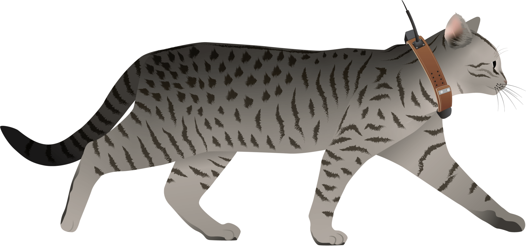
I have posted about this in a different group, but I love boosting the impact of my communication through use of visuals.
Free graphics relating to conservation technology and the environment are available at:
National Environmental Science Program Graphics Library
Graphics below of a feral cat with a tracking collar and a cat grooming trap are examples of symbols available courtesy of the NESP Resilient Landscapes Hub, nesplandscapes.edu.au.
UMCES Integration and Application Network Media Library
Geospatial Group Café April 22
21 April 2025 6:47pm
MyProgress: Advancing GIS and R programming skills.
20 April 2025 1:45pm
Enterprise Geospatial Undergraduate Intern

18 April 2025 2:50pm
Ground Truth: How Are You Verifying What Maps Show?
 Léa Smadja
and 1 more
Léa Smadja
and 1 more
16 April 2025 3:35pm
Geospatial Group Café (April)
Elsa Carla De Grandi
and 2 more
15 April 2025 11:38am
21 April 2025 4:59pm
23 April 2025 9:17am
11 June 2025 11:05am
Application of computer vision for off-highway vehicle route detection: A case study in Mojave desert tortoise habitat
8 April 2025 2:30pm
22 April 2025 11:05pm
22 April 2025 11:05pm
24 April 2025 9:24am
Airbus Foundation: Harnessing Aerospace Capabilities for Nature-Based Climate Resilience. EUR 10,000 + extras

4 April 2025 3:18pm
Ecology Georeferencing - A dataset

4 April 2025 2:59pm
Free Webinar by Nature FIRST: Bridging Ecology and ESG – Smarter Decisions with Knowledge Graphs
2 April 2025 10:59am
Multiple grants
28 March 2025 1:42pm
SCGIS International Conference: Geospatial Technology Innovations for Conservation

27 March 2025 6:35pm
Nature Tech Unconference - Anyone attending?
8 March 2025 12:11pm
15 March 2025 8:28am
Definitely!

21 March 2025 12:07pm
The Futures Wild team will be there :)
26 March 2025 7:54pm
Yep see you on friday
Generative AI for simulating landscapes before and after restoration activities

26 March 2025 1:59pm
26 March 2025 7:50pm
Yep we are working on it

1/ segment
2/remote unwanted ecosytem
3/get local potential habitat
4/generate
5/add to picture
Cloud-Native Geospatial Conference
26 March 2025 3:40pm
United Nations Open Source Principles

13 March 2025 4:13pm
25 March 2025 11:54am
All sound, would be nice if there were only 5, though!
Mole-Rat Mystery. Can anyone help?
19 March 2025 3:25pm
20 March 2025 4:17pm
Hi Sean! I love that you are naturally curious and are pursuing really cool projects in your free time. I know absolutely nothing about cape dune mole rats (in fact, never heard of them prior to this post, but I will confess I was interested in the concept of a mole-rat mystery), but I did have some thoughts about where you might find more information-
It seems like the types of questions you are asking are pretty specific and niche. My first thought on how to find someone with expertise in these specific rodents was to go to their iNat page- there you can see the top observer and top identifier. Both individuals are active researchers, so I think reaching out to them on iNat or finding their e-mails from their respective organizations' sites might be a good way to get in touch.
I also did a quick search in Google Scholar in which I typed in only the scientific name and hit go. The two publications linked above caught my eye as potentially helpful in your search- particularly the first one. They excavated burrows and noted things like home range size, that males have more burrows than females, etc. I didn't go much beyond the abstracts but these seem like they might get you on the right tracks!
Happy ratting!
25 March 2025 8:36am
Good morning Vance
Thank you very much! I am looking into some papers that I was kindly directed to by Jocelyn Stalker ( her comment below) and am looking for ways to establish population dynamics just by looking at the mounds. Once I have figured this part out I should be able to correlate the information to the drone data. The Ground Sampling Distance (GSD) for this project is very small, 1.3cm per pixel. This has proven to be very useful because I am able to use the very fine 3D models to run change detections that pick up new heaps and vegetation reductions (which may be due to feeding) on a weekly basis. It helps not only visualise but also quantify where the most activity has occurred. I will keep you posted!
25 March 2025 8:47am
Good morning Jocelyn
Thank you very much for your comment, this is proving to be very useful advice and thank you so much for setting me on the right path!! This is very exciting!!
They are the most extra ordinary little creatures and as I don't know much about them either, I thought I'd try learn as much as I can (not just through literature, but through my own observations as well). I walk past these mounds daily and am always intrigued when I see more mounds and really enjoy watching them actively push the dune sand up to the surface (you don't see the wee fellas but you can watch the sand move as they burrow away). One afternoon while flying my drone (I was quantifying the changes in sediment deposition and erosion volumes in the estuary after a flood that was soon followed by a super high tide), I had a heap between my legs and all of a sardine it starts moving! So that sparked my curiosity even further.
I will keep you posted on my findings and thank you again for the papers and the direction! It is greatly appreciated!!
Transitioning to GIS from Tech

17 March 2025 10:54am

Drone Photogrammetry & GIS Introduction (Foundation) Course
 Sean Hill
and 1 more
Sean Hill
and 1 more
18 March 2025 12:47pm
mapmixture: An R package and web app for spatial visualisation of admixture and population structure
Modern GIS: Moving from Desktop to Cloud
12 March 2025 7:10pm
Hansen Global Forest Change Dataset
11 March 2025 11:12am
Hansen Global Forest Change v1.11 (2000-2023) [deprecated] | Earth Engine Data Catalog | Google for Developers
Results from time-series analysis of Landsat images in characterizing global forest extent and change. The 'first' and 'last' bands are reference multispectral imagery from the first and last available years for Landsat spectral bands corresponding to red, NIR, SWIR1, and SWIR2. Reference composite imagery represents median observations from a set …

Data storage and Esri integration with Microsoft Azure

8 January 2025 10:30am
GPS collars for domestic dogs

20 January 2025 3:26am
20 February 2025 8:46pm
What are your parameters? Do you need yes no movement, which could be collected with an accelerometer and no lat-long data?
Movement on an XY grid once an hour within a tightly bounded area?
High resolution once per second data? Large geographic area?
Different technologies deliver ddifferent datasets. Sometimes, significantly!
10 March 2025 11:37am
Hi Stephanie, at https://Savannahtracking.com we develop and manufacture a variety of collars with sizes ranging from about 95 grams for Raptors, 200grams - 1200g for mammals, and collars for large mammals such as Elephants. We currently have collars deployed on Dingoes which are about the same size as domestic dogs, and I believe that a similar solution will be perfect for your needs.
Our GPS collars can be programmed to collect high resolution data (15-minute gps positions) with hourly uploads via iridium satellite to our server where you can view and download the data from our dedicated windows or MAC SDM platforms. We also have a view only android/ios app. All our collars have two-way satellite communication, Internet based downloading via the free accompanying Savannah Tracking data manager software, automated Google Earth links for visualization, fully user definable geo fencing allowing for point, line and polygon fences and automated app and mail alarms in case of zone violation.
Kindly reach out to us and we can discuss a bespoke solution for your tracking needs at info@savannahtracking.com
11 March 2025 3:31am
Thank you! I will follow up by email.
deadtrees.earth
9 March 2025 11:14am
deadtrees.earth
An open database for accessing, contributing and visualizing remote sensing-based tree mortality data.

1 May 2025 11:44am