Group curators

Pen-Yuan Hsing
- @Nycticebus_scientia
- | he/they
MammalWeb.org

Amanda Matthes

Brianna Johns
- @briannajohns
- | she/they
Gathering for Open Science Hardware (GOSH)
Despite critical advancements in the tech solutions available to conservationists worldwide, many existing tools are cost-prohibitive in the landscapes that need them most. Additionally, those who create low-cost and open-source alternatives to pricey market tech often operate on tight budgets themselves, meaning they need more resources to promote their solutions to a broader market. We need increased communication around these solutions to highlight their availability, share lessons learned in their creation, and avoid duplication of efforts.
This group is a place to share low-cost, open-source devices for conservation; describe how they are used, including what needs they are addressing and how they fit into the wider conservation tech market; identify the obstacles in advancing the capacity of these technologies; and to discuss the future of these solutions, particularly their sustainability and how best to collaborate moving forward. We welcome contributions from both makers and users, whether active or prospective.
Here is how we see the current OSS space and how this group plans to change it by supporting both makers and users:
Many users do not appreciate the significant benefits of open-source tech. This group will educate users about the advantages and the need for open-source tech, specifically in the context of ecology work. We achieve this by stimulating regular discussions on the forum and by encouraging and supporting users to use open-source tools wherever possible.
Building OSS can be difficult. We want to support both established and potential makers who wish to develop OSS. The OSS group is a place where makers can find funding opportunities, ask current and potential users questions, and share their technologies.
Using OSS can be difficult. We also want to support adopters of OSS tech. We do this by offering a place for users to share challenges they face and crowdsource advice on things like technology choice or technical support.
Makers do not know what users want or need. The OSS group is a place that facilitates conversations between makers and users. This will give users a voice and ensure that makers are aware of the needs of users, enabling them to build better solutions.
The community is small and scattered. We want to grow an inclusive community of OSS practitioners. Our goal is to become the go-to place for discussions on the topic where people feel a sense of belonging.
Resources for getting started
- How do I use open source remote sensing data in Google Earth Engine? | Tech Tutors
- How do I use open source remote sensing data to monitor fishing? | Tech Tutors
- Low Cost, Open Source Solutions | Virtual Meetup
- What would an open source conservation technology toolkit look like? | Discussion
- December 2024 Open Source Solutions Community Call
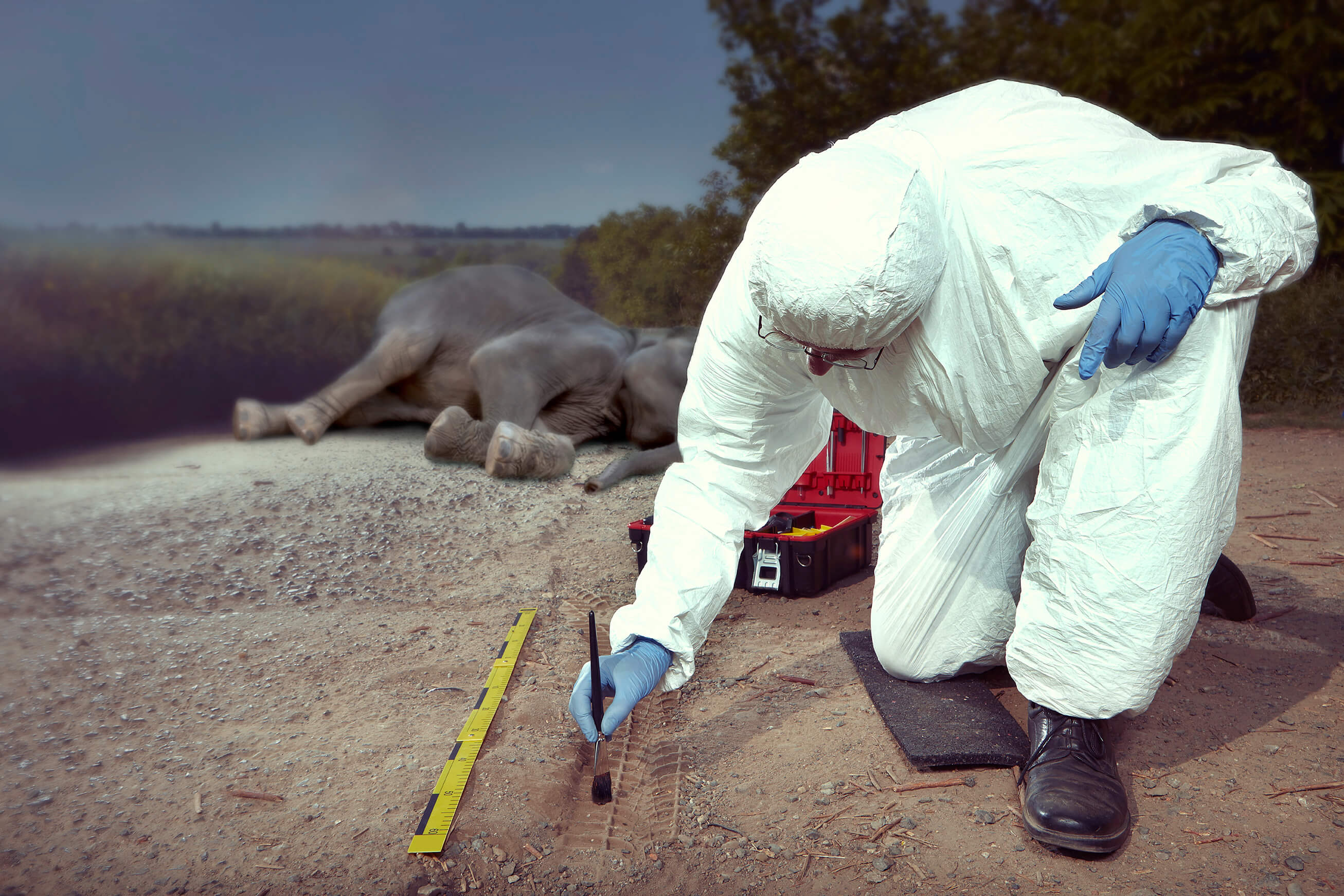
Header image: Shawn F. McCracken
Group curators

- @Nycticebus_scientia
- | he/they
MammalWeb.org
Co-founded citizen science camera-trapping project with interest in developing 100% open source wildlife tech. Advocate for open science/open research. Community member of the Gathering for Open Science Hardware.


- 3 Resources
- 24 Discussions
- 3 Groups
trying to understand and improve the welfare of all animals that can suffer

- 4 Resources
- 6 Discussions
- 7 Groups

- @briannajohns
- | she/they
Gathering for Open Science Hardware (GOSH)
Interested in the application of open source technologies for conservation research.


- 9 Resources
- 4 Discussions
- 4 Groups

- @jsulloa
- | He/Him
Instituto Humboldt & Red Ecoacústica Colombiana
Scientist and engineer developing smart tools for ecology and biodiversity conservation.


- 3 Resources
- 22 Discussions
- 7 Groups

- @frides238
- | She/her
Hi! I am Frida Ruiz, a current Mechanical Engineering undergraduate student very interested in habitat restoration & conservation. I am excited to connect with others and learn about technology applications within applied ecology & potential research opportunities

- 0 Resources
- 5 Discussions
- 13 Groups

- @Valluc
- | he/him
- 0 Resources
- 0 Discussions
- 4 Groups

- @Britneecheney
- | her/she
My name is Britnee Cheney. I am a keeper and trainer for three North American River Otters at an aquarium in Utah. I have recently started a conservation program for this species in the wild and am looking for resources and mentors to help me with my camera trapping.
- 0 Resources
- 13 Discussions
- 8 Groups

- @Robincrocs
- | He/Him//El//Ele
Wildlife biologist, works with Caimans and Crocodiles
- 0 Resources
- 0 Discussions
- 15 Groups

My name is Sean Hill and I have been using off the shelf consumer drones and open source photogrammetry and Geographic Information Systems Software (GIS) since 2019 for conservation purposes. As of 2024 I have started an online training platform called GeoWing Academy
- 1 Resources
- 14 Discussions
- 6 Groups

- @StephODonnell
- | She / Her


- 193 Resources
- 676 Discussions
- 32 Groups
Hello, I am a PhD student studying birds and box turtles!
- 0 Resources
- 0 Discussions
- 9 Groups

- @bluevalhalla
- | he/him
BearID Project & Arm
Developing AI and IoT for wildlife


- 0 Resources
- 45 Discussions
- 8 Groups
- @KellyFaller
- | she/her/hers
Rutgers University
Lead Estuary Science Coordinator at the Partnership for the Delaware Estuary and Masters Student at Rutgers University in the Department of Ecology and Evolution. Using bioacoustics in tidal marsh ecosystems for restoration and conservation.
- 0 Resources
- 3 Discussions
- 14 Groups

Over 35 years of experience in biodiversity conservation worldwide, largely focused on forests, rewilding and conservation technology. I run my own business assisting nonprofits and agencies in the conservation community
- 5 Resources
- 62 Discussions
- 12 Groups
- @jasminedaly
- | she/her/hers
Principal Consultant & Founder of Daly Analytics which helps nonprofits and purpose-driven teams make sense of their data.
- 0 Resources
- 0 Discussions
- 6 Groups
Article

Join us in celebrating this year’s Judging Panele Award winners!
19 August 2024
Article
Join us in celebrating this year’s Community Choice Award winners!
15 August 2024
Article

Vote for your favorite submissions that best demonstrate conservation impact, novel innovation/discovery, and strong storytelling of the work and the sector.
12 August 2024
Article
July 2024 OSS paper round-up
Amanda Matthes
In this instalment: ExMove for handling animal tracking data, HawkEar for spying on animals using cameras on birds, Pytorch-wildlife for species recognition and more!
11 August 2024
Article
Open Source Solutions Announcement: Introducing New OSS Group Leaders

Brianna Johns and 2 more
We are thrilled to welcome our 3 new Group Leaders for the 2024-2025 term, Bri Johns, Amanda Matthes, and Pen-Yuan Hsing!
8 August 2024
Careers
We are recruiting an (extendable) 2-year postdoc in my group to develop new technologies (cameras, microphones, deep learning, etc) to track earthworm activity in the field.
16 July 2024
Link
Keele University - KTP position
Claire Painton
Hi everyone - I wanted to share a fantastic opportunity at Keele University for a Knowledge Transfer Partnership (KTP) position with Arribada Initiative: to be responsible for developing and writing embedded software to...
8 July 2024

Funding
€4,000 travel grants are available for researchers interested in insect monitoring using automated cameras and computer vision
6 June 2024
Article
New WILDLABS Funding & Finance group

Frank van der Most
WildLabs will soon launch a 'Funding and Finance' group. What would be your wish list for such a group? Would you be interested in co-managing or otherwise helping out?
5 June 2024
Article
Share Your Work in a Conservation Technology Video

Robin Marti Sarasa
Do you have photos and videos of your conservation tech work? We want to include them in a conservation technology showcase video
17 May 2024
Funding
Travel grants for insect monitoring an AI

Tom August
€2,000 travel grants are available for researchers interested in insect monitoring using automated cameras and computer vision
3 May 2024
May 2025
June 2025
event
Nalini
October 2025
event

Lacey Hughey and 3 more
September 2024
event

Vanesa Reyes
event
Vanesa Reyes
| Description | Activity | Replies | Groups | Updated |
|---|---|---|---|---|
| The Mothbox team (@briannajohns, @hikinghack, @Hubertszcz, @wellreadpanda, @alex_rogers, @mothyash) is excited to announce that we’ve won a... |
|
Open Source Solutions | 1 hour ago | |
| Hi everyone,What should we share or demo about Software Quality Assurance? Alex Saunders and I, the two Software QA people at Wildlife Protection Solutions (WPS) are going to... |
|
Software Development, AI for Conservation, Open Source Solutions | 3 days 14 hours ago | |
| Interesting. Thanks for the explanation. Nice to hear your passion showing through. |
|
AI for Conservation, Camera Traps, Data management and processing tools, Open Source Solutions, Software Development | 3 weeks 3 days ago | |
| I have posted about this in a different group, but I love boosting the impact of my communication through use of visuals. Free graphics relating to conservation technology... |
|
Geospatial, Climate Change, Community Base, Connectivity, Funding and Finance, Open Source Solutions | 3 weeks 3 days ago | |
| 📸 Do you use camera traps in your work? Take part in our survey!Hi everyone! I’m currently a final-year engineering... |
|
Camera Traps, AI for Conservation, Data management and processing tools, Open Source Solutions, Software Development | 3 weeks 3 days ago | |
| One of our goals with explorer.land is to bridge satellite data and on-the-ground perspectives — helping teams combine field updates,... |
|
AI for Conservation, Geospatial, Open Source Solutions, Sensors | 1 month ago | |
| 15 years ago I had to rebuild the dams on a game reserve I was managing due to flood damage and neglect. How I wished there was an easier,... |
|
Drones, Conservation Tech Training and Education, Data management and processing tools, Emerging Tech, Geospatial, Open Source Solutions | 1 month 1 week ago | |
| Hi, just wanted to let whoever is interested that v.1.3 of DeepFaune is out! Deepfaune is a software that runs on any standard... |
|
Camera Traps, AI for Conservation, Open Source Solutions | 1 month 1 week ago | |
| New stable release : v1.5.1We are pleased to announce the latest release with several important enhancement, fixes and documentation improvements to ensure compatibility with the... |
+15
|
Acoustics, AI for Conservation, Open Source Solutions, Software Development | 1 month 1 week ago | |
| Hello everyone,Thank you all for your contribution!You can read some updates about this project in this post.Julia |
|
Acoustics, Community Base, Data management and processing tools, Open Source Solutions | 1 month 2 weeks ago | |
| Reposting the original post from the GOSH Community:Cool news from the mothbox team! We still don’t have any funding, but our next big goal... |
|
Open Source Solutions, Emerging Tech, Funding and Finance | 1 month 2 weeks ago | |
| Yep see you on friday |
+3
|
Geospatial, Acoustics, AI for Conservation, Camera Traps, Citizen Science, Community Base, Data management and processing tools, Emerging Tech, Open Source Solutions, Protected Area Management Tools | 1 month 3 weeks ago |


Mothbox Updates: Field expedition highlights - we deployed 19 Mothboxes in one go!
14 February 2025 7:48pm
Camera Trap Data Visualization Open Question
4 February 2025 3:00pm

12 February 2025 1:36pm
Quick question on this topic to take advantage of those that know a lot about it already. So once you have extracted all your camera data and are going through the AI object detection phase which identifies the animal types. What file formation that contains all of the time + location + labels in the photos data do the most people consider the most useful ? I'm imagining that it's some format that is used by the most expressive visualization software around I suppose. Is this correct ?
A quick look at the trapper format suggested to me that it's meta data from the camera traps and thus perform the AI matching phase. But it was a quick look, maybe it's something else ? Is the trapper format also for holding the labelled results ? (I might actually the asking the same question as the person that started this thread but in different words).
12 February 2025 2:04pm
Another question. Right now pretty much all camera traps trigger on either PIR sensors or small AI models. Small AI models would tend to have a limitation that they would only accurately detect animal types and recognise them at close distances where the animal is very large and I have question marks as to whether small models even in these circumstances are not going to make a lot of classification errors (I expect that they do and they are simply sorted out back at the office so to speak). PIR sensors would typically only see animals within say 6m - 10m distance. Maybe an elephant could be detected a bit further. Small animals only even closer.
But what about when camera traps can reliably see and recognise objects across a whole field, perhaps hundreds of meters?
Then in principle you don't have to deploy as many traps for a start. But I would expect you would need a different approach to how you want to report this and then visualize it as the co-ordinates of the trap itself is not going to give you much information. We would be in a situation to potentially have much more accurate and rich biodiversity information.
Maybe it's even possible to determine to a greater degree of accuracy where several different animals from the same camera trap image are spatially located, by knowing the 3D layout of what the camera can see and the location and size of the animal.
I expect that current camera trap data formats may fall short of being able to express that information in a sufficiently useful way, considering the in principle more information available and it could be multiple co-ordinates per species for each image that needs to be registered.
I'm likely going to be confronted with this soon as the systems I build use state of the art large number of parameter models that can see species types over much greater distances. I showed in a recent discussion here, detection of a polar bear at a distance between 130-150m.
Right now I would say it's an unknown as to how much more information about species we will be able to gather with this approach as the images were not being triggered in this manner till now. Maybe it's far greater than we would expect ? We have no idea right now.
AI for Bird and Bat Recognition
7 February 2025 11:57am

7 February 2025 5:06pm
Hi Lorenzo,
I highly recommend the OpenSoundscapes package (developed by the Kitzes Lab at U Pittsburgh) - there are workflows to build your own CNNs there, the documentation is really thorough, and the team are very responsive to inquiries. They also have a bioacoustics 'model zoo' that lists relevant models. The Perch model from Google would be good to look into as well.
Some recent papers I've seen that might also be worth checking out -
- Advanced montane bird monitoring using self-supervised learning and transformer on passive acoustic data
- A good horizon scan paper - The potential for AI to revolutionize conservation: a horizon scan
- Challenges and solutions for ecologists adopting AI
- And perhaps not directly related, but a new framework for deploying edge models onto recorders was just released - acoupi: An Open-Source Python Framework for Deploying Bioacoustic AI Models on Edge Devices
Hope that helps a bit!
acoupi: An Open-Source Python Framework for Deploying Bioacoustic AI Models on Edge Devices

7 February 2025 1:39am
[2501.17841] acoupi: An Open-Source Python Framework for Deploying Bioacoustic AI Models on Edge Devices
Abstract page for arXiv paper 2501.17841: acoupi: An Open-Source Python Framework for Deploying Bioacoustic AI Models on Edge Devices

Free/open-source app for field data collection
6 December 2024 2:04pm
4 February 2025 3:52pm
Awesome, thank you!
4 February 2025 3:57pm
Thanks! Essentially field technicians, students, researchers etc. go out into the field and find one of our study groups and from early in the morning until evening the researchers record the behaviour of individual animals at short intervals (e.g., their individual traits like age-sex class, ID, what the animal is doing, how many conspecifics it has within a certain radius, what kind of food the animal is eating if it happens to be foraging). Right now in our system things work well but we are using an app that is somewhat expensive so we want to move towards open-source
4 February 2025 4:26pm
Thanks! I am familiar with EarthRanger but wasn't aware it could be used for behavioural data collection
Can/Should UAVs Be The Answer To Urbanisation & Wildlife Conflicts
20 January 2025 11:00am
Open Hardware Summit 2025

14 January 2025 4:05pm
Mothbox Updates: field tests, canopy tower deployment, and fashion fundraiser!
19 December 2024 2:52pm
Announcement of Project SPARROW
18 December 2024 8:01pm
3 January 2025 6:48pm
Underwater wireless communication

9 December 2024 1:32pm

16 December 2024 6:59pm
It's probably much easier to find a company selling acoustic modems than to try and create your own...very challenging environment to work within. I have about 10 years working with underwater acoustics (as a non-engineer).

17 December 2024 1:50pm
To give you the best advice, I need a bit more information about your specific application. Underwater communication typically relies on acoustic modems because radio waves don't travel well through water. For longer distances, a hybrid solution is often used. This could involve an acoustic modem transmitting data from your underwater sensor to a surface buoy or platform. The buoy could then relay the data to shore using traditional radio communication, such as 900MHz radios (even commercially available options like Ubiquiti radios, depending on distance and line-of-sight). To help me understand your needs and recommend the right approach, could you tell me more about:
Data Rate Requirements: How much data do you need to transmit, and how often?
Range: What is the vertical distance between your sensor and the surface receiver?
Environment: Are you working in shallow or deep water? What is the water temperature, salinity, and expected noise level?
Power Budget: How much power is available for the underwater sensor and modem?
Cost: What is your budget for the acoustic modem system?
Integration: How will you integrate the modem with your sensor and surface receiving system?
Real-time or Delayed: Do you need the data in real-time, or can it be stored and transmitted later?

18 December 2024 11:56am
Steve and I are looking to develop a low-cost benthic drift camera with a live video feed. Our hope is to use an acoustic modem to give us a low quality feed for navigation / hazard avoidance. This could be as simple as a small black and white image refreshed every 1 sec. What we need to know from the system is are we at the bottom? and are we about to hit an obstacle?
Data Rate Requirements: A very low quality (360p) video stream - could be black & white and low fps to reduce bit rate requirements (hopefully 1kbps)
Range: At least depth 500m but ideally down to 2,000m (deployed below a vessel from a tether)
Environment: Deep water temperature range down to 0C. Open ocean salinity levels (33-35 psu). Limited noise apart from deployment vessel (engine & echosounder)
Power Budget: Transmitter must be powered by a battery capable of continuous working for at least 1 hour.
Cost: Ideally under £1000 (GBP) for the transmitter & receiver.
Integration: Don't know. We are hoping to plug into an arduino or equivalent.
Real-time or Delayed: We need real time transmission with very limited lag for slow moving obstacle avoidance.
It's a big ask, but any pointers would be very welcome
October + November 2024 OSS paper round-up

15 December 2024 7:05pm
Talk - Open source hardware for more equitable and sustainable conservation science
4 December 2024 5:54pm
Open Sustainable Technology directory
2 December 2024 4:17pm
Open Sustainable Technology
Open technology projects sustaining stable climate, energy supply, biodiversity and vital natural resources

Catch Up With the first Open Source Solutions Community Meeting!
 Pen-Yuan Hsing
and 2 more
Pen-Yuan Hsing
and 2 more
21 November 2024 1:56pm

21 November 2024 4:44pm
Computer Vision Developer
20 November 2024 10:39pm
Mothbox Updates: Recap of our Mothbox v4.5 workshop in Atlanta
13 November 2024 2:24pm
Automatic extraction of temperature/moon phase from camera trap video
29 November 2023 1:15pm

7 September 2024 9:44am
I just noticed that TrapTagger has integrated AI reading of timestamps for videos. I haven't had a chance to try it out yet, but it sounds promising.
28 October 2024 7:30pm
Small update. I uploaded >1000 videos from a spypoint flex camera and TrapTagger worked really well. Another program that I'm currently interested in is Timelapse which uses the file creation date/time. I haven't yet tried it, but it looks promising as well.

1 November 2024 12:29pm
Hi Lucy,
I now realised it is an old thread and you most likely have already found a solution long ago but this might be of interest to others.
As mentioned previously, it is definitely much better to take moon phase from the date and location. While moon phase in general is not a good proxy for illumination, that moon phase symbol on the video is even worse as it generalises the moon cycle into a few discreet categories. For calculating moon phase you can use suncalc package in R but if you want a deeper look and more detailed proxy for moonlight intensity, I wrote a paper on it
Biologically meaningful moonlight measures and their application in ecological research | Behavioral Ecology and Sociobiology
Light availability is one of the key drivers of animal activity, and moonlight is the brightest source of natural light at night. Moon phase is commonly us

with accompanying R package called moonlit
GitHub - msmielak/moonlit: moonlit - R package to estimate moonlight intensity for any given place and time
moonlit - R package to estimate moonlight intensity for any given place and time - msmielak/moonlit

When it comes to temperature I also agree that what is recorded in the camera is often very inconsistent so unless you have multiple cameras to average your measurements you are probably better off using something like NCEP/NCAR Reanalysis (again, there is an R package for that) but if you insist on extracting temperature from the picture, I tried it using tesseract and wrote a description here:
Good luck!
Can wireless charging technology be used for animal sensors?
17 October 2024 7:03am
23 October 2024 3:43pm
The results in the paper you mentioned are really exciting technology. It can really do a lot of things.
Thanks for your reply!
23 October 2024 4:00pm
Although this technology may not be mature now, and there are still many problems to be discussed and solved, I think it will have good application prospects.
Unfortunately, I am just an undergraduate student in China, and what I can do is very limited. Maybe in the future I can also do some similar research or what I want to do. Just like you, I am studying hard now.
Thank you very much for this forum and the professionals who responded to me. You have allowed me to see more perspectives and many things I didn't realize. Thank you very much!
28 October 2024 3:13pm
No problem at all Yu (@JY) and good luck with your studies! Happy to discuss this and any other ideas any time.
All the best,
Rob
Getting a Software Job in Conservation

25 October 2024 9:18pm
ClimateTriage

22 October 2024 9:16am
ClimateTriage - Impactful open source contributions
Launch your open source journey in climate and sustainability. Explore current Good First Issues from open source initiatives focused on protecting natural resources.

Open Sustainable Technology
22 October 2024 9:12am
Open Sustainable Technology
Open technology projects sustaining stable climate, energy supply, biodiversity and vital natural resources
Recycled & DIY Remote Monitoring Buoy
15 January 2024 1:14am
3 October 2024 9:16am
Hi Brett,this ocean lab sychelles is great to hear from you! I love your remote monitoring buoy project, especially the recycling of DFAD buoys and the design of custom-built ones that are full of interesting features. The expandability of the navigation buoys enabling it to be configured as hydrophones, cameras, or water quality monitors is a great feature. The technical marvels, such as recycling DFADs' circuits, making your own hydrophone, and designing a super-efficient system, are terrific. Moreover, it is encouraging to witness the deployment of your early system, particularly the live video and water quality data you have collected. You will definitely make a positive impact on the Wildlabs community with your knowledge of electrical engineering and software development. I care to hear more of your discoveries and any news that you will be sharing. Keep doing what you excel at!

8 October 2024 8:46am
Thank you for sharing!
21 October 2024 12:45am
Hi Brett,
I am interested in developing really low cost multi channel underwater acoustic recorders. Can you tell me a bit more about the board and stuff you were using for yours? You can get me at chris@wilcoanalytics.org.
Thanks,
Chris
Resources wanted to advise on the business model of an emerging low-cost device
27 September 2024 5:32am
13 October 2024 11:13pm
Dear @jared ,
Thank you so much for your answer. We have been focusing very deeply into the technology part of the challenge and not yet on the legal issues or product lifecycle. Definitely a lot of food for thoughts there.... thanks!
13 October 2024 11:13pm
Dear @jared ,
Thank you so much for your answer. We have been focusing very deeply into the technology part of the challenge and not yet on the legal issues or product lifecycle. Definitely a lot of food for thoughts there.... thanks!
14 October 2024 3:36am
Jared's answer is excellent IMHO. One level down, you have a couple of options. One is to charge for the convenience of buying a finished, assembled, and tested product, that's for the folks that have money and no time. Those that have time but no money can build it themselves from the open source. One danger to this approach is if low cost chinese clones come on the market, whether they do probably depends a lot on the size of the market.
Another option is to withhold some 'pro/plus' feature from the open source, that depends on whether you can identify such features. A similar option is to offer features that big outfits with good funding need. For example, you could offer calibrated versions at a premium, if that's applicable and needed by such organizations. In many cases companies sell devices cheap that are usable by someone who one has one or a couple and then charge for a management system for those that have dozens or hundreds of devices, dunno whether this applies to your case. All this comes down to whether you can segment your customer base so you can create premium features for the wealthy segment.
MS and PhD Opportunities in Ocean Engineering and Oceanography

6 October 2024 9:44am
September 2024 OSS paper round-up
3 October 2024 5:51pm
Support no-code custom AI for camera trap images by filling out this survey
2 October 2024 10:43pm
Project Spotlight: SnapperGPS
1 October 2024 2:29pm
August 2024 OSS paper round-up
15 September 2024 8:59pm
Global model for Livestock detection in airborne imagery - Data, Applications, and Needs
12 August 2024 8:19pm

4 September 2024 6:15pm
It looks like the website has not been updated since 2022 and indeed you need to register. If you go under 'Manage Account' you may be able to register. I tried to register but I got an error saying 'Login failed! Account is not active'. I got an email saying "Your account must be approved before being activated. Once your account has been approved, you will be notified." So I am waiting for the account to be approved...
I'll keep you posted

6 September 2024 12:46pm
Hi Ben!
Great initiative!
A review of deep learning techniques for detecting animals in aerial and satellite images
https://www.sciencedirect.com/science/article/pii/S1569843224000864#b0475
lists a number of data sets (incl. one published by you it seems...)
Also, @dmorris keeps a list of Terrestrial wild animal images (aerial/drone):
https://lila.science/otherdatasets#images-terrestrial-animals-drone
List of other conservation data sets - LILA BC
LILA BC - List of other conservation-related data sets

which seem like it might be useful for you.

9 September 2024 8:10pm
Hi @benweinstein !
- Surely a general detector might be very useful for detecting objects in aerial imagery! Maybe something similar to what MegaDetector does in camera trap images, generally detecting person, animal, and vehicle (and thus also empty photos). This could greatly improve semi-automated procedures. It could also serve as a first step for context-specific detectors or classifiers to be developed on top of this general one.
- There is also the WAID dataset that is readily available. Our research group could also provide images containing cows, sheep, and deer from South America.
Best
12 February 2025 12:31pm
Hey Ed!
Great to see you here and thanks a lot for your thorough answer.
We will be checking out Trapper for sure - cc @Jeremy_ ! A standardized data exchange format like Camtrap DP makes a lot of sense and we have it in mind to build the first prototypes.
Our main requirements are the following:
In the first prototyping stage, it is useful for us to keep it lean while keeping in mind the interface (data exchange format) so that we can move fast.
Regards,
Arthur