Group curators

Vance Russell

Ahmed Junaid
- @ahmedjunaid
- | He/His

Elsa Carla De Grandi
Fauna & Flora
Who We Are
Geospatial data and analysis is critical for conservation, from planning to implementation and measuring success. Every day, mapping and spatial analysis are aiding conservation decisions, protected areas designation, habitat management on reserves and monitoring of wildlife populations, to name but a few examples. The Geospatial group focuses on all aspects of this field, from field surveys to remote sensing and data development/analysis to GIS systems.
How to Get Started
Want to learn more about how remote sensing is used in conservation? Check out the first two episodes of this season of Tech Tutors, where our Tutors answer the questions How do I use open source remote sensing data to monitor fishing? and How do I access and visualise open source remote sensing data in Google Earth Engine? You can also check out our Virtual Meetup Archive for a range of panels that overlap with Geospatial topics, or take a look at our Earth Observation 101 lecture series from Dr. Cristian Rossi.
Our Purpose
The WILDLABS Geospatial Group is for conservation practitioners, geospatial analysts, and academics that want to:
- Share geospatial resources, best practices, data, and ideas;
- Network amongst geospatial and data practitioners;
- Create peer learning opportunities;
- Promote the use of free and open-source geospatial software; and
- Improve the use of GIS software and geospatial analyses in conservation management and research.
Group curators

Over 35 years of experience in biodiversity conservation worldwide, largely focused on forests, rewilding and conservation technology. I run my own business assisting nonprofits and agencies in the conservation community


- 5 Resources
- 62 Discussions
- 12 Groups
- @ahmedjunaid
- | He/His
Zoologist, Ecologist, Herpetologist, Conservation Biologist


- 63 Resources
- 7 Discussions
- 26 Groups

Fauna & Flora
Remote Sensing Scientist, Conservation Technology & Nature Markets @ Fauna & Flora - WILDLABS Geospatial Group Co-Lead

- 34 Resources
- 28 Discussions
- 8 Groups
- @KB
- | she/her
Wildlife ecologist specializing in animal movement modeling and habitat selection with a strong interest in conservation policy and management decisions.
- 0 Resources
- 0 Discussions
- 17 Groups

- @williamkingwill
- | Mr
Hi, my name is William. I am Senior Data Scientist/ Remote Sensing Engineer with experience in GIS, Machine Learning, Systems Engineering, Data Science Pipelines. I am motivated and passionate about using my skills for wildlife and biodiversity conservation.
- 0 Resources
- 0 Discussions
- 7 Groups

- @akshayanc
- | She/her
Hi, I'm Akshaya from India. I have completed MSc in Ecology with a specialization in Ecological Informatics at Digital University Kerala.
- 0 Resources
- 0 Discussions
- 2 Groups

- @TaliaSpeaker
- | She/her
WILDLABS & World Wide Fund for Nature/ World Wildlife Fund (WWF)
I'm the WILDLABS Research Specialist at WWF-US


- 23 Resources
- 62 Discussions
- 25 Groups

WILDLABS & Wildlife Conservation Society (WCS)
I'm the Bioacoustics Research Analyst at WILDLABS. I'm a marine biologist with particular interest in the acoustics behavior of cetaceans. I'm also a backend web developer, hoping to use technology to improve wildlife conservation efforts.


- 27 Resources
- 34 Discussions
- 34 Groups

Worked as a mechanical engineer for a defence co, then software engineer, then for a research lab specialising in underwater robotics.


- 1 Resources
- 144 Discussions
- 16 Groups

Sustainability Manager for CERES Tag LTD. An animal health company; animal monitoring, conservation, & anti-poaching/ rural crime. Wildlife, livestock, equine & companion. #CeresTrace #CeresWild #CeresRanch


- 2 Resources
- 20 Discussions
- 24 Groups

- @carlybatist
- | she/her
ecoacoustics, biodiversity monitoring, nature tech


- 111 Resources
- 356 Discussions
- 19 Groups

Senior Wildlife Research Scientist
- 0 Resources
- 0 Discussions
- 7 Groups
- @ahmedjunaid
- | He/His
Zoologist, Ecologist, Herpetologist, Conservation Biologist
- 63 Resources
- 7 Discussions
- 26 Groups

- @frides238
- | She/her
Hi! I am Frida Ruiz, a current Mechanical Engineering undergraduate student very interested in habitat restoration & conservation. I am excited to connect with others and learn about technology applications within applied ecology & potential research opportunities

- 0 Resources
- 5 Discussions
- 13 Groups
- @Valluc
- | he/him
- 0 Resources
- 0 Discussions
- 4 Groups
Link
Survey on Earth Observation in Wildlife Ecology
Helena Wehner
Hi together, I am working on detecting causalities between land surface dynamics and animal movement by using satellite-based earth observation data. As this is might be your expertise I kindly ask for your support...
8 May 2025

Article

Fires in Serengeti and Masai Mara National Parks have burned massive areas this year. With Google Earth Engine, it's possible to quantify burn severity using the normalized burn ratio function, then calculate the total...
29 April 2025
Article
A fascinating journey of unleashing my potentials in spatial analysis using ArcGIS Pro and R programming.
20 April 2025
Careers
Enterprise Geospatial Undergraduate Intern
World Wildlife Fund
WWF’s Compass community provides network-coordinated, cutting-edge data and analytics that enable effective conservation decision making, policy, advocacy and monitoring for WWF. The intern will collaborate with members...
18 April 2025
Careers

White-tailed eagle recovery across multi-use landscapes in England
8 April 2025
Article
Driving off-highway vehicles (OHVs), which contributes to habitat degradation and fragmentation, is a common recreational activity in the United States and other parts of the world, particularly in desert environments...
8 April 2025
Funding

The Airbus Foundation, in partnership with the Solar Impulse Foundation and Space4Good, has launched a Call for Projects to support initiatives using aerospace technology to enhance nature-based climate resilience. This...
4 April 2025
Funding
Multiple grants

Frank van der Most
I have been a bit distracted the past months by my move from Costa Rica to Spain ( all went well, thank you, I just miss the rain forest and the Ticos ) and have to catch up on funding calls. Because I still have little...
28 March 2025

AMMonitor 2
16 March 2025
AMMonitor
16 March 2025
Link
mapmixture (R package).
16 March 2025
Drone Photogrammetry & GIS Introduction (Foundation) Course
Drone Photogrammetry & GIS Introduction (Foundation) Course
Drone Photogrammetry & GIS Introduction (Foundation) Course

GIS E-learning Course 1: What is GIS and why should you care?

GIS E-learning Course 1: What is GIS and why should you care?
GIS E-learning Course 1: What is GIS and why should you care?


GIS E-learning Course 2: Introduction to QGIS
GIS E-learning Course 2: Introduction to QGIS
GIS E-learning Course 2: Introduction to QGIS
GIS E-learning Course 3: Introduction to ArcGIS Pro
GIS E-learning Course 3: Introduction to ArcGIS Pro
GIS E-learning Course 3: Introduction to ArcGIS Pro
GIS E-learning Course 4: Becoming Confident in Spatial Analysis & Geoprocessing
GIS E-learning Course 4: Becoming Confident in Spatial Analysis & Geoprocessing
GIS E-learning Course 4: Becoming Confident in Spatial Analysis & Geoprocessing

June 2025
event
Joel Masselink
October 2025
event

Lacey Hughey and 3 more
November 2025

May 2025
event

Indepth Research Institute
April 2025
event

Elsa Carla De Grandi and 2 more
event
Nalini
126 Products
Recently updated products
| Description | Activity | Replies | Groups | Updated |
|---|---|---|---|---|
| Hi there! Funnily enough, I have been attending ARSET Trainings for years - I think I've participated in about 80% of the ones they have offered over that time - they are awesome... |
|
Geospatial | 8 months 1 week ago | |
| Thank you so much for your advice.🙏 |
|
Geospatial | 8 months 1 week ago | |
| Hi @benweinstein !Surely a general detector might be very useful for detecting objects in aerial imagery! Maybe something similar to what MegaDetector does in camera trap images,... |
|
AI for Conservation, Open Source Solutions, Protected Area Management Tools, Drones, Geospatial | 8 months 1 week ago | |
| Very interesting topic |
|
Citizen Science, Community Base, Open Source Solutions, Geospatial | 9 months 2 weeks ago | |
| Wonderfully |
|
Geospatial | 9 months 2 weeks ago | |
| Thanks!I'm definitely looking at Smart and EarthRanger for overall management eventually, but for now I just want to track what we have better - especially as a base map to... |
|
Geospatial, Data management and processing tools | 9 months 4 weeks ago | |
| @cmwainaina please take a look |
|
Animal Movement, AI for Conservation, Camera Traps, Connectivity, Data management and processing tools, East Africa Community, Emerging Tech, Ethics of Conservation Tech, Human-Wildlife Conflict, Marine Conservation, Protected Area Management Tools, Geospatial, Sensors, Software Development | 9 months 4 weeks ago | |
| Thanks, Cathy! |
|
Geospatial | 10 months 2 weeks ago | |
| Tagging @Chelsea_Smith so she sees this :) |
|
Geospatial, Data management and processing tools, Protected Area Management Tools | 11 months ago | |
| Hi Vance,I just wanted to assign landcover types to each point data. But you mentioning temporal change of landcover, that will be best analysis to do.Thank you so much,Sarah. |
|
Geospatial | 11 months ago | |
| Unfortunately I may fail to deliver so I cannot take it up. Am off net at times for two weeks straight. But excited about everything GIS so I follow keenly. Thank you... |
|
Geospatial | 11 months 3 weeks ago | |
| Thank you Carly, I will definitely take a look. |
|
Acoustics, Animal Movement, Climate Change, Conservation Tech Training and Education, Data management and processing tools, Geospatial, Software Development | 1 year 2 months ago |


AniMove Summer School 2025
21 May 2025 1:08pm
Planet Imagery is no longer available on GFW
15 May 2025 2:15pm
NASA webinar on animal tracking + remote sensing
16 May 2025 6:06pm
Can RGB drone data & Machine Learning be of value in Conservation?
14 May 2025 12:52pm
Survey on Earth Observation in Wildlife Ecology
8 May 2025 12:42pm

Maps, Education and Community
21 May 2025 2:39pm

21 May 2025 5:46pm
Connecting the Dots: Integrating Animal Movement Data into Global Conservation Frameworks
Lacey Hughey
and 3 more
30 April 2025 1:38am
Fires in the Serengeti: Burn Severity & Remote Sensing with Earth Engine
29 April 2025 6:16pm
1 May 2025 11:44am
From Field to Funder: How to communicate impact?
16 April 2025 3:51pm

17 April 2025 5:04pm
Great questions @LeaOpenForests !
I don't have concrete answers since I am not a stakeholder in any project in particular. Based on experience with research on the potential for a similar one-stop-shop for science metrics, I would suggest that there is no simple solution: different actors do need and have different views on presenting and viewing impact. This means possible gaps between what one group of actors need and what the other is willing or able to produce. One can hope, search and aim for sufficient overlap, but I don't see how they would necessarily or naturally overlap.
Still, I would guess that if there are dimensions of overlap, they are time, space and actor-networks

28 April 2025 3:18pm
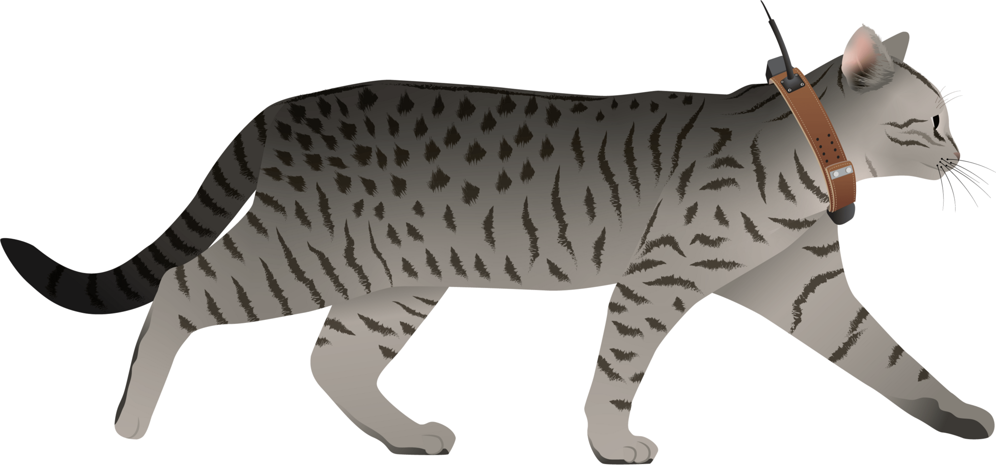
I have posted about this in a different group, but I love boosting the impact of my communication through use of visuals.
Free graphics relating to conservation technology and the environment are available at:
National Environmental Science Program Graphics Library
Graphics below of a feral cat with a tracking collar and a cat grooming trap are examples of symbols available courtesy of the NESP Resilient Landscapes Hub, nesplandscapes.edu.au.
UMCES Integration and Application Network Media Library
Geospatial Group Café April 22
21 April 2025 6:47pm
MyProgress: Advancing GIS and R programming skills.
20 April 2025 1:45pm
Enterprise Geospatial Undergraduate Intern
18 April 2025 2:50pm
Ground Truth: How Are You Verifying What Maps Show?
 Léa Smadja
and 1 more
Léa Smadja
and 1 more
16 April 2025 3:35pm
Off-The-Shelf Drones & Open Source GIS Software for Dam Site Surveying?
15 April 2025 3:57pm
Geospatial Group Café (April)
Elsa Carla De Grandi
and 2 more
15 April 2025 11:38am
21 April 2025 4:59pm
23 April 2025 9:17am
Evaluation of Global Forest Watch
17 March 2025 4:51pm
9 April 2025 8:05pm
Hi @iainmcnicol , welcome to WILDLABS! Thanks for posting this on here. I have shared with my colleagues at Fauna & Flora who have some experience (especially with the deforestation alerts) and could maybe provide feedback as well. We also have a page on 'The Inventory' where we're asking people to review various data products, tools, platforms etc including one for Global Forest Watch. As you can see not many reviews currently so it would be great (if possible by anonymising responses etc.) to get the information from your survey and translate this into something we could add to 'The Inventory' for the wider community. Let me know your thoughts on this!
Also is there a closing date for the survey?
Application of computer vision for off-highway vehicle route detection: A case study in Mojave desert tortoise habitat
8 April 2025 2:30pm

22 April 2025 11:05pm
22 April 2025 11:05pm
24 April 2025 9:24am
Airbus Foundation: Harnessing Aerospace Capabilities for Nature-Based Climate Resilience. EUR 10,000 + extras
4 April 2025 3:18pm
Ecology Georeferencing - A dataset
4 April 2025 2:59pm
GIS Mapping and Spatial Analysis in Crime Mapping and Analysis Training Workshop
2 April 2025 1:54pm
Free Webinar by Nature FIRST: Bridging Ecology and ESG – Smarter Decisions with Knowledge Graphs
2 April 2025 10:59am
Multiple grants
28 March 2025 1:42pm
SCGIS International Conference: Geospatial Technology Innovations for Conservation
27 March 2025 6:35pm
Nature Tech Unconference - Anyone attending?
8 March 2025 12:11pm
15 March 2025 8:28am
Definitely!

21 March 2025 12:07pm
The Futures Wild team will be there :)

26 March 2025 7:54pm
Yep see you on friday
Generative AI for simulating landscapes before and after restoration activities

26 March 2025 1:59pm
26 March 2025 7:50pm
Yep we are working on it
#berlin #ia #paysage #naturetech #solutionsfondéessurlanature #greentech… | Olivier Rovellotti 🌍 | 11 comments
🌿 Quand la Technologie Devient L'alliée du Paysagiste 🌍 🎨 Imaginer & Générer Grâce à l’IA générative (Stable Diffusion, Segment Anything), on peut imaginer #Berlin plus verte et tester différents scénarios d’aménagement. Une nouvelle manière d'explorer les possibles, en s’inspirant des principes des plus grands (McHarg, Clément, Burle Marx). 🌳💡 https://lnkd.in/g-uM7d-k 📚 Apprendre Les plateformes comme NBS EduWORLD rendent les solutions fondées sur la nature plus accessibles à tous. https://lnkd.in/gnBTkyN5 🔎 Cartographier & Anticiper Des outils comme ecoTeka permettent d’identifier les espaces à renaturer en croisant données SIG et IA. Cartographie, suivi des arbres, calcul des services écosystémiques… https://lnkd.in/daTBxbwn 🔗 Réfléchir: Dans "Harnessing generative AI to support nature-based solutions", Sandra Lavorel et Al nous donne des pistes d'explorations pour aller plus loin https://lnkd.in/gSH6Au9s 💬 Et vous ? 🌱🤖 #IA #Paysage #NatureTech #SolutionsFondéesSurLaNature #GreenTech #Biodiversité #NBSEduWorld #FosterTheFuture #TeachFromNature #NatureBasedSolutions #ClimateChange #STEM | 11 comments on LinkedIn

1/ segment
2/remote unwanted ecosytem
3/get local potential habitat
4/generate
5/add to picture
Cloud-Native Geospatial Conference
26 March 2025 3:40pm
United Nations Open Source Principles

13 March 2025 4:13pm
25 March 2025 11:54am
All sound, would be nice if there were only 5, though!
Mole-Rat Mystery. Can anyone help?
19 March 2025 3:25pm

20 March 2025 4:17pm
Hi Sean! I love that you are naturally curious and are pursuing really cool projects in your free time. I know absolutely nothing about cape dune mole rats (in fact, never heard of them prior to this post, but I will confess I was interested in the concept of a mole-rat mystery), but I did have some thoughts about where you might find more information-
It seems like the types of questions you are asking are pretty specific and niche. My first thought on how to find someone with expertise in these specific rodents was to go to their iNat page- there you can see the top observer and top identifier. Both individuals are active researchers, so I think reaching out to them on iNat or finding their e-mails from their respective organizations' sites might be a good way to get in touch.
I also did a quick search in Google Scholar in which I typed in only the scientific name and hit go. The two publications linked above caught my eye as potentially helpful in your search- particularly the first one. They excavated burrows and noted things like home range size, that males have more burrows than females, etc. I didn't go much beyond the abstracts but these seem like they might get you on the right tracks!
Happy ratting!

25 March 2025 8:36am
Good morning Vance
Thank you very much! I am looking into some papers that I was kindly directed to by Jocelyn Stalker ( her comment below) and am looking for ways to establish population dynamics just by looking at the mounds. Once I have figured this part out I should be able to correlate the information to the drone data. The Ground Sampling Distance (GSD) for this project is very small, 1.3cm per pixel. This has proven to be very useful because I am able to use the very fine 3D models to run change detections that pick up new heaps and vegetation reductions (which may be due to feeding) on a weekly basis. It helps not only visualise but also quantify where the most activity has occurred. I will keep you posted!
25 March 2025 8:47am
Good morning Jocelyn
Thank you very much for your comment, this is proving to be very useful advice and thank you so much for setting me on the right path!! This is very exciting!!
They are the most extra ordinary little creatures and as I don't know much about them either, I thought I'd try learn as much as I can (not just through literature, but through my own observations as well). I walk past these mounds daily and am always intrigued when I see more mounds and really enjoy watching them actively push the dune sand up to the surface (you don't see the wee fellas but you can watch the sand move as they burrow away). One afternoon while flying my drone (I was quantifying the changes in sediment deposition and erosion volumes in the estuary after a flood that was soon followed by a super high tide), I had a heap between my legs and all of a sardine it starts moving! So that sparked my curiosity even further.
I will keep you posted on my findings and thank you again for the papers and the direction! It is greatly appreciated!!
Transitioning to GIS from Tech

17 March 2025 10:54am

18 May 2025 8:37pm
The loss of the free NICFI tropics data has been a huge loss for us at CI. We have many teams that were using it for lots of different use cases. If anyone has alternatives, we would love to hear about them! Just looking at what we can get from Sentinel/Landsat now.